793:"}},"text\/plain":{"en":{"":"coordinates of the point of view"}}},"{\"value\":{\"latitude\":51.420885,\"longitude\":-1.3456,\"altitude\":null,\"precision\":1.0e-6,\"globe\":\"http:\\\/\\\/www.wikidata.org\\\/entity\\\/Q2\"},\"type\":\"globecoordinate\"}":{"text\/html":{"en":{"P1259":"51\u00b025'15.186"N, 1\u00b020'44.160"W"}},"text\/plain":{"en":{"P1259":"51\u00b025'15.186\"N, 1\u00b020'44.160\"W"}}}}": -->
636:"}},"text\/plain":{"en":{"":"inception"}}},"{\"value\":{\"time\":\"+2008-08-21T00:00:00Z\",\"timezone\":0,\"before\":0,\"after\":0,\"precision\":11,\"calendarmodel\":\"http:\\\/\\\/www.wikidata.org\\\/entity\\\/Q1985727\"},\"type\":\"time\"}":{"text\/html":{"en":{"P571":"21 August 2008"}},"text\/plain":{"en":{"P571":"21 August 2008"}}}}": -->
670:
238:
252:
273:
311:
316:
87:
457:"}},"text\/plain":{"en":{"P2699":"https:\/\/www.geograph.org.uk\/profile\/2562"}}},"{\"value\":{\"entity-type\":\"property\",\"numeric-id\":2093,\"id\":\"P2093\"},\"type\":\"wikibase-entityid\"}":{"text\/html":{"en":{"":"
686:"}},"text\/plain":{"en":{"P973":"https:\/\/www.geograph.org.uk\/photo\/937133"}}},"{\"value\":{\"entity-type\":\"property\",\"numeric-id\":7384,\"id\":\"P7384\"},\"type\":\"wikibase-entityid\"}":{"text\/html":{"en":{"":"
461:"}},"text\/plain":{"en":{"":"author name string"}}},"{\"value\":\"Andrew Smith\",\"type\":\"string\"}":{"text\/html":{"en":{"P2093":"Andrew Smith"}},"text\/plain":{"en":{"P2093":"Andrew Smith"}}}}": -->
678:"}},"text\/plain":{"en":{"P7482":"file available on the internet"}}},"{\"value\":{\"entity-type\":\"property\",\"numeric-id\":973,\"id\":\"P973\"},\"type\":\"wikibase-entityid\"}":{"text\/html":{"en":{"":"
445:"}},"text\/plain":{"en":{"":"object of statement has role"}}},"{\"value\":{\"entity-type\":\"item\",\"numeric-id\":33231,\"id\":\"Q33231\"},\"type\":\"wikibase-entityid\"}":{"text\/html":{"en":{"P3831":"
592:"}},"text\/plain":{"en":{"":"copyright license"}}},"{\"value\":{\"entity-type\":\"item\",\"numeric-id\":19068220,\"id\":\"Q19068220\"},\"type\":\"wikibase-entityid\"}":{"text\/html":{"en":{"P275":"
548:"}},"text\/plain":{"en":{"":"copyright status"}}},"{\"value\":{\"entity-type\":\"item\",\"numeric-id\":50423863,\"id\":\"Q50423863\"},\"type\":\"wikibase-entityid\"}":{"text\/html":{"en":{"P6216":"
674:"}},"text\/plain":{"en":{"":"source of file"}}},"{\"value\":{\"entity-type\":\"item\",\"numeric-id\":74228490,\"id\":\"Q74228490\"},\"type\":\"wikibase-entityid\"}":{"text\/html":{"en":{"P7482":"
449:"}},"text\/plain":{"en":{"P3831":"photographer"}}},"{\"value\":{\"entity-type\":\"property\",\"numeric-id\":2699,\"id\":\"P2699\"},\"type\":\"wikibase-entityid\"}":{"text\/html":{"en":{"":"
698:"}},"text\/plain":{"en":{"":"operator"}}},"{\"value\":{\"entity-type\":\"item\",\"numeric-id\":1503119,\"id\":\"Q1503119\"},\"type\":\"wikibase-entityid\"}":{"text\/html":{"en":{"P137":"
694:"}},"text\/plain":{"en":{"P7384":"937133"}}},"{\"value\":{\"entity-type\":\"property\",\"numeric-id\":137,\"id\":\"P137\"},\"type\":\"wikibase-entityid\"}":{"text\/html":{"en":{"":"
441:"}},"text\/plain":{"en":{"":"creator"}}},"{\"value\":{\"entity-type\":\"property\",\"numeric-id\":3831,\"id\":\"P3831\"},\"type\":\"wikibase-entityid\"}":{"text\/html":{"en":{"":"
43:
789:
453:"}},"text\/plain":{"en":{"":"URL"}}},"{\"value\":\"https:\\\/\\\/www.geograph.org.uk\\\/profile\\\/2562\",\"type\":\"string\"}":{"text\/html":{"en":{"P2699":"
690:"}},"text\/plain":{"en":{"":"geograph.org.uk image ID"}}},"{\"value\":\"937133\",\"type\":\"string\"}":{"text\/html":{"en":{"P7384":"
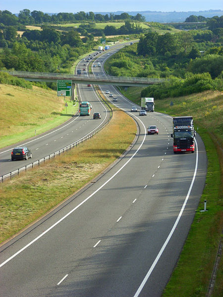
886:== {{int:filedesc}} == {{Information |description={{en|1=Showing the Newbury Bypass as it crosses the Lambourn valley. The nearer bridge carries a public footpath just east of Bagnor. The more distant one is at the A4 junction at Speen.}} |date=2008-08-21
363:– You must give appropriate credit, provide a link to the license, and indicate if changes were made. You may do so in any reasonable manner, but not in any way that suggests the licensor endorses you or your use.
235:
229:
141:
Showing the
Newbury Bypass as it crosses the Lambourn valley. The nearer bridge carries a public footpath just east of Bagnor. The more distant one is at the A4 junction at Speen.
691:
675:
593:
549:
699:
446:
790:
687:
671:
545:
458:
450:
442:
695:
683:
679:
633:
589:
454:
438:
596:"}},"text\/plain":{"en":{"P275":"Creative Commons Attribution-ShareAlike 2.0 Generic"}}}}": -->
993:
53:
47:
725:
619:
575:
245:
775:
280:
971:
This file contains additional information, probably added from the digital camera or scanner used to create or digitize it.
1085:
370:
98:
66:
502:
800:
753:
709:
559:
525:
510:
495:
768:
738:
643:
603:
468:
427:
702:"}},"text\/plain":{"en":{"P137":"Geograph Britain and Ireland"}}}}": -->
1116:
326:
974:
If the file has been modified from its original state, some details may not fully reflect the modified file.
369:– If you remix, transform, or build upon the material, you must distribute your contributions under the
287:
on the
Geograph website for the photographer's contact details. The copyright on this image is owned by
552:"}},"text\/plain":{"en":{"P6216":"copyrighted"}}}}": -->
896:
The following pages on the
English Knowledge use this file (pages on other projects are not listed):
106:
198:
1159:
868:
863:
760:
745:
517:
323:
182:
57:
42:
8:
1195:
267:
910:
251:
292:
93:
417:
915:
879:
1223:
1177:
1008:
905:
1048:
943:
171:
161:
810:
719:
653:
613:
569:
478:
1205:
272:
948:
1028:
284:
1241:
1018:
900:
836:
Click on a date/time to view the file as it appeared at that time.
237:
230:
51° 25′ 15.19″ N, 1° 20′ 44.16″ W
983:
150:
81:
411:
Add a one-line explanation of what this file represents
958:
933:
894:
924:
834:
105:
Commons is a freely licensed media file repository.
620:
Creative
Commons Attribution-ShareAlike 2.0 Generic
594:
Creative
Commons Attribution-ShareAlike 2.0 Generic
71:(480 × 640 pixels, file size: 150 KB, MIME type:
1200:Flash did not fire, compulsory flash suppression
380:https://creativecommons.org/licenses/by-sa/2.0
86:
386:Creative Commons Attribution-Share Alike 2.0
304:
146:
128:
684:https:\/\/www.geograph.org.uk\/photo\/937133
455:https:\/\/www.geograph.org.uk\/profile\/2562
167:
156:
14:
346:– to copy, distribute and transmit the work
926:The following other wikis use this file:
746:https://www.geograph.org.uk/photo/937133
518:https://www.geograph.org.uk/profile/2562
244:View this and other nearby images on:
205:
117:
1086:Adobe Photoshop Elements 3.0 Windows
291:and is licensed for reuse under the
220:
827:
327:Attribution-Share Alike 2.0 Generic
315:
310:
295:Attribution-ShareAlike 2.0 license.
13:
969:
416:
410:
301:
278:
135:
118:
64:
1258:
976:
415:
1039:Date and time of data generation
895:
801:coordinates of the point of view
791:coordinates of the point of view
401:
357:Under the following conditions:
322:This file is licensed under the
314:
309:
303:
271:
250:
236:
85:
31:
21:
398:
136:
1013:1/270 sec (0.0037037037037037)
944:Gebruiker:Addess2007/Kladblok7
921:
831:
726:file available on the internet
676:file available on the internet
397:
279:This image was taken from the
26:
1:
816:51°25'15.186"N, 1°20'44.160"W
36:
891:
776:Geograph Britain and Ireland
700:Geograph Britain and Ireland
496:object of statement has role
443:object of statement has role
423:Items portrayed in this file
263:
7:
1127:Date and time of digitizing
966:
10:
1263:
955:Usage on www.wikidata.org
940:Usage on nl.wikipedia.org
930:Usage on de.wikipedia.org
371:same or compatible license
125:
120:
1092:File change date and time
1003:(C) by Caplio R4 User
828:
211:Andrew Smith /
192:Andrew Smith /
16:
754:geograph.org.uk image ID
688:geograph.org.uk image ID
400:
337:
92:This is a file from the
41:
885:
183:required by the license
149:
131:The A34, Donnington.jpg
96:. Information from its
1135:Image compression mode
949:A34 (Groot-Brittannië)
864:03:36, 25 January 2011
285:this photograph's page
256:51.420885; -1.345600
99:description page there
46:Size of this preview:
1169:Maximum land aperture
1130:17:33, 21 August 2008
1095:11:23, 26 August 2008
1066:Horizontal resolution
1042:17:33, 21 August 2008
1100:Y and C positioning
1074:Vertical resolution
980:Camera manufacturer
352:– to adapt the work
213:The A34, Donnington
194:The A34, Donnington
52:Other resolutions:
1233:Scene capture type
1228:Auto white balance
911:Newbury, Berkshire
526:author name string
459:author name string
1250:
1249:
1172:3.3 APEX (f/3.14)
922:Global file usage
889:
604:copyright license
590:copyright license
409:
300:
299:
283:collection. See
261:
260:
218:
217:
186:
114:
113:
94:Wikimedia Commons
32:Global file usage
1254:
1108:Exposure Program
1000:Copyright holder
977:
876:
838:
778:
773:
763:
758:
748:
743:
739:described at URL
680:described at URL
560:copyright status
546:copyright status
533:
530:
520:
515:
505:
500:
407:
393:
390:
387:
384:
381:
373:as the original.
335:
324:Creative Commons
318:
317:
313:
312:
307:
306:
293:Creative Commons
281:Geograph project
275:
268:
257:
254:
240:
239:
233:
232:
221:
180:
152:
140:
132:
126:
110:
89:
88:
82:
76:
74:
61:
58:480 × 640 pixels
54:180 × 240 pixels
48:450 × 600 pixels
1262:
1261:
1257:
1256:
1255:
1253:
1252:
1251:
1151:APEX brightness
994:Caplio R4
965:
920:
897:
890:
882:
874:
830:
829:
826:
825:
824:
823:
822:
821:
820:
819:
817:
807:
806:
805:
803:
788:
787:
786:
785:
784:
783:
782:
781:
780:
779:
774:
771:
765:
764:
759:
756:
750:
749:
744:
741:
732:
731:
730:
728:
716:
715:
714:
712:
669:
668:
667:
666:
665:
664:
663:
662:
660:
650:
649:
648:
646:
631:
630:
629:
628:
627:
626:
625:
624:
622:
610:
609:
608:
606:
587:
586:
585:
584:
583:
582:
581:
580:
578:
566:
565:
564:
562:
543:
542:
541:
540:
539:
538:
537:
536:
535:
534:
531:
528:
522:
521:
516:
513:
507:
506:
501:
498:
489:
488:
487:
485:
475:
474:
473:
471:
436:
435:
434:
433:
432:
430:
414:
413:
412:
395:
394:
391:
388:
385:
382:
379:
378:
336:
333:
330:
319:
296:
266:
255:
228:
227:
224:Camera location
219:
208:
201:
189:
162:geograph.org.uk
142:
130:
123:
116:
115:
104:
103:
102:is shown below.
78:
72:
70:
63:
62:
51:
12:
11:
5:
1260:
1248:
1247:
1244:
1238:
1237:
1234:
1230:
1229:
1226:
1220:
1219:
1216:
1212:
1211:
1208:
1202:
1201:
1198:
1192:
1191:
1188:
1184:
1183:
1180:
1174:
1173:
1170:
1166:
1165:
1162:
1156:
1155:
1152:
1148:
1147:
1144:
1140:
1139:
1136:
1132:
1131:
1128:
1124:
1123:
1120:
1113:
1112:
1111:Normal program
1109:
1105:
1104:
1101:
1097:
1096:
1093:
1089:
1088:
1083:
1079:
1078:
1075:
1071:
1070:
1067:
1063:
1062:
1059:
1055:
1054:
1051:
1044:
1043:
1040:
1036:
1035:
1032:
1025:
1024:
1021:
1015:
1014:
1011:
1005:
1004:
1001:
997:
996:
991:
987:
986:
981:
968:
964:
963:
962:
961:
953:
952:
951:
946:
938:
937:
936:
923:
919:
918:
916:Newbury bypass
913:
908:
903:
893:
888:
887:
884:
880:
877:
871:
866:
861:
857:
856:
853:
850:
847:
844:
841:
833:
818:
815:
813:
812:
811:
809:
808:
804:
799:
797:
796:
795:
794:
792:
767:
766:
752:
751:
737:
736:
735:
734:
733:
729:
724:
722:
721:
720:
718:
717:
713:
710:source of file
708:
706:
705:
704:
703:
701:
697:
693:
689:
685:
681:
677:
673:
672:source of file
661:
659:21 August 2008
658:
656:
655:
654:
652:
651:
647:
642:
640:
639:
638:
637:
635:
623:
618:
616:
615:
614:
612:
611:
607:
602:
600:
599:
598:
597:
595:
591:
579:
574:
572:
571:
570:
568:
567:
563:
558:
556:
555:
554:
553:
551:
547:
524:
523:
509:
508:
494:
493:
492:
491:
490:
486:
483:
481:
480:
479:
477:
476:
472:
467:
465:
464:
463:
462:
460:
456:
452:
448:
444:
440:
431:
426:
424:
421:
420:
419:
418:
406:
405:
402:
399:
377:
376:
375:
374:
364:
355:
354:
353:
347:
340:You are free:
331:
321:
320:
302:
298:
297:
276:
265:
262:
259:
258:
248:
242:
225:
216:
215:
209:
206:
203:
202:
197:
190:
187:
175:
174:
169:
165:
164:
158:
154:
153:
151:21 August 2008
148:
144:
143:
133:
124:
122:
119:
112:
111:
90:
80:
79:
45:
40:
39:
34:
29:
24:
19:
9:
6:
4:
3:
2:
1259:
1245:
1243:
1240:
1239:
1235:
1232:
1231:
1227:
1225:
1224:White balance
1222:
1221:
1218:Auto exposure
1217:
1215:Exposure mode
1214:
1213:
1209:
1207:
1204:
1203:
1199:
1197:
1194:
1193:
1189:
1186:
1185:
1181:
1179:
1178:Metering mode
1176:
1175:
1171:
1168:
1167:
1163:
1161:
1160:Exposure bias
1158:
1157:
1153:
1150:
1149:
1145:
1143:APEX aperture
1142:
1141:
1137:
1134:
1133:
1129:
1126:
1125:
1121:
1118:
1115:
1114:
1110:
1107:
1106:
1102:
1099:
1098:
1094:
1091:
1090:
1087:
1084:
1082:Software used
1081:
1080:
1076:
1073:
1072:
1068:
1065:
1064:
1060:
1057:
1056:
1052:
1050:
1046:
1045:
1041:
1038:
1037:
1033:
1030:
1027:
1026:
1022:
1020:
1017:
1016:
1012:
1010:
1009:Exposure time
1007:
1006:
1002:
999:
998:
995:
992:
989:
988:
985:
982:
979:
978:
975:
972:
960:
957:
956:
954:
950:
947:
945:
942:
941:
939:
935:
932:
931:
929:
928:
927:
917:
914:
912:
909:
907:
906:Bypass (road)
904:
902:
899:
898:
883:
878:
872:
870:
867:
865:
862:
859:
858:
854:
851:
848:
845:
842:
840:
839:
837:
814:
802:
798:
777:
770:
762:
755:
747:
740:
727:
723:
711:
707:
657:
645:
641:
621:
617:
605:
601:
577:
573:
561:
557:
527:
519:
512:
504:
497:
482:
470:
466:
429:
425:
422:
403:
396:
383:CC BY-SA 2.0
372:
368:
365:
362:
359:
358:
356:
351:
348:
345:
342:
341:
339:
338:
332:Attribution:
328:
325:
308:
294:
290:
286:
282:
277:
274:
270:
269:
253:
249:
247:
246:OpenStreetMap
243:
241:
231:
226:
223:
222:
214:
210:
204:
200:
196: /
195:
191:
184:
179:
177:
176:
173:
170:
166:
163:
159:
155:
145:
139:
134:
127:
108:
101:
100:
95:
91:
84:
83:
77:
68:
67:Original file
59:
55:
49:
44:
38:
35:
33:
30:
28:
25:
23:
20:
18:
15:
1187:Light source
1049:focal length
990:Camera model
973:
970:
925:
835:
832:File history
532:Andrew Smith
503:photographer
447:photographer
366:
360:
349:
343:
334:Andrew Smith
289:Andrew Smith
288:
212:
199:CC BY-SA 2.0
193:
172:Andrew Smith
137:
107:You can help
97:
65:
22:File history
1206:Color space
1058:Orientation
984:RICOH
576:copyrighted
550:copyrighted
367:share alike
361:attribution
178:Attribution
129:Description
892:File usage
873:480 × 640
849:Dimensions
484:some value
73:image/jpeg
27:File usage
1242:Sharpness
1029:ISO speed
881:BaldBoris
846:Thumbnail
843:Date/Time
644:inception
634:inception
264:Licensing
207:InfoField
188:InfoField
138:English:
1236:Standard
1103:Co-sited
1019:F-number
967:Metadata
959:Q4649158
934:A34 road
901:A34 road
875:(150 KB)
769:operator
696:operator
404:Captions
350:to remix
344:to share
329:license.
37:Metadata
1190:Unknown
1182:Pattern
1119:version
1053:17.3 mm
860:current
855:Comment
469:creator
439:creator
428:depicts
408:English
121:Summary
69:
1246:Normal
1077:72 dpi
1069:72 dpi
1061:Normal
1031:rating
761:937133
692:937133
234:
168:Author
157:Source
1196:Flash
1047:Lens
1023:f/4.2
160:From
1210:sRGB
1122:2.21
1117:Exif
852:User
392:true
389:true
147:Date
17:File
1154:5.6
1146:4.1
1138:2.8
1034:100
511:URL
451:URL
772::
757::
742::
529::
514::
499::
56:|
50:.
1164:0
185:)
181:(
109:.
75:)
60:.

