723:"}},"text\/plain":{"en":{"":"coordinates of the point of view"}}},"{\"value\":{\"latitude\":55.838025,\"longitude\":-4.37256,\"altitude\":null,\"precision\":1.0e-6,\"globe\":\"http:\\\/\\\/www.wikidata.org\\\/entity\\\/Q2\"},\"type\":\"globecoordinate\"}":{"text\/html":{"en":{"P1259":"55\u00b050'16.890"N, 4\u00b022'21.216"W"}},"text\/plain":{"en":{"P1259":"55\u00b050'16.890\"N, 4\u00b022'21.216\"W"}}},"{\"value\":{\"entity-type\":\"property\",\"numeric-id\":7787,\"id\":\"P7787\"},\"type\":\"wikibase-entityid\"}":{"text\/html":{"en":{"":"
910:"}},"text\/plain":{"en":{"":"coordinates of depicted place"}}},"{\"value\":{\"latitude\":55.83456,\"longitude\":-4.37043,\"altitude\":null,\"precision\":1.0e-5,\"globe\":\"http:\\\/\\\/www.wikidata.org\\\/entity\\\/Q2\"},\"type\":\"globecoordinate\"}":{"text\/html":{"en":{"P9149":"55\u00b050'4.42"N, 4\u00b022'13.55"W"}},"text\/plain":{"en":{"P9149":"55\u00b050'4.42\"N, 4\u00b022'13.55\"W"}}},"{\"value\":{\"entity-type\":\"property\",\"numeric-id\":7787,\"id\":\"P7787\"},\"type\":\"wikibase-entityid\"}":{"text\/html":{"en":{"":"
502:"}},"text\/plain":{"en":{"":"author name string"}}},"{\"value\":\"Lairich Rig\",\"type\":\"string\"}":{"text\/html":{"en":{"P2093":"Lairich Rig"}},"text\/plain":{"en":{"P2093":"Lairich Rig"}}},"{\"value\":{\"entity-type\":\"property\",\"numeric-id\":2699,\"id\":\"P2699\"},\"type\":\"wikibase-entityid\"}":{"text\/html":{"en":{"":"
685:"}},"text\/plain":{"en":{"":"inception"}}},"{\"value\":{\"time\":\"+2005-09-02T00:00:00Z\",\"timezone\":0,\"before\":0,\"after\":0,\"precision\":11,\"calendarmodel\":\"http:\\\/\\\/www.wikidata.org\\\/entity\\\/Q1985727\"},\"type\":\"time\"}":{"text\/html":{"en":{"P571":"2 September 2005"}},"text\/plain":{"en":{"P571":"2 September 2005"}}}}": -->
787:
287:
237:
279:
229:
906:
251:
322:
360:
365:
62:
795:"}},"text\/plain":{"en":{"P7482":"file available on the internet"}}},"{\"value\":{\"entity-type\":\"property\",\"numeric-id\":137,\"id\":\"P137\"},\"type\":\"wikibase-entityid\"}":{"text\/html":{"en":{"":"
803:"}},"text\/plain":{"en":{"P137":"Geograph Britain and Ireland"}}},"{\"value\":{\"entity-type\":\"property\",\"numeric-id\":7384,\"id\":\"P7384\"},\"type\":\"wikibase-entityid\"}":{"text\/html":{"en":{"":"
494:"}},"text\/plain":{"en":{"":"object of statement has role"}}},"{\"value\":{\"entity-type\":\"item\",\"numeric-id\":33231,\"id\":\"Q33231\"},\"type\":\"wikibase-entityid\"}":{"text\/html":{"en":{"P3831":"
641:"}},"text\/plain":{"en":{"":"copyright license"}}},"{\"value\":{\"entity-type\":\"item\",\"numeric-id\":19068220,\"id\":\"Q19068220\"},\"type\":\"wikibase-entityid\"}":{"text\/html":{"en":{"P275":"
597:"}},"text\/plain":{"en":{"":"copyright status"}}},"{\"value\":{\"entity-type\":\"item\",\"numeric-id\":50423863,\"id\":\"Q50423863\"},\"type\":\"wikibase-entityid\"}":{"text\/html":{"en":{"P6216":"
791:"}},"text\/plain":{"en":{"":"source of file"}}},"{\"value\":{\"entity-type\":\"item\",\"numeric-id\":74228490,\"id\":\"Q74228490\"},\"type\":\"wikibase-entityid\"}":{"text\/html":{"en":{"P7482":"
498:"}},"text\/plain":{"en":{"P3831":"photographer"}}},"{\"value\":{\"entity-type\":\"property\",\"numeric-id\":2093,\"id\":\"P2093\"},\"type\":\"wikibase-entityid\"}":{"text\/html":{"en":{"":"
914:"}},"text\/plain":{"en":{"":"heading"}}},"{\"value\":{\"amount\":\"+157\",\"unit\":\"http:\\\/\\\/www.wikidata.org\\\/entity\\\/Q28390\"},\"type\":\"quantity\"}":{"text\/html":{"en":{"P7787":"157
799:"}},"text\/plain":{"en":{"":"operator"}}},"{\"value\":{\"entity-type\":\"item\",\"numeric-id\":1503119,\"id\":\"Q1503119\"},\"type\":\"wikibase-entityid\"}":{"text\/html":{"en":{"P137":"
727:"}},"text\/plain":{"en":{"":"heading"}}},"{\"value\":{\"amount\":\"+157\",\"unit\":\"http:\\\/\\\/www.wikidata.org\\\/entity\\\/Q28390\"},\"type\":\"quantity\"}":{"text\/html":{"en":{"P7787":"157
811:"}},"text\/plain":{"en":{"P7384":"1663679"}}},"{\"value\":{\"entity-type\":\"property\",\"numeric-id\":973,\"id\":\"P973\"},\"type\":\"wikibase-entityid\"}":{"text\/html":{"en":{"":"
490:"}},"text\/plain":{"en":{"":"creator"}}},"{\"value\":{\"entity-type\":\"property\",\"numeric-id\":3831,\"id\":\"P3831\"},\"type\":\"wikibase-entityid\"}":{"text\/html":{"en":{"":"
593:
815:"}},"text\/plain":{"en":{"":"described at URL"}}},"{\"value\":\"https:\\\/\\\/www.geograph.org.uk\\\/photo\\\/1663679\",\"type\":\"string\"}":{"text\/html":{"en":{"P973":"
506:"}},"text\/plain":{"en":{"":"URL"}}},"{\"value\":\"https:\\\/\\\/www.geograph.org.uk\\\/profile\\\/22713\",\"type\":\"string\"}":{"text\/html":{"en":{"P2699":"
807:"}},"text\/plain":{"en":{"":"geograph.org.uk image ID"}}},"{\"value\":\"1663679\",\"type\":\"string\"}":{"text\/html":{"en":{"P7384":"
33:
270:
220:
412:– You must give appropriate credit, provide a link to the license, and indicate if changes were made. You may do so in any reasonable manner, but not in any way that suggests the licensor endorses you or your use.
234:
284:
808:
792:
642:
598:
800:
495:
911:
907:
804:
788:
724:
720:
594:
503:
499:
491:
816:
507:
812:
796:
682:
638:
487:
41:
73:
645:"}},"text\/plain":{"en":{"P275":"Creative Commons Attribution-ShareAlike 2.0 Generic"}}}}": -->
510:"}},"text\/plain":{"en":{"P2699":"https:\/\/www.geograph.org.uk\/profile\/22713"}}}}": -->
157:
819:"}},"text\/plain":{"en":{"P973":"https:\/\/www.geograph.org.uk\/photo\/1663679"}}}}": -->
842:
668:
624:
294:
244:
862:
329:
419:
551:
952:
925:
870:
826:
765:
738:
608:
572:
559:
544:
885:
855:
692:
652:
517:
476:
1015:
1010:
32:
375:
418:– If you remix, transform, or build upon the material, you must distribute your contributions under the
336:
on the
Geograph website for the photographer's contact details. The copyright on this image is owned by
601:"}},"text\/plain":{"en":{"P6216":"copyrighted"}}}}": -->
1043:
The following pages on the
English Knowledge use this file (pages on other projects are not listed):
918:"}},"text\/plain":{"en":{"P7787":"157 degree"}}}}": -->
731:"}},"text\/plain":{"en":{"P7787":"157 degree"}}}}": -->
81:
892:
877:
579:
372:
173:
8:
1047:
316:
300:
250:
341:
68:
466:
189:
1026:
146:
136:
935:
836:
748:
702:
662:
618:
527:
321:
333:
983:
Click on a date/time to view the file as it appeared at that time.
286:
236:
271:
55° 50′ 04.4″ N, 4° 22′ 14″ W
221:
55° 50′ 16.9″ N, 4° 22′ 21″ W
125:
56:
460:
Add a one-line explanation of what this file represents
1041:
981:
164:
Creative
Commons Attribution Share-alike license 2.0
80:
Commons is a freely licensed media file repository.
669:
Creative
Commons Attribution-ShareAlike 2.0 Generic
643:
Creative
Commons Attribution-ShareAlike 2.0 Generic
46:(640 × 480 pixels, file size: 63 KB, MIME type:
429:https://creativecommons.org/licenses/by-sa/2.0
61:
817:https:\/\/www.geograph.org.uk\/photo\/1663679
508:https:\/\/www.geograph.org.uk\/profile\/22713
435:Creative Commons Attribution-Share Alike 2.0
353:
152:
121:
103:
142:
131:
14:
915:
728:
395:– to copy, distribute and transmit the work
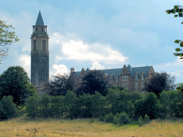
106:Leverndale Hospital (geograph 1663679).jpg
42:Leverndale_Hospital_(geograph_1663679).jpg
893:https://www.geograph.org.uk/photo/1663679
580:https://www.geograph.org.uk/profile/22713
1033:Transferred from geograph.co.uk using
293:View this and other nearby images on:
243:View this and other nearby images on:
196:
92:
340:and is licensed for reuse under the
261:
211:
974:
376:Attribution-Share Alike 2.0 Generic
364:
359:
344:Attribution-ShareAlike 2.0 license.
13:
465:
459:
350:
327:
110:
93:
39:
1059:
464:
1042:
739:coordinates of the point of view
721:coordinates of the point of view
450:
406:Under the following conditions:
371:This file is licensed under the
363:
358:
352:
320:
299:
285:
277:
249:
235:
227:
60:
21:
447:
111:
36:No higher resolution available.
978:
843:file available on the internet
793:file available on the internet
446:
328:This image was taken from the
26:
1:
926:coordinates of depicted place
908:coordinates of depicted place
754:55°50'16.890"N, 4°22'21.216"W
1038:
863:Geograph Britain and Ireland
801:Geograph Britain and Ireland
545:object of statement has role
492:object of statement has role
472:Items portrayed in this file
312:
276:
226:
7:
10:
1064:
941:55°50'4.42"N, 4°22'13.55"W
420:same or compatible license
100:
95:
975:
16:
871:geograph.org.uk image ID
805:geograph.org.uk image ID
449:
386:
202:Lairich Rig /
183:Lairich Rig /
67:This is a file from the
31:
1032:
174:required by the license
124:
71:. Information from its
334:this photograph's page
305:55.834560; -4.370430
255:55.838025; -4.372560
74:description page there
1011:15:38, 22 April 2019
1048:Leverndale Hospital
401:– to adapt the work
204:Leverndale Hospital
185:Leverndale Hospital
116:Leverndale Hospital
560:author name string
500:author name string
1036:
917:
730:
653:copyright license
639:copyright license
458:
349:
348:
332:collection. See
310:
309:
260:
259:
209:
208:
177:
161:
158:Reusing this file
89:
88:
69:Wikimedia Commons
1055:
1023:
985:
963:
962:
957:
895:
890:
886:described at URL
880:
875:
865:
860:
813:described at URL
776:
775:
770:
708:2 September 2005
609:copyright status
595:copyright status
582:
577:
567:
564:
554:
549:
456:
442:
439:
436:
433:
430:
422:as the original.
384:
373:Creative Commons
367:
366:
362:
361:
356:
355:
342:Creative Commons
330:Geograph project
324:
317:
306:
303:
289:
288:
282:
281:
280:
274:
273:
262:
256:
253:
239:
238:
232:
231:
230:
224:
223:
212:
171:
155:
127:
126:2 September 2005
115:
107:
101:
85:
64:
63:
57:
51:
49:
1063:
1062:
1058:
1057:
1056:
1054:
1053:
1052:
1044:
1037:
1029:
1021:
977:
976:
973:
972:
971:
970:
969:
968:
967:
966:
965:
964:
960:
958:
955:
946:
945:
944:
942:
932:
931:
930:
928:
905:
904:
903:
902:
901:
900:
899:
898:
897:
896:
891:
888:
882:
881:
876:
873:
867:
866:
861:
858:
849:
848:
847:
845:
833:
832:
831:
829:
786:
785:
784:
783:
782:
781:
780:
779:
778:
777:
773:
771:
768:
759:
758:
757:
755:
745:
744:
743:
741:
718:
717:
716:
715:
714:
713:
712:
711:
709:
699:
698:
697:
695:
680:
679:
678:
677:
676:
675:
674:
673:
671:
659:
658:
657:
655:
636:
635:
634:
633:
632:
631:
630:
629:
627:
615:
614:
613:
611:
592:
591:
590:
589:
588:
587:
586:
585:
584:
583:
578:
575:
569:
568:
565:
562:
556:
555:
550:
547:
538:
537:
536:
534:
524:
523:
522:
520:
485:
484:
483:
482:
481:
479:
463:
462:
461:
444:
443:
440:
437:
434:
431:
428:
427:
385:
382:
379:
368:
345:
315:
304:
278:
269:
268:
265:Object location
254:
228:
219:
218:
215:Camera location
210:
199:
192:
180:
137:geograph.org.uk
117:
105:
98:
91:
90:
79:
78:
77:is shown below.
53:
47:
45:
38:
37:
12:
11:
5:
1061:
1051:
1050:
1040:
1035:
1034:
1031:
1027:
1024:
1018:
1013:
1008:
1004:
1003:
1000:
997:
994:
991:
988:
980:
951:
950:
949:
948:
947:
943:
940:
938:
937:
936:
934:
933:
929:
924:
922:
921:
920:
919:
913:
909:
884:
883:
869:
868:
854:
853:
852:
851:
850:
846:
841:
839:
838:
837:
835:
834:
830:
827:source of file
825:
823:
822:
821:
820:
818:
814:
810:
806:
802:
798:
794:
790:
789:source of file
764:
763:
762:
761:
760:
756:
753:
751:
750:
749:
747:
746:
742:
737:
735:
734:
733:
732:
726:
722:
710:
707:
705:
704:
703:
701:
700:
696:
691:
689:
688:
687:
686:
684:
672:
667:
665:
664:
663:
661:
660:
656:
651:
649:
648:
647:
646:
644:
640:
628:
623:
621:
620:
619:
617:
616:
612:
607:
605:
604:
603:
602:
600:
596:
571:
570:
558:
557:
543:
542:
541:
540:
539:
535:
532:
530:
529:
528:
526:
525:
521:
516:
514:
513:
512:
511:
509:
505:
501:
497:
493:
489:
480:
475:
473:
470:
469:
468:
467:
455:
454:
451:
448:
426:
425:
424:
423:
413:
404:
403:
402:
396:
389:You are free:
380:
370:
369:
351:
347:
346:
325:
314:
311:
308:
307:
297:
291:
266:
258:
257:
247:
241:
216:
207:
206:
200:
197:
194:
193:
188:
181:
178:
166:
165:
162:
150:
149:
144:
140:
139:
133:
129:
128:
123:
119:
118:
108:
99:
97:
94:
87:
86:
65:
55:
54:
35:
30:
29:
24:
19:
9:
6:
4:
3:
2:
1060:
1049:
1046:
1045:
1030:
1025:
1019:
1017:
1014:
1012:
1009:
1006:
1005:
1001:
998:
995:
992:
989:
987:
986:
984:
954:
939:
927:
923:
894:
887:
879:
872:
864:
857:
844:
840:
828:
824:
767:
752:
740:
736:
706:
694:
690:
670:
666:
654:
650:
626:
622:
610:
606:
581:
574:
561:
553:
546:
531:
519:
515:
478:
474:
471:
452:
445:
432:CC BY-SA 2.0
421:
417:
414:
411:
408:
407:
405:
400:
397:
394:
391:
390:
388:
387:
381:Attribution:
377:
374:
357:
343:
339:
335:
331:
326:
323:
319:
318:
302:
298:
296:
295:OpenStreetMap
292:
290:
272:
267:
264:
263:
252:
248:
246:
245:OpenStreetMap
242:
240:
222:
217:
214:
213:
205:
201:
195:
191:
187: /
186:
182:
175:
170:
168:
167:
163:
159:
154:
151:
148:
145:
141:
138:
134:
130:
120:
114:
109:
102:
83:
76:
75:
70:
66:
59:
58:
52:
43:
34:
28:
25:
23:
20:
18:
15:
982:
979:File history
552:photographer
496:photographer
415:
409:
398:
392:
337:
275:
225:
203:
190:CC BY-SA 2.0
184:
112:
82:You can help
72:
40:
22:File history
625:copyrighted
599:copyrighted
566:Lairich Rig
416:share alike
410:attribution
383:Lairich Rig
338:Lairich Rig
169:Attribution
147:Lairich Rig
104:Description
1039:File usage
1020:640 × 480
996:Dimensions
533:some value
153:Permission
48:image/jpeg
27:File usage
1028:Dormskirk
993:Thumbnail
990:Date/Time
693:inception
683:inception
313:Licensing
198:InfoField
179:InfoField
113:English:
856:operator
797:operator
453:Captions
399:to remix
393:to share
378:license.
1022:(63 KB)
1007:current
1002:Comment
953:heading
912:heading
878:1663679
809:1663679
766:heading
725:heading
518:creator
488:creator
477:depicts
457:English
96:Summary
44:
961:degree
916:degree
774:degree
729:degree
283:
233:
143:Author
132:Source
135:From
999:User
959:157
772:157
441:true
438:true
122:Date
17:File
573:URL
504:URL
956::
889::
874::
859::
769::
576::
563::
548::
176:)
172:(
160:)
156:(
84:.
50:)
.jpg)
.jpg¶ms=055.838025_N_-004.372560_E_globe:Earth_type:camera_source:geograph-osgb36(NS51526308)_heading:157.00&language=en)
.jpg¶ms=055.834560_N_-004.370430_E_globe:Earth_class:object_type:object_source:geograph-osgb36(NS51646269)_heading:157.00&language=en)
