319:
37:
551:
287:
105:
44:
190:
Hukuntsi is the headquarters for the
Kgalagadi North Sub-District thus it is home to the Rural Administration Centre for government offices. Also located in Hukuntsi are a hospital and a clinic, 3 elementary school and 1 community junior secondary school. Amenities available in Hukuntsi include
171:
Hukuntsi, meaning "many corners", is named for its status as one of the four major villages in its region of the
Kgalagadi Desert. It's located 114 kilometres away from the village of
226:
206:
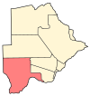
Lokgwabe is a village in
Kgalagadi District of Botswana. It is located in the Kalahari Desert and the village has a primary school. The population was 1,304 in 2001 census.
209:
In
Hukuntsi there is Entabeni Hotel which has up to 20 rooms. The other is Shi Hotel with also up to 20 rooms. There is a bed and breakfast named CM apartments.
191:
guest houses, several take away restaurants, an independently owned supermarkets, two wholesalers, butcheries and variety shops. The village is served by
276:
68:
592:
233:
183:
highway. It had a population of 4,654 in the 2011 census. The majority of
Hukuntsi's population are Bangologa people, a Tswana clan (
611:
621:
269:
140:
585:
512:
36:
616:
262:
198:
Weather in
Hukuntsi varies dramatically- very cold nights in the winter and very hot days in the summer.
578:
184:
254:
145:
115:
463:
8:
290:
157:
120:
192:
566:
493:
383:
562:
408:
368:
343:
318:
172:
605:
527:
514:
83:
70:
473:
468:
550:
433:
423:
393:
284:
453:
363:
348:
558:
488:
458:
413:
403:
398:
388:
358:
338:
333:
294:
286:
176:
165:
161:
108:
104:
448:
428:
418:
308:
498:
478:
443:
438:
180:
378:
373:
483:
603:
586:
270:
227:"2011 Botswana Population and Housing Census"
593:
579:
277:
263:
604:
258:
18:Place in Kgalagadi District, Botswana
545:
13:
14:
633:
549:
317:
285:
103:
43:
42:
35:
219:
1:
212:
612:Populated places in Botswana
565:. You can help Knowledge by
7:
201:
10:
638:
544:
185:List of Sotho-Tswana clans
326:
315:
301:
139:
131:
126:
114:
99:
64:
30:
23:
622:Botswana geography stubs
561:location article is a
528:23.99889°S 21.78000°E
84:23.99889°S 21.78000°E
295:Republic of Botswana
239:on 23 September 2015
56:Location in Botswana
533:-23.99889; 21.78000
524: /
89:-23.99889; 21.78000
80: /
617:Kgalagadi District
291:Kgalagadi District
158:Kgalagadi District
132: • Total
121:Kgalagadi District
574:
573:
507:
506:
151:
150:
629:
595:
588:
581:
553:
546:
539:
538:
536:
535:
534:
529:
525:
522:
521:
520:
517:
321:
289:
279:
272:
265:
256:
255:
249:
248:
246:
244:
238:
232:. Archived from
231:
223:
193:Hukuntsi Airport
156:is a village in
107:
95:
94:
92:
91:
90:
85:
81:
78:
77:
76:
73:
46:
45:
39:
21:
20:
637:
636:
632:
631:
630:
628:
627:
626:
602:
601:
600:
599:
542:
532:
530:
526:
523:
518:
515:
513:
511:
510:
508:
503:
322:
313:
297:
283:
253:
252:
242:
240:
236:
229:
225:
224:
220:
215:
204:
88:
86:
82:
79:
74:
71:
69:
67:
66:
60:
59:
58:
57:
54:
53:
52:
51:
47:
26:
19:
12:
11:
5:
635:
625:
624:
619:
614:
598:
597:
590:
583:
575:
572:
571:
554:
505:
504:
502:
501:
496:
491:
486:
481:
476:
471:
466:
461:
456:
451:
446:
441:
436:
431:
426:
421:
416:
411:
406:
401:
396:
391:
386:
381:
376:
371:
366:
361:
356:
351:
346:
341:
336:
330:
328:
327:Rural villages
324:
323:
316:
314:
312:
311:
305:
303:
302:Urban villages
299:
298:
282:
281:
274:
267:
259:
251:
250:
217:
216:
214:
211:
203:
200:
149:
148:
143:
137:
136:
133:
129:
128:
124:
123:
118:
112:
111:
101:
97:
96:
62:
61:
55:
49:
48:
41:
40:
34:
33:
32:
31:
28:
27:
24:
17:
9:
6:
4:
3:
2:
634:
623:
620:
618:
615:
613:
610:
609:
607:
596:
591:
589:
584:
582:
577:
576:
570:
568:
564:
560:
555:
552:
548:
547:
543:
540:
537:
500:
497:
495:
492:
490:
487:
485:
482:
480:
477:
475:
472:
470:
467:
465:
462:
460:
457:
455:
452:
450:
447:
445:
442:
440:
437:
435:
432:
430:
427:
425:
422:
420:
417:
415:
412:
410:
407:
405:
402:
400:
397:
395:
392:
390:
387:
385:
382:
380:
377:
375:
372:
370:
367:
365:
362:
360:
357:
355:
352:
350:
347:
345:
342:
340:
337:
335:
332:
331:
329:
325:
320:
310:
307:
306:
304:
300:
296:
292:
288:
280:
275:
273:
268:
266:
261:
260:
257:
235:
228:
222:
218:
210:
207:
199:
196:
194:
188:
186:
182:
178:
175:, off of the
174:
169:
167:
163:
159:
155:
147:
144:
142:
138:
134:
130:
125:
122:
119:
117:
113:
110:
106:
102:
98:
93:
65:Coordinates:
63:
38:
29:
22:
16:
567:expanding it
556:
541:
509:
353:
243:11 September
241:. Retrieved
234:the original
221:
208:
205:
197:
189:
170:
153:
152:
15:
531: /
474:Struizendam
469:Rapples Pan
87: /
606:Categories
519:21°46′48″E
516:23°59′56″S
434:Middlepits
424:Maralaleng
394:Kolonkwane
213:References
127:Population
75:21°46′48″E
72:23°59′56″S
464:Phuduhudu
454:Omaweneno
364:Inalegolo
349:Gakhibane
559:Botswana
489:Vaalhoek
459:Phepheng
414:Makopong
404:Lokgwabe
399:Lehututu
389:Kokotsha
359:Hunhukwe
354:Hukuntsi
339:Bokspits
334:Bogogobo
202:Lokgwabe
177:Gaborone
166:Botswana
162:Kalahari
154:Hukuntsi
116:District
109:Botswana
50:Hukuntsi
25:Hukuntsi
449:Ngwatle
429:Maubelo
419:Maleshe
309:Tsabong
293:of the
141:Climate
100:Country
499:Zutswa
479:Tshane
444:Ncaang
439:Monong
181:Ghanzi
557:This
494:Werda
384:Khawa
379:Khuis
374:Khisa
237:(PDF)
230:(PDF)
164:) in
135:4,654
563:stub
484:Ukwi
409:Make
369:Kang
344:Bray
245:2013
173:Kang
187:).
146:BWh
608::
195:.
168:.
594:e
587:t
580:v
569:.
278:e
271:t
264:v
247:.
179:-
160:(
Text is available under the Creative Commons Attribution-ShareAlike License. Additional terms may apply.

