635:"}},"text\/plain":{"en":{"":"inception"}}},"{\"value\":{\"time\":\"+2007-10-05T00:00:00Z\",\"timezone\":0,\"before\":0,\"after\":0,\"precision\":11,\"calendarmodel\":\"http:\\\/\\\/www.wikidata.org\\\/entity\\\/Q1985727\"},\"type\":\"time\"}":{"text\/html":{"en":{"P571":"5 October 2007"}},"text\/plain":{"en":{"P571":"5 October 2007"}}}}": -->
43:
372:
327:
378:
383:
236:
99:
574:"}},"text\/plain":{"en":{"P275":"GNU Free Documentation License, version 1.2 or later"}}},"{\"value\":{\"entity-type\":\"item\",\"numeric-id\":14946043,\"id\":\"Q14946043\"},\"type\":\"wikibase-entityid\"}":{"text\/html":{"en":{"P275":"
673:"}},"text\/plain":{"en":{"":"media type"}}},"{\"value\":\"image\\\/svg+xml\",\"type\":\"string\"}":{"text\/html":{"en":{"P1163":"image\/svg+xml"}},"text\/plain":{"en":{"P1163":"image\/svg+xml"}}}}": -->
570:"}},"text\/plain":{"en":{"":"copyright license"}}},"{\"value\":{\"entity-type\":\"item\",\"numeric-id\":50829104,\"id\":\"Q50829104\"},\"type\":\"wikibase-entityid\"}":{"text\/html":{"en":{"P275":"
526:"}},"text\/plain":{"en":{"":"copyright status"}}},"{\"value\":{\"entity-type\":\"item\",\"numeric-id\":50423863,\"id\":\"Q50423863\"},\"type\":\"wikibase-entityid\"}":{"text\/html":{"en":{"P6216":"
669:
782:
749:
424:– You must give appropriate credit, provide a link to the license, and indicate if changes were made. You may do so in any reasonable manner, but not in any way that suggests the licensor endorses you or your use.
284:
799:{{Information |Description={{ja|概要 大阪府豊能町位置図 *作成者 Lincun *使用データ 国土交通省 国土数値情報(行政区域(N03)・湖沼(W09))}} {{en|Location of Toyono in Osaka, Japan.}} |Source=Transferred from [http://ja.w
575:
571:
527:
670:
523:
632:
567:
344:
246:
on
Japanese Knowledge. It may also be a file based on one of these maps (see info in file history or author field for more info on later editors). Source:
256:
Data used : Ministry of Land, Infrastructure, Transport and
Tourism - National Land Numerical Information (Administrative Area (N03) / Lake (W09))
69:
73:
65:
61:
57:
53:
47:
464:
110:
822:
578:"}},"text\/plain":{"en":{"P275":"Creative Commons Attribution-ShareAlike 3.0 Unported"}}}}": -->
82:
342:; with no Invariant Sections, no Front-Cover Texts, and no Back-Cover Texts. A copy of the license is included in the section entitled
293:
223:
618:
601:
553:
300:
1014:
This file contains additional information, probably added from the digital camera or scanner used to create or digitize it.
896:
811:
806:
781:
776:
431:
767:
680:
537:
334:
642:
585:
512:
966:
393:
1017:
If the file has been modified from its original state, some details may not fully reflect the modified file.
1001:
956:
339:
430:– If you remix, transform, or build upon the material, you must distribute your contributions under the
530:"}},"text\/plain":{"en":{"P6216":"copyrighted"}}}}": -->
839:
The following pages on the
English Knowledge use this file (pages on other projects are not listed):
748:
743:
42:
118:
278:
332:
Permission is granted to copy, distribute and/or modify this document under the terms of the
390:
8:
759:
164:
161:
105:
502:
843:
936:
866:
472:
272:
243:
212:
848:
792:
690:
652:
612:
595:
547:
996:
926:
290:
This tag does not indicate the copyright status of the attached work.
242:
This file is a map of a municipality in Japan created and uploaded by
321:
716:
Click on a date/time to view the file as it appeared at that time.
235:
886:
976:
176:
93:
87:(SVG file, nominally 490 × 690 pixels, file size: 32 KB)
496:
Add a one-line explanation of what this file represents
986:
837:
857:
714:
619:
Creative
Commons Attribution-ShareAlike 3.0 Unported
602:
576:
Creative
Commons Attribution-ShareAlike 3.0 Unported
572:
338:, Version 1.2 or any later version published by the
117:
Commons is a freely licensed media file repository.
946:
916:
906:
876:
467:. All following user names refer to ja.wikipedia.
441:https://creativecommons.org/licenses/by-sa/3.0
98:
447:Creative Commons Attribution-Share Alike 3.0
371:
218:
172:
140:
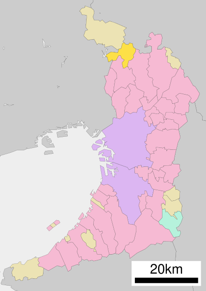
266:使用データ : 国土交通省 国土数値情報(行政区域(N03)・湖沼(W09))
208:
182:
14:
407:– to copy, distribute and transmit the work
46:Size of this PNG preview of this SVG file:
859:The following other wikis use this file:
458:
285:this category for more files like this
129:
394:Attribution-Share Alike 3.0 Unported
350:http://www.gnu.org/copyleft/fdl.html
230:
768:File:Map_of_Osaka_Prefecture_Ja.svg
707:
382:
377:
153:Location of Toyono in Osaka, Japan.
13:
1012:
501:
495:
463:The original description page was
462:
368:
260:
250:
155:
147:
130:
80:
1054:
1019:
500:
143:Toyono in Osaka Prefecture Ja.svg
838:
486:
418:Under the following conditions:
389:This file is licensed under the
381:
376:
370:
326:
325:
261:
234:
156:
97:
31:
21:
483:
271:The original file was licensed
251:
148:
854:
711:
482:
356:GNU Free Documentation License
345:GNU Free Documentation License
335:GNU Free Documentation License
26:
1:
36:
834:
508:Items portrayed in this file
317:
7:
1009:
10:
1059:
993:Usage on zh.wikipedia.org
983:Usage on www.wikidata.org
973:Usage on vi.wikipedia.org
963:Usage on uk.wikipedia.org
953:Usage on th.wikipedia.org
943:Usage on sv.wikipedia.org
933:Usage on ko.wikipedia.org
923:Usage on ja.wikipedia.org
913:Usage on it.wikipedia.org
903:Usage on fr.wikipedia.org
893:Usage on fa.wikipedia.org
883:Usage on es.wikipedia.org
873:Usage on ca.wikipedia.org
863:Usage on ar.wikipedia.org
432:same or compatible license
137:
132:
708:
189:
16:
829:{{基礎自治体位置図画像情報|大阪府|豊能町}}
485:
477:{{基礎自治体位置図画像情報|大阪府|豊能町}}
475:500×772×0 (16574 bytes)
398:
340:Free Software Foundation
104:This is a file from the
41:
828:
798:
765:
194:Data: 国土交通省 国土数値情報(行政区域
175:
108:. Information from its
744:09:02, 22 October 2020
111:description page there
807:13:41, 5 October 2007
70:1,454 × 2,048 pixels
777:14:12, 2 March 2008
459:Original upload log
413:– to adapt the work
52:Other resolutions:
296:is still required.
66:727 × 1,024 pixels
1046:
1045:
855:Global file usage
832:
586:copyright license
568:copyright license
494:
471:2007-10-05 13:41
367:
366:
314:
313:
310:
309:
305:
301:Commons:Licensing
227:
224:Reusing this file
126:
125:
106:Wikimedia Commons
32:Global file usage
1050:
1020:
844:Osaka Prefecture
819:
789:
756:
718:
538:copyright status
524:copyright status
492:
454:
451:
448:
445:
442:
434:as the original.
391:Creative Commons
385:
384:
380:
379:
374:
373:
363:
360:
357:
354:
351:
329:
328:
322:
304:
297:
289:
281:
280:{{Cc-by-sa-3.0}}
275:
265:
255:
238:
231:
221:
201:
197:
191:
178:
160:
152:
144:
138:
122:
101:
100:
94:
88:
77:
74:490 × 690 pixels
62:545 × 768 pixels
58:341 × 480 pixels
54:170 × 240 pixels
48:426 × 600 pixels
1058:
1057:
1053:
1052:
1051:
1049:
1048:
1047:
1008:
853:
840:
833:
825:
817:
795:
787:
762:
754:
710:
709:
706:
705:
704:
703:
702:
701:
700:
699:
697:
687:
686:
685:
683:
668:
667:
666:
665:
664:
663:
662:
661:
659:
649:
648:
647:
645:
630:
629:
628:
627:
626:
625:
624:
623:
621:
610:
609:
608:
607:
606:
604:
592:
591:
590:
588:
565:
564:
563:
562:
561:
560:
559:
558:
556:
544:
543:
542:
540:
521:
520:
519:
518:
517:
515:
499:
498:
497:
468:
461:
456:
455:
452:
449:
446:
443:
440:
439:
397:
386:
361:
358:
355:
352:
349:
320:
315:
298:
291:
279:
273:
267:
257:
199:
195:
188:Original file:
168:
154:
142:
135:
128:
127:
116:
115:
114:is shown below.
90:
86:
79:
78:
51:
12:
11:
5:
1056:
1044:
1043:
1040:
1036:
1035:
1032:
1028:
1027:
1024:
1011:
1007:
1006:
1005:
1004:
999:
991:
990:
989:
981:
980:
979:
971:
970:
969:
967:Тойоно (Осака)
961:
960:
959:
951:
950:
949:
941:
940:
939:
931:
930:
929:
921:
920:
919:
911:
910:
909:
901:
900:
899:
897:تویونو، اوساکا
891:
890:
889:
887:Toyono (Osaka)
881:
880:
879:
871:
870:
869:
856:
852:
851:
846:
836:
831:
830:
827:
823:
820:
814:
809:
804:
801:
800:
797:
793:
790:
784:
779:
774:
771:
770:
764:
761:AichiWikiFixer
760:
757:
751:
746:
741:
737:
736:
733:
730:
727:
724:
721:
713:
698:
695:
693:
692:
691:
689:
688:
684:
679:
677:
676:
675:
674:
672:
660:
658:5 October 2007
657:
655:
654:
653:
651:
650:
646:
641:
639:
638:
637:
636:
634:
622:
617:
615:
614:
613:
611:
605:
600:
598:
597:
596:
594:
593:
589:
584:
582:
581:
580:
579:
577:
573:
569:
557:
552:
550:
549:
548:
546:
545:
541:
536:
534:
533:
532:
531:
529:
525:
516:
511:
509:
506:
505:
504:
503:
491:
490:
487:
484:
480:
479:
460:
457:
438:
437:
436:
435:
425:
416:
415:
414:
408:
401:You are free:
388:
387:
369:
365:
364:
330:
319:
316:
312:
311:
308:
307:
269:
268:
258:
239:
228:
216:
215:
210:
206:
205:
204:
203:
192:
184:
180:
179:
177:5 October 2007
174:
170:
169:
145:
136:
134:
131:
124:
123:
102:
92:
91:
45:
40:
39:
34:
29:
24:
19:
9:
6:
4:
3:
2:
1055:
1041:
1038:
1037:
1033:
1030:
1029:
1025:
1022:
1021:
1018:
1015:
1003:
1000:
998:
995:
994:
992:
988:
985:
984:
982:
978:
977:Toyono, Osaka
975:
974:
972:
968:
965:
964:
962:
958:
955:
954:
952:
948:
945:
944:
942:
938:
935:
934:
932:
928:
925:
924:
922:
918:
915:
914:
912:
908:
905:
904:
902:
898:
895:
894:
892:
888:
885:
884:
882:
878:
875:
874:
872:
868:
865:
864:
862:
861:
860:
850:
849:Toyono, Osaka
847:
845:
842:
841:
826:
821:
815:
813:
810:
808:
805:
803:
802:
796:
791:
785:
783:
780:
778:
775:
773:
772:
769:
763:
758:
752:
750:
747:
745:
742:
739:
738:
734:
731:
728:
725:
722:
720:
719:
717:
696:image/svg+xml
694:
682:
678:
656:
644:
640:
620:
616:
603:
599:
587:
583:
555:
551:
539:
535:
514:
510:
507:
488:
481:
478:
474:
470:
469:
466:
444:CC BY-SA 3.0
433:
429:
426:
423:
420:
419:
417:
412:
409:
406:
403:
402:
400:
399:
395:
392:
375:
347:
346:
341:
337:
336:
331:
324:
323:
306:
302:
295:
294:copyright tag
288:
286:
282:
276:
264:
259:
254:
249:
248:
247:
245:
240:
237:
233:
232:
229:
225:
220:
217:
214:
211:
207:
193:
187:
186:
185:
181:
171:
166:
163:
159:
151:
146:
139:
120:
113:
112:
107:
103:
96:
95:
89:
84:
83:Original file
75:
71:
67:
63:
59:
55:
49:
44:
38:
35:
33:
30:
28:
25:
23:
20:
18:
15:
1016:
1013:
858:
715:
712:File history
476:
427:
421:
410:
404:
343:
333:
270:
262:
252:
241:
157:
149:
119:You can help
109:
81:
22:File history
1023:Short title
766:Updated as
554:copyrighted
528:copyrighted
428:share alike
422:attribution
141:Description
835:File usage
816:500 × 772
786:500 × 772
753:490 × 690
729:Dimensions
681:media type
671:media type
219:Permission
27:File usage
726:Thumbnail
723:Date/Time
643:inception
633:inception
318:Licensing
292:A normal
253:English:
150:English:
1010:Metadata
987:Q1352491
489:Captions
411:to remix
405:to share
396:license.
274:{{GFDL}}
190:Own work
37:Metadata
1002:大阪府行政區劃
957:โทโยโนะ
818:(16 KB)
794:Arthena
788:(27 KB)
755:(32 KB)
740:current
735:Comment
513:depicts
493:English
133:Summary
85:
1039:Height
1026:大阪府区画図
947:Toyono
917:Toyono
907:Toyono
877:Toyono
867:تويونو
824:Lincun
473:Lincun
283:. See
244:Lincun
213:Lincun
209:Author
183:Source
162:ja:大阪府
1031:Width
200:(W09)
196:(N03)
937:도요노정
732:User
465:here
453:true
450:true
362:true
359:true
353:GFDL
299:See
277:and
263:日本語:
173:Date
158:日本語:
17:File
1042:690
1034:490
997:豐能町
927:豊能町
287:.
198:・湖沼
167:位置図
165:豊能町
72:|
68:|
64:|
60:|
56:|
50:.
348:.
303:.
226:)
222:(
202:)
121:.
76:.
Text is available under the Creative Commons Attribution-ShareAlike License. Additional terms may apply.
