900:"}},"text\/plain":{"en":{"":"coordinates of the point of view"}}},"{\"value\":{\"latitude\":52.892245,\"longitude\":-1.15072,\"altitude\":null,\"precision\":1.0e-6,\"globe\":\"http:\\\/\\\/www.wikidata.org\\\/entity\\\/Q2\"},\"type\":\"globecoordinate\"}":{"text\/html":{"en":{"P1259":"52\u00b053'32.082"N, 1\u00b09'2.592"W"}},"text\/plain":{"en":{"P1259":"52\u00b053'32.082\"N, 1\u00b09'2.592\"W"}}},"{\"value\":{\"entity-type\":\"property\",\"numeric-id\":7787,\"id\":\"P7787\"},\"type\":\"wikibase-entityid\"}":{"text\/html":{"en":{"":"
1006:"}},"text\/plain":{"en":{"":"coordinates of depicted place"}}},"{\"value\":{\"latitude\":52.892775,\"longitude\":-1.1507,\"altitude\":null,\"precision\":1.0e-6,\"globe\":\"http:\\\/\\\/www.wikidata.org\\\/entity\\\/Q2\"},\"type\":\"globecoordinate\"}":{"text\/html":{"en":{"P9149":"52\u00b053'33.990"N, 1\u00b09'2.520"W"}},"text\/plain":{"en":{"P9149":"52\u00b053'33.990\"N, 1\u00b09'2.520\"W"}}},"{\"value\":{\"entity-type\":\"property\",\"numeric-id\":7787,\"id\":\"P7787\"},\"type\":\"wikibase-entityid\"}":{"text\/html":{"en":{"":"
43:
968:"}},"text\/plain":{"en":{"":"inception"}}},"{\"value\":{\"time\":\"+2010-02-24T00:00:00Z\",\"timezone\":0,\"before\":0,\"after\":0,\"precision\":11,\"calendarmodel\":\"http:\\\/\\\/www.wikidata.org\\\/entity\\\/Q1985727\"},\"type\":\"time\"}":{"text\/html":{"en":{"P571":"24 February 2010"}},"text\/plain":{"en":{"P571":"24 February 2010"}}}}": -->
777:
356:
306:
1002:
298:
370:
320:
391:
429:
434:
260:
99:
602:"}},"text\/plain":{"en":{"P2699":"https:\/\/www.geograph.org.uk\/profile\/17441"}}},"{\"value\":{\"entity-type\":\"property\",\"numeric-id\":2093,\"id\":\"P2093\"},\"type\":\"wikibase-entityid\"}":{"text\/html":{"en":{"":"
801:"}},"text\/plain":{"en":{"P973":"https:\/\/www.geograph.org.uk\/photo\/1725022"}}},"{\"value\":{\"entity-type\":\"property\",\"numeric-id\":137,\"id\":\"P137\"},\"type\":\"wikibase-entityid\"}":{"text\/html":{"en":{"":"
785:"}},"text\/plain":{"en":{"P7482":"file available on the internet"}}},"{\"value\":{\"entity-type\":\"property\",\"numeric-id\":7384,\"id\":\"P7384\"},\"type\":\"wikibase-entityid\"}":{"text\/html":{"en":{"":"
606:"}},"text\/plain":{"en":{"":"author name string"}}},"{\"value\":\"David Lally\",\"type\":\"string\"}":{"text\/html":{"en":{"P2093":"David Lally"}},"text\/plain":{"en":{"P2093":"David Lally"}}}}": -->
590:"}},"text\/plain":{"en":{"":"value of statement has role"}}},"{\"value\":{\"entity-type\":\"item\",\"numeric-id\":33231,\"id\":\"Q33231\"},\"type\":\"wikibase-entityid\"}":{"text\/html":{"en":{"P3831":"
1112:"}},"text\/plain":{"en":{"":"location of creation"}}},"{\"value\":{\"entity-type\":\"item\",\"numeric-id\":2361806,\"id\":\"Q2361806\"},\"type\":\"wikibase-entityid\"}":{"text\/html":{"en":{"P1071":"
1074:"}},"text\/plain":{"en":{"":"media type"}}},"{\"value\":\"image\\\/jpeg\",\"type\":\"string\"}":{"text\/html":{"en":{"P1163":"image\/jpeg"}},"text\/plain":{"en":{"P1163":"image\/jpeg"}}}}": -->
737:"}},"text\/plain":{"en":{"":"copyright license"}}},"{\"value\":{\"entity-type\":\"item\",\"numeric-id\":19068220,\"id\":\"Q19068220\"},\"type\":\"wikibase-entityid\"}":{"text\/html":{"en":{"P275":"
693:"}},"text\/plain":{"en":{"":"copyright status"}}},"{\"value\":{\"entity-type\":\"item\",\"numeric-id\":50423863,\"id\":\"Q50423863\"},\"type\":\"wikibase-entityid\"}":{"text\/html":{"en":{"P6216":"
781:"}},"text\/plain":{"en":{"":"source of file"}}},"{\"value\":{\"entity-type\":\"item\",\"numeric-id\":74228490,\"id\":\"Q74228490\"},\"type\":\"wikibase-entityid\"}":{"text\/html":{"en":{"P7482":"
1194:
594:"}},"text\/plain":{"en":{"P3831":"photographer"}}},"{\"value\":{\"entity-type\":\"property\",\"numeric-id\":2699,\"id\":\"P2699\"},\"type\":\"wikibase-entityid\"}":{"text\/html":{"en":{"":"
805:"}},"text\/plain":{"en":{"":"operator"}}},"{\"value\":{\"entity-type\":\"item\",\"numeric-id\":1503119,\"id\":\"Q1503119\"},\"type\":\"wikibase-entityid\"}":{"text\/html":{"en":{"P137":"
539:"}},"text\/plain":{"en":{"":"depicts"}}},"{\"value\":{\"entity-type\":\"item\",\"numeric-id\":7591331,\"id\":\"Q7591331\"},\"type\":\"wikibase-entityid\"}":{"text\/html":{"en":{"P180":"
1010:"}},"text\/plain":{"en":{"":"heading"}}},"{\"value\":{\"amount\":\"+0\",\"unit\":\"http:\\\/\\\/www.wikidata.org\\\/entity\\\/Q28390\"},\"type\":\"quantity\"}":{"text\/html":{"en":{"P7787":"0
904:"}},"text\/plain":{"en":{"":"heading"}}},"{\"value\":{\"amount\":\"+0\",\"unit\":\"http:\\\/\\\/www.wikidata.org\\\/entity\\\/Q28390\"},\"type\":\"quantity\"}":{"text\/html":{"en":{"P7787":"0
793:"}},"text\/plain":{"en":{"P7384":"1725022"}}},"{\"value\":{\"entity-type\":\"property\",\"numeric-id\":973,\"id\":\"P973\"},\"type\":\"wikibase-entityid\"}":{"text\/html":{"en":{"":"
586:"}},"text\/plain":{"en":{"":"creator"}}},"{\"value\":{\"entity-type\":\"property\",\"numeric-id\":3831,\"id\":\"P3831\"},\"type\":\"wikibase-entityid\"}":{"text\/html":{"en":{"":"
1108:
789:"}},"text\/plain":{"en":{"":"geograph.org.uk image ID"}}},"{\"value\":\"1725022\",\"type\":\"string\"}":{"text\/html":{"en":{"P7384":"
289:
1253:
481:– You must give appropriate credit, provide a link to the license, and indicate if changes were made. You may do so in any reasonable manner, but not in any way that suggests the licensor endorses you or your use.
303:
353:
1211:== {{int:filedesc}} == {{Information |description={{en|1=St Peter's, Ruddington Taken from Church Street}} |date=2010-02-24 |source=From |author=[http://www.geograph.org.uk/profile/17441 David Lal
65:
61:
57:
53:
47:
110:
78:
790:
782:
738:
694:
1113:
806:
540:
591:
1109:
1071:
1007:
1003:
901:
897:
786:
778:
690:
603:
595:
587:
798:
599:
965:
802:
794:
734:
583:
536:
1204:
741:"}},"text\/plain":{"en":{"P275":"Creative Commons Attribution-ShareAlike 2.0 Generic"}}}}": -->
832:
764:
720:
363:
313:
1139:
882:
569:
398:
1296:
This file contains additional information, probably added from the digital camera or scanner used to create or digitize it.
1193:
1188:
69:
42:
488:
647:
1123:
1081:
1048:
1021:
942:
915:
845:
816:
704:
670:
655:
640:
543:"}},"text\/plain":{"en":{"P180":"St. Peter's Church, Ruddington"}}}}": -->
975:
875:
860:
748:
613:
553:
809:"}},"text\/plain":{"en":{"P137":"Geograph Britain and Ireland"}}}}": -->
1235:
1225:
444:
1299:
If the file has been modified from its original state, some details may not fully reflect the modified file.
487:– If you remix, transform, or build upon the material, you must distribute your contributions under the
405:
on the
Geograph website for the photographer's contact details. The copyright on this image is owned by
238:
697:"}},"text\/plain":{"en":{"P6216":"copyrighted"}}}}": -->
243:
1221:
The following pages on the
English Knowledge use this file (pages on other projects are not listed):
1116:"}},"text\/plain":{"en":{"P1071":"Ruddington"}}}}": -->
265:
1014:"}},"text\/plain":{"en":{"P7787":"0 degree"}}}}": -->
908:"}},"text\/plain":{"en":{"P7787":"0 degree"}}}}": -->
118:
210:
867:
852:
662:
441:
194:
8:
385:
369:
319:
410:
105:
183:
173:
1133:
1091:
1031:
985:
925:
826:
758:
714:
623:
563:
390:
269:
1230:
402:
1161:
Click on a date/time to view the file as it appeared at that time.
259:
355:
305:
340:
52° 53′ 34″ N, 1° 09′ 03″ W
290:
52° 53′ 32″ N, 1° 09′ 03″ W
162:
93:
1273:
1263:
529:
Add a one-line explanation of what this file represents
143:
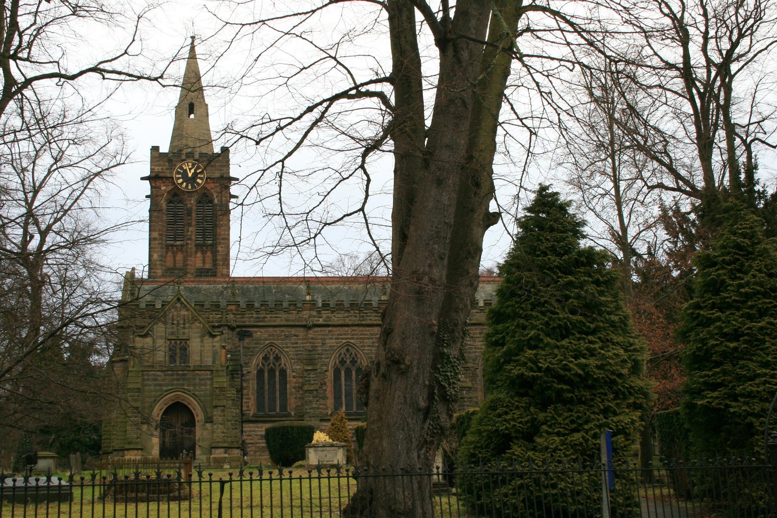
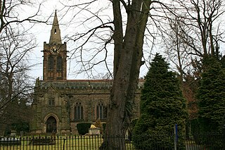
St Peter's, Ruddington - geograph.org.uk - 1725022.jpg
1283:
1219:
83:(1,600 × 1,067 pixels, file size: 547 KB, MIME type:
1244:
1159:
117:
Commons is a freely licensed media file repository.
765:
Creative
Commons Attribution-ShareAlike 2.0 Generic
739:
Creative
Commons Attribution-ShareAlike 2.0 Generic
153:St Peter's, Ruddington Taken from Church Street
498:https://creativecommons.org/licenses/by-sa/2.0
98:
799:https:\/\/www.geograph.org.uk\/photo\/1725022
600:https:\/\/www.geograph.org.uk\/profile\/17441
504:Creative Commons Attribution-Share Alike 2.0
422:
158:
140:
179:
168:
14:
1011:
905:
464:– to copy, distribute and transmit the work
1246:The following other wikis use this file:
868:https://www.geograph.org.uk/photo/1725022
663:https://www.geograph.org.uk/profile/17441
362:View this and other nearby images on:
312:View this and other nearby images on:
270:entry St. Peter's Church, Ruddington
217:
129:
409:and is licensed for reuse under the
330:
280:
254:
1254:كنيسه القديس بطرس (المملكه المتحده)
1152:
445:Attribution-Share Alike 2.0 Generic
433:
428:
413:Attribution-ShareAlike 2.0 license.
13:
1294:
1236:St Peter's Church, Ruddington
534:
528:
419:
396:
236:
147:
130:
76:
1320:
1301:
533:
1220:
916:coordinates of the point of view
898:coordinates of the point of view
519:
475:Under the following conditions:
440:This file is licensed under the
432:
427:
421:
389:
368:
354:
346:
318:
304:
296:
258:
97:
31:
21:
516:
275:with data related to this item.
148:
1241:
1226:Listed buildings in Ruddington
1156:
833:file available on the internet
783:file available on the internet
570:St. Peter's Church, Ruddington
541:St. Peter's Church, Ruddington
515:
397:This image was taken from the
26:
1:
1022:coordinates of depicted place
1004:coordinates of depicted place
36:
1216:
883:Geograph Britain and Ireland
807:Geograph Britain and Ireland
549:Items portrayed in this file
381:
7:
1291:
1250:Usage on arz.wikipedia.org
1037:52°53'33.990"N, 1°9'2.520"W
931:52°53'32.082"N, 1°9'2.592"W
641:value of statement has role
588:value of statement has role
10:
1325:
1280:Usage on www.wikidata.org
1270:Usage on fr.wikipedia.org
1260:Usage on eu.wikipedia.org
489:same or compatible license
345:
295:
232:
137:
132:
1153:
16:
846:geograph.org.uk image ID
787:geograph.org.uk image ID
518:
455:
223:David Lally /
204:David Lally /
104:This is a file from the
41:
1210:
257:
195:required by the license
161:
108:. Information from its
403:this photograph's page
374:52.892775; -1.150700
324:52.892245; -1.150720
225:St Peter's, Ruddington
206:St Peter's, Ruddington
111:description page there
46:Size of this preview:
1124:location of creation
1110:location of creation
70:1,600 × 1,067 pixels
1189:12:58, 5 March 2011
470:– to adapt the work
237:This is a photo of
52:Other resolutions:
671:author name string
604:author name string
66:1,280 × 854 pixels
62:1,024 × 683 pixels
1312:
1311:
1242:Global file usage
1214:
1013:
907:
749:copyright license
735:copyright license
527:
418:
417:
401:collection. See
379:
378:
329:
328:
279:
278:
273:
253:
252:
230:
229:
198:
126:
125:
106:Wikimedia Commons
32:Global file usage
1316:
1302:
1201:
1163:
1059:
1058:
1053:
991:24 February 2010
953:
952:
947:
885:
880:
870:
865:
861:described at URL
855:
850:
795:described at URL
705:copyright status
691:copyright status
678:
675:
665:
660:
650:
645:
525:
511:
508:
505:
502:
499:
491:as the original.
453:
442:Creative Commons
436:
435:
431:
430:
425:
424:
411:Creative Commons
399:Geograph project
393:
386:
375:
372:
358:
357:
351:
350:
349:
343:
342:
331:
325:
322:
308:
307:
301:
300:
299:
293:
292:
281:
271:
262:
255:
246:
233:
192:
164:
163:24 February 2010
152:
144:
138:
122:
101:
100:
94:
88:
86:
73:
58:640 × 427 pixels
54:320 × 213 pixels
48:800 × 534 pixels
1324:
1323:
1319:
1318:
1317:
1315:
1314:
1313:
1290:
1240:
1222:
1215:
1207:
1199:
1155:
1154:
1151:
1150:
1149:
1148:
1147:
1146:
1145:
1144:
1142:
1130:
1129:
1128:
1126:
1107:
1106:
1105:
1104:
1103:
1102:
1101:
1100:
1098:
1088:
1087:
1086:
1084:
1069:
1068:
1067:
1066:
1065:
1064:
1063:
1062:
1061:
1060:
1056:
1054:
1051:
1042:
1041:
1040:
1038:
1028:
1027:
1026:
1024:
1001:
1000:
999:
998:
997:
996:
995:
994:
992:
982:
981:
980:
978:
963:
962:
961:
960:
959:
958:
957:
956:
955:
954:
950:
948:
945:
936:
935:
934:
932:
922:
921:
920:
918:
895:
894:
893:
892:
891:
890:
889:
888:
887:
886:
881:
878:
872:
871:
866:
863:
857:
856:
851:
848:
839:
838:
837:
835:
823:
822:
821:
819:
776:
775:
774:
773:
772:
771:
770:
769:
767:
755:
754:
753:
751:
732:
731:
730:
729:
728:
727:
726:
725:
723:
711:
710:
709:
707:
688:
687:
686:
685:
684:
683:
682:
681:
680:
679:
676:
673:
667:
666:
661:
658:
652:
651:
646:
643:
634:
633:
632:
630:
620:
619:
618:
616:
581:
580:
579:
578:
577:
576:
575:
574:
572:
560:
559:
558:
556:
532:
531:
530:
513:
512:
509:
506:
503:
500:
497:
496:
454:
451:
448:
437:
414:
384:
373:
347:
338:
337:
334:Object location
323:
297:
288:
287:
284:Camera location
248:
242:
239:listed building
231:
220:
213:
201:
174:geograph.org.uk
154:
142:
135:
128:
127:
116:
115:
114:is shown below.
90:
84:
82:
75:
74:
51:
12:
11:
5:
1322:
1310:
1309:
1306:
1293:
1289:
1288:
1287:
1286:
1278:
1277:
1276:
1268:
1267:
1266:
1258:
1257:
1256:
1243:
1239:
1238:
1233:
1228:
1218:
1213:
1212:
1209:
1205:
1202:
1198:1,600 × 1,067
1196:
1191:
1186:
1182:
1181:
1178:
1175:
1172:
1169:
1166:
1158:
1143:
1138:
1136:
1135:
1134:
1132:
1131:
1127:
1122:
1120:
1119:
1118:
1117:
1115:
1111:
1099:
1096:
1094:
1093:
1092:
1090:
1089:
1085:
1080:
1078:
1077:
1076:
1075:
1073:
1047:
1046:
1045:
1044:
1043:
1039:
1036:
1034:
1033:
1032:
1030:
1029:
1025:
1020:
1018:
1017:
1016:
1015:
1009:
1005:
993:
990:
988:
987:
986:
984:
983:
979:
974:
972:
971:
970:
969:
967:
941:
940:
939:
938:
937:
933:
930:
928:
927:
926:
924:
923:
919:
914:
912:
911:
910:
909:
903:
899:
874:
873:
859:
858:
844:
843:
842:
841:
840:
836:
831:
829:
828:
827:
825:
824:
820:
817:source of file
815:
813:
812:
811:
810:
808:
804:
800:
796:
792:
788:
784:
780:
779:source of file
768:
763:
761:
760:
759:
757:
756:
752:
747:
745:
744:
743:
742:
740:
736:
724:
719:
717:
716:
715:
713:
712:
708:
703:
701:
700:
699:
698:
696:
692:
669:
668:
654:
653:
639:
638:
637:
636:
635:
631:
628:
626:
625:
624:
622:
621:
617:
612:
610:
609:
608:
607:
605:
601:
597:
593:
589:
585:
573:
568:
566:
565:
564:
562:
561:
557:
552:
550:
547:
546:
545:
544:
542:
538:
524:
523:
520:
517:
495:
494:
493:
492:
482:
473:
472:
471:
465:
458:You are free:
449:
439:
438:
420:
416:
415:
394:
383:
380:
377:
376:
366:
360:
335:
327:
326:
316:
310:
285:
277:
276:
263:
251:
250:
228:
227:
221:
218:
215:
214:
209:
202:
199:
187:
186:
181:
177:
176:
170:
166:
165:
160:
156:
155:
145:
136:
134:
131:
124:
123:
102:
92:
91:
45:
40:
39:
34:
29:
24:
19:
9:
6:
4:
3:
2:
1321:
1307:
1304:
1303:
1300:
1297:
1285:
1282:
1281:
1279:
1275:
1272:
1271:
1269:
1265:
1262:
1261:
1259:
1255:
1252:
1251:
1249:
1248:
1247:
1237:
1234:
1232:
1229:
1227:
1224:
1223:
1208:
1203:
1197:
1195:
1192:
1190:
1187:
1184:
1183:
1179:
1176:
1173:
1170:
1167:
1165:
1164:
1162:
1141:
1137:
1125:
1121:
1095:
1083:
1079:
1050:
1035:
1023:
1019:
989:
977:
973:
944:
929:
917:
913:
884:
877:
869:
862:
854:
847:
834:
830:
818:
814:
766:
762:
750:
746:
722:
718:
706:
702:
672:
664:
657:
649:
642:
627:
615:
611:
571:
567:
555:
551:
548:
521:
514:
501:CC BY-SA 2.0
490:
486:
483:
480:
477:
476:
474:
469:
466:
463:
460:
459:
457:
456:
450:Attribution:
446:
443:
426:
412:
408:
404:
400:
395:
392:
388:
387:
371:
367:
365:
364:OpenStreetMap
361:
359:
341:
336:
333:
332:
321:
317:
315:
314:OpenStreetMap
311:
309:
291:
286:
283:
282:
274:
267:
264:
261:
256:
249:
245:
240:
235:
234:
226:
222:
216:
212:
208: /
207:
203:
196:
191:
189:
188:
185:
182:
178:
175:
171:
167:
157:
151:
146:
139:
120:
113:
112:
107:
103:
96:
95:
89:
80:
79:Original file
71:
67:
63:
59:
55:
49:
44:
38:
35:
33:
30:
28:
25:
23:
20:
18:
15:
1298:
1295:
1245:
1160:
1157:File history
648:photographer
592:photographer
484:
478:
467:
461:
406:
344:
294:
224:
211:CC BY-SA 2.0
205:
149:
119:You can help
109:
77:
22:File history
1206:GeographBot
721:copyrighted
695:copyrighted
677:David Lally
485:share alike
479:attribution
452:David Lally
407:David Lally
190:Attribution
184:David Lally
141:Description
1305:_error
1274:Ruddington
1264:Ruddington
1231:Ruddington
1217:File usage
1174:Dimensions
1140:Ruddington
1114:Ruddington
1097:image/jpeg
1082:media type
1072:media type
629:some value
272:(Q7591331)
85:image/jpeg
27:File usage
1171:Thumbnail
1168:Date/Time
976:inception
966:inception
382:Licensing
219:InfoField
200:InfoField
150:English:
1292:Metadata
1284:Q7591331
1200:(547 KB)
876:operator
803:operator
522:Captions
468:to remix
462:to share
447:license.
266:Wikidata
37:Metadata
1185:current
1180:Comment
1049:heading
1008:heading
943:heading
902:heading
853:1725022
791:1725022
614:creator
584:creator
554:depicts
537:depicts
526:English
244:1263576
241:number
133:Summary
81:
1057:degree
1012:degree
951:degree
906:degree
352:
302:
180:Author
169:Source
172:From
1177:User
510:true
507:true
268:has
159:Date
17:File
656:URL
596:URL
1055:0
1052::
949:0
946::
879::
864::
849::
674::
659::
644::
68:|
64:|
60:|
56:|
50:.
1308:0
247:.
197:)
193:(
121:.
87:)
72:.
Text is available under the Creative Commons Attribution-ShareAlike License. Additional terms may apply.
_heading:0.00&language=en)
_heading:0.00&language=en)