781:"}},"text\/plain":{"en":{"":"coordinates of the point of view"}}},"{\"value\":{\"latitude\":50.79832,\"longitude\":-3.6147,\"altitude\":null,\"precision\":1.0e-5,\"globe\":\"http:\\\/\\\/www.wikidata.org\\\/entity\\\/Q2\"},\"type\":\"globecoordinate\"}":{"text\/html":{"en":{"P1259":"50\u00b047'53.95"N, 3\u00b036'52.92"W"}},"text\/plain":{"en":{"P1259":"50\u00b047'53.95\"N, 3\u00b036'52.92\"W"}}},"{\"value\":{\"entity-type\":\"property\",\"numeric-id\":7787,\"id\":\"P7787\"},\"type\":\"wikibase-entityid\"}":{"text\/html":{"en":{"":"
1012:"}},"text\/plain":{"en":{"":"coordinates of depicted place"}}},"{\"value\":{\"latitude\":50.79832,\"longitude\":-3.615,\"altitude\":null,\"precision\":1.0e-5,\"globe\":\"http:\\\/\\\/www.wikidata.org\\\/entity\\\/Q2\"},\"type\":\"globecoordinate\"}":{"text\/html":{"en":{"P9149":"50\u00b047'53.95"N, 3\u00b036'54.00"W"}},"text\/plain":{"en":{"P9149":"50\u00b047'53.95\"N, 3\u00b036'54.00\"W"}}},"{\"value\":{\"entity-type\":\"property\",\"numeric-id\":7787,\"id\":\"P7787\"},\"type\":\"wikibase-entityid\"}":{"text\/html":{"en":{"":"
560:"}},"text\/plain":{"en":{"":"author name string"}}},"{\"value\":\"Liz Moon\",\"type\":\"string\"}":{"text\/html":{"en":{"P2093":"Liz Moon"}},"text\/plain":{"en":{"P2093":"Liz Moon"}}},"{\"value\":{\"entity-type\":\"property\",\"numeric-id\":2699,\"id\":\"P2699\"},\"type\":\"wikibase-entityid\"}":{"text\/html":{"en":{"":"
743:"}},"text\/plain":{"en":{"":"inception"}}},"{\"value\":{\"time\":\"+2009-10-10T00:00:00Z\",\"timezone\":0,\"before\":0,\"after\":0,\"precision\":11,\"calendarmodel\":\"http:\\\/\\\/www.wikidata.org\\\/entity\\\/Q1985727\"},\"type\":\"time\"}":{"text\/html":{"en":{"P571":"10 October 2009"}},"text\/plain":{"en":{"P571":"10 October 2009"}}}}": -->
845:
318:
268:
1008:
260:
332:
282:
43:
353:
391:
396:
87:
853:"}},"text\/plain":{"en":{"P7482":"file available on the internet"}}},"{\"value\":{\"entity-type\":\"property\",\"numeric-id\":137,\"id\":\"P137\"},\"type\":\"wikibase-entityid\"}":{"text\/html":{"en":{"":"
861:"}},"text\/plain":{"en":{"P137":"Geograph Britain and Ireland"}}},"{\"value\":{\"entity-type\":\"property\",\"numeric-id\":7384,\"id\":\"P7384\"},\"type\":\"wikibase-entityid\"}":{"text\/html":{"en":{"":"
552:"}},"text\/plain":{"en":{"":"object of statement has role"}}},"{\"value\":{\"entity-type\":\"item\",\"numeric-id\":33231,\"id\":\"Q33231\"},\"type\":\"wikibase-entityid\"}":{"text\/html":{"en":{"P3831":"
968:"}},"text\/plain":{"en":{"":"location of creation"}}},"{\"value\":{\"entity-type\":\"item\",\"numeric-id\":2534603,\"id\":\"Q2534603\"},\"type\":\"wikibase-entityid\"}":{"text\/html":{"en":{"P1071":"
1080:"}},"text\/plain":{"en":{"":"media type"}}},"{\"value\":\"image\\\/jpeg\",\"type\":\"string\"}":{"text\/html":{"en":{"P1163":"image\/jpeg"}},"text\/plain":{"en":{"P1163":"image\/jpeg"}}}}": -->
699:"}},"text\/plain":{"en":{"":"copyright license"}}},"{\"value\":{\"entity-type\":\"item\",\"numeric-id\":19068220,\"id\":\"Q19068220\"},\"type\":\"wikibase-entityid\"}":{"text\/html":{"en":{"P275":"
655:"}},"text\/plain":{"en":{"":"copyright status"}}},"{\"value\":{\"entity-type\":\"item\",\"numeric-id\":50423863,\"id\":\"Q50423863\"},\"type\":\"wikibase-entityid\"}":{"text\/html":{"en":{"P6216":"
849:"}},"text\/plain":{"en":{"":"source of file"}}},"{\"value\":{\"entity-type\":\"item\",\"numeric-id\":74228490,\"id\":\"Q74228490\"},\"type\":\"wikibase-entityid\"}":{"text\/html":{"en":{"P7482":"
556:"}},"text\/plain":{"en":{"P3831":"photographer"}}},"{\"value\":{\"entity-type\":\"property\",\"numeric-id\":2093,\"id\":\"P2093\"},\"type\":\"wikibase-entityid\"}":{"text\/html":{"en":{"":"
501:"}},"text\/plain":{"en":{"":"depicts"}}},"{\"value\":{\"entity-type\":\"item\",\"numeric-id\":17548184,\"id\":\"Q17548184\"},\"type\":\"wikibase-entityid\"}":{"text\/html":{"en":{"P180":"
1016:"}},"text\/plain":{"en":{"":"heading"}}},"{\"value\":{\"amount\":\"+270\",\"unit\":\"http:\\\/\\\/www.wikidata.org\\\/entity\\\/Q28390\"},\"type\":\"quantity\"}":{"text\/html":{"en":{"P7787":"270
857:"}},"text\/plain":{"en":{"":"operator"}}},"{\"value\":{\"entity-type\":\"item\",\"numeric-id\":1503119,\"id\":\"Q1503119\"},\"type\":\"wikibase-entityid\"}":{"text\/html":{"en":{"P137":"
785:"}},"text\/plain":{"en":{"":"heading"}}},"{\"value\":{\"amount\":\"+270\",\"unit\":\"http:\\\/\\\/www.wikidata.org\\\/entity\\\/Q28390\"},\"type\":\"quantity\"}":{"text\/html":{"en":{"P7787":"270
869:"}},"text\/plain":{"en":{"P7384":"1577159"}}},"{\"value\":{\"entity-type\":\"property\",\"numeric-id\":973,\"id\":\"P973\"},\"type\":\"wikibase-entityid\"}":{"text\/html":{"en":{"":"
1156:
548:"}},"text\/plain":{"en":{"":"creator"}}},"{\"value\":{\"entity-type\":\"property\",\"numeric-id\":3831,\"id\":\"P3831\"},\"type\":\"wikibase-entityid\"}":{"text\/html":{"en":{"":"
1076:
865:"}},"text\/plain":{"en":{"":"geograph.org.uk image ID"}}},"{\"value\":\"1577159\",\"type\":\"string\"}":{"text\/html":{"en":{"P7384":"
251:
443:– You must give appropriate credit, provide a link to the license, and indicate if changes were made. You may do so in any reasonable manner, but not in any way that suggests the licensor endorses you or your use.
265:
315:
53:
47:
98:
66:
866:
850:
700:
656:
502:
969:
858:
553:
1077:
1013:
1009:
965:
862:
846:
782:
778:
652:
561:
557:
549:
874:
565:
870:
854:
740:
696:
545:
498:
1166:
1173:== {{int:filedesc}} == {{Information |description={{en|1=Shobrooke Church Devon}} |date=2009-10-10 |source=From |author= |permission= |other_ver
703:"}},"text\/plain":{"en":{"P275":"Creative Commons Attribution-ShareAlike 2.0 Generic"}}}}": -->
568:"}},"text\/plain":{"en":{"P2699":"https:\/\/www.geograph.org.uk\/profile\/19235"}}}}": -->
877:"}},"text\/plain":{"en":{"P973":"https:\/\/www.geograph.org.uk\/photo\/1577159"}}}}": -->
1187:
900:
726:
682:
531:
325:
275:
995:
920:
360:
1298:
This file contains additional information, probably added from the digital camera or scanner used to create or digitize it.
450:
609:
1155:
1150:
1087:
1054:
1027:
979:
928:
884:
823:
796:
666:
630:
617:
602:
57:
42:
943:
913:
750:
710:
575:
515:
1192:
406:
505:"}},"text\/plain":{"en":{"P180":"Church of St Swithin"}}}}": -->
1301:
If the file has been modified from its original state, some details may not fully reflect the modified file.
449:– If you remix, transform, or build upon the material, you must distribute your contributions under the
367:
on the
Geograph website for the photographer's contact details. The copyright on this image is owned by
125:
659:"}},"text\/plain":{"en":{"P6216":"copyrighted"}}}}": -->
130:
1183:
The following pages on the
English Knowledge use this file (pages on other projects are not listed):
1020:"}},"text\/plain":{"en":{"P7787":"270 degree"}}}}": -->
789:"}},"text\/plain":{"en":{"P7787":"270 degree"}}}}": -->
972:"}},"text\/plain":{"en":{"P1071":"Shobrooke"}}}}": -->
106:
220:
950:
935:
637:
403:
204:
8:
347:
331:
281:
372:
93:
1197:
193:
183:
1097:
1037:
989:
894:
806:
760:
720:
676:
585:
525:
352:
364:
1202:
1123:
Click on a date/time to view the file as it appeared at that time.
317:
267:
163:
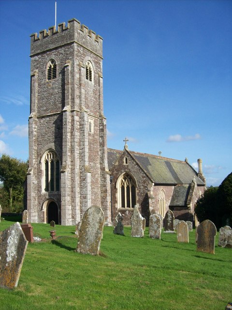
St
Swithin's parish church, Shobrooke, Devon, seen from the west
1285:
302:
50° 47′ 54″ N, 3° 36′ 54″ W
252:
50° 47′ 54″ N, 3° 36′ 53″ W
172:
81:
1240:
1220:
491:
Add a one-line explanation of what this file represents
1275:
1260:
1250:
1230:
153:
Shobrooke Church Devon - geograph.org.uk - 1577159.jpg
1270:
1181:
1211:
1121:
105:
Commons is a freely licensed media file repository.
727:
Creative
Commons Attribution-ShareAlike 2.0 Generic
701:
Creative
Commons Attribution-ShareAlike 2.0 Generic
71:(480 × 640 pixels, file size: 79 KB, MIME type:
460:https://creativecommons.org/licenses/by-sa/2.0
86:
875:https:\/\/www.geograph.org.uk\/photo\/1577159
566:https:\/\/www.geograph.org.uk\/profile\/19235
466:Creative Commons Attribution-Share Alike 2.0
384:
168:
150:
189:
178:
14:
1017:
786:
426:– to copy, distribute and transmit the work
1213:The following other wikis use this file:
951:https://www.geograph.org.uk/photo/1577159
638:https://www.geograph.org.uk/profile/19235
1188:Grade II* listed buildings in Mid Devon
324:View this and other nearby images on:
274:View this and other nearby images on:
227:
117:
371:and is licensed for reuse under the
292:
242:
1114:
407:Attribution-Share Alike 2.0 Generic
395:
390:
375:Attribution-ShareAlike 2.0 license.
13:
1296:
1282:Usage on zh-min-nan.wikipedia.org
496:
490:
381:
358:
157:
123:
118:
64:
1322:
1303:
495:
1182:
797:coordinates of the point of view
779:coordinates of the point of view
481:
437:Under the following conditions:
402:This file is licensed under the
394:
389:
383:
351:
330:
316:
308:
280:
266:
258:
85:
31:
21:
1193:List of civil parishes in Devon
478:
158:
1208:
1118:
901:file available on the internet
851:file available on the internet
477:
359:This image was taken from the
26:
1:
1028:coordinates of depicted place
1010:coordinates of depicted place
36:
1178:
921:Geograph Britain and Ireland
859:Geograph Britain and Ireland
603:object of statement has role
550:object of statement has role
511:Items portrayed in this file
343:
307:
257:
7:
1293:
1237:Usage on lld.wikipedia.org
1217:Usage on ceb.wikipedia.org
1043:50°47'53.95"N, 3°36'54.00"W
812:50°47'53.95"N, 3°36'52.92"W
10:
1327:
1267:Usage on www.wikidata.org
1257:Usage on pl.wikipedia.org
1247:Usage on nl.wikipedia.org
1227:Usage on fr.wikipedia.org
451:same or compatible license
147:
142:
119:
1115:
16:
929:geograph.org.uk image ID
863:geograph.org.uk image ID
480:
417:
92:This is a file from the
41:
1172:
235:Shobrooke Church Devon
216:Shobrooke Church Devon
205:required by the license
171:
96:. Information from its
365:this photograph's page
336:50.798320; -3.615000
286:50.798320; -3.614700
99:description page there
46:Size of this preview:
233:Liz Moon /
214:Liz Moon /
980:location of creation
966:location of creation
532:Church of St Swithin
503:Church of St Swithin
1151:21:29, 3 March 2011
432:– to adapt the work
124:This is a photo of
52:Other resolutions:
618:author name string
558:author name string
1314:
1313:
1209:Global file usage
1176:
1019:
788:
711:copyright license
697:copyright license
489:
380:
379:
363:collection. See
341:
340:
291:
290:
240:
239:
208:
140:
139:
114:
113:
94:Wikimedia Commons
32:Global file usage
1318:
1304:
1198:Nicholas Marston
1163:
1125:
1065:
1064:
1059:
953:
948:
944:described at URL
938:
933:
923:
918:
871:described at URL
834:
833:
828:
667:copyright status
653:copyright status
640:
635:
625:
622:
612:
607:
487:
473:
470:
467:
464:
461:
453:as the original.
415:
404:Creative Commons
398:
397:
393:
392:
387:
386:
373:Creative Commons
361:Geograph project
355:
348:
337:
334:
320:
319:
313:
312:
311:
305:
304:
293:
287:
284:
270:
269:
263:
262:
261:
255:
254:
243:
202:
174:
162:
154:
148:
133:
120:
110:
89:
88:
82:
76:
74:
61:
58:480 × 640 pixels
54:180 × 240 pixels
48:450 × 600 pixels
1326:
1325:
1321:
1320:
1319:
1317:
1316:
1315:
1292:
1207:
1184:
1177:
1169:
1161:
1117:
1116:
1113:
1112:
1111:
1110:
1109:
1108:
1107:
1106:
1104:
1094:
1093:
1092:
1090:
1075:
1074:
1073:
1072:
1071:
1070:
1069:
1068:
1067:
1066:
1062:
1060:
1057:
1048:
1047:
1046:
1044:
1034:
1033:
1032:
1030:
1007:
1006:
1005:
1004:
1003:
1002:
1001:
1000:
998:
986:
985:
984:
982:
963:
962:
961:
960:
959:
958:
957:
956:
955:
954:
949:
946:
940:
939:
934:
931:
925:
924:
919:
916:
907:
906:
905:
903:
891:
890:
889:
887:
844:
843:
842:
841:
840:
839:
838:
837:
836:
835:
831:
829:
826:
817:
816:
815:
813:
803:
802:
801:
799:
776:
775:
774:
773:
772:
771:
770:
769:
767:
766:10 October 2009
757:
756:
755:
753:
738:
737:
736:
735:
734:
733:
732:
731:
729:
717:
716:
715:
713:
694:
693:
692:
691:
690:
689:
688:
687:
685:
673:
672:
671:
669:
650:
649:
648:
647:
646:
645:
644:
643:
642:
641:
636:
633:
627:
626:
623:
620:
614:
613:
608:
605:
596:
595:
594:
592:
582:
581:
580:
578:
543:
542:
541:
540:
539:
538:
537:
536:
534:
522:
521:
520:
518:
494:
493:
492:
475:
474:
471:
468:
465:
462:
459:
458:
416:
413:
410:
399:
376:
346:
335:
309:
300:
299:
296:Object location
285:
259:
250:
249:
246:Camera location
241:
230:
223:
211:
184:geograph.org.uk
173:10 October 2009
164:
152:
145:
135:
129:
126:listed building
116:
115:
104:
103:
102:is shown below.
78:
72:
70:
63:
62:
51:
12:
11:
5:
1324:
1312:
1311:
1308:
1295:
1291:
1290:
1289:
1288:
1280:
1279:
1278:
1273:
1265:
1264:
1263:
1255:
1254:
1253:
1245:
1244:
1243:
1235:
1234:
1233:
1225:
1224:
1223:
1210:
1206:
1205:
1200:
1195:
1190:
1180:
1175:
1174:
1171:
1167:
1164:
1158:
1153:
1148:
1144:
1143:
1140:
1137:
1134:
1131:
1128:
1120:
1105:
1102:
1100:
1099:
1098:
1096:
1095:
1091:
1086:
1084:
1083:
1082:
1081:
1079:
1053:
1052:
1051:
1050:
1049:
1045:
1042:
1040:
1039:
1038:
1036:
1035:
1031:
1026:
1024:
1023:
1022:
1021:
1015:
1011:
999:
994:
992:
991:
990:
988:
987:
983:
978:
976:
975:
974:
973:
971:
967:
942:
941:
927:
926:
912:
911:
910:
909:
908:
904:
899:
897:
896:
895:
893:
892:
888:
885:source of file
883:
881:
880:
879:
878:
876:
872:
868:
864:
860:
856:
852:
848:
847:source of file
822:
821:
820:
819:
818:
814:
811:
809:
808:
807:
805:
804:
800:
795:
793:
792:
791:
790:
784:
780:
768:
765:
763:
762:
761:
759:
758:
754:
749:
747:
746:
745:
744:
742:
730:
725:
723:
722:
721:
719:
718:
714:
709:
707:
706:
705:
704:
702:
698:
686:
681:
679:
678:
677:
675:
674:
670:
665:
663:
662:
661:
660:
658:
654:
629:
628:
616:
615:
601:
600:
599:
598:
597:
593:
590:
588:
587:
586:
584:
583:
579:
574:
572:
571:
570:
569:
567:
563:
559:
555:
551:
547:
535:
530:
528:
527:
526:
524:
523:
519:
514:
512:
509:
508:
507:
506:
504:
500:
486:
485:
482:
479:
457:
456:
455:
454:
444:
435:
434:
433:
427:
420:You are free:
411:
401:
400:
382:
378:
377:
356:
345:
342:
339:
338:
328:
322:
297:
289:
288:
278:
272:
247:
238:
237:
231:
228:
225:
224:
219:
212:
209:
197:
196:
191:
187:
186:
180:
176:
175:
170:
166:
165:
155:
146:
144:
141:
138:
137:
112:
111:
90:
80:
79:
45:
40:
39:
34:
29:
24:
19:
9:
6:
4:
3:
2:
1323:
1309:
1306:
1305:
1302:
1299:
1287:
1284:
1283:
1281:
1277:
1274:
1272:
1269:
1268:
1266:
1262:
1259:
1258:
1256:
1252:
1249:
1248:
1246:
1242:
1239:
1238:
1236:
1232:
1229:
1228:
1226:
1222:
1219:
1218:
1216:
1215:
1214:
1204:
1201:
1199:
1196:
1194:
1191:
1189:
1186:
1185:
1170:
1165:
1159:
1157:
1154:
1152:
1149:
1146:
1145:
1141:
1138:
1135:
1132:
1129:
1127:
1126:
1124:
1101:
1089:
1085:
1056:
1041:
1029:
1025:
997:
993:
981:
977:
952:
945:
937:
930:
922:
915:
902:
898:
886:
882:
825:
810:
798:
794:
764:
752:
748:
728:
724:
712:
708:
684:
680:
668:
664:
639:
632:
619:
611:
604:
589:
577:
573:
533:
529:
517:
513:
510:
483:
476:
463:CC BY-SA 2.0
452:
448:
445:
442:
439:
438:
436:
431:
428:
425:
422:
421:
419:
418:
412:Attribution:
408:
405:
388:
374:
370:
366:
362:
357:
354:
350:
349:
333:
329:
327:
326:OpenStreetMap
323:
321:
303:
298:
295:
294:
283:
279:
277:
276:OpenStreetMap
273:
271:
253:
248:
245:
244:
236:
232:
226:
222:
218: /
217:
213:
206:
201:
199:
198:
195:
192:
188:
185:
181:
177:
167:
161:
156:
149:
136:
132:
127:
122:
121:
108:
101:
100:
95:
91:
84:
83:
77:
68:
67:Original file
59:
55:
49:
44:
38:
35:
33:
30:
28:
25:
23:
20:
18:
15:
1300:
1297:
1212:
1122:
1119:File history
610:photographer
554:photographer
446:
440:
429:
423:
368:
306:
256:
234:
221:CC BY-SA 2.0
215:
159:
107:You can help
97:
65:
22:File history
1168:GeographBot
683:copyrighted
657:copyrighted
447:share alike
441:attribution
200:Attribution
151:Description
1307:_error
1179:File usage
1160:480 × 640
1136:Dimensions
1103:image/jpeg
1088:media type
1078:media type
591:some value
73:image/jpeg
27:File usage
1286:Shobrooke
1276:Q17548184
1261:Shobrooke
1251:Shobrooke
1241:Shobrooke
1231:Shobrooke
1221:Shobrooke
1203:Shobrooke
1133:Thumbnail
1130:Date/Time
996:Shobrooke
970:Shobrooke
751:inception
741:inception
344:Licensing
229:InfoField
210:InfoField
160:English:
1294:Metadata
1271:Q2534603
914:operator
855:operator
624:Liz Moon
484:Captions
430:to remix
424:to share
414:Liz Moon
409:license.
369:Liz Moon
194:Liz Moon
37:Metadata
1162:(79 KB)
1147:current
1142:Comment
1055:heading
1014:heading
936:1577159
867:1577159
824:heading
783:heading
576:creator
546:creator
516:depicts
499:depicts
488:English
143:Summary
131:1107048
128:number
69:
1063:degree
1018:degree
832:degree
787:degree
314:
264:
190:Author
179:Source
182:From
1139:User
1061:270
830:270
472:true
469:true
169:Date
17:File
631:URL
562:URL
1058::
947::
932::
917::
827::
634::
621::
606::
56:|
50:.
1310:0
207:)
203:(
134:.
109:.
75:)
60:.
Text is available under the Creative Commons Attribution-ShareAlike License. Additional terms may apply.
_heading:270.00&language=en)
_heading:270.00&language=en)
