251:
43:
582:
730:
588:
271:
593:
99:
889:"}},"text\/plain":{"en":{"P275":"GNU Free Documentation License, version 1.2 or later"}}},"{\"value\":{\"entity-type\":\"item\",\"numeric-id\":14946043,\"id\":\"Q14946043\"},\"type\":\"wikibase-entityid\"}":{"text\/html":{"en":{"P275":"
742:"}},"text\/plain":{"en":{"P2699":"https:\/\/commons.wikimedia.org\/wiki\/user:NordNordWest"}}},"{\"value\":{\"entity-type\":\"property\",\"numeric-id\":2093,\"id\":\"P2093\"},\"type\":\"wikibase-entityid\"}":{"text\/html":{"en":{"":"
750:"}},"text\/plain":{"en":{"P2093":"NordNordWest","P4174":"NordNordWest"}}},"{\"value\":{\"entity-type\":\"property\",\"numeric-id\":4174,\"id\":\"P4174\"},\"type\":\"wikibase-entityid\"}":{"text\/html":{"en":{"":"
950:"}},"text\/plain":{"en":{"":"media type"}}},"{\"value\":\"image\\\/svg+xml\",\"type\":\"string\"}":{"text\/html":{"en":{"P1163":"image\/svg+xml"}},"text\/plain":{"en":{"P1163":"image\/svg+xml"}}}}": -->
885:"}},"text\/plain":{"en":{"":"copyright license"}}},"{\"value\":{\"entity-type\":\"item\",\"numeric-id\":50829104,\"id\":\"Q50829104\"},\"type\":\"wikibase-entityid\"}":{"text\/html":{"en":{"P275":"
841:"}},"text\/plain":{"en":{"":"copyright status"}}},"{\"value\":{\"entity-type\":\"item\",\"numeric-id\":50423863,\"id\":\"Q50423863\"},\"type\":\"wikibase-entityid\"}":{"text\/html":{"en":{"P6216":"
734:"}},"text\/plain":{"en":{"":"creator"}}},"{\"value\":{\"entity-type\":\"property\",\"numeric-id\":2699,\"id\":\"P2699\"},\"type\":\"wikibase-entityid\"}":{"text\/html":{"en":{"":"
1146:
946:
881:
1056:
1026:
746:"}},"text\/plain":{"en":{"":"author name string"}}},"{\"value\":\"NordNordWest\",\"type\":\"string\"}":{"text\/html":{"en":{"P2093":"NordNordWest","P4174":"
738:"}},"text\/plain":{"en":{"":"URL"}}},"{\"value\":\"https:\\\/\\\/commons.wikimedia.org\\\/wiki\\\/user:NordNordWest\",\"type\":\"string\"}":{"text\/html":{"en":{"P2699":"
1855:
634:– You must give appropriate credit, provide a link to the license, and indicate if changes were made. You may do so in any reasonable manner, but not in any way that suggests the licensor endorses you or your use.
747:
739:
890:
886:
842:
1860:
1687:
1178:
947:
838:
751:
743:
735:
882:
731:
1167:}} Quadratische Plattkarte. Geographische Begrenzung der Karte: * N: 0.6° S * S: 12.2° S * W: 140.4° O * O: 159.7° O {{en|Location map of [[:en:Papua New Guinea
1979:
554:
73:
69:
65:
61:
57:
53:
47:
110:
893:"}},"text\/plain":{"en":{"P275":"Creative Commons Attribution-ShareAlike 3.0 Unported"}}}}": -->
82:
285:
552:; with no Invariant Sections, no Front-Cover Texts, and no Back-Cover Texts. A copy of the license is included in the section entitled
933:
916:
868:
1560:
1555:
1990:
This file contains additional information, probably added from the digital camera or scanner used to create or digitize it.
1145:
1140:
1115:
1110:
1085:
1080:
1055:
1050:
641:
250:
957:
852:
816:
803:
788:
1575:
1540:
544:
1945:
900:
761:
720:
823:
1940:
1440:
603:
510:
1993:
If the file has been modified from its original state, some details may not fully reflect the modified file.
1177:
More than 100 pages use this file. The following list shows the first 100 pages that use this file only. A
549:
278:
1260:
640:– If you remix, transform, or build upon the material, you must distribute your contributions under the
754:"}},"text\/plain":{"en":{"":"Wikimedia username"}}}}": -->
1845:
845:"}},"text\/plain":{"en":{"P6216":"copyrighted"}}}}": -->
1390:
1025:
1020:
42:
795:
118:
1245:
1680:
1535:
1490:
1350:
542:
Permission is granted to copy, distribute and/or modify this document under the terms of the
1530:
1450:
1300:
1290:
600:
8:
1550:
1510:
1225:
270:
1955:
1525:
1435:
1230:
1164:
236:
154:
1710:
182:
1705:
1645:
1570:
1515:
1315:
1156:
1126:
1066:
1036:
528:
I, the copyright holder of this work, hereby publish it under the following licenses:
105:
1735:
710:
320:
1545:
1360:
1295:
1925:
1615:
1365:
1345:
1330:
1305:
1255:
1210:
1920:
1665:
1640:
1580:
1495:
1465:
1405:
1395:
1335:
1325:
1280:
1250:
1215:
1190:
428:
392:
1635:
1625:
1620:
1585:
1485:
1480:
1425:
1310:
1205:
1200:
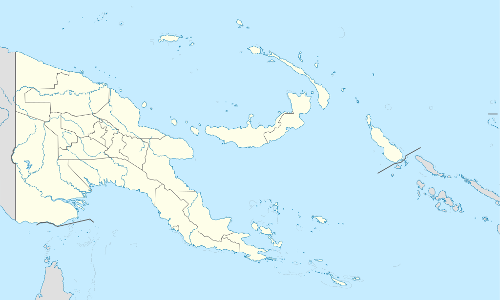
1096:
500:
491:
482:
473:
464:
455:
446:
437:
419:
410:
401:
383:
374:
365:
356:
347:
338:
329:
311:
302:
293:
1765:
1650:
1605:
1600:
1500:
1470:
1445:
1275:
1235:
1630:
1520:
1505:
1285:
967:
927:
910:
862:
771:
1885:
1565:
1265:
1950:
1890:
1760:
1910:
1820:
531:
1930:
1655:
1590:
1455:
1420:
1415:
1385:
1355:
1340:
993:
Click on a date/time to view the file as it appeared at that time.
1073:
Reverted to version as of 19:42, 8 December 2009 no need to revert
1905:
1800:
1755:
1675:
1610:
1595:
1875:
1815:
1745:
1660:
1460:
1410:
1400:
1375:
1370:
1320:
1240:
1220:
1195:
1185:
1960:
1935:
1830:
1775:
1915:
1670:
1475:
1380:
159:
Quadratische
Plattkarte. Geographische Begrenzung der Karte:
87:(SVG file, nominally 2,280 × 1,370 pixels, file size: 501 KB)
1870:
1825:
1880:
1835:
1750:
1270:
1795:
1790:
1785:
1740:
187:
Equirectangular projection. Geographic limits of the map:
1946:
Módulu:Mapa de llocalización/datos/Papúa Nueva Guinea/usu
1805:
1780:
1725:
1430:
93:
1900:
740:
https:\/\/commons.wikimedia.org\/wiki\/user:NordNordWest
1810:
1770:
223:
United States
National Imagery and Mapping Agency data
1941:
Módulu:Mapa de llocalización/datos/Papúa Nueva Guinea
1895:
1175:
1970:
1965:
1696:
1163:{{Information |Description= {{de|Positionskarte von
991:
934:
Creative
Commons Attribution-ShareAlike 3.0 Unported
917:
891:
Creative
Commons Attribution-ShareAlike 3.0 Unported
887:
548:, Version 1.2 or any later version published by the
117:
Commons is a freely licensed media file repository.
1846:
Plantilla:Mapa de localización Papua y Nueva Guinea
1720:
1715:
277:This map has been made or improved in the German
1103:Reverted to version as of 19:51, 5 September 2008
796:https://commons.wikimedia.org/user:NordNordWest
651:https://creativecommons.org/licenses/by-sa/3.0
98:
657:Creative Commons Attribution-Share Alike 3.0
581:
206:
140:
242:
232:
214:
14:
617:– to copy, distribute and transmit the work
46:Size of this PNG preview of this SVG file:
669:You may select the license of your choice.
1711:Papoea-Nieu-Guinese nasionale krieketspan
1698:The following other wikis use this file:
1706:Sjabloon:Liggingkaart Papoea-Nieu-Guinee
1736:Vorlage:Positionskarte Papua-Neuguinea
1561:Papua New Guinea national cricket team
1556:Papua New Guinea National Rugby League
1956:Provincia de Nueva Bretaña Occidental
129:
1926:Aeropuertu Internacional de Jacksons
1856:قالب:خريطة مواقع بابوا غينيا الجديدة
604:Attribution-Share Alike 3.0 Unported
560:http://www.gnu.org/copyleft/fdl.html
984:
592:
587:
13:
1988:
1576:Port Moresby International Airport
1541:Normanby Island (Papua New Guinea)
709:
703:
695:
687:
668:
578:
527:
276:
175:
147:
130:
80:
2022:
1995:
708:
143:Papua New Guinea location map.svg
688:Location map of Papua New Guinea
678:
628:Under the following conditions:
599:This file is licensed under the
591:
586:
580:
536:
535:
269:
249:
97:
31:
21:
675:
321:
176:
1693:
1441:Lake Murray (Papua New Guinea)
988:
674:
566:GNU Free Documentation License
555:GNU Free Documentation License
545:GNU Free Documentation License
148:
26:
1:
1921:Archipiélagu de les Lluisiaes
36:
1861:كأس العالم لدوري الرغبي 2017
1261:D'Entrecasteaux Islands
1172:
716:Items portrayed in this file
521:
7:
1985:
1951:Islles d'Entrecasteaux
1867:Usage on ast.wikipedia.org
1732:Usage on als.wikipedia.org
704:Karta över Papua New Guinea
10:
2027:
1852:Usage on ar.wikipedia.org
1842:Usage on an.wikipedia.org
1702:Usage on af.wikipedia.org
642:same or compatible license
265:
137:
132:
985:
429:
393:
16:
1891:Islles del Duque de York
1391:Kiunga, Papua New Guinea
696:Lageplan Papua-Neuguinea
677:
608:
550:Free Software Foundation
501:
492:
483:
474:
465:
456:
447:
438:
420:
411:
402:
384:
375:
366:
357:
348:
339:
330:
312:
303:
294:
104:This is a file from the
41:
1911:Islles del Almirantalgu
1821:Marshall-Bennett-Inseln
1162:
1141:19:51, 5 September 2008
1132:
1102:
1072:
1042:
256:Equivalent physical map
226:World Data Base II data
209:
108:. Information from its
1766:D’Entrecasteaux-Inseln
1246:Buna, Papua New Guinea
1111:19:42, 8 December 2009
111:description page there
1931:Aeropuertu de Guasopa
1886:Archipiélagu Bismarck
1681:Wau, Papua New Guinea
1536:Nissan Island Airport
1491:Misima Island Airport
1351:Jacquinot Bay Airport
1531:New Ireland (island)
1451:Lihir Island Airport
1301:Finschhafen District
1291:Duke of York Islands
288:to improve as well.
74:2,280 × 1,370 pixels
70:2,560 × 1,538 pixels
1906:Estrechu de Dampier
1801:St.-Matthias-Inseln
1761:Admiralitäts-Inseln
1756:Duke-of-York-Inseln
1551:Operation Vengeance
1511:Mount Hagen Airport
1226:Bougainville Island
623:– to adapt the work
153:Positionskarte von
52:Other resolutions:
1816:Louisiade-Archipel
1526:New Hanover Island
1436:Lae Nadzab Airport
1231:Buka, Bougainville
1081:23:00, 25 May 2011
1051:07:49, 26 May 2011
1021:15:48, 5 June 2012
817:Wikimedia username
804:author name string
752:Wikimedia username
744:author name string
322:Deutsch (Sie-Form)
66:1,280 × 769 pixels
62:1,024 × 615 pixels
2014:
2013:
1980:more global usage
1746:Bismarck-Archipel
1694:Global file usage
1646:Trobriand Islands
1571:Porgera Gold Mine
1516:Namatanai Airport
1316:Goodenough Island
1170:
901:copyright license
883:copyright license
702:
694:
686:
577:
576:
519:
518:
513:
263:
262:
219:own work, using
126:
125:
106:Wikimedia Commons
32:Global file usage
2018:
1996:
1961:Islles Trobriand
1936:Puertu de Dreger
1831:Trobriand-Inseln
1776:Westliche Inseln
1546:Nukumanu Islands
1361:Kandrian Airport
1296:Fergusson Island
1153:
1123:
1093:
1063:
1033:
995:
853:copyright status
839:copyright status
826:
821:
811:
808:
798:
793:
700:
692:
684:
664:
661:
658:
655:
652:
644:as the original.
601:Creative Commons
595:
594:
590:
589:
584:
583:
573:
570:
567:
564:
561:
539:
538:
532:
514:
509:
273:
266:
253:
183:Papua New Guinea
181:Location map of
180:
152:
144:
138:
122:
101:
100:
94:
88:
77:
58:640 × 385 pixels
54:320 × 192 pixels
48:800 × 481 pixels
2026:
2025:
2021:
2020:
2019:
2017:
2016:
2015:
1984:
1916:Monte Lamington
1692:
1616:Tabubil Airport
1366:Kavieng Airport
1346:Hoskins Airport
1331:Goroka District
1306:Gasmata Airport
1256:Chimbu Province
1211:Baimuru Airport
1171:
1165:Papua-Neuguinea
1159:
1151:
1129:
1121:
1099:
1091:
1069:
1061:
1039:
1031:
987:
986:
983:
982:
981:
980:
979:
978:
977:
976:
974:
964:
963:
962:
960:
945:
944:
943:
942:
941:
940:
939:
938:
936:
925:
924:
923:
922:
921:
919:
907:
906:
905:
903:
880:
879:
878:
877:
876:
875:
874:
873:
871:
859:
858:
857:
855:
836:
835:
834:
833:
832:
831:
830:
829:
828:
827:
822:
819:
813:
812:
809:
806:
800:
799:
794:
791:
782:
781:
780:
778:
768:
767:
766:
764:
729:
728:
727:
726:
725:
723:
707:
706:
705:
698:
697:
690:
689:
672:
671:
670:
666:
665:
662:
659:
656:
653:
650:
649:
607:
596:
571:
568:
565:
562:
559:
530:
529:
524:
515:
503:
494:
485:
476:
467:
458:
449:
440:
431:
422:
413:
404:
395:
386:
377:
368:
359:
350:
341:
332:
323:
314:
305:
296:
292:
289:
279:Kartenwerkstatt
264:
257:
254:
185:
157:
155:Papua-Neuguinea
142:
135:
128:
127:
116:
115:
114:is shown below.
90:
86:
79:
78:
51:
12:
11:
5:
2024:
2012:
2011:
2008:
2004:
2003:
2000:
1987:
1982:of this file.
1976:
1975:
1974:
1973:
1968:
1963:
1958:
1953:
1948:
1943:
1938:
1933:
1928:
1923:
1918:
1913:
1908:
1903:
1898:
1893:
1888:
1883:
1878:
1873:
1871:Puertu Moresbi
1865:
1864:
1863:
1858:
1850:
1849:
1848:
1840:
1839:
1838:
1833:
1828:
1826:Woodlark-Insel
1823:
1818:
1813:
1808:
1803:
1798:
1793:
1788:
1783:
1778:
1773:
1768:
1763:
1758:
1753:
1748:
1743:
1738:
1730:
1729:
1728:
1723:
1718:
1713:
1708:
1695:
1690:to this file.
1684:
1683:
1678:
1673:
1668:
1666:Vanimo Airport
1663:
1658:
1653:
1648:
1643:
1641:Tayap language
1638:
1633:
1628:
1623:
1618:
1613:
1608:
1603:
1598:
1593:
1588:
1583:
1581:Rabaul Airport
1578:
1573:
1568:
1563:
1558:
1553:
1548:
1543:
1538:
1533:
1528:
1523:
1518:
1513:
1508:
1503:
1498:
1496:Momote Airport
1493:
1488:
1483:
1478:
1473:
1468:
1466:Madang Airport
1463:
1458:
1453:
1448:
1443:
1438:
1433:
1428:
1423:
1418:
1413:
1408:
1406:Kokoda Airport
1403:
1398:
1396:Kiunga Airport
1393:
1388:
1383:
1378:
1373:
1368:
1363:
1358:
1353:
1348:
1343:
1338:
1336:Gurney Airport
1333:
1328:
1326:Goroka Airport
1323:
1318:
1313:
1308:
1303:
1298:
1293:
1288:
1283:
1281:Daulo District
1278:
1273:
1268:
1263:
1258:
1253:
1251:Chimbu Airport
1248:
1243:
1238:
1233:
1228:
1223:
1218:
1216:Balimo Airport
1213:
1208:
1203:
1198:
1193:
1191:Aiyura Airport
1188:
1181:is available.
1174:
1169:
1168:
1161:
1157:
1154:
1150:2,280 × 1,370
1148:
1143:
1138:
1135:
1134:
1131:
1127:
1124:
1120:2,280 × 1,370
1118:
1113:
1108:
1105:
1104:
1101:
1097:
1094:
1090:2,280 × 1,370
1088:
1083:
1078:
1075:
1074:
1071:
1067:
1064:
1060:2,280 × 1,370
1058:
1053:
1048:
1045:
1044:
1041:
1037:
1034:
1030:2,280 × 1,370
1028:
1023:
1018:
1014:
1013:
1010:
1007:
1004:
1001:
998:
990:
975:
972:
970:
969:
968:
966:
965:
961:
956:
954:
953:
952:
951:
949:
937:
932:
930:
929:
928:
926:
920:
915:
913:
912:
911:
909:
908:
904:
899:
897:
896:
895:
894:
892:
888:
884:
872:
867:
865:
864:
863:
861:
860:
856:
851:
849:
848:
847:
846:
844:
840:
815:
814:
802:
801:
787:
786:
785:
784:
783:
779:
776:
774:
773:
772:
770:
769:
765:
760:
758:
757:
756:
755:
753:
749:
745:
741:
737:
733:
724:
719:
717:
714:
713:
712:
711:
699:
691:
683:
682:
679:
676:
667:
648:
647:
646:
645:
635:
626:
625:
624:
618:
611:You are free:
598:
597:
579:
575:
574:
540:
526:
525:
523:
520:
517:
516:
291:
274:
261:
260:
259:
258:
255:
248:
244:
243:Other versions
240:
239:
234:
230:
229:
228:
227:
224:
216:
212:
211:
208:
204:
203:
202:
201:
198:
195:
192:
174:
173:
170:
167:
164:
145:
136:
134:
131:
124:
123:
102:
92:
91:
45:
40:
39:
34:
29:
24:
19:
9:
6:
4:
3:
2:
2023:
2009:
2006:
2005:
2001:
1998:
1997:
1994:
1991:
1983:
1981:
1972:
1969:
1967:
1964:
1962:
1959:
1957:
1954:
1952:
1949:
1947:
1944:
1942:
1939:
1937:
1934:
1932:
1929:
1927:
1924:
1922:
1919:
1917:
1914:
1912:
1909:
1907:
1904:
1902:
1899:
1897:
1894:
1892:
1889:
1887:
1884:
1882:
1881:Montes Herzog
1879:
1877:
1876:Nueva Bretaña
1874:
1872:
1869:
1868:
1866:
1862:
1859:
1857:
1854:
1853:
1851:
1847:
1844:
1843:
1841:
1837:
1836:Mount Wilhelm
1834:
1832:
1829:
1827:
1824:
1822:
1819:
1817:
1814:
1812:
1809:
1807:
1804:
1802:
1799:
1797:
1794:
1792:
1789:
1787:
1784:
1782:
1779:
1777:
1774:
1772:
1769:
1767:
1764:
1762:
1759:
1757:
1754:
1752:
1751:Neubritannien
1749:
1747:
1744:
1742:
1739:
1737:
1734:
1733:
1731:
1727:
1724:
1722:
1719:
1717:
1714:
1712:
1709:
1707:
1704:
1703:
1701:
1700:
1699:
1691:
1689:
1682:
1679:
1677:
1674:
1672:
1669:
1667:
1664:
1662:
1659:
1657:
1654:
1652:
1649:
1647:
1644:
1642:
1639:
1637:
1636:Tanga Islands
1634:
1632:
1629:
1627:
1626:Tagula Island
1624:
1622:
1621:Tadji Airport
1619:
1617:
1614:
1612:
1609:
1607:
1604:
1602:
1599:
1597:
1594:
1592:
1589:
1587:
1586:Rossel Island
1584:
1582:
1579:
1577:
1574:
1572:
1569:
1567:
1564:
1562:
1559:
1557:
1554:
1552:
1549:
1547:
1544:
1542:
1539:
1537:
1534:
1532:
1529:
1527:
1524:
1522:
1519:
1517:
1514:
1512:
1509:
1507:
1504:
1502:
1499:
1497:
1494:
1492:
1489:
1487:
1486:Misima Island
1484:
1482:
1481:Mendi Airport
1479:
1477:
1474:
1472:
1469:
1467:
1464:
1462:
1459:
1457:
1454:
1452:
1449:
1447:
1444:
1442:
1439:
1437:
1434:
1432:
1429:
1427:
1426:Kuot language
1424:
1422:
1419:
1417:
1414:
1412:
1409:
1407:
1404:
1402:
1399:
1397:
1394:
1392:
1389:
1387:
1384:
1382:
1379:
1377:
1374:
1372:
1369:
1367:
1364:
1362:
1359:
1357:
1354:
1352:
1349:
1347:
1344:
1342:
1339:
1337:
1334:
1332:
1329:
1327:
1324:
1322:
1319:
1317:
1314:
1312:
1311:Girua Airport
1309:
1307:
1304:
1302:
1299:
1297:
1294:
1292:
1289:
1287:
1284:
1282:
1279:
1277:
1274:
1272:
1269:
1267:
1264:
1262:
1259:
1257:
1254:
1252:
1249:
1247:
1244:
1242:
1239:
1237:
1234:
1232:
1229:
1227:
1224:
1222:
1219:
1217:
1214:
1212:
1209:
1207:
1206:Awaba Airport
1204:
1202:
1201:Astrolabe Bay
1199:
1197:
1194:
1192:
1189:
1187:
1184:
1183:
1182:
1180:
1166:
1160:
1155:
1149:
1147:
1144:
1142:
1139:
1137:
1136:
1130:
1125:
1119:
1117:
1114:
1112:
1109:
1107:
1106:
1100:
1095:
1089:
1087:
1084:
1082:
1079:
1077:
1076:
1070:
1065:
1059:
1057:
1054:
1052:
1049:
1047:
1046:
1040:
1035:
1029:
1027:
1024:
1022:
1019:
1016:
1015:
1011:
1008:
1005:
1002:
999:
997:
996:
994:
973:image/svg+xml
971:
959:
955:
935:
931:
918:
914:
902:
898:
870:
866:
854:
850:
825:
818:
805:
797:
790:
775:
763:
759:
722:
718:
715:
680:
673:
654:CC BY-SA 3.0
643:
639:
636:
633:
630:
629:
627:
622:
619:
616:
613:
612:
610:
609:
605:
602:
585:
557:
556:
551:
547:
546:
541:
534:
533:
512:
508:
504:
499:
495:
490:
486:
481:
477:
472:
468:
463:
459:
454:
450:
445:
441:
436:
432:
427:
423:
418:
414:
409:
405:
400:
396:
391:
387:
382:
378:
373:
369:
364:
360:
355:
351:
346:
342:
337:
333:
328:
324:
319:
315:
310:
306:
301:
297:
290:
287:
283:
280:
275:
272:
268:
267:
252:
247:
246:
245:
241:
238:
235:
231:
225:
222:
221:
220:
217:
213:
205:
199:
196:
193:
190:
189:
188:
184:
179:
171:
168:
165:
162:
161:
160:
156:
151:
146:
139:
120:
113:
112:
107:
103:
96:
95:
89:
84:
83:Original file
75:
71:
67:
63:
59:
55:
49:
44:
38:
35:
33:
30:
28:
25:
23:
20:
18:
15:
1992:
1989:
1977:
1796:Tanga-Inseln
1791:Tabar-Inseln
1786:Lihir-Inseln
1741:Port Moresby
1726:Daru-lughawe
1697:
1685:
1651:Tufi Airport
1606:Suki Airport
1601:Shaggy Ridge
1501:Moro Airport
1471:Manus Island
1446:Lihir Island
1276:Daru Airport
1236:Buka Airport
1176:
1158:NordNordWest
1128:NordNordWest
1068:NordNordWest
1038:NordNordWest
992:
989:File history
824:NordNordWest
810:NordNordWest
748:NordNordWest
637:
631:
620:
614:
553:
543:
506:
497:
488:
479:
470:
461:
452:
443:
434:
425:
416:
407:
398:
394:Plattdüütsch
389:
380:
371:
362:
353:
344:
335:
326:
317:
308:
299:
295:azərbaycanca
286:propose maps
281:
237:NordNordWest
218:
186:
177:
158:
149:
119:You can help
109:
81:
22:File history
1806:Vitu-Inseln
1781:Feni-Inseln
1631:Takuu Atoll
1521:New Britain
1506:Mount Hagen
1286:Dobu Island
869:copyrighted
843:copyrighted
638:share alike
632:attribution
439:slovenščina
200:E: 159.7° E
197:W: 140.4° E
172:O: 159.7° O
169:W: 140.4° O
141:Description
2010:1370.084px
1901:Islla Daru
1688:more links
1566:Popondetta
1266:Dart Reefs
1173:File usage
1006:Dimensions
958:media type
948:media type
777:some value
457:македонски
385:Nederlands
284:. You can
210:05-09-2008
194:S: 12.2° S
166:S: 12.2° S
27:File usage
2002:2279.51px
1811:Neuirland
1179:full list
1003:Thumbnail
1000:Date/Time
522:Licensing
430:sicilianu
412:português
282:(Map Lab)
191:N: 0.6° S
178:English:
163:N: 0.6° S
150:Deutsch:
1986:Metadata
1771:Lavongai
1656:Ukarumpa
1591:Salamaua
1456:Lorengau
1421:Kundiawa
1416:Konedobu
1386:Kiriwina
1356:Kainantu
1341:HMAS AE1
1152:(674 KB)
1133:+ rivers
1122:(767 KB)
1098:AlexR.L.
1092:(674 KB)
1062:(767 KB)
1032:(501 KB)
681:Captions
621:to remix
615:to share
606:license.
367:latviešu
358:italiano
349:français
37:Metadata
1896:Tabubil
1676:Waigani
1611:Tabubil
1596:Samarai
1017:current
1012:Comment
762:creator
732:creator
721:depicts
701:Swedish
685:English
484:հայերեն
475:ქართული
466:русский
340:español
331:English
313:Deutsch
304:čeština
133:Summary
85:
2007:Height
1971:Vakuta
1966:Kitava
1721:Giluwe
1716:Ulawun
1661:Vanimo
1461:Madang
1411:Kokopo
1401:Kokoda
1376:Kikori
1371:Kerema
1321:Goroka
1241:Bulolo
1221:Boridi
1196:Alotau
1186:Aitape
693:German
505:
496:
487:
478:
469:
460:
451:
442:
433:
424:
421:română
415:
406:
403:polski
397:
388:
379:
376:magyar
370:
361:
352:
343:
334:
325:
316:
307:
298:
233:Author
215:Source
1999:Width
1978:View
1686:View
1671:Wabag
1476:Mendi
1381:Kimbe
493:বাংলা
448:suomi
1271:Daru
1009:User
663:true
660:true
572:true
569:true
563:GFDL
207:Date
17:File
1431:Lae
1043:upd
789:URL
736:URL
511:+/−
502:ไทย
820::
807::
792::
72:|
68:|
64:|
60:|
56:|
50:.
558:.
507:∙
498:∙
489:∙
480:∙
471:∙
462:∙
453:∙
444:∙
435:∙
426:∙
417:∙
408:∙
399:∙
390:∙
381:∙
372:∙
363:∙
354:∙
345:∙
336:∙
327:∙
318:∙
309:∙
300:∙
121:.
76:.
Text is available under the Creative Commons Attribution-ShareAlike License. Additional terms may apply.


