349:
43:
438:
355:
360:
99:
593:"}},"text\/plain":{"en":{"":"copyright license"}}},"{\"value\":{\"entity-type\":\"item\",\"numeric-id\":14946043,\"id\":\"Q14946043\"},\"type\":\"wikibase-entityid\"}":{"text\/html":{"en":{"P275":"
549:"}},"text\/plain":{"en":{"":"copyright status"}}},"{\"value\":{\"entity-type\":\"item\",\"numeric-id\":50423863,\"id\":\"Q50423863\"},\"type\":\"wikibase-entityid\"}":{"text\/html":{"en":{"P6216":"
637:"}},"text\/plain":{"en":{"":"source of file"}}},"{\"value\":{\"entity-type\":\"item\",\"numeric-id\":66458942,\"id\":\"Q66458942\"},\"type\":\"wikibase-entityid\"}":{"text\/html":{"en":{"P7482":"
1071:
633:
1101:
778:
748:
1081:
1111:
1096:
1136:
1126:
1086:
719:
1116:
1106:
1131:
1121:
1076:
866:
1091:
441:
The frontiers depicted on the Indian maps in
Knowledge are from a neutral point of view and may differ from official government maps of India, Pakistan and China. Please consult local laws governing publication of maps before
765:{{Information |Description=Locator map for the state of updated to show white borders for districts |Source=self-made, based on India locator map by |Date=Feb 2008 |Author= Mkeranat |Permission= |other_versions= }}
881:
401:– You must give appropriate credit, provide a link to the license, and indicate if changes were made. You may do so in any reasonable manner, but not in any way that suggests the licensor endorses you or your use.
1066:
951:
638:
594:
550:
788:
758:
634:
546:
590:
946:
981:
597:"}},"text\/plain":{"en":{"P275":"Creative Commons Attribution-ShareAlike 3.0 Unported"}}}}": -->
302:
and include a link to this page. No explicit permission is needed from me, but id appreciate an email if my work has been of help to you.
1145:
332:
813:
795:{{Information |Description=Locator map for the state of |Source=self-made, based on India locator map by |Date=Feb 2008 |Author=
664:
620:
576:
73:
69:
65:
61:
57:
53:
47:
986:
966:
274:
1156:
This file contains additional information, probably added from the digital camera or scanner used to create or digitize it.
408:
110:
648:
560:
641:"}},"text\/plain":{"en":{"P7482":"original creation by uploader"}}}}": -->
82:
604:
535:
1056:
1036:
1016:
991:
971:
203:
777:
772:
747:
742:
207:
199:
370:
211:
1159:
If the file has been modified from its original state, some details may not fully reflect the modified file.
1046:
1041:
1011:
996:
976:
961:
856:
828:
407:– If you remix, transform, or build upon the material, you must distribute your contributions under the
188:
553:"}},"text\/plain":{"en":{"P6216":"copyrighted"}}}}": -->
809:
The following pages on the
English Knowledge use this file (pages on other projects are not listed):
1026:
243:
255:
118:
936:
846:
921:
901:
367:
247:
1051:
1031:
1001:
305:
If you dont want to release your work under a creative commons license, please mail me at
8:
718:
713:
42:
823:
157:. Equirectangular projection - Geographic limits of the map: top=24.27, bottom=17.691
105:
911:
525:
342:
I, the copyright holder of this work, hereby publish it under the following license:
464:
295:
1021:
931:
891:
284:
231:
215:
818:
796:
729:
307:
239:
926:
437:
658:
614:
570:
1006:
956:
488:
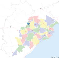
312:
686:
Click on a date/time to view the file as it appeared at that time.
195:
184:
227:
154:
223:
87:(SVG file, nominally 2,269 × 2,241 pixels, file size: 211 KB)
93:
473:
If inappropriate please set warp_status = skip to hide.
166:
807:
837:
684:
621:
Creative
Commons Attribution-ShareAlike 3.0 Unported
595:
Creative
Commons Attribution-ShareAlike 3.0 Unported
117:
Commons is a freely licensed media file repository.
459:
483:
135:
451:
316:to negotiate a custom license as per your needs.
902:Knowledge:Kartenwerkstatt/Positionskarten/Asien
418:https://creativecommons.org/licenses/by-sa/3.0
98:
424:Creative Commons Attribution-Share Alike 3.0
348:
327:
162:
145:
262:
172:
14:
384:– to copy, distribute and transmit the work
46:Size of this PNG preview of this SVG file:
132:
839:The following other wikis use this file:
814:2009 Odisha Legislative Assembly election
455:second half of 20 century and 21 century
1072:साँचा:ओड़िशा के लोकसभा निर्वाचन क्षेत्र
912:Accidente ferroviario de Odisha de 2009
467:Georeference the map in Wikimaps Warper
294:If you are using the image under the
129:
872:खाँचा:उड़ीसा कय लोकसभा चुनाव क्षेत्र
371:Attribution-Share Alike 3.0 Unported
296:creative commons share alike license
153:Locator map for the Indian state of
1102:जगतसिंहपुर लोक सभा निर्वाचन क्षेत्र
892:Plantilya:Location map India Orissa
677:
359:
354:
13:
1154:
1082:भुवनेश्वर लोक सभा निर्वाचन क्षेत्र
524:
518:
510:
345:
341:
130:
80:
1188:
1161:
1112:कलाहांडी लोक सभा निर्वाचन क्षेत्र
1097:ढेंकानाल लोक सभा निर्वाचन क्षेत्र
799:|Permission= |other_versions= }}
523:
1137:बरहमपुर लोक सभा निर्वाचन क्षेत्र
1127:बालासोर लोक सभा निर्वाचन क्षेत्र
1087:बलांगिर लोक सभा निर्वाचन क्षेत्र
808:
501:
436:
395:Under the following conditions:
366:This file is licensed under the
358:
353:
347:
267:
97:
31:
21:
1117:कंधमाल लोक सभा निर्वाचन क्षेत्र
1107:जाजपुर लोक सभा निर्वाचन क्षेत्र
882:Ҡалып:ПозКарта Һиндостан Орисса
498:
196:University of Texas map library
185:University of Texas map library
1132:बरगढ़ लोक सभा निर्वाचन क्षेत्र
1122:भद्रक लोक सभा निर्वाचन क्षेत्र
1077:आस्का लोक सभा निर्वाचन क्षेत्र
937:الگو:Location map India Orissa
857:সাঁচ:Location map India Orissa
847:قالب:Location map India Orissa
834:
681:
497:
221:State and District boundaries:
26:
1:
867:लोकसभा चुनाव क्षेत्रन कय सूची
665:original creation by uploader
639:original creation by uploader
465:
36:
1092:कटक लोक सभा निर्वाचन क्षेत्र
804:
531:Items portrayed in this file
270:
244:Survey of India Map Explorer
7:
1151:
888:Usage on ceb.wikipedia.org
863:Usage on awa.wikipedia.org
829:List of districts of Odisha
300:CC-by-sa PlaneMad/Wikimedia
10:
1193:
1063:Usage on hi.wikipedia.org
943:Usage on gu.wikipedia.org
918:Usage on fa.wikipedia.org
908:Usage on es.wikipedia.org
898:Usage on de.wikipedia.org
878:Usage on ba.wikipedia.org
853:Usage on as.wikipedia.org
843:Usage on ar.wikipedia.org
409:same or compatible license
678:
478:
446:
177:
16:
500:
375:
298:please credit the photo
189:India Political map 2001
104:This is a file from the
41:
794:
773:21:32, 14 February 2008
764:
743:13:28, 21 February 2008
735:
714:17:28, 6 September 2008
108:. Information from its
489:WikiProject India Maps
447: Geotemporal data
228:2001 Census State Maps
182:International Borders:
148:Odisha locator map.svg
111:description page there
253:Map specific sources:
790:Mkeranat~commonswiki
760:Mkeranat~commonswiki
232:Survey of India Maps
74:2,269 × 2,241 pixels
70:2,074 × 2,048 pixels
66:1,037 × 1,024 pixels
1067:नलबण पक्षी अभयारण्य
479: Archival data
390:– to adapt the work
248:Columbia University
240:US Army Map Service
212:Kashmir Region 2004
208:Western Sector 1988
204:Eastern Sector 1988
200:China-India Borders
52:Other resolutions:
310:or catch me at my
140:Orissa locator map
1180:
1179:
1146:more global usage
952:મલ્કાનગિરિ જિલ્લો
835:Global file usage
824:Jajpur derailment
802:
605:copyright license
591:copyright license
517:
509:
494:
493:
474:
336:
333:Reusing this file
322:
321:
193:Disputed Borders:
126:
125:
106:Wikimedia Commons
32:Global file usage
1184:
1162:
785:
755:
726:
688:
561:copyright status
547:copyright status
515:
507:
472:
471:
469:
468:
440:
431:
428:
425:
422:
419:
411:as the original.
368:Creative Commons
362:
361:
357:
356:
351:
350:
330:
268:
179:
168:
149:
133:
122:
101:
100:
94:
88:
77:
62:778 × 768 pixels
58:486 × 480 pixels
54:243 × 240 pixels
48:607 × 600 pixels
1192:
1191:
1187:
1186:
1185:
1183:
1182:
1181:
1150:
833:
810:
803:
791:
783:
761:
753:
732:
724:
680:
679:
676:
675:
674:
673:
672:
671:
670:
669:
667:
655:
654:
653:
651:
632:
631:
630:
629:
628:
627:
626:
625:
623:
611:
610:
609:
607:
588:
587:
586:
585:
584:
583:
582:
581:
579:
567:
566:
565:
563:
544:
543:
542:
541:
540:
538:
522:
521:
520:
513:
512:
495:
466:
463:
434:
433:
432:
429:
426:
423:
420:
417:
416:
374:
363:
344:
343:
323:
224:Census of India
158:
147:
141:
128:
127:
116:
115:
114:is shown below.
90:
86:
79:
78:
51:
12:
11:
5:
1190:
1178:
1177:
1174:
1170:
1169:
1166:
1153:
1148:of this file.
1142:
1141:
1140:
1139:
1134:
1129:
1124:
1119:
1114:
1109:
1104:
1099:
1094:
1089:
1084:
1079:
1074:
1069:
1061:
1060:
1059:
1054:
1049:
1044:
1039:
1034:
1029:
1024:
1019:
1014:
1009:
1004:
999:
994:
989:
984:
979:
974:
969:
964:
959:
954:
949:
947:સંબલપુર જિલ્લો
941:
940:
939:
934:
929:
924:
916:
915:
914:
906:
905:
904:
896:
895:
894:
886:
885:
884:
876:
875:
874:
869:
861:
860:
859:
851:
850:
849:
836:
832:
831:
826:
821:
816:
806:
801:
800:
793:
789:
786:
780:
775:
770:
767:
766:
763:
759:
756:
750:
745:
740:
737:
736:
734:
730:
727:
723:2,269 × 2,241
721:
716:
711:
707:
706:
703:
700:
697:
694:
691:
683:
668:
663:
661:
660:
659:
657:
656:
652:
649:source of file
647:
645:
644:
643:
642:
640:
636:
635:source of file
624:
619:
617:
616:
615:
613:
612:
608:
603:
601:
600:
599:
598:
596:
592:
580:
575:
573:
572:
571:
569:
568:
564:
559:
557:
556:
555:
554:
552:
548:
539:
534:
532:
529:
528:
527:
526:
514:
506:
505:
502:
499:
492:
491:
485:
481:
480:
476:
475:
461:
460:Georeferencing
457:
456:
453:
449:
448:
444:
443:
415:
414:
413:
412:
402:
393:
392:
391:
385:
378:You are free:
365:
364:
346:
340:
339:
337:
325:
324:
320:
319:
318:
317:
303:
280:was created by
271:
266:
264:
260:
259:
237:Other sources:
174:
170:
169:
167:September 2008
164:
160:
159:
152:
150:
143:
142:
139:
137:
131:
124:
123:
102:
92:
91:
45:
40:
39:
34:
29:
24:
19:
9:
6:
4:
3:
2:
1189:
1175:
1172:
1171:
1167:
1164:
1163:
1160:
1157:
1149:
1147:
1138:
1135:
1133:
1130:
1128:
1125:
1123:
1120:
1118:
1115:
1113:
1110:
1108:
1105:
1103:
1100:
1098:
1095:
1093:
1090:
1088:
1085:
1083:
1080:
1078:
1075:
1073:
1070:
1068:
1065:
1064:
1062:
1058:
1055:
1053:
1050:
1048:
1045:
1043:
1040:
1038:
1035:
1033:
1030:
1028:
1025:
1023:
1020:
1018:
1015:
1013:
1010:
1008:
1005:
1003:
1000:
998:
995:
993:
990:
988:
985:
983:
980:
978:
975:
973:
970:
968:
965:
963:
960:
958:
955:
953:
950:
948:
945:
944:
942:
938:
935:
933:
930:
928:
925:
923:
920:
919:
917:
913:
910:
909:
907:
903:
900:
899:
897:
893:
890:
889:
887:
883:
880:
879:
877:
873:
870:
868:
865:
864:
862:
858:
855:
854:
852:
848:
845:
844:
842:
841:
840:
830:
827:
825:
822:
820:
819:Barabati fort
817:
815:
812:
811:
798:
792:
787:
781:
779:
776:
774:
771:
769:
768:
762:
757:
751:
749:
746:
744:
741:
739:
738:
733:
728:
722:
720:
717:
715:
712:
709:
708:
704:
701:
698:
695:
692:
690:
689:
687:
666:
662:
650:
646:
622:
618:
606:
602:
578:
574:
562:
558:
537:
533:
530:
503:
496:
490:
486:
482:
477:
470:
462:
458:
454:
452:Date depicted
450:
445:
439:
435:
421:CC BY-SA 3.0
410:
406:
403:
400:
397:
396:
394:
389:
386:
383:
380:
379:
377:
376:
372:
369:
352:
338:
334:
329:
326:
315:
314:
309:
308:
304:
301:
297:
293:
292:
291:
290:
287:
286:
285:User:PlaneMad
282:
281:
278:
277:
272:
269:
265:
261:
257:
254:
251:
250:
249:
245:
241:
238:
235:
233:
229:
225:
222:
219:
217:
213:
209:
205:
201:
197:
194:
191:
190:
186:
183:
180:
175:
171:
165:
161:
156:
151:
144:
138:
134:
120:
113:
112:
107:
103:
96:
95:
89:
84:
83:Original file
75:
71:
67:
63:
59:
55:
49:
44:
38:
35:
33:
30:
28:
25:
23:
20:
18:
15:
1158:
1155:
1143:
982:પારળાખેમુંડી
838:
685:
682:File history
404:
398:
387:
381:
311:
306:
299:
288:
283:
279:
275:
273:
252:
236:
220:
216:Kashmir Maps
192:
181:
176:
119:You can help
109:
81:
22:File history
577:copyrighted
551:copyrighted
405:share alike
399:attribution
146:Description
805:File usage
782:647 × 564
752:647 × 564
699:Dimensions
328:Permission
276:This Image
27:File usage
1176:2241.29px
1168:2269.39px
987:સુવર્ણપુર
967:ભવાનીપટના
696:Thumbnail
693:Date/Time
1152:Metadata
1057:ઝારસુગડા
1037:નબરંગપુર
1017:બાલેશ્વર
992:સુન્દરગઢ
972:કેન્દુઝર
922:برهماپور
797:Mkeranat
784:(130 KB)
754:(132 KB)
731:Planemad
725:(211 KB)
504:Captions
487:Part of
388:to remix
382:to share
373:license.
178:Own work
155:w:Orissa
37:Metadata
1047:ધેંકનાલ
1042:બારિપદા
1012:બલાંગીર
997:સંબલપુર
977:કોરાપુટ
962:ફુલબાણી
710:current
705:Comment
536:depicts
508:English
313:Website
263:Creator
85:
1173:Height
1027:નુઆપડા
932:رورکلا
519:ଓଡ଼ିଶା
511:Odisha
442:usage.
206:&
173:Source
1165:Width
1144:View
1052:દેવગઢ
1032:નયાગઢ
1002:ભદ્રક
927:کوتاک
484:Notes
136:Title
1022:બરગઢ
702:User
516:Odia
430:true
427:true
163:Date
17:File
1007:બૌઢ
957:કટક
256:IMD
246:,
242:,
230:-
226:-
214:-
210:-
202:-
198:-
187:-
72:|
68:|
64:|
60:|
56:|
50:.
335:)
331:(
289:.
258:.
234:.
218:.
121:.
76:.
Text is available under the Creative Commons Attribution-ShareAlike License. Additional terms may apply.
