833:"}},"text\/plain":{"en":{"":"coordinates of the point of view"}}},"{\"value\":{\"latitude\":57.099041,\"longitude\":-3.713622,\"altitude\":null,\"precision\":1.0e-6,\"globe\":\"http:\\\/\\\/www.wikidata.org\\\/entity\\\/Q2\"},\"type\":\"globecoordinate\"}":{"text\/html":{"en":{"P1259":"57\u00b05'56.548"N, 3\u00b042'49.039"W"}},"text\/plain":{"en":{"P1259":"57\u00b05'56.548\"N, 3\u00b042'49.039\"W"}}},"{\"value\":{\"entity-type\":\"property\",\"numeric-id\":7787,\"id\":\"P7787\"},\"type\":\"wikibase-entityid\"}":{"text\/html":{"en":{"":"
43:
485:"}},"text\/plain":{"en":{"":"author name string"}}},"{\"value\":\"Alan O'Dowd\",\"type\":\"string\"}":{"text\/html":{"en":{"P2093":"Alan O'Dowd"}},"text\/plain":{"en":{"P2093":"Alan O'Dowd"}}},"{\"value\":{\"entity-type\":\"property\",\"numeric-id\":2699,\"id\":\"P2699\"},\"type\":\"wikibase-entityid\"}":{"text\/html":{"en":{"":"
795:"}},"text\/plain":{"en":{"":"inception"}}},"{\"value\":{\"time\":\"+2015-07-21T00:00:00Z\",\"timezone\":0,\"before\":0,\"after\":0,\"precision\":11,\"calendarmodel\":\"http:\\\/\\\/www.wikidata.org\\\/entity\\\/Q1985727\"},\"type\":\"time\"}":{"text\/html":{"en":{"P571":"21 July 2015"}},"text\/plain":{"en":{"P571":"21 July 2015"}}}}": -->
672:
278:
829:
292:
313:
351:
356:
103:
493:"}},"text\/plain":{"en":{"P2699":"https:\/\/www.geograph.org.uk\/profile\/34944"}}},"{\"value\":{\"entity-type\":\"property\",\"numeric-id\":3831,\"id\":\"P3831\"},\"type\":\"wikibase-entityid\"}":{"text\/html":{"en":{"":"
696:"}},"text\/plain":{"en":{"P973":"https:\/\/www.geograph.org.uk\/photo\/4587204"}}},"{\"value\":{\"entity-type\":\"property\",\"numeric-id\":137,\"id\":\"P137\"},\"type\":\"wikibase-entityid\"}":{"text\/html":{"en":{"":"
680:"}},"text\/plain":{"en":{"P7482":"file available on the internet"}}},"{\"value\":{\"entity-type\":\"property\",\"numeric-id\":7384,\"id\":\"P7384\"},\"type\":\"wikibase-entityid\"}":{"text\/html":{"en":{"":"
497:"}},"text\/plain":{"en":{"":"object of statement has role"}}},"{\"value\":{\"entity-type\":\"item\",\"numeric-id\":33231,\"id\":\"Q33231\"},\"type\":\"wikibase-entityid\"}":{"text\/html":{"en":{"P3831":"
632:"}},"text\/plain":{"en":{"":"copyright license"}}},"{\"value\":{\"entity-type\":\"item\",\"numeric-id\":19068220,\"id\":\"Q19068220\"},\"type\":\"wikibase-entityid\"}":{"text\/html":{"en":{"P275":"
588:"}},"text\/plain":{"en":{"":"copyright status"}}},"{\"value\":{\"entity-type\":\"item\",\"numeric-id\":50423863,\"id\":\"Q50423863\"},\"type\":\"wikibase-entityid\"}":{"text\/html":{"en":{"P6216":"
676:"}},"text\/plain":{"en":{"":"source of file"}}},"{\"value\":{\"entity-type\":\"item\",\"numeric-id\":74228490,\"id\":\"Q74228490\"},\"type\":\"wikibase-entityid\"}":{"text\/html":{"en":{"P7482":"
939:
700:"}},"text\/plain":{"en":{"":"operator"}}},"{\"value\":{\"entity-type\":\"item\",\"numeric-id\":1503119,\"id\":\"Q1503119\"},\"type\":\"wikibase-entityid\"}":{"text\/html":{"en":{"P137":"
837:"}},"text\/plain":{"en":{"":"heading"}}},"{\"value\":{\"amount\":\"+90\",\"unit\":\"http:\\\/\\\/www.wikidata.org\\\/entity\\\/Q28390\"},\"type\":\"quantity\"}":{"text\/html":{"en":{"P7787":"90
688:"}},"text\/plain":{"en":{"P7384":"4587204"}}},"{\"value\":{\"entity-type\":\"property\",\"numeric-id\":973,\"id\":\"P973\"},\"type\":\"wikibase-entityid\"}":{"text\/html":{"en":{"":"
481:"}},"text\/plain":{"en":{"":"creator"}}},"{\"value\":{\"entity-type\":\"property\",\"numeric-id\":2093,\"id\":\"P2093\"},\"type\":\"wikibase-entityid\"}":{"text\/html":{"en":{"":"
584:
403:– You must give appropriate credit, provide a link to the license, and indicate if changes were made. You may do so in any reasonable manner, but not in any way that suggests the licensor endorses you or your use.
275:
69:
65:
61:
57:
53:
47:
82:
114:
685:
677:
633:
589:
701:
498:
834:
830:
681:
673:
585:
494:
486:
482:
693:
490:
792:
697:
689:
629:
478:
636:"}},"text\/plain":{"en":{"P275":"Creative Commons Attribution-ShareAlike 2.0 Generic"}}}}": -->
1023:
198:
1107:
727:
659:
615:
285:
777:
320:
1001:
This file contains additional information, probably added from the digital camera or scanner used to create or digitize it.
938:
933:
410:
73:
42:
570:
875:
848:
740:
711:
599:
563:
548:
535:
802:
770:
755:
643:
508:
467:
704:"}},"text\/plain":{"en":{"P137":"Geograph Britain and Ireland"}}}}": -->
1138:
366:
1004:
If the file has been modified from its original state, some details may not fully reflect the modified file.
409:– If you remix, transform, or build upon the material, you must distribute your contributions under the
327:
on the
Geograph website for the photographer's contact details. The copyright on this image is owned by
970:
501:"}},"text\/plain":{"en":{"P3831":"photographer"}}}}": -->
592:"}},"text\/plain":{"en":{"P6216":"copyrighted"}}}}": -->
966:
The following pages on the
English Knowledge use this file (pages on other projects are not listed):
841:"}},"text\/plain":{"en":{"P7787":"90 degree"}}}}": -->
122:
230:
1186:
762:
747:
555:
363:
214:
8:
1222:
307:
291:
1335:
332:
109:
457:
988:
1290:
1204:
1030:
187:
177:
1345:
1300:
1070:
949:
858:
812:
721:
653:
609:
518:
1240:
312:
1050:
324:
1013:
1355:
1040:
906:
Click on a date/time to view the file as it appeared at that time.
1133:
Landscape mode (for landscape photos with the background in focus)
277:
262:
57° 05′ 56.55″ N, 3° 42′ 49.04″ W
166:
97:
451:
Add a one-line explanation of what this file represents
87:(4,608 × 3,456 pixels, file size: 4.99 MB, MIME type:
964:
147:
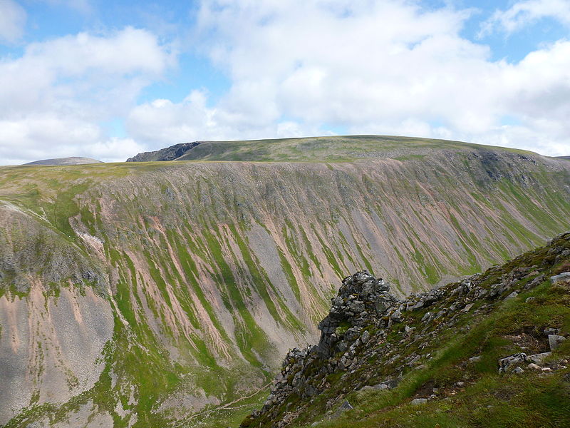
Looking across the Lairig Ghru (geograph 4587204).jpg
979:
904:
205:
Creative
Commons Attribution Share-alike license 2.0
121:
Commons is a freely licensed media file repository.
660:
Creative
Commons Attribution-ShareAlike 2.0 Generic
634:
Creative
Commons Attribution-ShareAlike 2.0 Generic
1227:Flash did not fire, compulsory flash suppression
420:https://creativecommons.org/licenses/by-sa/2.0
102:
694:https:\/\/www.geograph.org.uk\/photo\/4587204
491:https:\/\/www.geograph.org.uk\/profile\/34944
426:Creative Commons Attribution-Share Alike 2.0
344:
193:
162:
144:
183:
172:
14:
838:
386:– to copy, distribute and transmit the work
981:The following other wikis use this file:
763:https://www.geograph.org.uk/photo/4587204
556:https://www.geograph.org.uk/profile/34944
989:Desastre de la meseta de los Cairngorm
956:Transferred from geograph.co.uk using
284:View this and other nearby images on:
237:
133:
331:and is licensed for reuse under the
252:
897:
367:Attribution-Share Alike 2.0 Generic
355:
350:
335:Attribution-ShareAlike 2.0 license.
13:
999:
456:
450:
341:
318:
151:
134:
80:
1380:
1006:
455:
1061:Date and time of data generation
965:
849:coordinates of the point of view
831:coordinates of the point of view
441:
397:Under the following conditions:
362:This file is licensed under the
354:
349:
343:
311:
290:
276:
268:
101:
31:
21:
438:
152:
976:
901:
728:file available on the internet
678:file available on the internet
437:
319:This image was taken from the
245:Looking across the Lairig Ghru
226:Looking across the Lairig Ghru
157:Looking across the Lairig Ghru
26:
1:
1269:A directly photographed image
36:
961:
864:57°5'56.548"N, 3°42'49.039"W
778:Geograph Britain and Ireland
702:Geograph Britain and Ireland
564:object of statement has role
495:object of statement has role
463:Items portrayed in this file
303:
7:
1149:Date and time of digitizing
996:
267:
10:
1385:
1311:Focal length in 35 mm film
1253:One-chip color area sensor
1232:Supported Flashpix version
985:Usage on es.wikipedia.org
971:Cairngorm Plateau disaster
411:same or compatible license
141:
136:
1157:Meaning of each component
1114:File change date and time
898:
16:
741:geograph.org.uk image ID
682:geograph.org.uk image ID
440:
377:
243:Alan O'Dowd /
224:Alan O'Dowd /
108:This is a file from the
41:
1274:Custom image processing
955:
934:13:21, 19 February 2016
215:required by the license
165:
112:. Information from its
1199:3.4453125 APEX (f/3.3)
1178:Image compression mode
325:this photograph's page
296:57.099041; -3.713622
115:description page there
46:Size of this preview:
1196:Maximum land aperture
1088:Horizontal resolution
1368:north east july 2015
1261:Digital still camera
74:4,608 × 3,456 pixels
70:2,560 × 1,920 pixels
1152:13:39, 21 July 2015
1122:Y and C positioning
1117:13:39, 21 July 2015
1096:Vertical resolution
1064:13:39, 21 July 2015
1035:1/800 sec (0.00125)
1010:Camera manufacturer
392:– to adapt the work
52:Other resolutions:
1319:Scene capture type
1295:Auto white balance
536:author name string
483:author name string
66:1,280 × 960 pixels
62:1,024 × 768 pixels
1372:
1371:
977:Global file usage
959:
840:
644:copyright license
630:copyright license
449:
340:
339:
323:collection. See
301:
300:
250:
249:
218:
202:
199:Reusing this file
130:
129:
110:Wikimedia Commons
32:Global file usage
1376:
1130:Exposure Program
1007:
946:
908:
886:
885:
880:
780:
775:
765:
760:
756:described at URL
750:
745:
690:described at URL
600:copyright status
586:copyright status
573:
568:
558:
553:
543:
540:
447:
433:
430:
427:
424:
421:
413:as the original.
375:
364:Creative Commons
358:
357:
353:
352:
347:
346:
333:Creative Commons
321:Geograph project
315:
308:
297:
294:
280:
279:
273:
272:
271:
265:
264:
253:
212:
196:
168:
156:
148:
142:
126:
105:
104:
98:
92:
90:
77:
58:640 × 480 pixels
54:320 × 240 pixels
48:800 × 600 pixels
1384:
1383:
1379:
1378:
1377:
1375:
1374:
1373:
995:
975:
967:
960:
952:
944:
900:
899:
896:
895:
894:
893:
892:
891:
890:
889:
888:
887:
883:
881:
878:
869:
868:
867:
865:
855:
854:
853:
851:
828:
827:
826:
825:
824:
823:
822:
821:
819:
809:
808:
807:
805:
790:
789:
788:
787:
786:
785:
784:
783:
782:
781:
776:
773:
767:
766:
761:
758:
752:
751:
746:
743:
734:
733:
732:
730:
718:
717:
716:
714:
671:
670:
669:
668:
667:
666:
665:
664:
662:
650:
649:
648:
646:
627:
626:
625:
624:
623:
622:
621:
620:
618:
606:
605:
604:
602:
583:
582:
581:
580:
579:
578:
577:
576:
575:
574:
569:
566:
560:
559:
554:
551:
545:
544:
541:
538:
529:
528:
527:
525:
515:
514:
513:
511:
476:
475:
474:
473:
472:
470:
454:
453:
452:
435:
434:
431:
428:
425:
422:
419:
418:
376:
373:
370:
359:
336:
306:
295:
269:
260:
259:
256:Camera location
251:
240:
233:
221:
178:geograph.org.uk
158:
146:
139:
132:
131:
120:
119:
118:is shown below.
94:
88:
86:
79:
78:
51:
12:
11:
5:
1382:
1370:
1369:
1366:
1362:
1361:
1358:
1352:
1351:
1348:
1342:
1341:
1338:
1332:
1331:
1328:
1324:
1323:
1320:
1316:
1315:
1312:
1308:
1307:
1304:
1297:
1296:
1293:
1287:
1286:
1283:
1279:
1278:
1277:Normal process
1275:
1271:
1270:
1267:
1263:
1262:
1259:
1255:
1254:
1251:
1250:Sensing method
1247:
1246:
1243:
1237:
1236:
1233:
1229:
1228:
1225:
1219:
1218:
1215:
1211:
1210:
1207:
1201:
1200:
1197:
1193:
1192:
1189:
1183:
1182:
1179:
1175:
1174:
1173:
1172:
1171:does not exist
1169:
1166:
1163:
1158:
1154:
1153:
1150:
1146:
1145:
1142:
1135:
1134:
1131:
1127:
1126:
1123:
1119:
1118:
1115:
1111:
1110:
1105:
1101:
1100:
1097:
1093:
1092:
1089:
1085:
1084:
1081:
1077:
1076:
1073:
1066:
1065:
1062:
1058:
1057:
1054:
1047:
1046:
1043:
1037:
1036:
1033:
1027:
1026:
1021:
1017:
1016:
1011:
998:
994:
993:
992:
991:
978:
974:
973:
963:
958:
957:
954:
950:
947:
943:4,608 × 3,456
941:
936:
931:
927:
926:
923:
920:
917:
914:
911:
903:
874:
873:
872:
871:
870:
866:
863:
861:
860:
859:
857:
856:
852:
847:
845:
844:
843:
842:
836:
832:
820:
817:
815:
814:
813:
811:
810:
806:
801:
799:
798:
797:
796:
794:
769:
768:
754:
753:
739:
738:
737:
736:
735:
731:
726:
724:
723:
722:
720:
719:
715:
712:source of file
710:
708:
707:
706:
705:
703:
699:
695:
691:
687:
683:
679:
675:
674:source of file
663:
658:
656:
655:
654:
652:
651:
647:
642:
640:
639:
638:
637:
635:
631:
619:
614:
612:
611:
610:
608:
607:
603:
598:
596:
595:
594:
593:
591:
587:
562:
561:
547:
546:
534:
533:
532:
531:
530:
526:
523:
521:
520:
519:
517:
516:
512:
507:
505:
504:
503:
502:
500:
496:
492:
488:
484:
480:
471:
466:
464:
461:
460:
459:
458:
446:
445:
442:
439:
417:
416:
415:
414:
404:
395:
394:
393:
387:
380:You are free:
371:
361:
360:
342:
338:
337:
316:
305:
302:
299:
298:
288:
282:
257:
248:
247:
241:
238:
235:
234:
229:
222:
219:
207:
206:
203:
191:
190:
185:
181:
180:
174:
170:
169:
164:
160:
159:
149:
140:
138:
135:
128:
127:
106:
96:
95:
45:
40:
39:
34:
29:
24:
19:
9:
6:
4:
3:
2:
1381:
1367:
1364:
1363:
1359:
1357:
1354:
1353:
1349:
1347:
1344:
1343:
1339:
1337:
1334:
1333:
1329:
1327:Scene control
1326:
1325:
1321:
1318:
1317:
1313:
1310:
1309:
1305:
1302:
1299:
1298:
1294:
1292:
1291:White balance
1289:
1288:
1285:Auto exposure
1284:
1282:Exposure mode
1281:
1280:
1276:
1273:
1272:
1268:
1265:
1264:
1260:
1257:
1256:
1252:
1249:
1248:
1244:
1242:
1239:
1238:
1234:
1231:
1230:
1226:
1224:
1221:
1220:
1216:
1213:
1212:
1208:
1206:
1205:Metering mode
1203:
1202:
1198:
1195:
1194:
1190:
1188:
1187:Exposure bias
1185:
1184:
1180:
1177:
1176:
1170:
1167:
1164:
1161:
1160:
1159:
1156:
1155:
1151:
1148:
1147:
1143:
1140:
1137:
1136:
1132:
1129:
1128:
1124:
1121:
1120:
1116:
1113:
1112:
1109:
1106:
1104:Software used
1103:
1102:
1098:
1095:
1094:
1090:
1087:
1086:
1082:
1079:
1078:
1074:
1072:
1068:
1067:
1063:
1060:
1059:
1055:
1052:
1049:
1048:
1044:
1042:
1039:
1038:
1034:
1032:
1031:Exposure time
1029:
1028:
1025:
1022:
1019:
1018:
1015:
1012:
1009:
1008:
1005:
1002:
990:
987:
986:
984:
983:
982:
972:
969:
968:
953:
948:
942:
940:
937:
935:
932:
929:
928:
924:
921:
918:
915:
912:
910:
909:
907:
877:
862:
850:
846:
816:
804:
800:
779:
772:
764:
757:
749:
742:
729:
725:
713:
709:
661:
657:
645:
641:
617:
613:
601:
597:
572:
565:
557:
550:
537:
522:
510:
506:
469:
465:
462:
443:
436:
423:CC BY-SA 2.0
412:
408:
405:
402:
399:
398:
396:
391:
388:
385:
382:
381:
379:
378:
372:Attribution:
368:
365:
348:
334:
330:
326:
322:
317:
314:
310:
309:
293:
289:
287:
286:OpenStreetMap
283:
281:
263:
258:
255:
254:
246:
242:
236:
232:
228: /
227:
223:
216:
211:
209:
208:
204:
200:
195:
192:
189:
186:
182:
179:
175:
171:
161:
155:
150:
143:
124:
117:
116:
111:
107:
100:
99:
93:
84:
83:Original file
75:
71:
67:
63:
59:
55:
49:
44:
38:
35:
33:
30:
28:
25:
23:
20:
18:
15:
1301:Digital zoom
1214:Light source
1071:focal length
1020:Camera model
1003:
1000:
980:
905:
902:File history
818:21 July 2015
571:photographer
499:photographer
406:
400:
389:
383:
328:
266:
244:
231:CC BY-SA 2.0
225:
167:21 July 2015
153:
123:You can help
113:
81:
22:File history
1258:File source
1241:Color space
1080:Orientation
616:copyrighted
590:copyrighted
542:Alan O'Dowd
407:share alike
401:attribution
374:Alan O'Dowd
329:Alan O'Dowd
210:Attribution
188:Alan O'Dowd
145:Description
1346:Saturation
1266:Scene type
962:File usage
919:Dimensions
524:some value
194:Permission
89:image/jpeg
27:File usage
1356:Sharpness
1108:Ver.1.0
1051:ISO speed
1014:Panasonic
945:(4.99 MB)
916:Thumbnail
913:Date/Time
803:inception
793:inception
304:Licensing
239:InfoField
220:InfoField
154:English:
1365:Keywords
1336:Contrast
1322:Standard
1125:Co-sited
1041:F-number
1024:DMC-FS35
997:Metadata
771:operator
698:operator
444:Captions
390:to remix
384:to share
369:license.
37:Metadata
1217:Unknown
1209:Pattern
1141:version
1099:180 dpi
1091:180 dpi
951:Thincat
930:current
925:Comment
876:heading
835:heading
748:4587204
686:4587204
509:creator
479:creator
468:depicts
448:English
137:Summary
85:
1360:Normal
1350:Normal
1340:Normal
1083:Normal
1053:rating
884:degree
839:degree
274:
184:Author
173:Source
1314:28 mm
1303:ratio
1223:Flash
1069:Lens
1045:f/3.3
176:From
1330:None
1245:sRGB
1139:Exif
1075:5 mm
922:User
432:true
429:true
163:Date
17:File
1144:2.3
1056:100
882:90
549:URL
487:URL
1168:Cr
1165:Cb
879::
774::
759::
744::
567::
552::
539::
72:|
68:|
64:|
60:|
56:|
50:.
1306:0
1235:1
1191:0
1181:4
1162:Y
217:)
213:(
201:)
197:(
125:.
91:)
76:.
Text is available under the Creative Commons Attribution-ShareAlike License. Additional terms may apply.

.jpg)
.jpg¶ms=057.099041_N_-003.713622_E_globe:Earth_type:camera_heading:90.00&language=en)
