43:
604:"}},"text\/plain":{"en":{"":"inception"}}},"{\"value\":{\"time\":\"+2014-07-25T00:00:00Z\",\"timezone\":0,\"before\":0,\"after\":0,\"precision\":11,\"calendarmodel\":\"http:\\\/\\\/www.wikidata.org\\\/entity\\\/Q1985727\"},\"type\":\"time\"}":{"text\/html":{"en":{"P571":"25 July 2014"}},"text\/plain":{"en":{"P571":"25 July 2014"}}}}": -->
216:
380:
227:
334:
386:
391:
99:
740:
710:
560:"}},"text\/plain":{"en":{"":"copyright license"}}},"{\"value\":{\"entity-type\":\"item\",\"numeric-id\":19068220,\"id\":\"Q19068220\"},\"type\":\"wikibase-entityid\"}":{"text\/html":{"en":{"P275":"
516:"}},"text\/plain":{"en":{"":"copyright status"}}},"{\"value\":{\"entity-type\":\"item\",\"numeric-id\":50423863,\"id\":\"Q50423863\"},\"type\":\"wikibase-entityid\"}":{"text\/html":{"en":{"P6216":"
680:
512:
768:
353:
The ODbL does not require any particular license for maps produced from ODbL data. Prior to 1 August 2020, map tiles produced by the OpenStreetMap
Foundation were licensed under the
73:
69:
65:
61:
57:
53:
47:
561:
517:
110:
82:
513:
601:
557:
303:
297:
1330:
1165:
309:
288:
1340:
1335:
739:
734:
709:
704:
564:"}},"text\/plain":{"en":{"P275":"Creative Commons Attribution-ShareAlike 2.0 Generic"}}}}": -->
1300:
800:
247:
210:
1365:
1355:
409:© OpenStreetMap contributors. © Natural England copyright 2012. Contains Ordnance Survey data © Crown copyright and database right 2012.
1160:
1310:
587:
543:
257:
221:
1458:
This file contains additional information, probably added from the digital camera or scanner used to create or digitize it.
1360:
1040:
445:
162:
1085:
990:
1295:
527:
1400:
611:
571:
502:
679:
674:
42:
1185:
1170:
1405:
1395:
1390:
1385:
1245:
1180:
1175:
401:
890:
1461:
If the file has been modified from its original state, some details may not fully reflect the modified file.
1010:
767:
More than 100 pages use this file. The following list shows the first 100 pages that use this file only. A
1425:
1345:
444:– If you remix, transform, or build upon the material, you must distribute your contributions under the
1240:
1145:
1065:
1420:
1090:
1060:
1045:
1020:
980:
960:
875:
830:
820:
520:"}},"text\/plain":{"en":{"P6216":"copyrighted"}}}}": -->
1380:
1025:
1250:
965:
945:
118:
292:
1235:
1195:
1140:
885:
1315:
1410:
1350:
1075:
1035:
880:
1220:
1210:
1070:
1015:
1000:
995:
900:
795:
398:
8:
1115:
985:
233:
154:
1200:
850:
215:
1230:
1030:
930:
895:
860:
105:
492:
1265:
1260:
1050:
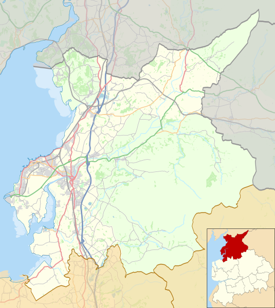
915:
780:
1375:
1370:
1225:
354:
1270:
1155:
865:
835:
815:
785:
346:
261:
251:
226:
1110:
1255:
1120:
1100:
1095:
274:
950:
925:
920:
905:
845:
750:
720:
690:
621:
581:
537:
268:
1215:
1130:
1105:
970:
810:
1445:
313:
167:
Equirectangular map projection on WGS 84 datum, with N/S stretched 165%
1205:
855:
775:
333:
1325:
1135:
1125:
1080:
1055:
975:
955:
935:
910:
870:
825:
790:
328:
805:
647:
Click on a date/time to view the file as it appeared at that time.
1435:
1190:
1150:
1005:
940:
840:
357:. Maps produced by other people may be subject to other licences.
342:
87:(SVG file, nominally 1,164 × 1,305 pixels, file size: 5.03 MB)
1426:
Module:Location map/data/United
Kingdom City of Lancaster/doc
264:, created using Ordnance Survey data and Natural England data
1301:وحدة:Location map/data/United Kingdom City of Lancaster/شرح
1421:
Module:Location map/data/United
Kingdom City of Lancaster
194:
93:
1296:وحدة:Location map/data/United Kingdom City of Lancaster
486:
Add a one-line explanation of what this file represents
304:
File:Location map United
Kingdom Lancaster Central1.png
298:
File:Location map United
Kingdom Lancaster Central.png
765:
1286:
645:
234:
http://www.openstreetmap.org/#map=10/54.0767/-2.6353
117:
Commons is a freely licensed media file repository.
588:
Creative
Commons Attribution-ShareAlike 2.0 Generic
562:
Creative
Commons Attribution-ShareAlike 2.0 Generic
1166:St John the Evangelist's Church, Gressingham
143:Location map United Kingdom City of Lancaster.svg
455:https://creativecommons.org/licenses/by-sa/2.0
310:File:Location map United Kingdom Morecambe.svg
289:File:Location map United Kingdom Lancaster.svg
98:
461:Creative Commons Attribution-Share Alike 2.0
379:
366:http://opendatacommons.org/licenses/odbl/1.0/
190:
140:
801:Arkholme for Kirkby Lonsdale railway station
697:Some minor colour changes to improve clarity
282:
241:
201:
14:
1161:St John the Baptist's Church, Tunstall
421:– to copy, distribute and transmit the work
46:Size of this PNG preview of this SVG file:
1288:The following other wikis use this file:
248:Lancaster UK ward map 2010 (blank).svg
211:Lancaster UK ward map 2010 (blank).svg
129:
1041:Lancaster Green Ayre railway station
345:, which is made available under the
341:This work contains information from
254:, created using Ordnance Survey data
1086:Morecambe Promenade railway station
991:Halton railway station (Lancashire)
757:User created page with UploadWizard
638:
402:Attribution-Share Alike 2.0 Generic
390:
385:
13:
1456:
491:
485:
376:
163:Area of Outstanding Natural Beauty
147:
130:
80:
1490:
1463:
1186:St Wilfrid's Church, Melling
1171:St Margaret's Church, Hornby
490:
476:
432:Under the following conditions:
397:This file is licensed under the
389:
384:
378:
332:
225:
214:
97:
31:
21:
1181:St Peter's Church, Heysham
1176:St Oswald's Church, Warton
473:
258:England and Wales AONBs map.svg
222:England and Wales AONBs map.svg
157:district, Lancashire, England.
148:
1283:
1246:White Hill (Forest of Bowland)
642:
472:
26:
1:
891:Christ Church, Over Wyresdale
206:This file was derived from:
36:
1011:Heysham Port railway station
762:
498:Items portrayed in this file
347:Open Database License (ODbL)
331:
324:
7:
1453:
1307:Usage on azb.wikipedia.org
10:
1495:
1442:Usage on zh.wikipedia.org
1432:Usage on sk.wikipedia.org
1417:Usage on si.wikipedia.org
1322:Usage on fa.wikipedia.org
1292:Usage on ar.wikipedia.org
1241:Wennington railway station
1146:Silverdale railway station
1066:Leighton Moss RSPB reserve
446:same or compatible license
269:OpenStreetMap contributors
137:
132:
1091:Morecambe railway station
1061:Leighton Hall, Lancashire
1046:Lancaster railway station
1021:Hornby Castle, Lancashire
981:HM Prison Lancaster Farms
961:Great Stone of Fourstones
876:Carnforth railway station
831:Bay Horse railway station
821:Bare Lane railway station
639:
306:for Lancaster city centre
300:for Lancaster city centre
197:22:51, updated 2017-05-03
16:
1026:Hornby Village Institute
475:
412:
104:This is a file from the
41:
1251:Whittington, Lancashire
966:Green Hill (Lancashire)
946:Galgate railway station
756:
727:Added Heysham link road
726:
696:
193:
108:. Information from its
1236:Wennington, Lancashire
1196:Sunderland, Lancashire
1141:Silverdale, Lancashire
886:Christ Church, Glasson
111:description page there
1076:Middleton, Lancashire
1036:Lancaster, Lancashire
881:Caton-with-Littledale
360:Open Database License
1436:Lancaster (Anglicko)
1221:Tunstall, Lancashire
1211:Thurnham, Lancashire
1071:Melling-with-Wrayton
1016:Hornby-with-Farleton
1001:Heaton-with-Oxcliffe
996:Hawthornthwaite Fell
901:Claughton, Lancaster
796:Arkholme-with-Cawood
355:CC-BY-SA-2.0 license
74:1,164 × 1,305 pixels
70:1,827 × 2,048 pixels
1116:Overton, Lancashire
986:Halton-with-Aughton
735:22:06, 25 July 2014
427:– to adapt the work
170:Geographic limits:
52:Other resolutions:
1331:ویدینگتون، لانکاشر
1201:Tatham, Lancashire
851:Burrow-with-Burrow
66:913 × 1,024 pixels
1482:
1481:
1341:ونینگتون، لانکاشر
1336:سیلوردیل، لانکاشر
1284:Global file usage
1231:Warton, Lancaster
1226:Ward's Stone
1031:Ireby, Lancashire
931:Ellel, Lancashire
896:City of Lancaster
861:Capernwray Chapel
760:
705:21:27, 3 May 2017
675:21:43, 7 May 2018
572:copyright license
558:copyright license
484:
375:
374:
358:
321:
320:
273:derivative work:
155:City of Lancaster
126:
125:
106:Wikimedia Commons
32:Global file usage
1486:
1464:
1366:میدلتون، لانکاشر
1356:تونستال، لانکاشر
1266:Wray-with-Botton
1261:Wray, Lancashire
1051:Leck, Lancashire
916:Cockersand Abbey
781:Abbeystead House
747:
717:
687:
649:
528:copyright status
514:copyright status
482:
468:
465:
462:
459:
456:
448:as the original.
410:
399:Creative Commons
393:
392:
388:
387:
382:
381:
370:
367:
364:
361:
352:
336:
329:
229:
218:
196:
152:
144:
138:
122:
101:
100:
94:
88:
77:
62:685 × 768 pixels
58:428 × 480 pixels
54:214 × 240 pixels
48:535 × 600 pixels
1494:
1493:
1489:
1488:
1487:
1485:
1484:
1483:
1452:
1311:لنکستر، لانکاشر
1282:
1271:Yealand Conyers
1156:Slyne-with-Hest
866:Capernwray Hall
836:Bolton-le-Sands
816:Bare, Morecambe
786:Abraham Heights
761:
753:
745:
723:
715:
693:
685:
641:
640:
637:
636:
635:
634:
633:
632:
631:
630:
628:
618:
617:
616:
614:
599:
598:
597:
596:
595:
594:
593:
592:
590:
578:
577:
576:
574:
555:
554:
553:
552:
551:
550:
549:
548:
546:
534:
533:
532:
530:
511:
510:
509:
508:
507:
505:
489:
488:
487:
470:
469:
466:
463:
460:
457:
454:
453:
411:
408:
405:
394:
368:
365:
362:
359:
327:
322:
267:OpenStreetMap:
186:
165:
161:
142:
135:
128:
127:
116:
115:
114:is shown below.
90:
86:
79:
78:
51:
12:
11:
5:
1492:
1480:
1479:
1476:
1472:
1471:
1468:
1455:
1451:
1450:
1449:
1448:
1440:
1439:
1438:
1430:
1429:
1428:
1423:
1415:
1414:
1413:
1408:
1403:
1398:
1393:
1388:
1383:
1378:
1373:
1368:
1363:
1361:وارتون، لنکستر
1358:
1353:
1348:
1343:
1338:
1333:
1328:
1320:
1319:
1318:
1313:
1305:
1304:
1303:
1298:
1285:
1280:to this file.
1274:
1273:
1268:
1263:
1258:
1253:
1248:
1243:
1238:
1233:
1228:
1223:
1218:
1213:
1208:
1203:
1198:
1193:
1188:
1183:
1178:
1173:
1168:
1163:
1158:
1153:
1148:
1143:
1138:
1133:
1128:
1123:
1118:
1113:
1111:Over Wyresdale
1108:
1103:
1098:
1093:
1088:
1083:
1078:
1073:
1068:
1063:
1058:
1053:
1048:
1043:
1038:
1033:
1028:
1023:
1018:
1013:
1008:
1003:
998:
993:
988:
983:
978:
973:
968:
963:
958:
953:
948:
943:
938:
933:
928:
923:
918:
913:
908:
903:
898:
893:
888:
883:
878:
873:
868:
863:
858:
853:
848:
843:
838:
833:
828:
823:
818:
813:
808:
803:
798:
793:
788:
783:
778:
771:is available.
764:
759:
758:
755:
751:
748:
744:1,164 × 1,305
742:
737:
732:
729:
728:
725:
721:
718:
714:1,164 × 1,305
712:
707:
702:
699:
698:
695:
691:
688:
684:1,164 × 1,305
682:
677:
672:
668:
667:
664:
661:
658:
655:
652:
644:
629:
626:
624:
623:
622:
620:
619:
615:
610:
608:
607:
606:
605:
603:
591:
586:
584:
583:
582:
580:
579:
575:
570:
568:
567:
566:
565:
563:
559:
547:
542:
540:
539:
538:
536:
535:
531:
526:
524:
523:
522:
521:
519:
515:
506:
501:
499:
496:
495:
494:
493:
481:
480:
477:
474:
452:
451:
450:
449:
439:
430:
429:
428:
422:
415:You are free:
406:
396:
395:
377:
373:
372:
339:
337:
326:
323:
319:
318:
317:
316:
307:
301:
295:
284:
283:Other versions
280:
279:
278:
277:
271:
265:
255:
243:
239:
238:
237:
236:
231:
219:
203:
199:
198:
192:
188:
187:
185:
184:
181:
178:
175:
159:
158:
145:
136:
134:
131:
124:
123:
102:
92:
91:
45:
40:
39:
34:
29:
24:
19:
9:
6:
4:
3:
2:
1491:
1477:
1474:
1473:
1469:
1466:
1465:
1462:
1459:
1447:
1444:
1443:
1441:
1437:
1434:
1433:
1431:
1427:
1424:
1422:
1419:
1418:
1416:
1412:
1409:
1407:
1404:
1402:
1401:اربی، لانکاشر
1399:
1397:
1394:
1392:
1389:
1387:
1384:
1382:
1379:
1377:
1374:
1372:
1369:
1367:
1364:
1362:
1359:
1357:
1354:
1352:
1349:
1347:
1344:
1342:
1339:
1337:
1334:
1332:
1329:
1327:
1324:
1323:
1321:
1317:
1314:
1312:
1309:
1308:
1306:
1302:
1299:
1297:
1294:
1293:
1291:
1290:
1289:
1281:
1279:
1272:
1269:
1267:
1264:
1262:
1259:
1257:
1256:Wolfhole Crag
1254:
1252:
1249:
1247:
1244:
1242:
1239:
1237:
1234:
1232:
1229:
1227:
1224:
1222:
1219:
1217:
1214:
1212:
1209:
1207:
1204:
1202:
1199:
1197:
1194:
1192:
1189:
1187:
1184:
1182:
1179:
1177:
1174:
1172:
1169:
1167:
1164:
1162:
1159:
1157:
1154:
1152:
1149:
1147:
1144:
1142:
1139:
1137:
1134:
1132:
1129:
1127:
1124:
1122:
1121:Priest Hutton
1119:
1117:
1114:
1112:
1109:
1107:
1104:
1102:
1101:Nether Kellet
1099:
1097:
1096:Nether Burrow
1094:
1092:
1089:
1087:
1084:
1082:
1079:
1077:
1074:
1072:
1069:
1067:
1064:
1062:
1059:
1057:
1054:
1052:
1049:
1047:
1044:
1042:
1039:
1037:
1034:
1032:
1029:
1027:
1024:
1022:
1019:
1017:
1014:
1012:
1009:
1007:
1004:
1002:
999:
997:
994:
992:
989:
987:
984:
982:
979:
977:
974:
972:
969:
967:
964:
962:
959:
957:
954:
952:
949:
947:
944:
942:
939:
937:
934:
932:
929:
927:
924:
922:
919:
917:
914:
912:
909:
907:
904:
902:
899:
897:
894:
892:
889:
887:
884:
882:
879:
877:
874:
872:
869:
867:
864:
862:
859:
857:
854:
852:
849:
847:
844:
842:
839:
837:
834:
832:
829:
827:
824:
822:
819:
817:
814:
812:
809:
807:
804:
802:
799:
797:
794:
792:
789:
787:
784:
782:
779:
777:
774:
773:
772:
770:
754:
749:
743:
741:
738:
736:
733:
731:
730:
724:
719:
713:
711:
708:
706:
703:
701:
700:
694:
689:
683:
681:
678:
676:
673:
670:
669:
665:
662:
659:
656:
653:
651:
650:
648:
625:
613:
609:
589:
585:
573:
569:
545:
541:
529:
525:
504:
500:
497:
478:
471:
458:CC BY-SA 2.0
447:
443:
440:
437:
434:
433:
431:
426:
423:
420:
417:
416:
414:
413:
407:Attribution:
403:
400:
383:
371:
356:
350:
348:
344:
343:OpenStreetMap
340:
338:
335:
330:
315:
311:
308:
305:
302:
299:
296:
294:
290:
287:
286:
285:
281:
276:
272:
270:
266:
263:
259:
256:
253:
249:
246:
245:
244:
240:
235:
232:
230:
228:
223:
220:
217:
212:
209:
208:
207:
204:
200:
189:
183:South: 53.91N
182:
180:North: 54.25N
179:
176:
173:
172:
171:
168:
164:
156:
151:
146:
139:
120:
113:
112:
107:
103:
96:
95:
89:
84:
83:Original file
75:
71:
67:
63:
59:
55:
49:
44:
38:
35:
33:
30:
28:
25:
23:
20:
18:
15:
1460:
1457:
1406:الل، لانکاشر
1396:یالند ردماین
1391:یالند کونیرز
1386:تتم، لانکاشر
1287:
1275:
951:Glasson Dock
926:Dolphinholme
921:Cowan Bridge
906:Clougha Pike
846:Borwick Hall
766:
646:
643:File history
627:25 July 2014
441:
435:
424:
418:
351:
205:
195:25 July 2014
169:
166:
149:
119:You can help
109:
81:
22:File history
1346:پریست هاتون
1216:Torrisholme
1131:Roeburndale
1106:Over Kellet
971:Gressingham
811:Bank Houses
544:copyrighted
518:copyrighted
442:share alike
436:attribution
177:East: 2.43W
174:West: 2.93W
153:Map of the
141:Description
1278:more links
1206:Tewitfield
856:Cantsfield
776:Abbeystead
763:File usage
660:Dimensions
27:File usage
1381:اسکاتفورت
1136:Scotforth
1126:Quernmore
1081:Morecambe
1056:Leck Fell
976:Grit Fell
956:Gragareth
936:Escowbeck
911:Cockerham
871:Carnforth
826:Bay Horse
791:Aldcliffe
769:full list
746:(5.03 MB)
716:(5.06 MB)
686:(5.03 MB)
657:Thumbnail
654:Date/Time
612:inception
602:inception
325:Licensing
314:Morecambe
293:Lancaster
262:Nilfanion
252:Nilfanion
150:English:
1454:Metadata
1411:گرسینگهم
1351:کوئرنمور
1316:کارنفورث
806:Bailrigg
479:Captions
425:to remix
419:to share
404:license.
37:Metadata
1376:اور کلت
1371:ندر کلت
1191:Stodday
1151:Skerton
1006:Heysham
941:Galgate
841:Borwick
752:Dr Greg
722:Dr Greg
692:Dr Greg
671:current
666:Comment
503:depicts
483:English
275:Dr Greg
224::
213::
133:Summary
85:
1475:Height
242:Author
202:Source
160:
1467:Width
1276:View
1478:1305
1470:1164
1326:هیشم
663:User
467:true
464:true
369:true
363:ODbL
312:for
291:for
191:Date
17:File
1446:希舍姆
349:.
260::
250::
72:|
68:|
64:|
60:|
56:|
50:.
121:.
76:.
Text is available under the Creative Commons Attribution-ShareAlike License. Additional terms may apply.

.svg)
