1055:"}},"text\/plain":{"en":{"":"coordinates of the point of view"}}},"{\"value\":{\"latitude\":51.789274084941354,\"longitude\":-3.677441945504534,\"altitude\":null,\"precision\":0.001,\"globe\":\"http:\\\/\\\/www.wikidata.org\\\/entity\\\/Q2\"},\"type\":\"globecoordinate\"}":{"text\/html":{"en":{"P1259":"51\u00b047'20"N, 3\u00b040'37"W"}},"text\/plain":{"en":{"P1259":"51\u00b047'20\"N, 3\u00b040'37\"W"}}},"{\"value\":{\"entity-type\":\"property\",\"numeric-id\":7787,\"id\":\"P7787\"},\"type\":\"wikibase-entityid\"}":{"text\/html":{"en":{"":"
1123:"}},"text\/plain":{"en":{"":"coordinates of depicted place"}}},"{\"value\":{\"latitude\":51.78839631359921,\"longitude\":-3.6759591307307353,\"altitude\":null,\"precision\":0.001,\"globe\":\"http:\\\/\\\/www.wikidata.org\\\/entity\\\/Q2\"},\"type\":\"globecoordinate\"}":{"text\/html":{"en":{"P9149":"51\u00b047'17"N, 3\u00b040'34"W"}},"text\/plain":{"en":{"P9149":"51\u00b047'17\"N, 3\u00b040'34\"W"}}}}": -->
766:"}},"text\/plain":{"en":{"":"author name string"}}},"{\"value\":\"Jaggery\",\"type\":\"string\"}":{"text\/html":{"en":{"P2093":"Jaggery"}},"text\/plain":{"en":{"P2093":"Jaggery"}}},"{\"value\":{\"entity-type\":\"property\",\"numeric-id\":1476,\"id\":\"P1476\"},\"type\":\"wikibase-entityid\"}":{"text\/html":{"en":{"":"
381:
315:
259:
207:
186:
170:
154:
138:
121:
1017:"}},"text\/plain":{"en":{"":"inception"}}},"{\"value\":{\"time\":\"+2011-08-29T00:00:00Z\",\"timezone\":0,\"before\":0,\"after\":0,\"precision\":11,\"calendarmodel\":\"http:\\\/\\\/www.wikidata.org\\\/entity\\\/Q1985727\"},\"type\":\"time\"}":{"text\/html":{"en":{"P571":"29 August 2011"}},"text\/plain":{"en":{"P571":"29 August 2011"}}}}": -->
894:
322:
274:
754:
336:
288:
359:
405:
410:
62:
762:"}},"text\/plain":{"en":{"P275":"Creative Commons Attribution-ShareAlike 2.0 Generic"}}},"{\"value\":{\"entity-type\":\"property\",\"numeric-id\":2093,\"id\":\"P2093\"},\"type\":\"wikibase-entityid\"}":{"text\/html":{"en":{"":"
615:"}},"text\/plain":{"en":{"P2699":"https:\/\/www.geograph.org.uk\/profile\/39302"}}},"{\"value\":{\"entity-type\":\"property\",\"numeric-id\":3831,\"id\":\"P3831\"},\"type\":\"wikibase-entityid\"}":{"text\/html":{"en":{"":"
1243:
902:"}},"text\/plain":{"en":{"P7482":"file available on the internet"}}},"{\"value\":{\"entity-type\":\"property\",\"numeric-id\":7384,\"id\":\"P7384\"},\"type\":\"wikibase-entityid\"}":{"text\/html":{"en":{"":"
619:"}},"text\/plain":{"en":{"":"object of statement has role"}}},"{\"value\":{\"entity-type\":\"item\",\"numeric-id\":33231,\"id\":\"Q33231\"},\"type\":\"wikibase-entityid\"}":{"text\/html":{"en":{"P3831":"
918:"}},"text\/plain":{"en":{"P137":"Geograph Britain and Ireland"}}},"{\"value\":{\"entity-type\":\"property\",\"numeric-id\":973,\"id\":\"P973\"},\"type\":\"wikibase-entityid\"}":{"text\/html":{"en":{"":"
1161:"}},"text\/plain":{"en":{"":"location of creation"}}},"{\"value\":{\"entity-type\":\"item\",\"numeric-id\":7689249,\"id\":\"Q7689249\"},\"type\":\"wikibase-entityid\"}":{"text\/html":{"en":{"P1071":"
758:"}},"text\/plain":{"en":{"":"copyright license"}}},"{\"value\":{\"entity-type\":\"item\",\"numeric-id\":19068220,\"id\":\"Q19068220\"},\"type\":\"wikibase-entityid\"}":{"text\/html":{"en":{"P275":"
714:"}},"text\/plain":{"en":{"":"copyright status"}}},"{\"value\":{\"entity-type\":\"item\",\"numeric-id\":50423863,\"id\":\"Q50423863\"},\"type\":\"wikibase-entityid\"}":{"text\/html":{"en":{"P6216":"
898:"}},"text\/plain":{"en":{"":"source of file"}}},"{\"value\":{\"entity-type\":\"item\",\"numeric-id\":74228490,\"id\":\"Q74228490\"},\"type\":\"wikibase-entityid\"}":{"text\/html":{"en":{"P7482":"
627:"}},"text\/plain":{"en":{"":"author name string"}}},"{\"value\":\"Jaggery\",\"type\":\"string\"}":{"text\/html":{"en":{"P2093":"Jaggery"}},"text\/plain":{"en":{"P2093":"Jaggery"}}}}": -->
623:"}},"text\/plain":{"en":{"P3831":"photographer"}}},"{\"value\":{\"entity-type\":\"property\",\"numeric-id\":2093,\"id\":\"P2093\"},\"type\":\"wikibase-entityid\"}":{"text\/html":{"en":{"":"
1059:"}},"text\/plain":{"en":{"":"heading"}}},"{\"value\":{\"amount\":\"+135\",\"unit\":\"http:\\\/\\\/www.wikidata.org\\\/entity\\\/Q28390\"},\"type\":\"quantity\"}":{"text\/html":{"en":{"P7787":"135
914:"}},"text\/plain":{"en":{"":"operator"}}},"{\"value\":{\"entity-type\":\"item\",\"numeric-id\":1503119,\"id\":\"Q1503119\"},\"type\":\"wikibase-entityid\"}":{"text\/html":{"en":{"P137":"
854:"}},"text\/plain":{"en":{"":"instance of"}}},"{\"value\":{\"entity-type\":\"item\",\"numeric-id\":125191,\"id\":\"Q125191\"},\"type\":\"wikibase-entityid\"}":{"text\/html":{"en":{"P31":"
526:"}},"text\/plain":{"en":{"P180":"road"}}},"{\"value\":{\"entity-type\":\"item\",\"numeric-id\":7689249,\"id\":\"Q7689249\"},\"type\":\"wikibase-entityid\"}":{"text\/html":{"en":{"P180":"
522:"}},"text\/plain":{"en":{"P180":"village"}}},"{\"value\":{\"entity-type\":\"item\",\"numeric-id\":34442,\"id\":\"Q34442\"},\"type\":\"wikibase-entityid\"}":{"text\/html":{"en":{"P180":"
910:"}},"text\/plain":{"en":{"P7384":"2576055"}}},"{\"value\":{\"entity-type\":\"property\",\"numeric-id\":137,\"id\":\"P137\"},\"type\":\"wikibase-entityid\"}":{"text\/html":{"en":{"":"
607:"}},"text\/plain":{"en":{"":"creator"}}},"{\"value\":{\"entity-type\":\"property\",\"numeric-id\":2699,\"id\":\"P2699\"},\"type\":\"wikibase-entityid\"}":{"text\/html":{"en":{"":"
518:"}},"text\/plain":{"en":{"":"depicts"}}},"{\"value\":{\"entity-type\":\"item\",\"numeric-id\":532,\"id\":\"Q532\"},\"type\":\"wikibase-entityid\"}":{"text\/html":{"en":{"P180":"
1157:
922:"}},"text\/plain":{"en":{"":"described at URL"}}},"{\"value\":\"https:\\\/\\\/www.geograph.org.uk\\\/photo\\\/2576055\",\"type\":\"string\"}":{"text\/html":{"en":{"P973":"
611:"}},"text\/plain":{"en":{"":"URL"}}},"{\"value\":\"https:\\\/\\\/www.geograph.org.uk\\\/profile\\\/39302\",\"type\":\"string\"}":{"text\/html":{"en":{"P2699":"
906:"}},"text\/plain":{"en":{"":"geograph.org.uk image ID"}}},"{\"value\":\"2576055\",\"type\":\"string\"}":{"text\/html":{"en":{"P7384":"
251:
307:
460:– You must give appropriate credit, provide a link to the license, and indicate if changes were made. You may do so in any reasonable manner, but not in any way that suggests the licensor endorses you or your use.
73:
41:
319:
271:
907:
899:
759:
715:
120:
1162:
915:
527:
855:
314:
258:
206:
169:
620:
523:
380:
185:
153:
137:
1158:
1120:
1056:
1052:
903:
895:
767:
763:
711:
624:
616:
608:
923:
612:
1014:
919:
911:
755:
604:
519:
515:
851:
1253:
1242:
1237:
32:
926:"}},"text\/plain":{"en":{"P973":"https:\/\/www.geograph.org.uk\/photo\/2576055"}}}}": -->
949:
800:
741:
329:
281:
1188:
984:
590:
777:"}},"text\/plain":{"en":{"P1476":"Junction ahead, A4221 near Coelbren"}}}}": -->
366:
881:
467:
683:
573:
1172:
1130:
1097:
1070:
962:
933:
826:
813:
725:
691:
676:
661:
1024:
992:
977:
784:
634:
556:
540:
865:
420:
466:– If you remix, transform, or build upon the material, you must distribute your contributions under the
373:
on the
Geograph website for the photographer's contact details. The copyright on this image is owned by
718:"}},"text\/plain":{"en":{"P6216":"copyrighted"}}}}": -->
1270:
The following pages on the
English Knowledge use this file (pages on other projects are not listed):
1165:"}},"text\/plain":{"en":{"P1071":"Tawe Uchaf"}}}}": -->
1063:"}},"text\/plain":{"en":{"P7787":"135 degree"}}}}": -->
530:"}},"text\/plain":{"en":{"P180":"Tawe Uchaf"}}}}": -->
858:"}},"text\/plain":{"en":{"P31":"photograph"}}}}": -->
81:
999:
969:
668:
774:
417:
8:
353:
219:
335:
287:
230:
386:
68:
771:
225:
212:
199:
1260:
Uploading geograph.org.uk image from https://www.geograph.org.uk/photo/2576055
375:
180:
164:
1182:
1140:
1080:
1034:
943:
875:
794:
735:
644:
584:
567:
550:
358:
1274:
370:
224:
218:
1210:
Click on a date/time to view the file as it appeared at that time.
108:
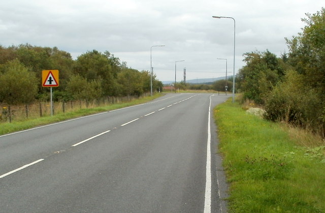
Junction ahead, A4221 near
Coelbren - geograph.org.uk - 2576055.jpg
42:
Junction_ahead,_A4221_near_Coelbren_-_geograph.org.uk_-_2576055.jpg
321:
273:
308:
51° 47′ 18″ N, 3° 40′ 33″ W
252:
51° 47′ 21″ N, 3° 40′ 39″ W
148:
56:
1268:
1208:
231:
80:
Commons is a freely licensed media file repository.
801:
Creative
Commons Attribution-ShareAlike 2.0 Generic
760:
Creative
Commons Attribution-ShareAlike 2.0 Generic
213:
200:
46:(640 × 419 pixels, file size: 54 KB, MIME type:
477:https://creativecommons.org/licenses/by-sa/2.0
61:
924:https:\/\/www.geograph.org.uk\/photo\/2576055
613:https:\/\/www.geograph.org.uk\/profile\/39302
483:Creative Commons Attribution-Share Alike 2.0
398:
144:
105:
176:
160:
14:
1060:
443:– to copy, distribute and transmit the work
379:
313:
257:
205:
184:
168:
152:
136:
119:
1000:https://www.geograph.org.uk/photo/2576055
669:https://www.geograph.org.uk/profile/39302
118:Junction ahead, A4221 near Coelbren
328:View this and other nearby images on:
280:View this and other nearby images on:
92:
385:and is licensed for reuse under the
298:
242:
1201:
834:Junction ahead, A4221 near Coelbren
772:Junction ahead, A4221 near Coelbren
508:Junction ahead, A4221 near Coelbren
429:Junction ahead, A4221 near Coelbren
421:Attribution-Share Alike 2.0 Generic
409:
404:
389:Attribution-ShareAlike 2.0 license.
13:
513:
507:
395:
364:
112:
93:
39:
1286:
512:
1269:
1071:coordinates of the point of view
1053:coordinates of the point of view
498:
454:Under the following conditions:
416:This file is licensed under the
408:
403:
397:
357:
334:
320:
286:
272:
264:
60:
21:
495:
135:village, road, Tawe Uchaf
36:No higher resolution available.
1205:
950:file available on the internet
900:file available on the internet
494:
365:This image was taken from the
348:
26:
1:
1131:coordinates of depicted place
1121:coordinates of depicted place
263:
1265:
985:Geograph Britain and Ireland
916:Geograph Britain and Ireland
677:object of statement has role
617:object of statement has role
536:Items portrayed in this file
347:
165:Geograph Britain and Ireland
96:
7:
10:
1291:
836:
468:same or compatible license
102:
95:
1202:
833:
16:
963:geograph.org.uk image ID
904:geograph.org.uk image ID
497:
434:
67:This is a file from the
31:
1259:
1238:12:06, 5 September 2021
147:
71:. Information from its
371:this photograph's page
340:51.788396; -3.675959
292:51.789274; -3.677442
74:description page there
1146:51°47'17"N, 3°40'34"W
1086:51°47'20"N, 3°40'37"W
1173:location of creation
1159:location of creation
449:– to adapt the work
814:author name string
764:author name string
692:author name string
625:author name string
1263:
1062:
785:copyright license
776:
773:
756:copyright license
506:
394:
393:
369:collection. See
345:
344:
297:
296:
240:
239:
235:
193:Place of creation
89:
88:
69:Wikimedia Commons
1282:
1250:
1212:
1108:
1107:
1102:
1002:
997:
993:described at URL
987:
982:
972:
967:
920:described at URL
839:
838:
835:
831:
821:
818:
726:copyright status
712:copyright status
699:
696:
686:
681:
671:
666:
504:
490:
487:
484:
481:
478:
470:as the original.
432:
418:Creative Commons
412:
411:
407:
406:
401:
400:
387:Creative Commons
383:
367:Geograph project
361:
354:
350:
341:
338:
324:
323:
317:
311:
310:
299:
293:
290:
276:
275:
269:
268:
267:
261:
255:
254:
243:
233:
227:
221:
215:
211:
209:
202:
188:
172:
156:
150:
140:
123:
117:
109:
103:
98:
85:
64:
63:
57:
51:
49:
1290:
1289:
1285:
1284:
1283:
1281:
1280:
1279:
1271:
1264:
1256:
1248:
1204:
1203:
1200:
1199:
1198:
1197:
1196:
1195:
1194:
1193:
1191:
1179:
1178:
1177:
1175:
1156:
1155:
1154:
1153:
1152:
1151:
1150:
1149:
1147:
1137:
1136:
1135:
1133:
1118:
1117:
1116:
1115:
1114:
1113:
1112:
1111:
1110:
1109:
1105:
1103:
1100:
1091:
1090:
1089:
1087:
1077:
1076:
1075:
1073:
1050:
1049:
1048:
1047:
1046:
1045:
1044:
1043:
1041:
1031:
1030:
1029:
1027:
1012:
1011:
1010:
1009:
1008:
1007:
1006:
1005:
1004:
1003:
998:
995:
989:
988:
983:
980:
974:
973:
968:
965:
956:
955:
954:
952:
940:
939:
938:
936:
893:
892:
891:
890:
889:
888:
887:
886:
884:
872:
871:
870:
868:
849:
848:
847:
846:
845:
844:
843:
842:
841:
840:
832:
829:
823:
822:
819:
816:
807:
806:
805:
803:
791:
790:
789:
787:
753:
752:
751:
750:
749:
748:
747:
746:
744:
732:
731:
730:
728:
709:
708:
707:
706:
705:
704:
703:
702:
701:
700:
697:
694:
688:
687:
682:
679:
673:
672:
667:
664:
655:
654:
653:
651:
641:
640:
639:
637:
602:
601:
600:
599:
598:
597:
596:
595:
593:
582:
581:
580:
579:
578:
576:
565:
564:
563:
562:
561:
559:
547:
546:
545:
543:
511:
510:
509:
492:
491:
488:
485:
482:
479:
476:
475:
433:
431:by Jaggery
427:
424:
413:
390:
352:
339:
306:
305:
302:Object location
291:
265:
250:
249:
246:Camera location
241:
196:
132:
124:
113:
107:
100:
91:
90:
79:
78:
77:is shown below.
53:
47:
45:
38:
37:
12:
11:
5:
1288:
1278:
1277:
1267:
1262:
1261:
1258:
1254:
1251:
1245:
1240:
1235:
1231:
1230:
1227:
1224:
1221:
1218:
1215:
1207:
1192:
1187:
1185:
1184:
1183:
1181:
1180:
1176:
1171:
1169:
1168:
1167:
1166:
1164:
1160:
1148:
1145:
1143:
1142:
1141:
1139:
1138:
1134:
1129:
1127:
1126:
1125:
1124:
1122:
1096:
1095:
1094:
1093:
1092:
1088:
1085:
1083:
1082:
1081:
1079:
1078:
1074:
1069:
1067:
1066:
1065:
1064:
1058:
1054:
1042:
1040:29 August 2011
1039:
1037:
1036:
1035:
1033:
1032:
1028:
1023:
1021:
1020:
1019:
1018:
1016:
991:
990:
976:
975:
961:
960:
959:
958:
957:
953:
948:
946:
945:
944:
942:
941:
937:
934:source of file
932:
930:
929:
928:
927:
925:
921:
917:
913:
909:
905:
901:
897:
896:source of file
885:
880:
878:
877:
876:
874:
873:
869:
864:
862:
861:
860:
859:
857:
853:
825:
824:
812:
811:
810:
809:
808:
804:
799:
797:
796:
795:
793:
792:
788:
783:
781:
780:
779:
778:
769:
765:
761:
757:
745:
740:
738:
737:
736:
734:
733:
729:
724:
722:
721:
720:
719:
717:
713:
690:
689:
675:
674:
660:
659:
658:
657:
656:
652:
649:
647:
646:
645:
643:
642:
638:
633:
631:
630:
629:
628:
626:
622:
618:
614:
610:
606:
594:
589:
587:
586:
585:
583:
577:
572:
570:
569:
568:
566:
560:
555:
553:
552:
551:
549:
548:
544:
539:
537:
534:
533:
532:
531:
529:
525:
521:
517:
503:
502:
499:
496:
474:
473:
472:
471:
461:
452:
451:
450:
444:
437:You are free:
425:
415:
414:
396:
392:
391:
362:
351:
346:
343:
342:
332:
326:
303:
295:
294:
284:
278:
247:
238:
237:
232:United Kingdom
197:
194:
190:
189:
178:
174:
173:
162:
158:
157:
149:29 August 2011
146:
142:
141:
133:
130:
126:
125:
110:
101:
99:
94:
87:
86:
65:
55:
54:
35:
30:
29:
24:
19:
9:
6:
4:
3:
2:
1287:
1276:
1273:
1272:
1257:
1252:
1246:
1244:
1241:
1239:
1236:
1233:
1232:
1228:
1225:
1222:
1219:
1216:
1214:
1213:
1211:
1190:
1186:
1174:
1170:
1144:
1132:
1128:
1099:
1084:
1072:
1068:
1038:
1026:
1022:
1001:
994:
986:
979:
971:
964:
951:
947:
935:
931:
883:
879:
867:
863:
828:
815:
802:
798:
786:
782:
743:
739:
727:
723:
693:
685:
678:
670:
663:
648:
636:
632:
592:
588:
575:
571:
558:
554:
542:
538:
535:
500:
493:
480:CC BY-SA 2.0
469:
465:
462:
459:
456:
455:
453:
448:
445:
442:
439:
438:
436:
435:
430:
426:Attribution:
422:
419:
402:
388:
384:
382:
377:
372:
368:
363:
360:
356:
355:
337:
333:
331:
330:OpenStreetMap
327:
325:
316:
309:
304:
301:
300:
289:
285:
283:
282:OpenStreetMap
279:
277:
260:
253:
248:
245:
244:
234:
228:
222:
216:
208:
203:
198:
192:
191:
187:
182:
179:
175:
171:
166:
163:
159:
155:
143:
139:
134:
128:
127:
122:
116:
111:
104:
83:
76:
75:
70:
66:
59:
58:
52:
43:
34:
28:
25:
23:
20:
18:
15:
1209:
1206:File history
684:photographer
621:photographer
463:
457:
446:
440:
428:
374:
262:
114:
82:You can help
72:
40:
22:File history
1255:GeographBot
866:instance of
852:instance of
742:copyrighted
716:copyrighted
464:share alike
458:attribution
106:Description
1275:A4221 road
1266:File usage
1247:640 × 419
1223:Dimensions
1189:Tawe Uchaf
1163:Tawe Uchaf
882:photograph
856:photograph
650:some value
591:Tawe Uchaf
528:Tawe Uchaf
214:Tawe Uchaf
201:Tawe Uchaf
48:image/jpeg
27:File usage
1220:Thumbnail
1217:Date/Time
1025:inception
1015:inception
837:(English)
775:(English)
349:Licensing
195:InfoField
131:InfoField
978:operator
912:operator
501:Captions
447:to remix
441:to share
423:license.
115:English:
1249:(54 KB)
1234:current
1229:Comment
1098:heading
1057:heading
970:2576055
908:2576055
820:Jaggery
698:Jaggery
635:creator
605:creator
557:village
541:depicts
520:village
516:depicts
505:English
376:Jaggery
181:Jaggery
129:Depicts
97:Summary
44:
1106:degree
1061:degree
378:
318:
312:
270:
256:
204:
183:
177:Author
167:
161:Source
151:
827:title
768:title
226:Wales
220:Powys
1226:User
1104:135
574:road
524:road
489:true
486:true
145:Date
17:File
662:URL
609:URL
1101::
996::
981::
966::
830::
817::
695::
680::
665::
236:)
229:→
223:→
217:→
210:(
84:.
50:)
Text is available under the Creative Commons Attribution-ShareAlike License. Additional terms may apply.