870:"}},"text\/plain":{"en":{"":"coordinates of the point of view"}}},"{\"value\":{\"latitude\":51.756281,\"longitude\":-4.996877,\"altitude\":null,\"precision\":1.0e-6,\"globe\":\"http:\\\/\\\/www.wikidata.org\\\/entity\\\/Q2\"},\"type\":\"globecoordinate\"}":{"text\/html":{"en":{"P1259":"51\u00b045'22.612"N, 4\u00b059'48.757"W"}},"text\/plain":{"en":{"P1259":"51\u00b045'22.612\"N, 4\u00b059'48.757\"W"}}},"{\"value\":{\"entity-type\":\"property\",\"numeric-id\":7787,\"id\":\"P7787\"},\"type\":\"wikibase-entityid\"}":{"text\/html":{"en":{"":"
938:"}},"text\/plain":{"en":{"":"coordinates of depicted place"}}},"{\"value\":{\"latitude\":51.75655,\"longitude\":-4.99704,\"altitude\":null,\"precision\":1.0e-5,\"globe\":\"http:\\\/\\\/www.wikidata.org\\\/entity\\\/Q2\"},\"type\":\"globecoordinate\"}":{"text\/html":{"en":{"P9149":"51\u00b045'23.58"N, 4\u00b059'49.34"W"}},"text\/plain":{"en":{"P9149":"51\u00b045'23.58\"N, 4\u00b059'49.34\"W"}}},"{\"value\":{\"entity-type\":\"property\",\"numeric-id\":7787,\"id\":\"P7787\"},\"type\":\"wikibase-entityid\"}":{"text\/html":{"en":{"":"
522:"}},"text\/plain":{"en":{"":"author name string"}}},"{\"value\":\"Stephen McKay\",\"type\":\"string\"}":{"text\/html":{"en":{"P2093":"Stephen McKay"}},"text\/plain":{"en":{"P2093":"Stephen McKay"}}},"{\"value\":{\"entity-type\":\"property\",\"numeric-id\":2699,\"id\":\"P2699\"},\"type\":\"wikibase-entityid\"}":{"text\/html":{"en":{"":"
832:"}},"text\/plain":{"en":{"":"inception"}}},"{\"value\":{\"time\":\"+2018-05-14T00:00:00Z\",\"timezone\":0,\"before\":0,\"after\":0,\"precision\":11,\"calendarmodel\":\"http:\\\/\\\/www.wikidata.org\\\/entity\\\/Q1985727\"},\"type\":\"time\"}":{"text\/html":{"en":{"P571":"14 May 2018"}},"text\/plain":{"en":{"P571":"14 May 2018"}}}}": -->
38:
709:
315:
265:
307:
257:
934:
279:
350:
388:
393:
90:
1134:"}},"text\/plain":{"en":{"":"ISO speed"}}},"{\"value\":{\"amount\":\"+100\",\"unit\":\"1\"},\"type\":\"quantity\"}":{"text\/html":{"en":{"P6789":"100"}},"text\/plain":{"en":{"P6789":"100"}}}}": -->
1051:"}},"text\/plain":{"en":{"":"f-number"}}},"{\"value\":{\"amount\":\"+14\",\"unit\":\"1\"},\"type\":\"quantity\"}":{"text\/html":{"en":{"P6790":"14"}},"text\/plain":{"en":{"P6790":"14"}}}}": -->
530:"}},"text\/plain":{"en":{"P2699":"https:\/\/www.geograph.org.uk\/profile\/1621"}}},"{\"value\":{\"entity-type\":\"property\",\"numeric-id\":3831,\"id\":\"P3831\"},\"type\":\"wikibase-entityid\"}":{"text\/html":{"en":{"":"
733:"}},"text\/plain":{"en":{"P973":"https:\/\/www.geograph.org.uk\/photo\/5777864"}}},"{\"value\":{\"entity-type\":\"property\",\"numeric-id\":137,\"id\":\"P137\"},\"type\":\"wikibase-entityid\"}":{"text\/html":{"en":{"":"
717:"}},"text\/plain":{"en":{"P7482":"file available on the internet"}}},"{\"value\":{\"entity-type\":\"property\",\"numeric-id\":7384,\"id\":\"P7384\"},\"type\":\"wikibase-entityid\"}":{"text\/html":{"en":{"":"
534:"}},"text\/plain":{"en":{"":"object of statement has role"}}},"{\"value\":{\"entity-type\":\"item\",\"numeric-id\":33231,\"id\":\"Q33231\"},\"type\":\"wikibase-entityid\"}":{"text\/html":{"en":{"P3831":"
669:"}},"text\/plain":{"en":{"":"copyright license"}}},"{\"value\":{\"entity-type\":\"item\",\"numeric-id\":19068220,\"id\":\"Q19068220\"},\"type\":\"wikibase-entityid\"}":{"text\/html":{"en":{"P275":"
625:"}},"text\/plain":{"en":{"":"copyright status"}}},"{\"value\":{\"entity-type\":\"item\",\"numeric-id\":50423863,\"id\":\"Q50423863\"},\"type\":\"wikibase-entityid\"}":{"text\/html":{"en":{"P6216":"
1089:"}},"text\/plain":{"en":{"":"focal length"}}},"{\"value\":{\"amount\":\"+28.13\",\"unit\":\"http:\\\/\\\/www.wikidata.org\\\/entity\\\/Q174789\"},\"type\":\"quantity\"}":{"text\/html":{"en":{"P2151":"28.13
713:"}},"text\/plain":{"en":{"":"source of file"}}},"{\"value\":{\"entity-type\":\"item\",\"numeric-id\":74228490,\"id\":\"Q74228490\"},\"type\":\"wikibase-entityid\"}":{"text\/html":{"en":{"P7482":"
1006:"}},"text\/plain":{"en":{"":"exposure time"}}},"{\"value\":{\"amount\":\"+0.01\",\"unit\":\"http:\\\/\\\/www.wikidata.org\\\/entity\\\/Q11574\"},\"type\":\"quantity\"}":{"text\/html":{"en":{"P6757":"0.01
1172:"}},"text\/plain":{"en":{"":"instance of"}}},"{\"value\":{\"entity-type\":\"item\",\"numeric-id\":125191,\"id\":\"Q125191\"},\"type\":\"wikibase-entityid\"}":{"text\/html":{"en":{"P31":"
942:"}},"text\/plain":{"en":{"":"heading"}}},"{\"value\":{\"amount\":\"+337\",\"unit\":\"http:\\\/\\\/www.wikidata.org\\\/entity\\\/Q28390\"},\"type\":\"quantity\"}":{"text\/html":{"en":{"P7787":"337
874:"}},"text\/plain":{"en":{"":"heading"}}},"{\"value\":{\"amount\":\"+337\",\"unit\":\"http:\\\/\\\/www.wikidata.org\\\/entity\\\/Q28390\"},\"type\":\"quantity\"}":{"text\/html":{"en":{"P7787":"337
737:"}},"text\/plain":{"en":{"":"operator"}}},"{\"value\":{\"entity-type\":\"item\",\"numeric-id\":1503119,\"id\":\"Q1503119\"},\"type\":\"wikibase-entityid\"}":{"text\/html":{"en":{"P137":"
725:"}},"text\/plain":{"en":{"P7384":"5777864"}}},"{\"value\":{\"entity-type\":\"property\",\"numeric-id\":973,\"id\":\"P973\"},\"type\":\"wikibase-entityid\"}":{"text\/html":{"en":{"":"
518:"}},"text\/plain":{"en":{"":"creator"}}},"{\"value\":{\"entity-type\":\"property\",\"numeric-id\":2093,\"id\":\"P2093\"},\"type\":\"wikibase-entityid\"}":{"text\/html":{"en":{"":"
1130:
729:"}},"text\/plain":{"en":{"":"described at URL"}}},"{\"value\":\"https:\\\/\\\/www.geograph.org.uk\\\/photo\\\/5777864\",\"type\":\"string\"}":{"text\/html":{"en":{"P973":"
526:"}},"text\/plain":{"en":{"":"URL"}}},"{\"value\":\"https:\\\/\\\/www.geograph.org.uk\\\/profile\\\/1621\",\"type\":\"string\"}":{"text\/html":{"en":{"P2699":"
721:"}},"text\/plain":{"en":{"":"geograph.org.uk image ID"}}},"{\"value\":\"5777864\",\"type\":\"string\"}":{"text\/html":{"en":{"P7384":"
298:
248:
440:– You must give appropriate credit, provide a link to the license, and indicate if changes were made. You may do so in any reasonable manner, but not in any way that suggests the licensor endorses you or your use.
262:
312:
722:
714:
670:
626:
738:
1173:
535:
1131:
1086:
1048:
1003:
939:
935:
871:
867:
718:
710:
622:
531:
523:
519:
730:
56:
829:
734:
726:
666:
527:
515:
52:
48:
42:
1169:
69:
101:
673:"}},"text\/plain":{"en":{"P275":"Creative Commons Attribution-ShareAlike 2.0 Generic"}}}}": -->
185:
764:
696:
652:
322:
272:
814:
357:
1296:
This file contains additional information, probably added from the digital camera or scanner used to create or digitize it.
1199:
447:
607:
1141:
1100:
1058:
1017:
980:
953:
912:
885:
777:
748:
636:
600:
585:
572:
839:
807:
792:
680:
545:
504:
741:"}},"text\/plain":{"en":{"P137":"Geograph Britain and Ireland"}}}}": -->
1183:
1425:
403:
1253:
1248:
60:
37:
1299:
If the file has been modified from its original state, some details may not fully reflect the modified file.
1093:"}},"text\/plain":{"en":{"P2151":"28.13 millimetre"}}}}": -->
1308:
446:– If you remix, transform, or build upon the material, you must distribute your contributions under the
364:
on the
Geograph website for the photographer's contact details. The copyright on this image is owned by
538:"}},"text\/plain":{"en":{"P3831":"photographer"}}}}": -->
1394:
1010:"}},"text\/plain":{"en":{"P6757":"0.01 second"}}}}": -->
629:"}},"text\/plain":{"en":{"P6216":"copyrighted"}}}}": -->
1281:
The following pages on the
English Knowledge use this file (pages on other projects are not listed):
946:"}},"text\/plain":{"en":{"P7787":"337 degree"}}}}": -->
878:"}},"text\/plain":{"en":{"P7787":"337 degree"}}}}": -->
1285:
1176:"}},"text\/plain":{"en":{"P31":"photograph"}}}}": -->
109:
1465:
799:
784:
592:
400:
201:
8:
1485:
344:
328:
278:
1579:
369:
96:
494:
217:
1553:
1475:
1325:
1264:
164:
1589:
1365:
174:
1193:
1151:
1110:
1068:
1027:
963:
895:
849:
758:
690:
646:
555:
1503:
349:
1345:
1318:
361:
1599:
1335:
1221:
Click on a date/time to view the file as it appeared at that time.
314:
264:
299:
51° 45′ 23.6″ N, 4° 59′ 49″ W
249:
51° 45′ 22.6″ N, 4° 59′ 49″ W
153:
84:
488:
Add a one-line explanation of what this file represents
1279:
1219:
192:
Creative
Commons Attribution Share-alike license 2.0
108:
Commons is a freely licensed media file repository.
697:
Creative
Commons Attribution-ShareAlike 2.0 Generic
671:
Creative
Commons Attribution-ShareAlike 2.0 Generic
74:(1,280 × 851 pixels, file size: 392 KB, MIME type:
1490:Flash did not fire, compulsory flash suppression
457:https://creativecommons.org/licenses/by-sa/2.0
89:
731:https:\/\/www.geograph.org.uk\/photo\/5777864
463:Creative Commons Attribution-Share Alike 2.0
381:
180:
149:
131:
528:https:\/\/www.geograph.org.uk\/profile\/1621
170:
159:
14:
1090:
1007:
943:
875:
423:– to copy, distribute and transmit the work
800:https://www.geograph.org.uk/photo/5777864
593:https://www.geograph.org.uk/profile/1621
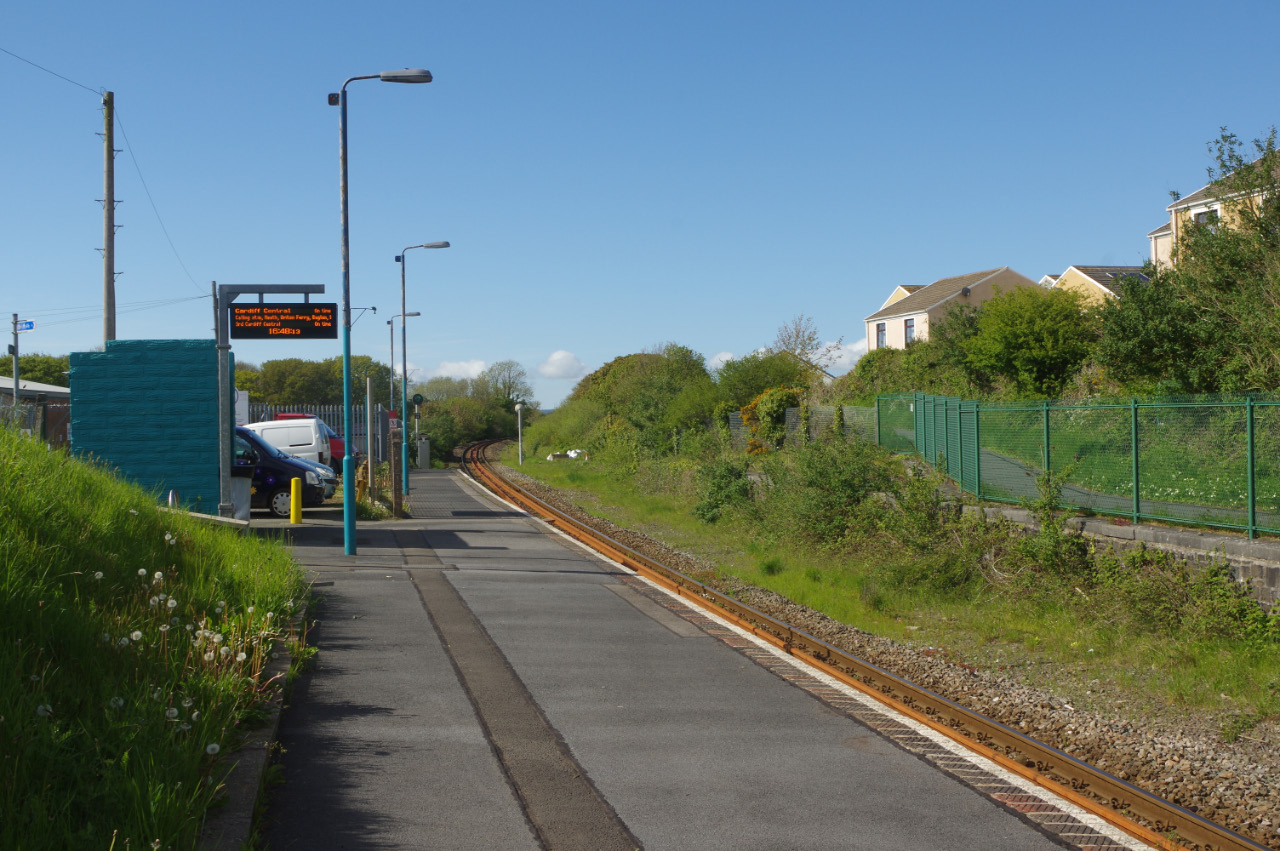
134:Johnston Station (geograph 5777864).jpg
1271:Transferred from geograph.co.uk using
321:View this and other nearby images on:
271:View this and other nearby images on:
224:
120:
368:and is licensed for reuse under the
289:
239:
1212:
404:Attribution-Share Alike 2.0 Generic
392:
387:
372:Attribution-ShareAlike 2.0 license.
13:
1294:
493:
487:
378:
355:
138:
121:
67:
1632:
1301:
492:
1356:Date and time of data generation
1280:
886:coordinates of the point of view
868:coordinates of the point of view
478:
434:Under the following conditions:
399:This file is licensed under the
391:
386:
380:
348:
327:
313:
305:
277:
263:
255:
88:
21:
475:
139:
1216:
765:file available on the internet
715:file available on the internet
474:
356:This image was taken from the
26:
1:
1532:A directly photographed image
1309:RICOH IMAGING COMPANY, LTD.
954:coordinates of depicted place
936:coordinates of depicted place
901:51°45'22.612"N, 4°59'48.757"W
31:
1276:
815:Geograph Britain and Ireland
739:Geograph Britain and Ireland
601:object of statement has role
532:object of statement has role
500:Items portrayed in this file
340:
304:
254:
7:
1436:Date and time of digitizing
1291:
969:51°45'23.58"N, 4°59'49.34"W
10:
1637:
1563:Focal length in 35 mm film
1516:One-chip color area sensor
1495:Supported Flashpix version
448:same or compatible license
230:Stephen McKay /
211:Stephen McKay /
128:
123:
1444:Meaning of each component
1401:File change date and time
1395:Adobe Photoshop Album 2.0
1213:
16:
1286:Johnston railway station
778:geograph.org.uk image ID
719:geograph.org.uk image ID
477:
414:
95:This is a file from the
36:
1537:Custom image processing
1270:
202:required by the license
152:
99:. Information from its
1609:Subject distance range
362:this photograph's page
333:51.756550; -4.997040
283:51.756281; -4.996877
102:description page there
41:Size of this preview:
1375:Horizontal resolution
1249:20:06, 13 August 2019
1558:Manual white balance
1524:Digital still camera
1409:Y and C positioning
1383:Vertical resolution
1319:PENTAX K-3
1305:Camera manufacturer
429:– to adapt the work
47:Other resolutions:
1571:Scene capture type
1439:16:49, 14 May 2018
1404:13:00, 16 May 2018
1359:16:49, 14 May 2018
573:author name string
520:author name string
61:1,280 × 851 pixels
57:1,024 × 681 pixels
1624:
1623:
1274:
1092:
1009:
945:
877:
681:copyright license
667:copyright license
486:
377:
376:
360:collection. See
338:
337:
288:
287:
237:
236:
205:
189:
186:Reusing this file
117:
116:
97:Wikimedia Commons
1628:
1420:Shutter priority
1417:Exposure Program
1330:1/100 sec (0.01)
1302:
1261:
1223:
1119:
1036:
991:
990:
985:
923:
922:
917:
817:
812:
802:
797:
793:described at URL
787:
782:
727:described at URL
637:copyright status
623:copyright status
610:
605:
595:
590:
580:
577:
484:
470:
467:
464:
461:
458:
450:as the original.
412:
401:Creative Commons
395:
394:
390:
389:
384:
383:
370:Creative Commons
358:Geograph project
352:
345:
334:
331:
317:
316:
310:
309:
308:
302:
301:
290:
284:
281:
267:
266:
260:
259:
258:
252:
251:
240:
232:Johnston Station
213:Johnston Station
199:
183:
155:
144:Johnston Station
143:
135:
129:
113:
92:
91:
85:
79:
77:
64:
53:640 × 426 pixels
49:320 × 213 pixels
43:800 × 532 pixels
1636:
1635:
1631:
1630:
1629:
1627:
1626:
1625:
1617:GPS tag version
1290:
1282:
1275:
1267:
1259:
1215:
1214:
1211:
1210:
1209:
1208:
1207:
1206:
1205:
1204:
1202:
1190:
1189:
1188:
1186:
1167:
1166:
1165:
1164:
1163:
1162:
1161:
1160:
1158:
1148:
1147:
1146:
1144:
1129:
1128:
1127:
1126:
1125:
1124:
1123:
1122:
1120:
1117:
1107:
1106:
1105:
1103:
1084:
1083:
1082:
1081:
1080:
1079:
1078:
1077:
1075:
1065:
1064:
1063:
1061:
1046:
1045:
1044:
1043:
1042:
1041:
1040:
1039:
1037:
1034:
1024:
1023:
1022:
1020:
1001:
1000:
999:
998:
997:
996:
995:
994:
993:
992:
988:
986:
983:
974:
973:
972:
970:
960:
959:
958:
956:
933:
932:
931:
930:
929:
928:
927:
926:
925:
924:
920:
918:
915:
906:
905:
904:
902:
892:
891:
890:
888:
865:
864:
863:
862:
861:
860:
859:
858:
856:
846:
845:
844:
842:
827:
826:
825:
824:
823:
822:
821:
820:
819:
818:
813:
810:
804:
803:
798:
795:
789:
788:
783:
780:
771:
770:
769:
767:
755:
754:
753:
751:
708:
707:
706:
705:
704:
703:
702:
701:
699:
687:
686:
685:
683:
664:
663:
662:
661:
660:
659:
658:
657:
655:
643:
642:
641:
639:
620:
619:
618:
617:
616:
615:
614:
613:
612:
611:
606:
603:
597:
596:
591:
588:
582:
581:
578:
575:
566:
565:
564:
562:
552:
551:
550:
548:
513:
512:
511:
510:
509:
507:
491:
490:
489:
472:
471:
468:
465:
462:
459:
456:
455:
413:
410:
407:
396:
373:
343:
332:
306:
297:
296:
293:Object location
282:
256:
247:
246:
243:Camera location
238:
227:
220:
208:
165:geograph.org.uk
145:
133:
126:
119:
118:
107:
106:
105:is shown below.
81:
75:
73:
66:
65:
46:
12:
11:
5:
1634:
1622:
1621:
1618:
1614:
1613:
1610:
1606:
1605:
1602:
1596:
1595:
1592:
1586:
1585:
1582:
1576:
1575:
1572:
1568:
1567:
1564:
1560:
1559:
1556:
1550:
1549:
1546:
1542:
1541:
1540:Custom process
1538:
1534:
1533:
1530:
1526:
1525:
1522:
1518:
1517:
1514:
1513:Sensing method
1510:
1509:
1506:
1500:
1499:
1496:
1492:
1491:
1488:
1482:
1481:
1478:
1472:
1471:
1468:
1462:
1461:
1460:
1459:
1458:does not exist
1456:
1453:
1450:
1445:
1441:
1440:
1437:
1433:
1432:
1429:
1422:
1421:
1418:
1414:
1413:
1410:
1406:
1405:
1402:
1398:
1397:
1392:
1388:
1387:
1384:
1380:
1379:
1376:
1372:
1371:
1368:
1361:
1360:
1357:
1353:
1352:
1349:
1342:
1341:
1338:
1332:
1331:
1328:
1322:
1321:
1316:
1312:
1311:
1306:
1293:
1289:
1288:
1278:
1273:
1272:
1269:
1265:
1262:
1256:
1251:
1246:
1242:
1241:
1238:
1235:
1232:
1229:
1226:
1218:
1203:
1198:
1196:
1195:
1194:
1192:
1191:
1187:
1182:
1180:
1179:
1178:
1177:
1175:
1171:
1159:
1156:
1154:
1153:
1152:
1150:
1149:
1145:
1140:
1138:
1137:
1136:
1135:
1133:
1121:
1115:
1113:
1112:
1111:
1109:
1108:
1104:
1099:
1097:
1096:
1095:
1094:
1088:
1076:
1073:
1071:
1070:
1069:
1067:
1066:
1062:
1057:
1055:
1054:
1053:
1052:
1050:
1038:
1032:
1030:
1029:
1028:
1026:
1025:
1021:
1016:
1014:
1013:
1012:
1011:
1005:
979:
978:
977:
976:
975:
971:
968:
966:
965:
964:
962:
961:
957:
952:
950:
949:
948:
947:
941:
937:
911:
910:
909:
908:
907:
903:
900:
898:
897:
896:
894:
893:
889:
884:
882:
881:
880:
879:
873:
869:
857:
854:
852:
851:
850:
848:
847:
843:
838:
836:
835:
834:
833:
831:
806:
805:
791:
790:
776:
775:
774:
773:
772:
768:
763:
761:
760:
759:
757:
756:
752:
749:source of file
747:
745:
744:
743:
742:
740:
736:
732:
728:
724:
720:
716:
712:
711:source of file
700:
695:
693:
692:
691:
689:
688:
684:
679:
677:
676:
675:
674:
672:
668:
656:
651:
649:
648:
647:
645:
644:
640:
635:
633:
632:
631:
630:
628:
624:
599:
598:
584:
583:
571:
570:
569:
568:
567:
563:
560:
558:
557:
556:
554:
553:
549:
544:
542:
541:
540:
539:
537:
533:
529:
525:
521:
517:
508:
503:
501:
498:
497:
496:
495:
483:
482:
479:
476:
454:
453:
452:
451:
441:
432:
431:
430:
424:
417:You are free:
408:
398:
397:
379:
375:
374:
353:
342:
339:
336:
335:
325:
319:
294:
286:
285:
275:
269:
244:
235:
234:
228:
225:
222:
221:
216:
209:
206:
194:
193:
190:
178:
177:
172:
168:
167:
161:
157:
156:
151:
147:
146:
136:
127:
125:
122:
115:
114:
93:
83:
82:
40:
35:
34:
29:
24:
19:
9:
6:
4:
3:
2:
1633:
1619:
1616:
1615:
1611:
1608:
1607:
1603:
1601:
1598:
1597:
1593:
1591:
1588:
1587:
1583:
1581:
1578:
1577:
1573:
1570:
1569:
1565:
1562:
1561:
1557:
1555:
1554:White balance
1552:
1551:
1548:Auto exposure
1547:
1545:Exposure mode
1544:
1543:
1539:
1536:
1535:
1531:
1528:
1527:
1523:
1520:
1519:
1515:
1512:
1511:
1507:
1505:
1502:
1501:
1497:
1494:
1493:
1489:
1487:
1484:
1483:
1479:
1477:
1476:Metering mode
1474:
1473:
1469:
1467:
1466:Exposure bias
1464:
1463:
1457:
1454:
1451:
1448:
1447:
1446:
1443:
1442:
1438:
1435:
1434:
1430:
1427:
1424:
1423:
1419:
1416:
1415:
1411:
1408:
1407:
1403:
1400:
1399:
1396:
1393:
1391:Software used
1390:
1389:
1385:
1382:
1381:
1377:
1374:
1373:
1369:
1367:
1363:
1362:
1358:
1355:
1354:
1350:
1347:
1344:
1343:
1339:
1337:
1334:
1333:
1329:
1327:
1326:Exposure time
1324:
1323:
1320:
1317:
1314:
1313:
1310:
1307:
1304:
1303:
1300:
1297:
1287:
1284:
1283:
1268:
1263:
1257:
1255:
1252:
1250:
1247:
1244:
1243:
1239:
1236:
1233:
1230:
1227:
1225:
1224:
1222:
1201:
1197:
1185:
1181:
1155:
1143:
1139:
1114:
1102:
1098:
1072:
1060:
1056:
1031:
1019:
1018:exposure time
1015:
1004:exposure time
982:
967:
955:
951:
914:
899:
887:
883:
853:
841:
837:
816:
809:
801:
794:
786:
779:
766:
762:
750:
746:
698:
694:
682:
678:
654:
650:
638:
634:
609:
602:
594:
587:
579:Stephen McKay
574:
559:
547:
543:
506:
502:
499:
480:
473:
460:CC BY-SA 2.0
449:
445:
442:
439:
436:
435:
433:
428:
425:
422:
419:
418:
416:
415:
411:Stephen McKay
409:Attribution:
405:
402:
385:
371:
367:
366:Stephen McKay
363:
359:
354:
351:
347:
346:
330:
326:
324:
323:OpenStreetMap
320:
318:
300:
295:
292:
291:
280:
276:
274:
273:OpenStreetMap
270:
268:
250:
245:
242:
241:
233:
229:
223:
219:
215: /
214:
210:
203:
198:
196:
195:
191:
187:
182:
179:
176:
175:Stephen McKay
173:
169:
166:
162:
158:
148:
142:
137:
130:
111:
104:
103:
98:
94:
87:
86:
80:
71:
70:Original file
62:
58:
54:
50:
44:
39:
33:
30:
28:
25:
23:
20:
18:
15:
1612:Distant view
1366:focal length
1315:Camera model
1298:
1295:
1258:1,280 × 851
1220:
1217:File history
1101:focal length
1087:focal length
608:photographer
536:photographer
443:
437:
426:
420:
365:
303:
253:
231:
218:CC BY-SA 2.0
212:
140:
110:You can help
100:
68:
22:File history
1521:File source
1504:Color space
1184:instance of
1170:instance of
855:14 May 2018
653:copyrighted
627:copyrighted
444:share alike
438:attribution
197:Attribution
154:14 May 2018
132:Description
1590:Saturation
1529:Scene type
1386:212.75 dpi
1378:212.75 dpi
1277:File usage
1234:Dimensions
1200:photograph
1174:photograph
1118:millimetre
1091:millimetre
561:some value
181:Permission
76:image/jpeg
27:File usage
1600:Sharpness
1346:ISO speed
1231:Thumbnail
1228:Date/Time
1142:ISO speed
1132:ISO speed
840:inception
830:inception
341:Licensing
226:InfoField
207:InfoField
141:English:
1580:Contrast
1574:Standard
1412:Co-sited
1370:28.13 mm
1336:F-number
1292:Metadata
1266:Fort esc
1260:(392 KB)
1059:f-number
1049:f-number
808:operator
735:operator
481:Captions
427:to remix
421:to share
406:license.
32:Metadata
1620:0.0.3.2
1480:Pattern
1428:version
1245:current
1240:Comment
981:heading
940:heading
913:heading
872:heading
785:5777864
723:5777864
546:creator
516:creator
505:depicts
485:English
124:Summary
72:
1594:Normal
1348:rating
1116:28.13
1035:second
1008:second
989:degree
944:degree
921:degree
876:degree
311:
261:
171:Author
160:Source
1566:42 mm
1486:Flash
1364:Lens
1033:0.01
163:From
1604:Hard
1584:Hard
1508:sRGB
1426:Exif
1340:f/14
1237:User
987:337
919:337
469:true
466:true
150:Date
17:File
1431:2.3
1351:100
1157:100
586:URL
524:URL
1455:Cr
1452:Cb
1074:14
984::
916::
811::
796::
781::
604::
589::
576::
59:|
55:|
51:|
45:.
1498:1
1470:0
1449:Y
204:)
200:(
188:)
184:(
112:.
78:)
63:.
Text is available under the Creative Commons Attribution-ShareAlike License. Additional terms may apply.
.jpg)
.jpg¶ms=051.756281_N_-004.996877_E_globe:Earth_type:camera_source:geograph-osgb36(SM93261065)_heading:337.00&language=en)
.jpg¶ms=051.756550_N_-004.997040_E_globe:Earth_class:object_type:object_source:geograph-osgb36(SM93251068)_heading:337.00&language=en)
