856:"}},"text\/plain":{"en":{"":"checksum"}}},"{\"value\":\"4509cf5a48b78986e9869edf52b3d19d177326b7\",\"type\":\"string\"}":{"text\/html":{"en":{"P4092":"4509cf5a48b78986e9869edf52b3d19d177326b7"}},"text\/plain":{"en":{"P4092":"4509cf5a48b78986e9869edf52b3d19d177326b7"}}},"{\"value\":{\"entity-type\":\"property\",\"numeric-id\":459,\"id\":\"P459\"},\"type\":\"wikibase-entityid\"}":{"text\/html":{"en":{"":"
645:"}},"text\/plain":{"en":{"":"inception"}}},"{\"value\":{\"time\":\"+2011-11-15T00:00:00Z\",\"timezone\":0,\"before\":0,\"after\":0,\"precision\":11,\"calendarmodel\":\"http:\\\/\\\/www.wikidata.org\\\/entity\\\/Q1985727\"},\"type\":\"time\"}":{"text\/html":{"en":{"P571":"15 November 2011"}},"text\/plain":{"en":{"P571":"15 November 2011"}}}}": -->
38:
446:
852:
320:
94:
458:"}},"text\/plain":{"en":{"P2093":"Nilfanion","P4174":"Nilfanion"}}},"{\"value\":{\"entity-type\":\"property\",\"numeric-id\":4174,\"id\":\"P4174\"},\"type\":\"wikibase-entityid\"}":{"text\/html":{"en":{"":"
818:"}},"text\/plain":{"en":{"":"media type"}}},"{\"value\":\"image\\\/svg+xml\",\"type\":\"string\"}":{"text\/html":{"en":{"P1163":"image\/svg+xml"}},"text\/plain":{"en":{"P1163":"image\/svg+xml"}}}}": -->
860:"}},"text\/plain":{"en":{"":"determination method"}}},"{\"value\":{\"entity-type\":\"item\",\"numeric-id\":13414952,\"id\":\"Q13414952\"},\"type\":\"wikibase-entityid\"}":{"text\/html":{"en":{"P459":"
683:"}},"text\/plain":{"en":{"":"data size"}}},"{\"value\":{\"amount\":\"+2243285\",\"unit\":\"http:\\\/\\\/www.wikidata.org\\\/entity\\\/Q8799\"},\"type\":\"quantity\"}":{"text\/html":{"en":{"P3575":"2,243,285
601:"}},"text\/plain":{"en":{"":"copyright license"}}},"{\"value\":{\"entity-type\":\"item\",\"numeric-id\":14946043,\"id\":\"Q14946043\"},\"type\":\"wikibase-entityid\"}":{"text\/html":{"en":{"P275":"
557:"}},"text\/plain":{"en":{"":"copyright status"}}},"{\"value\":{\"entity-type\":\"item\",\"numeric-id\":50423863,\"id\":\"Q50423863\"},\"type\":\"wikibase-entityid\"}":{"text\/html":{"en":{"P6216":"
462:"}},"text\/plain":{"en":{"":"Wikimedia username"}}},"{\"value\":{\"entity-type\":\"property\",\"numeric-id\":2699,\"id\":\"P2699\"},\"type\":\"wikibase-entityid\"}":{"text\/html":{"en":{"":"
728:"}},"text\/plain":{"en":{"":"height"}}},"{\"value\":{\"amount\":\"+1266\",\"unit\":\"http:\\\/\\\/www.wikidata.org\\\/entity\\\/Q355198\"},\"type\":\"quantity\"}":{"text\/html":{"en":{"P2048":"1,266
773:"}},"text\/plain":{"en":{"":"width"}}},"{\"value\":{\"amount\":\"+974\",\"unit\":\"http:\\\/\\\/www.wikidata.org\\\/entity\\\/Q355198\"},\"type\":\"quantity\"}":{"text\/html":{"en":{"P2049":"974
450:"}},"text\/plain":{"en":{"":"creator"}}},"{\"value\":{\"entity-type\":\"property\",\"numeric-id\":2093,\"id\":\"P2093\"},\"type\":\"wikibase-entityid\"}":{"text\/html":{"en":{"":"
814:
454:"}},"text\/plain":{"en":{"":"author name string"}}},"{\"value\":\"Nilfanion\",\"type\":\"string\"}":{"text\/html":{"en":{"P2093":"Nilfanion","P4174":"
466:"}},"text\/plain":{"en":{"":"URL"}}},"{\"value\":\"https:\\\/\\\/commons.wikimedia.org\\\/wiki\\\/user:Nilfanion\",\"type\":\"string\"}":{"text\/html":{"en":{"P2699":"
1229:
367:– You must give appropriate credit, provide a link to the license, and indicate if changes were made. You may do so in any reasonable manner, but not in any way that suggests the licensor endorses you or your use.
455:
861:
602:
558:
467:
1214:
1151:
853:
815:
770:
725:
680:
554:
463:
459:
451:
857:
642:
598:
447:
1146:
64:
68:
60:
56:
52:
48:
42:
1224:
105:
77:
982:
with the following information shown: *{{legend|#646464|Ward boundaries}} *{{legend|#667fff|Motorways}} *{{legend|#4cb336|Primary routes}} *{{lege
470:"}},"text\/plain":{"en":{"P2699":"https:\/\/commons.wikimedia.org\/wiki\/user:Nilfanion"}}}}": -->
605:"}},"text\/plain":{"en":{"P275":"Creative Commons Attribution-ShareAlike 3.0 Unported"}}}}": -->
298:
1254:
905:
628:
584:
1189:
1249:
374:
1061:
1021:
1116:
871:
825:
784:
739:
694:
568:
532:
517:
504:
898:
652:
612:
477:
436:
1036:
1194:
1169:
524:
330:
996:
139:
1239:
1011:
979:
687:"}},"text\/plain":{"en":{"P3575":"2,243,285 byte"}}}}": -->
373:– If you remix, transform, or build upon the material, you must distribute your contributions under the
960:
955:
37:
1234:
732:"}},"text\/plain":{"en":{"P2048":"1,266 pixel"}}}}": -->
561:"}},"text\/plain":{"en":{"P6216":"copyrighted"}}}}": -->
1179:
992:
The following pages on the
English Knowledge use this file (pages on other projects are not listed):
1091:
777:"}},"text\/plain":{"en":{"P2049":"974 pixel"}}}}": -->
1264:
267:
1111:
1101:
113:
1141:
539:
864:"}},"text\/plain":{"en":{"P459":"SHA-1"}}}}": -->
1076:
1131:
1121:
327:
8:
1066:
1204:
1051:
1136:
1046:
1041:
100:
426:
1126:
1026:
1006:
264:
1081:
287:
1106:
1086:
1071:
1001:
971:
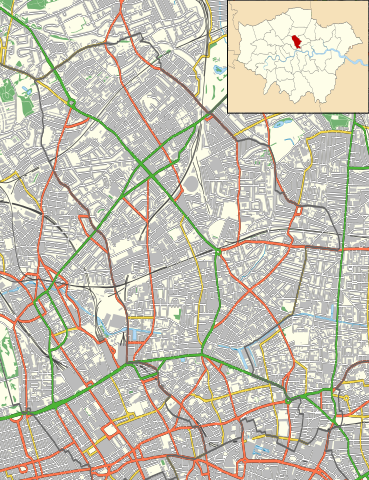
1096:
1056:
881:
835:
794:
749:
704:
662:
622:
578:
487:
227:
Equirectangular map projection on WGS 84 datum, with N/S stretched 160%
1031:
1016:
928:
Click on a date/time to view the file as it appeared at that time.
338:
Contains
Ordnance Survey data © Crown copyright and database right
1255:
Modül:Konum haritası/veri/Birleşik Krallık Londra
Islington/belge
1240:
Module:Location map/data/United
Kingdom London Islington/doc
1152:
Module:Location map/data/United
Kingdom London Islington/doc
82:(SVG file, nominally 974 × 1,266 pixels, file size: 2.14 MB)
1250:
Modül:Konum haritası/veri/Birleşik Krallık Londra
Islington
253:
88:
1235:
Module:Location map/data/United
Kingdom London Islington
1147:
Module:Location map/data/United
Kingdom London Islington
420:
Add a one-line explanation of what this file represents
1215:ಟೆಂಪ್ಲೇಟು:Location map United Kingdom London Islington
1180:
Plantilya:Location map United
Kingdom London Islington
990:
468:
https:\/\/commons.wikimedia.org\/wiki\/user:Nilfanion
1265:
Batakan:Location map United
Kingdom London Islington
1225:සැකිල්ල:Location map United Kingdom London Islington
1160:
926:
629:
Creative Commons Attribution-ShareAlike 3.0 Unported
603:
Creative Commons Attribution-ShareAlike 3.0 Unported
112:
Commons is a freely licensed media file repository.
1190:پودمان:Location map United Kingdom London Islington
1195:الگو:Location map United Kingdom London Islington
1170:قالب:Location map United Kingdom London Islington
978:{{Information |Description=Location map of the
277:All other data from VectorMap District product.
384:https://creativecommons.org/licenses/by-sa/3.0
93:
390:Creative Commons Attribution-Share Alike 3.0
308:
293:
249:
130:
540:https://commons.wikimedia.org/user:Nilfanion
283:
259:
14:
774:
729:
684:
350:– to copy, distribute and transmit the work
41:Size of this PNG preview of this SVG file:
1162:The following other wikis use this file:
887:4509cf5a48b78986e9869edf52b3d19d177326b7
142:with the following information shown:
274:Ward data from Boundary-Line product.
124:
1117:St Luke's Hospital for Lunatics
331:Attribution-Share Alike 3.0 Unported
133:Islington London UK location map.svg
1062:Honourable Artillery Company Museum
1022:Canonbury House and Canonbury Tower
919:
319:
314:
13:
425:
419:
305:
125:
75:
1278:
1037:City of London Maternity Hospital
424:
1205:Modèle:Géolocalisation/Islington
991:
410:
361:Under the following conditions:
326:This file is licensed under the
318:
313:
307:
92:
31:
21:
407:
1157:
923:
406:
26:
1:
997:2017 Finsbury Park van attack
1230:2017 ෆින්ස්බරි පාක් ප්රහාරය
987:
432:Items portrayed in this file
7:
1261:Usage on war.wikipedia.org
1176:Usage on ceb.wikipedia.org
1012:Caledonian Park Clock Tower
980:London Borough of Islington
140:London Borough of Islington
10:
1283:
1246:Usage on tr.wikipedia.org
1221:Usage on si.wikipedia.org
1211:Usage on kn.wikipedia.org
1201:Usage on fr.wikipedia.org
1186:Usage on fa.wikipedia.org
1166:Usage on ar.wikipedia.org
375:same or compatible license
127:
920:
16:
1092:Middlesex Sessions House
409:
341:
99:This is a file from the
36:
1112:Royal Northern Hospital
1102:Moorfields Eye Hospital
977:
956:23:10, 15 November 2011
252:
103:. Information from its
1142:York Road tube station
106:description page there
1077:London Fever Hospital
1132:Whittington Hospital
1122:The Angel, Islington
899:determination method
858:determination method
138:Location map of the
65:1,576 × 2,048 pixels
1067:Islington Town Hall
356:– to adapt the work
230:Geographic limits:
174:Non-primary A roads
47:Other resolutions:
1052:Finsbury Town Hall
518:Wikimedia username
505:author name string
460:Wikimedia username
452:author name string
69:974 × 1,266 pixels
61:788 × 1,024 pixels
1158:Global file usage
1137:Wilmington Square
1047:Dalston Synagogue
1042:Cloudesley Square
985:
776:
731:
686:
613:copyright license
599:copyright license
418:
403:
402:
302:
299:Reusing this file
121:
120:
101:Wikimedia Commons
32:Global file usage
1274:
1127:Thornhill Square
1027:Canonbury Square
1007:Barnsbury Square
968:
930:
908:
903:
803:
758:
713:
668:15 November 2011
569:copyright status
555:copyright status
542:
537:
527:
522:
512:
509:
416:
397:
394:
391:
388:
385:
377:as the original.
339:
328:Creative Commons
322:
321:
317:
316:
311:
310:
296:
255:
254:15 November 2011
134:
128:
117:
96:
95:
89:
83:
72:
57:591 × 768 pixels
53:369 × 480 pixels
49:185 × 240 pixels
43:461 × 599 pixels
1282:
1281:
1277:
1276:
1275:
1273:
1272:
1271:
1156:
1082:Lonsdale Square
993:
986:
974:
966:
922:
921:
918:
917:
916:
915:
914:
913:
912:
911:
910:
909:
904:
901:
892:
891:
890:
888:
878:
877:
876:
874:
851:
850:
849:
848:
847:
846:
845:
844:
842:
832:
831:
830:
828:
813:
812:
811:
810:
809:
808:
807:
806:
804:
801:
791:
790:
789:
787:
768:
767:
766:
765:
764:
763:
762:
761:
759:
756:
746:
745:
744:
742:
723:
722:
721:
720:
719:
718:
717:
716:
714:
711:
701:
700:
699:
697:
678:
677:
676:
675:
674:
673:
672:
671:
669:
659:
658:
657:
655:
640:
639:
638:
637:
636:
635:
634:
633:
631:
619:
618:
617:
615:
596:
595:
594:
593:
592:
591:
590:
589:
587:
575:
574:
573:
571:
552:
551:
550:
549:
548:
547:
546:
545:
544:
543:
538:
535:
529:
528:
523:
520:
514:
513:
510:
507:
498:
497:
496:
494:
484:
483:
482:
480:
445:
444:
443:
442:
441:
439:
423:
422:
421:
404:
399:
398:
395:
392:
389:
386:
383:
382:
340:
337:
334:
323:
265:Ordnance Survey
223:
221:
215:
213:
207:
205:
199:
197:
191:
189:
183:
181:
175:
173:
167:
165:
159:
157:
151:
150:Ward boundaries
149:
132:
123:
122:
111:
110:
109:is shown below.
85:
81:
74:
73:
46:
12:
11:
5:
1280:
1270:
1269:
1268:
1267:
1259:
1258:
1257:
1252:
1244:
1243:
1242:
1237:
1232:
1227:
1219:
1218:
1217:
1209:
1208:
1207:
1199:
1198:
1197:
1192:
1184:
1183:
1182:
1174:
1173:
1172:
1159:
1155:
1154:
1149:
1144:
1139:
1134:
1129:
1124:
1119:
1114:
1109:
1107:New River Head
1104:
1099:
1094:
1089:
1087:Maison Novelli
1084:
1079:
1074:
1072:Liverpool Road
1069:
1064:
1059:
1054:
1049:
1044:
1039:
1034:
1029:
1024:
1019:
1014:
1009:
1004:
1002:Arundel Square
999:
989:
984:
983:
976:
972:
969:
963:
958:
953:
949:
948:
945:
942:
939:
936:
933:
925:
897:
896:
895:
894:
893:
889:
886:
884:
883:
882:
880:
879:
875:
870:
868:
867:
866:
865:
863:
859:
855:
843:
840:
838:
837:
836:
834:
833:
829:
824:
822:
821:
820:
819:
817:
805:
799:
797:
796:
795:
793:
792:
788:
783:
781:
780:
779:
778:
772:
760:
754:
752:
751:
750:
748:
747:
743:
738:
736:
735:
734:
733:
727:
715:
709:
707:
706:
705:
703:
702:
698:
693:
691:
690:
689:
688:
682:
670:
667:
665:
664:
663:
661:
660:
656:
651:
649:
648:
647:
646:
644:
632:
627:
625:
624:
623:
621:
620:
616:
611:
609:
608:
607:
606:
604:
600:
588:
583:
581:
580:
579:
577:
576:
572:
567:
565:
564:
563:
562:
560:
556:
531:
530:
516:
515:
503:
502:
501:
500:
499:
495:
492:
490:
489:
488:
486:
485:
481:
476:
474:
473:
472:
471:
469:
465:
461:
457:
453:
449:
440:
435:
433:
430:
429:
428:
427:
415:
414:
411:
408:
401:
400:
381:
380:
379:
378:
368:
359:
358:
357:
351:
344:You are free:
335:
325:
324:
306:
303:
291:
290:
285:
281:
280:
279:
278:
275:
261:
257:
256:
251:
247:
246:
245:
244:
243:South: 51.515N
241:
238:
235:
225:
224:
219:
218:
216:
211:
210:
208:
203:
202:
200:
195:
194:
192:
187:
186:
184:
179:
178:
176:
171:
170:
168:
166:Primary routes
163:
162:
160:
155:
154:
152:
147:
146:
135:
126:
119:
118:
97:
87:
86:
40:
35:
34:
29:
24:
19:
9:
6:
4:
3:
2:
1279:
1266:
1263:
1262:
1260:
1256:
1253:
1251:
1248:
1247:
1245:
1241:
1238:
1236:
1233:
1231:
1228:
1226:
1223:
1222:
1220:
1216:
1213:
1212:
1210:
1206:
1203:
1202:
1200:
1196:
1193:
1191:
1188:
1187:
1185:
1181:
1178:
1177:
1175:
1171:
1168:
1167:
1165:
1164:
1163:
1153:
1150:
1148:
1145:
1143:
1140:
1138:
1135:
1133:
1130:
1128:
1125:
1123:
1120:
1118:
1115:
1113:
1110:
1108:
1105:
1103:
1100:
1098:
1097:Milner Square
1095:
1093:
1090:
1088:
1085:
1083:
1080:
1078:
1075:
1073:
1070:
1068:
1065:
1063:
1060:
1058:
1057:Gibson Square
1055:
1053:
1050:
1048:
1045:
1043:
1040:
1038:
1035:
1033:
1030:
1028:
1025:
1023:
1020:
1018:
1015:
1013:
1010:
1008:
1005:
1003:
1000:
998:
995:
994:
981:
975:
970:
964:
962:
959:
957:
954:
951:
950:
946:
943:
940:
937:
934:
932:
931:
929:
907:
900:
885:
873:
869:
841:image/svg+xml
839:
827:
823:
798:
786:
782:
753:
741:
737:
708:
696:
692:
666:
654:
650:
630:
626:
614:
610:
586:
582:
570:
566:
541:
534:
526:
519:
506:
491:
479:
475:
438:
434:
431:
412:
405:
387:CC BY-SA 3.0
376:
372:
369:
366:
363:
362:
360:
355:
352:
349:
346:
345:
343:
342:
336:Attribution:
332:
329:
312:
304:
300:
295:
292:
289:
286:
282:
276:
273:
272:
271:
269:
266:
262:
258:
248:
242:
240:North: 51.58N
239:
236:
233:
232:
231:
228:
217:
209:
201:
193:
185:
177:
169:
161:
153:
145:
144:
143:
141:
136:
129:
115:
108:
107:
102:
98:
91:
90:
84:
79:
78:Original file
70:
66:
62:
58:
54:
50:
44:
39:
33:
30:
28:
25:
23:
20:
18:
15:
1161:
965:974 × 1,266
927:
924:File history
370:
364:
353:
347:
263:
229:
226:
137:
114:You can help
104:
76:
22:File history
585:copyrighted
559:copyrighted
371:share alike
365:attribution
237:East: 0.07W
234:West: 0.15W
190:Minor roads
131:Description
988:File usage
941:Dimensions
826:media type
816:media type
710:2,243,285
493:some value
294:Permission
27:File usage
1032:City Road
1017:Canonbury
973:Nilfanion
967:(2.14 MB)
938:Thumbnail
935:Date/Time
695:data size
681:data size
653:inception
643:inception
525:Nilfanion
511:Nilfanion
456:Nilfanion
288:Nilfanion
222:Buildings
158:Motorways
872:checksum
854:checksum
413:Captions
354:to remix
348:to share
333:license.
268:OpenData
214:Woodland
198:Railways
952:current
947:Comment
478:creator
448:creator
437:depicts
417:English
182:B roads
80:
755:1,266
740:height
726:height
284:Author
260:Source
220:
212:
204:
196:
188:
180:
172:
164:
156:
148:
906:SHA-1
862:SHA-1
802:pixel
785:width
775:pixel
771:width
757:pixel
730:pixel
206:Water
944:User
800:974
712:byte
685:byte
396:true
393:true
250:Date
17:File
533:URL
464:URL
902::
536::
521::
508::
270:.
67:|
63:|
59:|
55:|
51:|
45:.
301:)
297:(
116:.
71:.
