43:
948:
829:
488:
137:
593:
768:
954:
959:
836:
736:
99:
715:
1122:"}},"text\/plain":{"en":{"":"copyright license"}}},"{\"value\":{\"entity-type\":\"item\",\"numeric-id\":14946043,\"id\":\"Q14946043\"},\"type\":\"wikibase-entityid\"}":{"text\/html":{"en":{"P275":"
1078:"}},"text\/plain":{"en":{"":"copyright status"}}},"{\"value\":{\"entity-type\":\"item\",\"numeric-id\":50423863,\"id\":\"Q50423863\"},\"type\":\"wikibase-entityid\"}":{"text\/html":{"en":{"P6216":"
1074:
1204:
1259:|author={{U|Soumya-8974}}<br>{{User:PlaneMad/Info}} <br/> '''International Borders:''' - <br/> '''Disputed Borders:''' [http://www.lib.utexas.edu/maps/ University of Tex...
491:
The frontiers depicted on the Indian maps in
Knowledge are from a neutral point of view and may differ from official government maps of India, Pakistan and China. Please consult local laws governing publication of maps before
1000:– You must give appropriate credit, provide a link to the license, and indicate if changes were made. You may do so in any reasonable manner, but not in any way that suggests the licensor endorses you or your use.
163:|1=File:India Ladakh locator map.svg|2=Territory administered by another country but claimed as part of Ladakh itself should be colored or noted in different way, otherwise it's a non-neutral depiction of India.}}
812:
This map is meant to be for illustrative purpose only and is not authenticated by official government sources. Please check the list of sources and references used to create the map for a measure of accuracy and
726:
856:
administrative boundary recognised by the international community. This UN ceasefire line is considered as a temporary solution to an ongoing conflict since the departure of the
British Raj.
865:
The depicted extent of the former territory of the
British Indian Empire, succeeded by Republic of India, may not be accepted by few countries as legal due to ongoing border disputes:
298:
816:
The usage of these maps in India, Pakistan and China are governed by different laws that restrict depictions of boundaries other than what is officially recognized by the state.
925:
The borders of the state of
Meghalaya, Assam and Arunachal Pradesh are shown as interpreted from the North-Eastern Areas (Reorganisation) Act, 1971, but has yet to be verified.
1123:
1079:
144:
Territory administered by another country but claimed as part of Ladakh itself should be colored or noted in different way, otherwise it's a non-neutral depiction of India.
1075:
905:
Minor areas of eastern
Kashmir's Ladakh division, Himachal Pradesh and Uttarakhand on the Chinese frontier are claimed by China. These areas are under Indian control.
1119:
797:
The territorial boundaries of India are shown as per the actual ground situation in accordance with international practices followed by the United
Nations (
332:
1308:
1328:
1126:"}},"text\/plain":{"en":{"P275":"Creative Commons Attribution-ShareAlike 3.0 Unported"}}}}": -->
804:
73:
69:
1318:
65:
61:
57:
53:
47:
372:
and include a link to this page. No explicit permission is needed from me, but id appreciate an email if my work has been of help to you.
344:
801:
479:
110:
635:
558:
526:
82:
603:
156:
1149:
1105:
1298:
1288:
1489:
This file contains additional information, probably added from the digital camera or scanner used to create or digitize it.
1283:
1007:
933:
The limit of the territorial waters of India extends to twelve nautical miles measured from the appropriate baseline. See
895:(shown white) is an actively contested region between India and Pakistan. Since 1984, the region is under Indian control.
1089:
1413:
1303:
1293:
1233:
1228:
914:
1133:
1064:
1423:
1363:
1313:
908:
A small area of
Uttarakhand adjoining the Nepal border along the Sarda river is disputed between the two countries.
417:
421:
413:
1408:
1373:
969:
425:
1418:
1383:
1492:
If the file has been modified from its original state, some details may not fully reflect the modified file.
1393:
1358:
1333:
1252:
870:
1403:
1353:
1323:
1006:– If you remix, transform, or build upon the material, you must distribute your contributions under the
1368:
1338:
846: : The territory India claims is legally theirs, but the claim is disputed by China and Pakistan.
402:
1378:
1343:
1082:"}},"text\/plain":{"en":{"P6216":"copyrighted"}}}}": -->
320:
1269:
The following pages on the
English Knowledge use this file (pages on other projects are not listed):
1388:
1256:
457:
1398:
1348:
886:
118:
1278:
1203:
1198:
798:
42:
160:
934:
1451:
966:
461:
375:
If you dont want to release your work under a creative commons license, please mail me at
8:
899:
767:
1273:
105:
1054:
674:
892:
882:
365:
354:
445:
807:
429:
874:
828:
650:
637:
618:
605:
573:
560:
541:
528:
453:
377:
1244:
1214:
1143:
1099:
487:
174:
878:
592:
297:
1251:== {{int:filedesc}} == {{Map |description=Ladakh locator map |legend=
902:
is almost entirely claimed by China as part of its
Tibetan territory.
746:
721:
698:
382:
175:
1171:
Click on a date/time to view the file as it appeared at that time.
881:). Since 1972, it is divided between all three countries. See also
818:
Please check local laws and modify the map accordingly before use.
409:
398:
735:
441:
1461:
835:
913:
For a detailed map of all disputed regions in South Asia, see
1466:
1446:
437:
87:(SVG file, nominally 1,574 × 1,738 pixels, file size: 966 KB)
1476:
714:
742:
310:
93:
869:
The northern
Himalayan region of the disputed territory
1048:
Add a one-line explanation of what this file represents
683:
If inappropriate please set warp_status = skip to hide.
509:
217:
1267:
823:
501:
1441:
1432:
1169:
1150:
Creative Commons Attribution-ShareAlike 3.0 Unported
1124:
Creative Commons Attribution-ShareAlike 3.0 Unported
117:
Commons is a freely licensed media file repository.
669:
292:
147:
In doing so, you could add a timestamp to the file.
693:
517:
207:
1471:
386:to negotiate a custom license as per your needs.
227:
1309:Knowledge:Userboxes/Location/Kashmir/Subregions
791:
1017:https://creativecommons.org/licenses/by-sa/3.0
860:
98:
1329:Knowledge:WikiProject India/userbox templates
1023:Creative Commons Attribution-Share Alike 3.0
947:
474:
306:
279:
1319:Knowledge:Userboxes/WikiProjects/Regional/05
759:
326:
316:
14:
983:– to copy, distribute and transmit the work
46:Size of this PNG preview of this SVG file:
276:
1434:The following other wikis use this file:
877:) and the Chinese-occupied territory of (
181:
803:) and the National Geographic Society (
677:Georeference the map in Wikimaps Warper
247:
1299:Knowledge:Userboxes/Life/Residence/04
1289:Knowledge:Userboxes/Life/Ethnicity/02
928:
364:If you are using the image under the
237:
142:This file requires updating because:
129:
1284:Knowledge:Userboxes/Life/Ancestry/06
970:Attribution-Share Alike 3.0 Unported
366:creative commons share alike license
1221:Included Siachen Glacier in Ladakh.
1162:
958:
953:
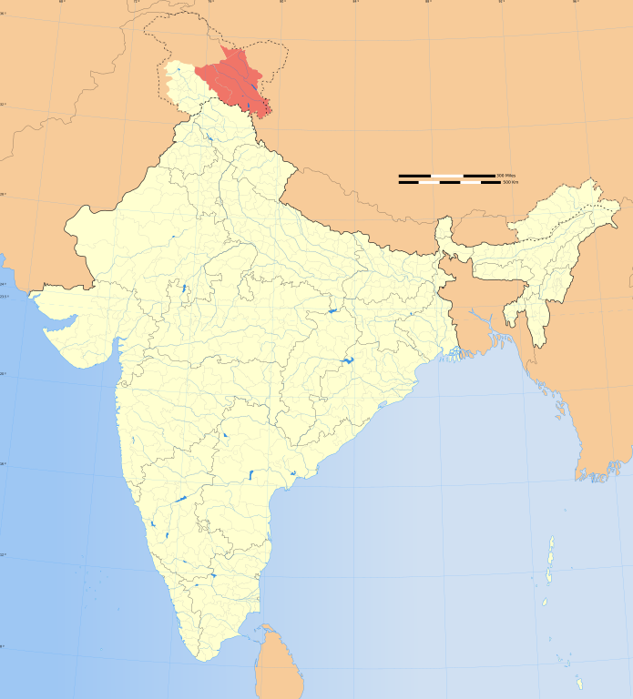
920:
13:
1487:
1414:Template:User interest Kashmir/doc
1304:Knowledge:Userboxes/Location/India
1294:Knowledge:Userboxes/Life/Origin/04
1053:
1047:
944:
915:Image:India disputed areas map.svg
834:
827:
824:Explanation of disputed boundaries
740:
719:
296:
222:Explanation of disputed boundaries
176:
130:
80:
1521:
1494:
1424:Template:User interest Ladakh/doc
1052:
177:
1364:Template:User citizen Ladakh/doc
1314:Knowledge:Userboxes/Travel/India
1268:
1038:
994:Under the following conditions:
965:This file is licensed under the
957:
952:
946:
850:Line of Control/Line of Conflict
766:
734:
713:
591:
486:
337:
152:Please notify the uploader with
135:
97:
31:
21:
1035:
873:is claimed by India including (
410:University of Texas map library
399:University of Texas map library
1429:
1409:Template:User interest Kashmir
1374:Template:User from Kashmir/doc
1255:|date=21 October 2020 |source=
1166:
1034:
898:The northeastern territory of
435:State and District boundaries:
259:
26:
1:
1419:Template:User interest Ladakh
1384:Template:User from Ladakh/doc
875:Pakistan-administered Kashmir
675:
36:
1394:Template:User in Kashmir/doc
1359:Template:User citizen Ladakh
1334:Knowledge:WikiProject Ladakh
1264:
1060:Items portrayed in this file
940:
792:Depiction of India's borders
458:Survey of India Map Explorer
340:
282:India Ladakh locator map.svg
212:Depiction of India's borders
187:
7:
1484:
1438:Usage on en.wiktionary.org
1404:Template:User in Ladakh/doc
1354:Template:User WP Ladakh/doc
1324:Knowledge:WikiProject India
871:Indian-administered Kashmir
861:Borders of disputed regions
370:CC-by-sa PlaneMad/Wikimedia
232:Borders of disputed regions
10:
1526:
1458:Usage on it.wikipedia.org
1369:Template:User from Kashmir
1339:Template:User Kashmir/doc1
1008:same or compatible license
521:
271:
197:
1379:Template:User from Ladakh
1344:Template:User Ladakh/doc1
1163:
688:
496:
16:
1389:Template:User in Kashmir
1257:File:India map blank.svg
1037:
974:
844:Boundary of Indian claim
786:
750:, or with something else
510:Spatial reference system
403:India Political map 2001
368:please credit the photo
321:File:India map blank.svg
104:This is a file from the
41:
1399:Template:User in Ladakh
1349:Template:User WP Ladakh
1250:
1220:
134:
108:. Information from its
1279:User:HarrySupertyphoon
1229:14:54, 21 October 2020
1199:08:23, 4 November 2020
937:for more information.
887:Line of Actual Control
839:
832:
699:WikiProject India Maps
497: Geotemporal data
442:2001 Census State Maps
396:International Borders:
301:
111:description page there
838:
831:
467:Map specific sources:
300:
705:SVG development
446:Survey of India Maps
74:1,574 × 1,738 pixels
70:1,855 × 2,048 pixels
1462:Distretto di Kargil
989:– to adapt the work
689: Archival data
462:Columbia University
454:US Army Map Service
426:Kashmir Region 2004
422:Western Sector 1988
418:Eastern Sector 1988
414:China-India Borders
52:Other resolutions:
929:Territorial waters
840:
833:
380:or catch me at my
302:
287:Ladakh locator map
252:Territorial waters
66:927 × 1,024 pixels
1513:
1512:
1430:Global file usage
1274:Outline of Ladakh
1262:
1134:copyright license
1120:copyright license
1046:
900:Arunachal Pradesh
780:
779:
745:was created with
684:
665:
664:
483:
480:Reusing this file
407:Disputed Borders:
392:
391:
182:
173:
172:
167:
148:
126:
125:
106:Wikimedia Commons
32:Global file usage
1517:
1495:
1467:Distretto di Leh
1241:
1211:
1173:
1090:copyright status
1076:copyright status
1044:
1030:
1027:
1024:
1021:
1018:
1010:as the original.
967:Creative Commons
961:
960:
956:
955:
950:
949:
921:Internal borders
770:
738:
729:
717:
682:
681:
679:
678:
661:
659:
658:
657:
652:
648:
647:
644:
643:
640:
629:
627:
626:
625:
620:
616:
615:
612:
611:
608:
595:
584:
582:
581:
580:
575:
571:
570:
567:
566:
563:
552:
550:
549:
548:
543:
539:
538:
535:
534:
531:
522:
490:
477:
338:
312:
283:
277:
265:
262:
253:
250:
243:
242:Internal borders
240:
233:
230:
223:
220:
213:
210:
203:
200:
193:
190:
183:
166:
164:
151:
146:
139:
138:
132:
131:
122:
101:
100:
94:
88:
77:
62:695 × 768 pixels
58:435 × 480 pixels
54:217 × 240 pixels
48:543 × 600 pixels
1525:
1524:
1520:
1519:
1518:
1516:
1515:
1514:
1483:
1477:Template:Ladakh
1447:Ladakh Division
1428:
1270:
1263:
1247:
1239:
1217:
1209:
1165:
1164:
1161:
1160:
1159:
1158:
1157:
1156:
1155:
1154:
1152:
1140:
1139:
1138:
1136:
1117:
1116:
1115:
1114:
1113:
1112:
1111:
1110:
1108:
1096:
1095:
1094:
1092:
1073:
1072:
1071:
1070:
1069:
1067:
1051:
1050:
1049:
1032:
1031:
1028:
1025:
1022:
1019:
1016:
1015:
973:
962:
943:
931:
923:
893:Siachen glacier
883:Line of Control
863:
826:
794:
789:
781:
774:
771:
755:
754:
753:
732:
731:
725:
708:
676:
673:
655:
653:
649:
645:
641:
638:
636:
634:
623:
621:
617:
613:
609:
606:
604:
602:
578:
576:
572:
568:
564:
561:
559:
557:
546:
544:
540:
536:
532:
529:
527:
525:
470:
438:Census of India
311:21 October 2020
288:
281:
274:
269:
263:
260:
251:
248:
241:
238:
231:
228:
221:
218:
211:
208:
201:
198:
191:
188:
184:
180:
154:
153:
136:
128:
127:
116:
115:
114:is shown below.
90:
86:
79:
78:
51:
12:
11:
5:
1523:
1511:
1510:
1507:
1503:
1502:
1499:
1486:
1482:
1481:
1480:
1479:
1474:
1469:
1464:
1456:
1455:
1454:
1449:
1444:
1431:
1427:
1426:
1421:
1416:
1411:
1406:
1401:
1396:
1391:
1386:
1381:
1376:
1371:
1366:
1361:
1356:
1351:
1346:
1341:
1336:
1331:
1326:
1321:
1316:
1311:
1306:
1301:
1296:
1291:
1286:
1281:
1276:
1266:
1261:
1260:
1249:
1245:
1242:
1238:1,574 × 1,738
1236:
1231:
1226:
1223:
1222:
1219:
1215:
1212:
1208:1,574 × 1,738
1206:
1201:
1196:
1192:
1191:
1188:
1185:
1182:
1179:
1176:
1168:
1153:
1148:
1146:
1145:
1144:
1142:
1141:
1137:
1132:
1130:
1129:
1128:
1127:
1125:
1121:
1109:
1104:
1102:
1101:
1100:
1098:
1097:
1093:
1088:
1086:
1085:
1084:
1083:
1081:
1077:
1068:
1063:
1061:
1058:
1057:
1056:
1055:
1043:
1042:
1039:
1036:
1014:
1013:
1012:
1011:
1001:
992:
991:
990:
984:
977:You are free:
964:
963:
945:
942:
939:
930:
927:
922:
919:
910:
909:
906:
903:
896:
890:
879:Ladakh plateau
862:
859:
858:
857:
847:
825:
822:
821:
820:
814:
813:verifiability.
810:
793:
790:
788:
785:
778:
777:
776:
775:
772:
765:
761:
760:Other versions
757:
756:
733:
712:
711:
709:
706:
702:
701:
695:
691:
690:
686:
685:
671:
670:Georeferencing
667:
666:
663:
662:
651:6.25°N 96.09°E
632:
630:
599:
598:
596:
589:
586:
585:
574:37.23°N 99.0°E
555:
553:
542:36.70°N 64.8°E
519:
515:
514:
511:
507:
506:
503:
499:
498:
494:
493:
484:
472:
471:
451:Other sources:
390:
389:
388:
387:
373:
350:was created by
341:
330:
328:
324:
323:
318:
314:
313:
308:
304:
303:
294:
290:
289:
286:
284:
275:
273:
270:
268:
267:
257:
256:
255:
245:
235:
225:
215:
195:
179:
171:
170:
169:
168:
140:
124:
123:
102:
92:
91:
45:
40:
39:
34:
29:
24:
19:
9:
6:
4:
3:
2:
1522:
1508:
1505:
1504:
1500:
1497:
1496:
1493:
1490:
1478:
1475:
1473:
1470:
1468:
1465:
1463:
1460:
1459:
1457:
1453:
1450:
1448:
1445:
1443:
1440:
1439:
1437:
1436:
1435:
1425:
1422:
1420:
1417:
1415:
1412:
1410:
1407:
1405:
1402:
1400:
1397:
1395:
1392:
1390:
1387:
1385:
1382:
1380:
1377:
1375:
1372:
1370:
1367:
1365:
1362:
1360:
1357:
1355:
1352:
1350:
1347:
1345:
1342:
1340:
1337:
1335:
1332:
1330:
1327:
1325:
1322:
1320:
1317:
1315:
1312:
1310:
1307:
1305:
1302:
1300:
1297:
1295:
1292:
1290:
1287:
1285:
1282:
1280:
1277:
1275:
1272:
1271:
1258:
1254:
1248:
1243:
1237:
1235:
1232:
1230:
1227:
1225:
1224:
1218:
1213:
1207:
1205:
1202:
1200:
1197:
1194:
1193:
1189:
1186:
1183:
1180:
1177:
1175:
1174:
1172:
1151:
1147:
1135:
1131:
1107:
1103:
1091:
1087:
1066:
1062:
1059:
1040:
1033:
1020:CC BY-SA 3.0
1009:
1005:
1002:
999:
996:
995:
993:
988:
985:
982:
979:
978:
976:
975:
971:
968:
951:
938:
936:
926:
918:
917:
916:
907:
904:
901:
897:
894:
891:
888:
884:
880:
876:
872:
868:
867:
866:
855:
851:
848:
845:
842:
841:
837:
830:
819:
815:
811:
808:
805:
802:
799:
796:
795:
784:
783:
769:
764:
763:
762:
758:
751:
748:
744:
737:
728:
723:
716:
710:
704:
703:
700:
696:
692:
687:
680:
672:
668:
660:
633:
631:
628:
619:5.9°N 68.76°E
601:
600:
597:
594:
590:
588:
587:
583:
556:
554:
551:
524:
523:
520:
516:
512:
508:
504:
500:
495:
489:
485:
481:
476:
473:
468:
465:
464:
463:
459:
455:
452:
449:
447:
443:
439:
436:
433:
431:
427:
423:
419:
415:
411:
408:
405:
404:
400:
397:
394:
385:
384:
379:
378:
374:
371:
367:
363:
362:
361:
360:
357:
356:
355:User:PlaneMad
352:
351:
348:
347:
342:
339:
336:
335:
334:
329:
325:
322:
319:
315:
309:
305:
299:
295:
291:
285:
278:
266:
258:
254:
246:
244:
236:
234:
226:
224:
216:
214:
206:
205:
204:
196:
194:
186:
185:
162:
158:
150:
149:
145:
141:
133:
120:
113:
112:
107:
103:
96:
95:
89:
84:
83:Original file
75:
71:
67:
63:
59:
55:
49:
44:
38:
35:
33:
30:
28:
25:
23:
20:
18:
15:
1491:
1488:
1433:
1170:
1167:File history
1003:
997:
986:
980:
932:
924:
912:
911:
864:
853:
852: : The
849:
843:
817:
782:
749:
518:Bounding box
502:Map location
466:
450:
434:
430:Kashmir Maps
406:
395:
393:
381:
376:
369:
358:
353:
349:
345:
343:
331:
143:
119:You can help
109:
81:
22:File history
1106:copyrighted
1080:copyrighted
1004:share alike
998:attribution
656:6.25; 96.09
579:37.23; 99.0
547:36.70; 64.8
333:Soumya-8974
280:Description
161:update-note
1265:File usage
1184:Dimensions
624:5.9; 68.76
475:Permission
346:This Image
293:Map legend
27:File usage
1181:Thumbnail
1178:Date/Time
941:Licensing
773:blank map
707:InfoField
264:Licensing
1485:Metadata
1240:(966 KB)
1210:(966 KB)
1041:Captions
987:to remix
981:to share
972:license.
854:de facto
747:Inkscape
724:code is
697:Part of
178:Contents
37:Metadata
1246:Sbb1413
1216:Sbb1413
1195:current
1190:Comment
1065:depicts
1045:English
642:96°05′E
610:68°46′E
565:99°00′E
562:37°14′N
533:64°48′E
530:36°42′N
383:Website
327:Creator
272:Summary
192:Summary
85:
1506:Height
1442:Ladakh
741:This
739:
718:
639:6°15′N
607:5°54′N
492:usage.
420:&
317:Source
1498:Width
1452:ലദാഖ്
787:Notes
727:valid
694:Notes
513:conic
505:India
202:Notes
157:subst
1509:1738
1501:1574
1253:left
1187:User
1029:true
1026:true
935:this
885:and
720:The
307:Date
165:~~~~
17:File
1472:Leh
743:map
722:SVG
646:/
614:/
569:/
537:/
249:2.5
239:2.4
229:2.3
219:2.2
209:2.1
806:,
800:,
654:/
622:/
577:/
545:/
460:,
456:,
444:-
440:-
428:-
424:-
416:-
412:-
401:-
155:{{
72:|
68:|
64:|
60:|
56:|
50:.
889:.
809:)
752:.
730:.
482:)
478:(
469:.
448:.
432:.
359:.
261:3
199:2
189:1
159::
121:.
76:.
Text is available under the Creative Commons Attribution-ShareAlike License. Additional terms may apply.

