43:
360:
855:
449:
554:
674:
366:
371:
694:
862:
99:
1142:"}},"text\/plain":{"en":{"":"media type"}}},"{\"value\":\"image\\\/svg+xml\",\"type\":\"string\"}":{"text\/html":{"en":{"P1163":"image\/svg+xml"}},"text\/plain":{"en":{"P1163":"image\/svg+xml"}}}}": -->
1054:"}},"text\/plain":{"en":{"":"copyright license"}}},"{\"value\":{\"entity-type\":\"item\",\"numeric-id\":14946043,\"id\":\"Q14946043\"},\"type\":\"wikibase-entityid\"}":{"text\/html":{"en":{"P275":"
1010:"}},"text\/plain":{"en":{"":"copyright status"}}},"{\"value\":{\"entity-type\":\"item\",\"numeric-id\":50423863,\"id\":\"Q50423863\"},\"type\":\"wikibase-entityid\"}":{"text\/html":{"en":{"P6216":"
1098:"}},"text\/plain":{"en":{"":"source of file"}}},"{\"value\":{\"entity-type\":\"item\",\"numeric-id\":66458942,\"id\":\"Q66458942\"},\"type\":\"wikibase-entityid\"}":{"text\/html":{"en":{"P7482":"
1248:
1278:
1138:
1813:
1808:
1738:
1733:
452:
The frontiers depicted on the Indian maps in
Knowledge are from a neutral point of view and may differ from official government maps of India, Pakistan and China. Please consult local laws governing publication of maps before
412:– You must give appropriate credit, provide a link to the license, and indicate if changes were made. You may do so in any reasonable manner, but not in any way that suggests the licensor endorses you or your use.
838:
This map is meant to be for illustrative purpose only and is not authenticated by official government sources. Please check the list of sources and references used to create the map for a measure of accuracy and
714:
882:
administrative boundary recognised by the international community. This UN ceasefire line is considered as a temporary solution to an ongoing conflict since the departure of the
British Raj.
710:
891:
The depicted extent of the former territory of the
British Indian Empire, succeeded by Republic of India, may not be accepted by few countries as legal due to ongoing border disputes:
168:
842:
The usage of these maps in India, Pakistan and China are governed by different laws that restrict depictions of boundaries other than what is officially recognized by the state.
951:
The borders of the state of
Meghalaya, Assam and Arunachal Pradesh are shown as interpreted from the North-Eastern Areas (Reorganisation) Act, 1971, but has yet to be verified.
1099:
1055:
1011:
2017:
1139:
1095:
1007:
931:
Minor areas of eastern
Kashmir's Ladakh division, Himachal Pradesh and Uttarakhand on the Chinese frontier are claimed by China. These areas are under Indian control.
1051:
726:
73:
69:
65:
61:
57:
53:
47:
285:
823:
The territorial boundaries of India are shown as per the actual ground situation in accordance with international practices followed by the United
Nations (
1705:
110:
1695:
82:
1490:
1778:
1475:
596:
519:
487:
1505:
1058:"}},"text\/plain":{"en":{"P275":"Creative Commons Attribution-ShareAlike 3.0 Unported"}}}}": -->
564:
830:
1665:
1485:
1585:
313:
and include a link to this page. No explicit permission is needed from me, but id appreciate an email if my work has been of help to you.
827:
343:
1700:
1660:
1605:
1277:
1272:
1247:
1242:
1580:
1510:
1450:
1125:
1081:
1037:
1690:
1635:
1565:
1440:
1500:
1465:
1455:
2028:
This file contains additional information, probably added from the digital camera or scanner used to create or digitize it.
1600:
1540:
1445:
419:
1295:{{WikiProject_India_Maps |Title=Jammu and Kashmir locator map |Description=Locator map of the state of Jammu and Kashmir,
959:
The limit of the territorial waters of India extends to twelve nautical miles measured from the appropriate baseline. See
701:
1535:
1320:
921:(shown white) is an actively contested region between India and Pakistan. Since 1984, the region is under Indian control.
1149:
1109:
1021:
1675:
1630:
1560:
1470:
1460:
1102:"}},"text\/plain":{"en":{"P7482":"original creation by uploader"}}}}": -->
940:
1065:
996:
1655:
1480:
934:
A small area of
Uttarakhand adjoining the Nepal border along the Sarda river is disputed between the two countries.
217:
1575:
221:
213:
1685:
1670:
1615:
1763:
381:
225:
2031:
If the file has been modified from its original state, some details may not fully reflect the modified file.
1650:
1645:
1595:
1325:
896:
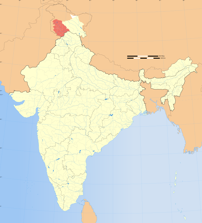
1748:
1570:
1525:
1495:
1217:
1212:
42:
418:– If you remix, transform, or build upon the material, you must distribute your contributions under the
1680:
1625:
1610:
1555:
1545:
722:
872: : The territory India claims is legally theirs, but the claim is disputed by China and Pakistan.
202:
1014:"}},"text\/plain":{"en":{"P6216":"copyrighted"}}}}": -->
1316:
The following pages on the
English Knowledge use this file (pages on other projects are not listed):
1723:
1640:
1590:
1530:
1788:
257:
1520:
1515:
912:
118:
1753:
1620:
1550:
824:
960:
1415:
1410:
378:
261:
316:
If you dont want to release your work under a creative commons license, please mail me at
8:
1370:
1430:
1420:
1380:
925:
673:
1425:
1355:
1265:{{Information |Description= |Source= |Date= |Author= |Permission= |other_versions= }}
105:
986:
353:
I, the copyright holder of this work, hereby publish it under the following license:
1435:
1400:
1395:
1360:
918:
908:
635:
306:
1390:
1375:
1345:
1340:
295:
245:
833:
706:
229:
1405:
1365:
1303:
1288:
1258:
900:
854:
611:
598:
579:
566:
534:
521:
502:
489:
318:
253:
1350:
1300:
1228:
735:
448:
1335:
1330:
1159:
1119:
1075:
1031:
904:
553:
167:
1843:
1385:
928:
is almost entirely claimed by China as part of its
Tibetan territory.
736:
659:
323:
1828:
1933:
1863:
1858:
1185:
Click on a date/time to view the file as it appeared at that time.
907:). Since 1972, it is divided between all three countries. See also
693:
1918:
1893:
1848:
1838:
1823:
1764:
Curfew imposed in Jammu and
Kashmir, three injured and four killed
844:
Please check local laws and modify the map accordingly before use.
209:
198:
1938:
1903:
1878:
1873:
1299:
with district boundaries. |Source=. |Date=August 6 2006 |Author=
241:
1913:
1898:
1888:
1868:
1853:
1833:
861:
1928:
1923:
1883:
1798:
1773:
154:
1968:
1908:
939:
For a detailed map of all disputed regions in South Asia, see
1296:
237:
87:(SVG file, nominally 1,574 × 1,738 pixels, file size: 966 KB)
1749:
United Nations Military Observer Group in India and Pakistan
180:
93:
895:
The northern Himalayan region of the disputed territory
980:
Add a one-line explanation of what this file represents
768:
644:
If inappropriate please set warp_status = skip to hide.
470:
1973:
1958:
1953:
2008:
1983:
1948:
1789:
Discussion Projet:Maghreb/Archive 2011 (janvier-juin)
1314:
849:
2003:
1993:
1988:
1714:
1706:
Category:Wikipedians interested in Jammu and Kashmir
1183:
1082:
Creative Commons Attribution-ShareAlike 3.0 Unported
1056:
Creative Commons Attribution-ShareAlike 3.0 Unported
117:
Commons is a freely licensed media file repository.
1998:
1978:
1963:
1696:
Category:WikiProject Jammu and Kashmir participants
630:
162:
1943:
1754:Benutzer:Faber-Castell/Verwaltungsgliederung/Asien
654:
135:
758:
478:
462:
1491:Knowledge:Userboxes/WikiProjects/alphabetical/15
778:
327:to negotiate a custom license as per your needs.
1476:Knowledge:Userboxes/Location/Kashmir/Subregions
817:
153:Locator map of the state of Jammu and Kashmir,
886:
429:https://creativecommons.org/licenses/by-sa/3.0
98:
1506:Knowledge:WikiProject India/userbox templates
435:Creative Commons Attribution-Share Alike 3.0
359:
338:
176:
145:
1666:Template:User interest Jammu and Kashmir/doc
1486:Knowledge:Userboxes/WikiProjects/Regional/05
665:
273:
186:
14:
1586:Template:User citizen Jammu and Kashmir/doc
395:– to copy, distribute and transmit the work
46:Size of this PNG preview of this SVG file:
132:
1716:The following other wikis use this file:
1701:Category:Wikipedians in Jammu and Kashmir
903:) and the Chinese-occupied territory of (
1661:Template:User interest Jammu and Kashmir
1606:Template:User from Jammu and Kashmir/doc
742:
466:second half of 20 century and 21 century
1581:Template:User citizen Jammu and Kashmir
1511:Knowledge:WikiProject Jammu and Kashmir
1451:Knowledge:Userboxes/Life/Citizenship/04
829:) and the National Geographic Society (
798:
638:Georeference the map in Wikimaps Warper
148:India Jammu and Kashmir locator map.svg
1691:Category:Jammu and Kashmir Wikipedians
1636:Template:User in Jammu and Kashmir/doc
1566:Template:User WP Jammu and Kashmir/doc
1814:साँचा:ज्ञानसन्दूक भारत के क्षेत्र/doc
1501:Knowledge:WikiProject India/Templates
1466:Knowledge:Userboxes/Life/Residence/04
1456:Knowledge:Userboxes/Life/Ethnicity/02
954:
788:
305:If you are using the image under the
129:
1601:Template:User from Jammu and Kashmir
1541:Template:User Jammu and Kashmir/doc1
1446:Knowledge:Userboxes/Life/Ancestry/06
382:Attribution-Share Alike 3.0 Unported
307:creative commons share alike license
1536:Template:User Jammu and Kashmir/cat
1321:Jammu and Kashmir (union territory)
1176:
946:
370:
365:
13:
2026:
1676:Template:User interest Kashmir/doc
1631:Template:User in Jammu and Kashmir
1561:Template:User WP Jammu and Kashmir
1471:Knowledge:Userboxes/Location/India
1461:Knowledge:Userboxes/Life/Origin/04
985:
979:
941:Image:India disputed areas map.svg
860:
853:
850:Explanation of disputed boundaries
773:Explanation of disputed boundaries
737:
356:
352:
166:
130:
80:
2060:
2033:
1809:साँचा:ज्ञानसन्दूक भारत के क्षेत्र
1739:মডেল:ভারতর নগর এলাকার তথ্যছক১/doc
984:
738:
1656:Template:User interest India/doc
1481:Knowledge:Userboxes/Travel/India
1315:
970:
876:Line of Control/Line of Conflict
692:
672:
552:
447:
406:Under the following conditions:
377:This file is licensed under the
369:
364:
358:
278:
97:
31:
21:
1576:Template:User citizen India/doc
967:
899:is claimed by India including (
688:
210:University of Texas map library
199:University of Texas map library
1711:
1686:Template:User proud Indian/doc
1671:Template:User interest Kashmir
1616:Template:User from Kashmir/doc
1180:
966:
924:The northeastern territory of
235:State and District boundaries:
26:
1:
1734:মডেল:ভারতর নগর এলাকার তথ্যছক১
1126:original creation by uploader
1100:original creation by uploader
901:Pakistan-administered Kashmir
636:
140:Jammu and Kashmir locator map
36:
1651:Template:User interest India
1646:Template:User in Kashmir/doc
1596:Template:User from India/doc
1326:Outline of Jammu and Kashmir
1311:
992:Items portrayed in this file
818:Depiction of India's borders
763:Depiction of India's borders
281:
258:Survey of India Map Explorer
7:
2023:
1795:Usage on hif.wikipedia.org
1770:Usage on en.wiktionary.org
1730:Usage on bpy.wikipedia.org
1571:Template:User citizen India
1526:Template:User IN states/doc
1496:Knowledge:WikiProject India
897:Indian-administered Kashmir
887:Borders of disputed regions
783:Borders of disputed regions
311:CC-by-sa PlaneMad/Wikimedia
10:
2065:
1820:Usage on it.wikipedia.org
1805:Usage on hi.wikipedia.org
1785:Usage on fr.wikipedia.org
1745:Usage on de.wikipedia.org
1720:Usage on ba.wikipedia.org
1681:Template:User proud Indian
1626:Template:User in India/doc
1611:Template:User from Kashmir
1556:Template:User WP India/doc
1546:Template:User Kashmir/doc1
748:
482:
420:same or compatible license
1760:Usage on en.wikinews.org
1177:
649:
457:
191:
157:with district boundaries.
16:
1844:Template:Jammu e Kashmir
1641:Template:User in Kashmir
1591:Template:User from India
1531:Template:User India/doc1
969:
870:Boundary of Indian claim
812:
702:this image as an overlay
471:Spatial reference system
386:
309:please credit the photo
203:India Political map 2001
104:This is a file from the
41:
1829:Jammu e Kashmir (Stato)
1521:Template:User IN states
1516:Template:Portal/doc/all
1294:
1264:
1243:06:48, 29 December 2008
1234:
108:. Information from its
1934:Distretto di Bandipore
1864:Distretto di Ganderbal
1859:Distretto di Baramulla
1621:Template:User in India
1551:Template:User WP India
1213:13:51, 21 October 2020
963:for more information.
913:Line of Actual Control
865:
858:
660:WikiProject India Maps
458: Geotemporal data
242:2001 Census State Maps
196:International Borders:
171:
111:description page there
1919:Distretto di Kishtwar
1894:Distretto di Udhampur
1849:Distretto di Anantnag
1839:Divisione del Kashmir
1824:Distretto di Srinagar
864:
857:
267:Map specific sources:
170:
1939:Distretto di Shopian
1904:Distretto di Rajouri
1879:Distretto di Pulwama
1874:Distretto di Kupwara
1416:User:Owais Khursheed
1411:User:Mubashir Saleem
1273:18:10, 6 August 2006
246:Survey of India Maps
74:1,574 × 1,738 pixels
70:1,855 × 2,048 pixels
1914:Distretto di Ramban
1899:Distretto di Poonch
1889:Distretto di Kathua
1869:Distretto di Kulgam
1854:Distretto di Budgam
1834:Divisione del Jammu
1371:User:Debjyoti Gorai
650: Archival data
401:– to adapt the work
262:Columbia University
254:US Army Map Service
226:Kashmir Region 2004
222:Western Sector 1988
218:Eastern Sector 1988
214:China-India Borders
52:Other resolutions:
1929:Distretto di Samba
1924:Distretto di Reasi
1884:Distretto di Jammu
1431:User:Theworldriser
1421:User:Tariq al sama
1381:User:Jaywardhan009
955:Territorial waters
866:
859:
803:Territorial waters
321:or catch me at my
172:
66:927 × 1,024 pixels
2052:
2051:
2018:more global usage
1909:Distretto di Doda
1799:Jammu and Kashmir
1774:Jammu and Kashmir
1712:Global file usage
1426:User:The Ultimate
1356:User:Buaidh/Test7
1309:
1066:copyright license
1052:copyright license
978:
926:Arunachal Pradesh
743:
734:
733:
730:
686:
685:
645:
626:
625:
347:
344:Reusing this file
333:
332:
207:Disputed Borders:
126:
125:
106:Wikimedia Commons
32:Global file usage
2056:
2034:
1436:User:World Riser
1401:User:Malik Naiem
1396:User:Lutfy Jahan
1361:User:Chinar Tree
1285:
1255:
1225:
1187:
1022:copyright status
1008:copyright status
976:
947:Internal borders
804:
801:
794:
793:Internal borders
791:
784:
781:
774:
771:
764:
761:
754:
751:
744:
720:
696:
689:
676:
643:
642:
640:
639:
622:
620:
619:
618:
613:
609:
608:
605:
604:
601:
590:
588:
587:
586:
581:
577:
576:
573:
572:
569:
556:
545:
543:
542:
541:
536:
532:
531:
528:
527:
524:
513:
511:
510:
509:
504:
500:
499:
496:
495:
492:
483:
451:
442:
439:
436:
433:
430:
422:as the original.
379:Creative Commons
373:
372:
368:
367:
362:
361:
341:
279:
193:
182:
181:29 December 2008
149:
133:
122:
101:
100:
94:
88:
77:
62:695 × 768 pixels
58:435 × 480 pixels
54:217 × 240 pixels
48:543 × 600 pixels
2064:
2063:
2059:
2058:
2057:
2055:
2054:
2053:
2022:
1710:
1441:User:فرح دیسائی
1391:User:Lone Human
1376:User:Gowhar Naz
1346:User:Ambar wiki
1341:User:Aflaq Peer
1317:
1310:
1304:w:user:Planemad
1291:
1283:
1261:
1253:
1231:
1223:
1179:
1178:
1175:
1174:
1173:
1172:
1171:
1170:
1169:
1168:
1166:
1156:
1155:
1154:
1152:
1137:
1136:
1135:
1134:
1133:
1132:
1131:
1130:
1128:
1116:
1115:
1114:
1112:
1093:
1092:
1091:
1090:
1089:
1088:
1087:
1086:
1084:
1072:
1071:
1070:
1068:
1049:
1048:
1047:
1046:
1045:
1044:
1043:
1042:
1040:
1028:
1027:
1026:
1024:
1005:
1004:
1003:
1002:
1001:
999:
983:
982:
981:
957:
949:
919:Siachen glacier
909:Line of Control
889:
852:
820:
815:
810:
802:
799:
792:
789:
782:
779:
772:
769:
762:
759:
752:
749:
745:
741:
687:
680:
677:
637:
634:
616:
614:
610:
606:
602:
599:
597:
595:
584:
582:
578:
574:
570:
567:
565:
563:
539:
537:
533:
529:
525:
522:
520:
518:
507:
505:
501:
497:
493:
490:
488:
486:
445:
444:
443:
440:
437:
434:
431:
428:
427:
385:
374:
355:
354:
334:
238:Census of India
158:
147:
141:
128:
127:
116:
115:
114:is shown below.
90:
86:
79:
78:
51:
12:
11:
5:
2062:
2050:
2049:
2046:
2042:
2041:
2038:
2025:
2020:of this file.
2014:
2013:
2012:
2011:
2006:
2001:
1996:
1991:
1986:
1981:
1976:
1971:
1966:
1961:
1956:
1951:
1946:
1941:
1936:
1931:
1926:
1921:
1916:
1911:
1906:
1901:
1896:
1891:
1886:
1881:
1876:
1871:
1866:
1861:
1856:
1851:
1846:
1841:
1836:
1831:
1826:
1818:
1817:
1816:
1811:
1803:
1802:
1801:
1793:
1792:
1791:
1783:
1782:
1781:
1776:
1768:
1767:
1766:
1758:
1757:
1756:
1751:
1743:
1742:
1741:
1736:
1728:
1727:
1726:
1713:
1709:
1708:
1703:
1698:
1693:
1688:
1683:
1678:
1673:
1668:
1663:
1658:
1653:
1648:
1643:
1638:
1633:
1628:
1623:
1618:
1613:
1608:
1603:
1598:
1593:
1588:
1583:
1578:
1573:
1568:
1563:
1558:
1553:
1548:
1543:
1538:
1533:
1528:
1523:
1518:
1513:
1508:
1503:
1498:
1493:
1488:
1483:
1478:
1473:
1468:
1463:
1458:
1453:
1448:
1443:
1438:
1433:
1428:
1423:
1418:
1413:
1408:
1403:
1398:
1393:
1388:
1383:
1378:
1373:
1368:
1363:
1358:
1353:
1348:
1343:
1338:
1333:
1328:
1323:
1313:
1308:
1307:
1301:w:user:Nichalp
1293:
1289:
1286:
1282:1,639 × 1,852
1280:
1275:
1270:
1267:
1266:
1263:
1259:
1256:
1252:1,574 × 1,738
1250:
1245:
1240:
1237:
1236:
1233:
1229:
1226:
1222:1,574 × 1,738
1220:
1215:
1210:
1206:
1205:
1202:
1199:
1196:
1193:
1190:
1182:
1167:
1164:
1162:
1161:
1160:
1158:
1157:
1153:
1148:
1146:
1145:
1144:
1143:
1141:
1129:
1124:
1122:
1121:
1120:
1118:
1117:
1113:
1110:source of file
1108:
1106:
1105:
1104:
1103:
1101:
1097:
1096:source of file
1085:
1080:
1078:
1077:
1076:
1074:
1073:
1069:
1064:
1062:
1061:
1060:
1059:
1057:
1053:
1041:
1036:
1034:
1033:
1032:
1030:
1029:
1025:
1020:
1018:
1017:
1016:
1015:
1013:
1009:
1000:
995:
993:
990:
989:
988:
987:
975:
974:
971:
968:
956:
953:
948:
945:
936:
935:
932:
929:
922:
916:
905:Ladakh plateau
888:
885:
884:
883:
873:
851:
848:
847:
846:
840:
839:verifiability.
836:
819:
816:
814:
811:
809:
808:
807:
806:
796:
786:
776:
766:
740:
732:
731:
718:
697:
684:
683:
682:
681:
678:
671:
667:
666:Other versions
663:
662:
656:
652:
651:
647:
646:
632:
631:Georeferencing
628:
627:
624:
623:
612:6.25°N 96.09°E
593:
591:
560:
559:
557:
550:
547:
546:
535:37.23°N 99.0°E
516:
514:
503:36.70°N 64.8°E
480:
476:
475:
472:
468:
467:
464:
460:
459:
455:
454:
426:
425:
424:
423:
413:
404:
403:
402:
396:
389:You are free:
376:
375:
357:
351:
350:
348:
336:
335:
331:
330:
329:
328:
314:
291:was created by
282:
277:
275:
271:
270:
251:Other sources:
188:
184:
183:
178:
174:
173:
164:
160:
159:
152:
150:
143:
142:
139:
137:
131:
124:
123:
102:
92:
91:
45:
40:
39:
34:
29:
24:
19:
9:
6:
4:
3:
2:
2061:
2047:
2044:
2043:
2039:
2036:
2035:
2032:
2029:
2021:
2019:
2010:
2007:
2005:
2002:
2000:
1997:
1995:
1992:
1990:
1987:
1985:
1982:
1980:
1977:
1975:
1972:
1970:
1967:
1965:
1962:
1960:
1957:
1955:
1952:
1950:
1947:
1945:
1942:
1940:
1937:
1935:
1932:
1930:
1927:
1925:
1922:
1920:
1917:
1915:
1912:
1910:
1907:
1905:
1902:
1900:
1897:
1895:
1892:
1890:
1887:
1885:
1882:
1880:
1877:
1875:
1872:
1870:
1867:
1865:
1862:
1860:
1857:
1855:
1852:
1850:
1847:
1845:
1842:
1840:
1837:
1835:
1832:
1830:
1827:
1825:
1822:
1821:
1819:
1815:
1812:
1810:
1807:
1806:
1804:
1800:
1797:
1796:
1794:
1790:
1787:
1786:
1784:
1780:
1777:
1775:
1772:
1771:
1769:
1765:
1762:
1761:
1759:
1755:
1752:
1750:
1747:
1746:
1744:
1740:
1737:
1735:
1732:
1731:
1729:
1725:
1722:
1721:
1719:
1718:
1717:
1707:
1704:
1702:
1699:
1697:
1694:
1692:
1689:
1687:
1684:
1682:
1679:
1677:
1674:
1672:
1669:
1667:
1664:
1662:
1659:
1657:
1654:
1652:
1649:
1647:
1644:
1642:
1639:
1637:
1634:
1632:
1629:
1627:
1624:
1622:
1619:
1617:
1614:
1612:
1609:
1607:
1604:
1602:
1599:
1597:
1594:
1592:
1589:
1587:
1584:
1582:
1579:
1577:
1574:
1572:
1569:
1567:
1564:
1562:
1559:
1557:
1554:
1552:
1549:
1547:
1544:
1542:
1539:
1537:
1534:
1532:
1529:
1527:
1524:
1522:
1519:
1517:
1514:
1512:
1509:
1507:
1504:
1502:
1499:
1497:
1494:
1492:
1489:
1487:
1484:
1482:
1479:
1477:
1474:
1472:
1469:
1467:
1464:
1462:
1459:
1457:
1454:
1452:
1449:
1447:
1444:
1442:
1439:
1437:
1434:
1432:
1429:
1427:
1424:
1422:
1419:
1417:
1414:
1412:
1409:
1407:
1406:User:Mhveinvp
1404:
1402:
1399:
1397:
1394:
1392:
1389:
1387:
1384:
1382:
1379:
1377:
1374:
1372:
1369:
1367:
1366:User:Dawa1989
1364:
1362:
1359:
1357:
1354:
1352:
1349:
1347:
1344:
1342:
1339:
1337:
1334:
1332:
1329:
1327:
1324:
1322:
1319:
1318:
1305:
1302:
1298:
1292:
1287:
1281:
1279:
1276:
1274:
1271:
1269:
1268:
1262:
1257:
1251:
1249:
1246:
1244:
1241:
1239:
1238:
1232:
1227:
1221:
1219:
1216:
1214:
1211:
1208:
1207:
1203:
1200:
1197:
1194:
1191:
1189:
1188:
1186:
1165:image/svg+xml
1163:
1151:
1147:
1127:
1123:
1111:
1107:
1083:
1079:
1067:
1063:
1039:
1035:
1023:
1019:
998:
994:
991:
972:
965:
964:
962:
952:
944:
943:
942:
933:
930:
927:
923:
920:
917:
914:
910:
906:
902:
898:
894:
893:
892:
881:
877:
874:
871:
868:
867:
863:
856:
845:
841:
837:
834:
831:
828:
825:
822:
821:
805:
797:
795:
787:
785:
777:
775:
767:
765:
757:
756:
755:
747:
746:
728:
724:
719:
716:
712:
708:
704:
703:
698:
695:
691:
690:
675:
670:
669:
668:
664:
661:
657:
653:
648:
641:
633:
629:
621:
594:
592:
589:
580:5.9°N 68.76°E
562:
561:
558:
555:
551:
549:
548:
544:
517:
515:
512:
485:
484:
481:
477:
473:
469:
465:
463:Date depicted
461:
456:
450:
446:
432:CC BY-SA 3.0
421:
417:
414:
411:
408:
407:
405:
400:
397:
394:
391:
390:
388:
387:
383:
380:
363:
349:
345:
340:
337:
326:
325:
320:
319:
315:
312:
308:
304:
303:
302:
301:
298:
297:
296:User:PlaneMad
293:
292:
289:
288:
283:
280:
276:
272:
268:
265:
264:
263:
259:
255:
252:
249:
247:
243:
239:
236:
233:
231:
227:
223:
219:
215:
211:
208:
205:
204:
200:
197:
194:
189:
185:
179:
175:
169:
165:
161:
156:
151:
144:
138:
134:
120:
113:
112:
107:
103:
96:
95:
89:
84:
83:Original file
75:
71:
67:
63:
59:
55:
49:
44:
38:
35:
33:
30:
28:
25:
23:
20:
18:
15:
2030:
2027:
2015:
1969:Doda (città)
1779:ജമ്മു-കശ്മീർ
1715:
1351:User:AnM2002
1306:|Thumbdir=CH
1184:
1181:File history
958:
950:
938:
937:
890:
879:
878: : The
875:
869:
843:
707:Google Earth
700:
479:Bounding box
415:
409:
398:
392:
322:
317:
310:
299:
294:
290:
286:
284:
266:
250:
234:
230:Kashmir Maps
206:
195:
190:
119:You can help
109:
81:
22:File history
1336:User:Abdars
1331:User:Aatuif
1038:copyrighted
1012:copyrighted
711:Google Maps
617:6.25; 96.09
540:37.23; 99.0
508:36.70; 64.8
416:share alike
410:attribution
146:Description
1312:File usage
1198:Dimensions
1150:media type
1140:media type
585:5.9; 68.76
339:Permission
287:This Image
163:Map legend
27:File usage
1974:Ganderbal
1959:Baramulla
1954:Bandipore
1724:Һиндостан
1386:User:KR72
1195:Thumbnail
1192:Date/Time
679:blank map
2024:Metadata
2009:Kishtwar
1984:Udhampur
1949:Anantnag
1290:Planemad
1284:(751 KB)
1260:Planemad
1254:(836 KB)
1235:Updated.
1224:(966 KB)
973:Captions
880:de facto
739:Contents
658:Part of
399:to remix
393:to share
384:license.
192:Own work
37:Metadata
2004:Kupwara
1994:Pulwama
1989:Rajouri
1230:Sbb1413
1209:current
1204:Comment
997:depicts
977:English
603:96°05′E
571:68°46′E
526:99°00′E
523:37°14′N
494:64°48′E
491:36°42′N
324:Website
274:Creator
85:
2045:Height
1999:Poonch
1979:Kathua
1964:Budgam
727:Source
600:6°15′N
568:5°54′N
453:usage.
220:&
187:Source
2037:Width
2016:View
1944:Jammu
1297:India
813:Notes
753:Notes
699:Open
655:Notes
474:conic
155:India
136:Title
2048:1738
2040:1574
1201:User
961:this
911:and
723:Help
715:Bing
441:true
438:true
177:Date
17:File
800:1.5
790:1.4
780:1.3
770:1.2
760:1.1
705:in
607:/
575:/
530:/
498:/
832:,
826:,
717:)
713:,
615:/
583:/
538:/
506:/
260:,
256:,
244:-
240:-
228:-
224:-
216:-
212:-
201:-
72:|
68:|
64:|
60:|
56:|
50:.
915:.
835:)
750:1
729:)
725:|
721:(
709:(
346:)
342:(
300:.
269:.
248:.
232:.
121:.
76:.
Text is available under the Creative Commons Attribution-ShareAlike License. Additional terms may apply.

