38:
359:
810:
448:
553:
673:
365:
370:
817:
94:
1765:
1105:"}},"text\/plain":{"en":{"":"media type"}}},"{\"value\":\"image\\\/svg+xml\",\"type\":\"string\"}":{"text\/html":{"en":{"P1163":"image\/svg+xml"}},"text\/plain":{"en":{"P1163":"image\/svg+xml"}}}}": -->
1017:"}},"text\/plain":{"en":{"":"copyright license"}}},"{\"value\":{\"entity-type\":\"item\",\"numeric-id\":14946043,\"id\":\"Q14946043\"},\"type\":\"wikibase-entityid\"}":{"text\/html":{"en":{"P275":"
973:"}},"text\/plain":{"en":{"":"copyright status"}}},"{\"value\":{\"entity-type\":\"item\",\"numeric-id\":50423863,\"id\":\"Q50423863\"},\"type\":\"wikibase-entityid\"}":{"text\/html":{"en":{"P6216":"
1061:"}},"text\/plain":{"en":{"":"source of file"}}},"{\"value\":{\"entity-type\":\"item\",\"numeric-id\":66458942,\"id\":\"Q66458942\"},\"type\":\"wikibase-entityid\"}":{"text\/html":{"en":{"P7482":"
1101:
1181:
1675:
1670:
1810:
1705:
451:
The frontiers depicted on the Indian maps in
Knowledge are from a neutral point of view and may differ from official government maps of India, Pakistan and China. Please consult local laws governing publication of maps before
411:– You must give appropriate credit, provide a link to the license, and indicate if changes were made. You may do so in any reasonable manner, but not in any way that suggests the licensor endorses you or your use.
793:
This map is meant to be for illustrative purpose only and is not authenticated by official government sources. Please check the list of sources and references used to create the map for a measure of accuracy and
1770:
837:
administrative boundary recognised by the international community. This UN ceasefire line is considered as a temporary solution to an ongoing conflict since the departure of the
British Raj.
846:
The depicted extent of the former territory of the
British Indian Empire, succeeded by Republic of India, may not be accepted by few countries as legal due to ongoing border disputes:
167:
1720:
1645:
797:
The usage of these maps in India, Pakistan and China are governed by different laws that restrict depictions of boundaries other than what is officially recognized by the state.
906:
The borders of the state of
Meghalaya, Assam and Arunachal Pradesh are shown as interpreted from the North-Eastern Areas (Reorganisation) Act, 1971, but has yet to be verified.
1062:
1018:
974:
1800:
1102:
1058:
970:
886:
Minor areas of eastern
Kashmir's Ladakh division, Himachal Pradesh and Uttarakhand on the Chinese frontier are claimed by China. These areas are under Indian control.
1680:
1014:
1362:
1630:
778:
The territorial boundaries of India are shown as per the actual ground situation in accordance with international practices followed by the United
Nations (
1730:
1625:
1635:
1412:
1909:
1437:
1021:"}},"text\/plain":{"en":{"P275":"Creative Commons Attribution-ShareAlike 3.0 Unported"}}}}": -->
785:
68:
64:
312:
and include a link to this page. No explicit permission is needed from me, but id appreciate an email if my work has been of help to you.
60:
56:
52:
48:
42:
1660:
782:
342:
284:
1407:
1397:
1587:
105:
595:
518:
486:
1577:
1372:
1277:
563:
77:
1088:
1044:
1000:
1760:
1695:
1432:
1387:
1367:
418:
914:
The limit of the territorial waters of India extends to twelve nautical miles measured from the appropriate baseline. See
1422:
876:(shown white) is an actively contested region between India and Pakistan. Since 1984, the region is under Indian control.
1112:
1072:
984:
1392:
1382:
1377:
1065:"}},"text\/plain":{"en":{"P7482":"original creation by uploader"}}}}": -->
895:
1209:
1204:
1028:
959:
1775:
1745:
1715:
1690:
1685:
1655:
1650:
1557:
1547:
1402:
889:
A small area of
Uttarakhand adjoining the Nepal border along the Sarda river is disputed between the two countries.
216:
1497:
1487:
220:
212:
1567:
380:
224:
1582:
1572:
1780:
1755:
1750:
1740:
1665:
1552:
1542:
1517:
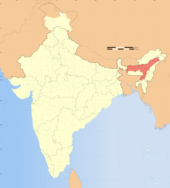
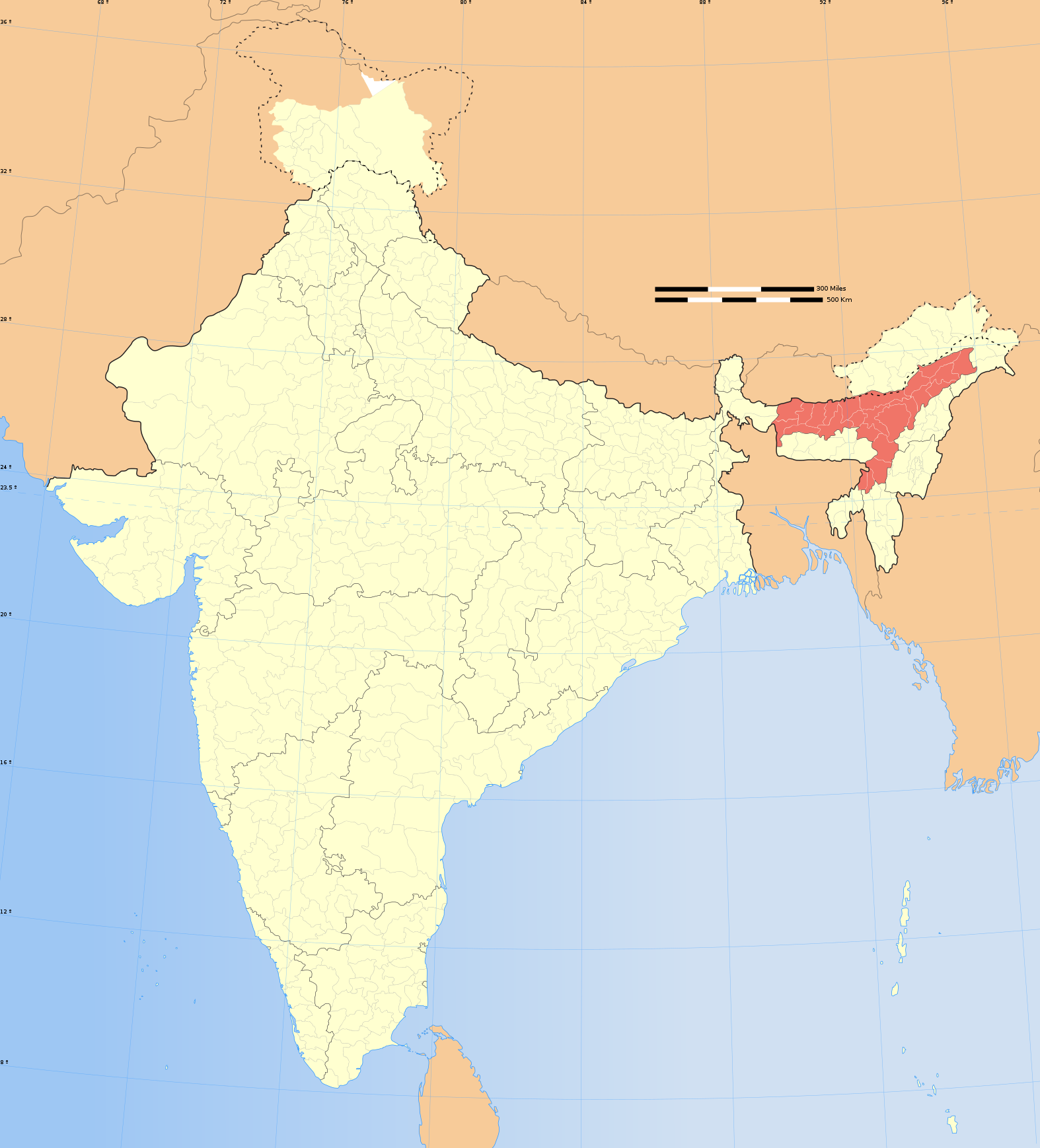
1507:
1267:
851:
1492:
1482:
1452:
1427:
1417:
1272:
417:– If you remix, transform, or build upon the material, you must distribute your contributions under the
1562:
1537:
1527:
1477:
1467:
827: : The territory India claims is legally theirs, but the claim is disputed by China and Pakistan.
201:
977:"}},"text\/plain":{"en":{"P6216":"copyrighted"}}}}": -->
1850:
1248:
The following pages on the
English Knowledge use this file (pages on other projects are not listed):
1790:
1710:
1700:
1620:
1615:
1610:
1512:
1502:
1457:
1442:
1282:
1227:{{WikiProject_India_Maps |Title=Assam locator map |Description=Locator map of the state of Assam,
256:
1447:
1317:
867:
113:
1532:
1522:
1472:
1462:
1342:
1322:
779:
1180:
1175:
37:
915:
377:
260:
1725:
1640:
315:
If you dont want to release your work under a creative commons license, please mail me at
8:
1357:
1302:
1257:
880:
672:
1297:
1292:
1287:
1252:
100:
949:
352:
I, the copyright holder of this work, hereby publish it under the following license:
1352:
1347:
873:
863:
634:
1860:
305:
1870:
1735:
1337:
294:
1327:
1307:
244:
788:
228:
1332:
1312:
1262:
1235:
1220:
1191:
855:
809:
610:
597:
578:
565:
533:
520:
501:
488:
317:
252:
1232:
690:
447:
1122:
1082:
1038:
994:
859:
1605:
552:
166:
883:
is almost entirely claimed by China as part of its
Tibetan territory.
691:
658:
322:
1148:
Click on a date/time to view the file as it appeared at that time.
862:). Since 1972, it is divided between all three countries. See also
799:
Please check local laws and modify the map accordingly before use.
208:
197:
1231:
with district boundaries. |Source=. |Date=August 6 2006 |Author=
240:
816:
153:
149:
894:
For a detailed map of all disputed regions in South Asia, see
1228:
236:
82:(SVG file, nominally 1,574 × 1,738 pixels, file size: 836 KB)
179:
88:
850:
The northern
Himalayan region of the disputed territory
1890:
935:
Add a one-line explanation of what this file represents
723:
643:
If inappropriate please set warp_status = skip to hide.
469:
1895:
1363:
Knowledge:Templates for discussion/Log/2012 February 4
1246:
804:
1900:
1596:
1146:
1045:
Creative Commons Attribution-ShareAlike 3.0 Unported
1019:
Creative Commons Attribution-ShareAlike 3.0 Unported
112:
Commons is a freely licensed media file repository.
1880:
1830:
629:
161:
1885:
1840:
653:
130:
1820:
713:
477:
461:
1413:Knowledge:Userboxes/WikiProjects/alphabetical/03
733:
326:to negotiate a custom license as per your needs.
772:
841:
428:https://creativecommons.org/licenses/by-sa/3.0
93:
1438:Knowledge:WikiProject India/userbox templates
434:Creative Commons Attribution-Share Alike 3.0
358:
337:
175:
140:
1766:শ্বহীদ মুকুন্দ কাকতি উচ্চ মাধ্যমিক বিদ্যালয়
664:
272:
185:
14:
394:– to copy, distribute and transmit the work
41:Size of this PNG preview of this SVG file:
127:
1598:The following other wikis use this file:
1408:Knowledge:Userboxes/WikiProjects/Regional
1398:Knowledge:Userboxes/Location/India/States
858:) and the Chinese-occupied territory of (
1851:Elefant „Osama“ zum Abschuss freigegeben
1588:Category:Wikipedians interested in Assam
697:
465:second half of 20 century and 21 century
1578:Category:WikiProject Assam participants
1373:Knowledge:Userboxes/Life/Citizenship/04
1278:User:Almithra/2012 Dhubri boat disaster
784:) and the National Geographic Society (
753:
637:Georeference the map in Wikimaps Warper
1433:Knowledge:WikiProject India/Templates
1388:Knowledge:Userboxes/Life/Residence/04
909:
743:
304:If you are using the image under the
124:
1368:Knowledge:Userboxes/Life/Ancestry/06
381:Attribution-Share Alike 3.0 Unported
306:creative commons share alike license
1423:Knowledge:WikiProject Assam/Members
1139:
901:
369:
364:
13:
1393:Knowledge:Userboxes/Location/India
1383:Knowledge:Userboxes/Life/Origin/04
1378:Knowledge:Userboxes/Life/Ethnicity
948:
942:
934:
896:Image:India disputed areas map.svg
815:
808:
805:Explanation of disputed boundaries
728:Explanation of disputed boundaries
692:
355:
351:
165:
125:
75:
1921:
947:
693:
1558:Template:User interest India/doc
1548:Template:User interest Assam/doc
1403:Knowledge:Userboxes/Travel/India
1247:
925:
831:Line of Control/Line of Conflict
671:
551:
446:
405:Under the following conditions:
376:This file is licensed under the
368:
363:
357:
277:
92:
31:
21:
1498:Template:User citizen India/doc
1488:Template:User citizen Assam/doc
922:
854:is claimed by India including (
209:University of Texas map library
198:University of Texas map library
1593:
1568:Template:User proud Indian/doc
1143:
921:
879:The northeastern territory of
234:State and District boundaries:
26:
1:
1583:Category:Wikipedians in Assam
1573:Category:Assamese Wikipedians
1089:original creation by uploader
1063:original creation by uploader
856:Pakistan-administered Kashmir
635:
1553:Template:User interest India
1543:Template:User interest Assam
1518:Template:User from India/doc
1508:Template:User from Assam/doc
1268:Human rights abuses in Assam
1243:
955:Items portrayed in this file
773:Depiction of India's borders
718:Depiction of India's borders
280:
257:Survey of India Map Explorer
148:Locator map of the state of
7:
1857:Usage on dty.wikipedia.org
1827:Usage on cdo.wikipedia.org
1676:বৰদৈবাম বিলমুখ পক্ষী উদ্যান
1493:Template:User citizen India
1483:Template:User citizen Assam
1453:Template:User IN states/doc
1428:Knowledge:WikiProject India
1418:Knowledge:WikiProject Assam
1273:List of Assam state symbols
852:Indian-administered Kashmir
842:Borders of disputed regions
738:Borders of disputed regions
310:CC-by-sa PlaneMad/Wikimedia
143:India Assam locator map.svg
10:
1926:
1877:Usage on es.wikipedia.org
1867:Usage on dv.wikipedia.org
1837:Usage on cy.wikipedia.org
1817:Usage on br.wikipedia.org
1807:Usage on bn.wikipedia.org
1797:Usage on be.wikipedia.org
1787:Usage on ba.wikipedia.org
1602:Usage on as.wikipedia.org
1563:Template:User proud Indian
1538:Template:User in India/doc
1528:Template:User in Assam/doc
1478:Template:User WP India/doc
1468:Template:User WP Assam/doc
703:
481:
419:same or compatible license
1847:Usage on de.wikinews.org
1671:কাজিৰঙা ৰাষ্ট্ৰীয় উদ্যান
1631:সদস্য:Anshuman.jrt/নলবাৰী
1140:
648:
456:
190:
156:with district boundaries.
16:
1636:সদস্য:Anshuman.jrt/শিলচৰ
1513:Template:User from India
1503:Template:User from Assam
1458:Template:User India/doc1
1443:Template:User Assam/doc1
1283:User:ArnabSaha/Userboxes
924:
825:Boundary of Indian claim
767:
470:Spatial reference system
385:
308:please credit the photo
202:India Political map 2001
99:This is a file from the
36:
1811:আসামের রাজ্য প্রতীকসমূহ
1801:Штаты і тэрыторыі Індыі
1706:অসমৰ ৰাজ্যিক প্ৰতীকসমূহ
1448:Template:User IN states
1318:User:Laqy-peenu/sandbox
1226:
1197:
1176:06:26, 29 December 2008
103:. Information from its
1533:Template:User in India
1523:Template:User in Assam
1473:Template:User WP India
1463:Template:User WP Assam
1343:User:Ssan2021/sandbox2
1323:User:NijwmTheDeveloper
918:for more information.
868:Line of Actual Control
820:
813:
659:WikiProject India Maps
457: Geotemporal data
241:2001 Census State Maps
195:International Borders:
170:
106:description page there
1771:২০২২ চনত অসমৰ বানপানী
819:
812:
266:Map specific sources:
169:
1205:17:56, 6 August 2006
245:Survey of India Maps
69:1,574 × 1,738 pixels
65:1,855 × 2,048 pixels
1358:User talk:Jogesh 69
1303:User:Debjyoti Gorai
1238:|Thumbdir=CHANGE }}
649: Archival data
400:– to adapt the work
261:Columbia University
253:US Army Map Service
225:Kashmir Region 2004
221:Western Sector 1988
217:Eastern Sector 1988
213:China-India Borders
47:Other resolutions:
1258:Brahmaputra floods
910:Territorial waters
821:
814:
758:Territorial waters
320:or catch me at my
171:
61:927 × 1,024 pixels
1910:more global usage
1594:Global file usage
1298:User:Buaidh/Test7
1293:User:Brishtibheja
1288:User:Beingsofiqul
1253:2020 Assam floods
1241:
1029:copyright license
1015:copyright license
941:
933:
881:Arunachal Pradesh
698:
685:
684:
644:
625:
624:
346:
343:Reusing this file
332:
331:
206:Disputed Borders:
135:Assam locator map
121:
120:
101:Wikimedia Commons
32:Global file usage
1917:
1721:পবিতৰা অভয়াৰণ্য
1681:বিহপুৰীয়া (নগৰ)
1646:বিশ্বনাথ চাৰিআলি
1353:User:Wiki.Gunjan
1348:User:Sujitking95
1217:
1188:
1150:
985:copyright status
971:copyright status
939:
931:
902:Internal borders
759:
756:
749:
748:Internal borders
746:
739:
736:
729:
726:
719:
716:
709:
706:
699:
675:
642:
641:
639:
638:
621:
619:
618:
617:
612:
608:
607:
604:
603:
600:
589:
587:
586:
585:
580:
576:
575:
572:
571:
568:
555:
544:
542:
541:
540:
535:
531:
530:
527:
526:
523:
512:
510:
509:
508:
503:
499:
498:
495:
494:
491:
482:
450:
441:
438:
435:
432:
429:
421:as the original.
378:Creative Commons
372:
371:
367:
366:
361:
360:
340:
278:
192:
181:
180:29 December 2008
144:
128:
117:
96:
95:
89:
83:
72:
57:695 × 768 pixels
53:435 × 480 pixels
49:217 × 240 pixels
43:543 × 600 pixels
1925:
1924:
1920:
1919:
1918:
1916:
1915:
1914:
1592:
1338:User:Sohail0801
1249:
1242:
1236:w:user:Planemad
1223:
1215:
1194:
1186:
1142:
1141:
1138:
1137:
1136:
1135:
1134:
1133:
1132:
1131:
1129:
1119:
1118:
1117:
1115:
1100:
1099:
1098:
1097:
1096:
1095:
1094:
1093:
1091:
1079:
1078:
1077:
1075:
1056:
1055:
1054:
1053:
1052:
1051:
1050:
1049:
1047:
1035:
1034:
1033:
1031:
1012:
1011:
1010:
1009:
1008:
1007:
1006:
1005:
1003:
991:
990:
989:
987:
968:
967:
966:
965:
964:
962:
946:
945:
944:
937:
936:
912:
904:
874:Siachen glacier
864:Line of Control
844:
807:
775:
770:
765:
757:
754:
747:
744:
737:
734:
727:
724:
717:
714:
707:
704:
700:
696:
686:
679:
676:
636:
633:
615:
613:
609:
605:
601:
598:
596:
594:
583:
581:
577:
573:
569:
566:
564:
562:
538:
536:
532:
528:
524:
521:
519:
517:
506:
504:
500:
496:
492:
489:
487:
485:
444:
443:
442:
439:
436:
433:
430:
427:
426:
384:
373:
354:
353:
333:
237:Census of India
157:
142:
136:
123:
122:
111:
110:
109:is shown below.
85:
81:
74:
73:
46:
12:
11:
5:
1923:
1912:of this file.
1906:
1905:
1904:
1903:
1898:
1893:
1888:
1883:
1875:
1874:
1873:
1865:
1864:
1863:
1855:
1854:
1853:
1845:
1844:
1843:
1835:
1834:
1833:
1825:
1824:
1823:
1815:
1814:
1813:
1805:
1804:
1803:
1795:
1794:
1793:
1785:
1784:
1783:
1778:
1773:
1768:
1763:
1758:
1753:
1748:
1743:
1738:
1733:
1728:
1723:
1718:
1713:
1708:
1703:
1698:
1693:
1688:
1683:
1678:
1673:
1668:
1663:
1658:
1653:
1648:
1643:
1638:
1633:
1628:
1623:
1618:
1613:
1608:
1595:
1591:
1590:
1585:
1580:
1575:
1570:
1565:
1560:
1555:
1550:
1545:
1540:
1535:
1530:
1525:
1520:
1515:
1510:
1505:
1500:
1495:
1490:
1485:
1480:
1475:
1470:
1465:
1460:
1455:
1450:
1445:
1440:
1435:
1430:
1425:
1420:
1415:
1410:
1405:
1400:
1395:
1390:
1385:
1380:
1375:
1370:
1365:
1360:
1355:
1350:
1345:
1340:
1335:
1330:
1328:User:Rinku8904
1325:
1320:
1315:
1310:
1308:User:Jogesh 69
1305:
1300:
1295:
1290:
1285:
1280:
1275:
1270:
1265:
1260:
1255:
1245:
1240:
1239:
1233:w:user:Nichalp
1225:
1221:
1218:
1214:1,639 × 1,852
1212:
1207:
1202:
1199:
1198:
1196:
1192:
1189:
1185:1,574 × 1,738
1183:
1178:
1173:
1169:
1168:
1165:
1162:
1159:
1156:
1153:
1145:
1130:
1127:
1125:
1124:
1123:
1121:
1120:
1116:
1111:
1109:
1108:
1107:
1106:
1104:
1092:
1087:
1085:
1084:
1083:
1081:
1080:
1076:
1073:source of file
1071:
1069:
1068:
1067:
1066:
1064:
1060:
1059:source of file
1048:
1043:
1041:
1040:
1039:
1037:
1036:
1032:
1027:
1025:
1024:
1023:
1022:
1020:
1016:
1004:
999:
997:
996:
995:
993:
992:
988:
983:
981:
980:
979:
978:
976:
972:
963:
958:
956:
953:
952:
951:
950:
938:
930:
929:
926:
923:
911:
908:
903:
900:
891:
890:
887:
884:
877:
871:
860:Ladakh plateau
843:
840:
839:
838:
828:
806:
803:
802:
801:
795:
794:verifiability.
791:
774:
771:
769:
766:
764:
763:
762:
761:
751:
741:
731:
721:
695:
683:
682:
681:
680:
677:
670:
666:
665:Other versions
662:
661:
655:
651:
650:
646:
645:
631:
630:Georeferencing
627:
626:
623:
622:
611:6.25°N 96.09°E
592:
590:
559:
558:
556:
549:
546:
545:
534:37.23°N 99.0°E
515:
513:
502:36.70°N 64.8°E
479:
475:
474:
471:
467:
466:
463:
459:
458:
454:
453:
425:
424:
423:
422:
412:
403:
402:
401:
395:
388:You are free:
375:
374:
356:
350:
349:
347:
335:
334:
330:
329:
328:
327:
313:
290:was created by
281:
276:
274:
270:
269:
250:Other sources:
187:
183:
182:
177:
173:
172:
163:
159:
158:
147:
145:
138:
137:
134:
132:
126:
119:
118:
97:
87:
86:
40:
35:
34:
29:
24:
19:
9:
6:
4:
3:
2:
1922:
1913:
1911:
1902:
1899:
1897:
1894:
1892:
1889:
1887:
1884:
1882:
1879:
1878:
1876:
1872:
1869:
1868:
1866:
1862:
1859:
1858:
1856:
1852:
1849:
1848:
1846:
1842:
1839:
1838:
1836:
1832:
1829:
1828:
1826:
1822:
1819:
1818:
1816:
1812:
1809:
1808:
1806:
1802:
1799:
1798:
1796:
1792:
1789:
1788:
1786:
1782:
1779:
1777:
1774:
1772:
1769:
1767:
1764:
1762:
1759:
1757:
1754:
1752:
1749:
1747:
1744:
1742:
1739:
1737:
1734:
1732:
1731:তিতাবৰ মহকুমা
1729:
1727:
1724:
1722:
1719:
1717:
1714:
1712:
1709:
1707:
1704:
1702:
1699:
1697:
1694:
1692:
1689:
1687:
1684:
1682:
1679:
1677:
1674:
1672:
1669:
1667:
1664:
1662:
1659:
1657:
1654:
1652:
1649:
1647:
1644:
1642:
1639:
1637:
1634:
1632:
1629:
1627:
1626:উত্তৰ লখিমপুৰ
1624:
1622:
1619:
1617:
1614:
1612:
1609:
1607:
1604:
1603:
1601:
1600:
1599:
1589:
1586:
1584:
1581:
1579:
1576:
1574:
1571:
1569:
1566:
1564:
1561:
1559:
1556:
1554:
1551:
1549:
1546:
1544:
1541:
1539:
1536:
1534:
1531:
1529:
1526:
1524:
1521:
1519:
1516:
1514:
1511:
1509:
1506:
1504:
1501:
1499:
1496:
1494:
1491:
1489:
1486:
1484:
1481:
1479:
1476:
1474:
1471:
1469:
1466:
1464:
1461:
1459:
1456:
1454:
1451:
1449:
1446:
1444:
1441:
1439:
1436:
1434:
1431:
1429:
1426:
1424:
1421:
1419:
1416:
1414:
1411:
1409:
1406:
1404:
1401:
1399:
1396:
1394:
1391:
1389:
1386:
1384:
1381:
1379:
1376:
1374:
1371:
1369:
1366:
1364:
1361:
1359:
1356:
1354:
1351:
1349:
1346:
1344:
1341:
1339:
1336:
1334:
1333:User:Rxrawlin
1331:
1329:
1326:
1324:
1321:
1319:
1316:
1314:
1313:User:Jrkalita
1311:
1309:
1306:
1304:
1301:
1299:
1296:
1294:
1291:
1289:
1286:
1284:
1281:
1279:
1276:
1274:
1271:
1269:
1266:
1264:
1263:Edosa pyriata
1261:
1259:
1256:
1254:
1251:
1250:
1237:
1234:
1230:
1224:
1219:
1213:
1211:
1208:
1206:
1203:
1201:
1200:
1195:
1190:
1184:
1182:
1179:
1177:
1174:
1171:
1170:
1166:
1163:
1160:
1157:
1154:
1152:
1151:
1149:
1128:image/svg+xml
1126:
1114:
1110:
1090:
1086:
1074:
1070:
1046:
1042:
1030:
1026:
1002:
998:
986:
982:
961:
957:
954:
927:
920:
919:
917:
907:
899:
898:
897:
888:
885:
882:
878:
875:
872:
869:
865:
861:
857:
853:
849:
848:
847:
836:
832:
829:
826:
823:
822:
818:
811:
800:
796:
792:
789:
786:
783:
780:
777:
776:
760:
752:
750:
742:
740:
732:
730:
722:
720:
712:
711:
710:
702:
701:
689:
688:
674:
669:
668:
667:
663:
660:
656:
652:
647:
640:
632:
628:
620:
593:
591:
588:
579:5.9°N 68.76°E
561:
560:
557:
554:
550:
548:
547:
543:
516:
514:
511:
484:
483:
480:
476:
472:
468:
464:
462:Date depicted
460:
455:
449:
445:
431:CC BY-SA 3.0
420:
416:
413:
410:
407:
406:
404:
399:
396:
393:
390:
389:
387:
386:
382:
379:
362:
348:
344:
339:
336:
325:
324:
319:
318:
314:
311:
307:
303:
302:
301:
300:
297:
296:
295:User:PlaneMad
292:
291:
288:
287:
282:
279:
275:
271:
267:
264:
263:
262:
258:
254:
251:
248:
246:
242:
238:
235:
232:
230:
226:
222:
218:
214:
210:
207:
204:
203:
199:
196:
193:
188:
184:
178:
174:
168:
164:
160:
155:
151:
146:
139:
133:
129:
115:
108:
107:
102:
98:
91:
90:
84:
79:
78:Original file
70:
66:
62:
58:
54:
50:
44:
39:
33:
30:
28:
25:
23:
20:
18:
15:
1907:
1597:
1147:
1144:File history
913:
905:
893:
892:
845:
834:
833: : The
830:
824:
798:
687:
478:Bounding box
414:
408:
397:
391:
321:
316:
309:
298:
293:
289:
285:
283:
265:
249:
233:
229:Kashmir Maps
205:
194:
189:
114:You can help
104:
76:
22:File history
1001:copyrighted
975:copyrighted
616:6.25; 96.09
539:37.23; 99.0
507:36.70; 64.8
415:share alike
409:attribution
141:Description
1891:Margherita
1661:নাৰায়ণপুৰ
1244:File usage
1161:Dimensions
1113:media type
1103:media type
943:असमराज्यम्
584:5.9; 68.76
338:Permission
286:This Image
162:Map legend
27:File usage
1896:Mushalpur
1791:Һиндостан
1761:চাৰিদুৱাৰ
1696:হাৰিভাংগা
1158:Thumbnail
1155:Date/Time
678:blank map
1776:ভূৰাগাঁও
1746:মাখিবাহা
1716:মাণিকপুৰ
1691:কৰিমগঞ্জ
1686:কোকৰাঝাৰ
1656:ঢকুৱাখনা
1651:বঙাইগাঁও
1222:Planemad
1216:(751 KB)
1193:Planemad
1187:(836 KB)
940:Sanskrit
928:Captions
835:de facto
694:Contents
657:Part of
398:to remix
392:to share
383:license.
191:Own work
1901:Barpeta
1781:ফুলবাৰী
1756:বালিপৰা
1751:ঘিলামৰা
1741:মৰিগাঁও
1666:পাঠশালা
1172:current
1167:Comment
960:depicts
932:English
602:96°05′E
570:68°46′E
525:99°00′E
522:37°14′N
493:64°48′E
490:36°42′N
323:Website
273:Creator
80:
1881:Rangia
1871:އާސާމު
1711:কৈহাটী
1701:সোণাৰি
1621:যোৰহাট
1616:বৰপেটা
1611:তেজপুৰ
599:6°15′N
567:5°54′N
452:usage.
219:&
186:Source
1908:View
1886:Lanka
1841:Assam
1831:Assam
1726:মঙলদৈ
1641:গহপুৰ
1229:India
768:Notes
708:Notes
654:Notes
473:conic
154:India
150:Assam
131:Title
1861:आसाम
1821:Asam
1736:ডিফু
1164:User
916:this
866:and
440:true
437:true
176:Date
17:File
1606:অসম
755:1.5
745:1.4
735:1.3
725:1.2
715:1.1
606:/
574:/
529:/
497:/
787:,
781:,
614:/
582:/
537:/
505:/
259:,
255:,
243:-
239:-
227:-
223:-
215:-
211:-
200:-
152:,
67:|
63:|
59:|
55:|
51:|
45:.
870:.
790:)
705:1
345:)
341:(
299:.
268:.
247:.
231:.
116:.
71:.
Text is available under the Creative Commons Attribution-ShareAlike License. Additional terms may apply.

