38:
359:
810:
448:
553:
673:
365:
370:
817:
94:
1097:"}},"text\/plain":{"en":{"":"media type"}}},"{\"value\":\"image\\\/svg+xml\",\"type\":\"string\"}":{"text\/html":{"en":{"P1163":"image\/svg+xml"}},"text\/plain":{"en":{"P1163":"image\/svg+xml"}}}}": -->
1596:
1541:
1009:"}},"text\/plain":{"en":{"":"copyright license"}}},"{\"value\":{\"entity-type\":\"item\",\"numeric-id\":14946043,\"id\":\"Q14946043\"},\"type\":\"wikibase-entityid\"}":{"text\/html":{"en":{"P275":"
965:"}},"text\/plain":{"en":{"":"copyright status"}}},"{\"value\":{\"entity-type\":\"item\",\"numeric-id\":50423863,\"id\":\"Q50423863\"},\"type\":\"wikibase-entityid\"}":{"text\/html":{"en":{"P6216":"
1053:"}},"text\/plain":{"en":{"":"source of file"}}},"{\"value\":{\"entity-type\":\"item\",\"numeric-id\":66458942,\"id\":\"Q66458942\"},\"type\":\"wikibase-entityid\"}":{"text\/html":{"en":{"P7482":"
1236:
1206:
1093:
451:
The frontiers depicted on the Indian maps in
Knowledge are from a neutral point of view and may differ from official government maps of India, Pakistan and China. Please consult local laws governing publication of maps before
1636:
411:– You must give appropriate credit, provide a link to the license, and indicate if changes were made. You may do so in any reasonable manner, but not in any way that suggests the licensor endorses you or your use.
793:
This map is meant to be for illustrative purpose only and is not authenticated by official government sources. Please check the list of sources and references used to create the map for a measure of accuracy and
1191:
837:
administrative boundary recognised by the international community. This UN ceasefire line is considered as a temporary solution to an ongoing conflict since the departure of the
British Raj.
846:
The depicted extent of the former territory of the
British Indian Empire, succeeded by Republic of India, may not be accepted by few countries as legal due to ongoing border disputes:
167:
797:
The usage of these maps in India, Pakistan and China are governed by different laws that restrict depictions of boundaries other than what is officially recognized by the state.
906:
The borders of the state of
Meghalaya, Assam and Arunachal Pradesh are shown as interpreted from the North-Eastern Areas (Reorganisation) Act, 1971, but has yet to be verified.
1054:
1010:
966:
1825:
1641:
1586:
1094:
1050:
962:
886:
Minor areas of eastern
Kashmir's Ladakh division, Himachal Pradesh and Uttarakhand on the Chinese frontier are claimed by China. These areas are under Indian control.
1006:
68:
64:
60:
56:
52:
48:
42:
284:
778:
The territorial boundaries of India are shown as per the actual ground situation in accordance with international practices followed by the United
Nations (
1631:
1518:
105:
1606:
77:
1343:
595:
518:
486:
1363:
1013:"}},"text\/plain":{"en":{"P275":"Creative Commons Attribution-ShareAlike 3.0 Unported"}}}}": -->
563:
785:
1483:
1423:
312:
and include a link to this page. No explicit permission is needed from me, but id appreciate an email if my work has been of help to you.
782:
342:
1513:
1338:
1328:
1478:
1443:
1235:
1230:
1205:
1200:
1418:
1348:
1303:
1080:
1036:
992:
1626:
1463:
1403:
1358:
1318:
1438:
1378:
1298:
418:
1253:{{WikiProject_India_Maps |Title=Arunachal Pradesh locator map |Description=Locator map of the state of Arunachal Pradesh,
914:
The limit of the territorial waters of India extends to twelve nautical miles measured from the appropriate baseline. See
1373:
876:(shown white) is an actively contested region between India and Pakistan. Since 1984, the region is under Indian control.
1104:
1064:
976:
1458:
1398:
1323:
1313:
1308:
1057:"}},"text\/plain":{"en":{"P7482":"original creation by uploader"}}}}": -->
895:
1020:
951:
1546:
1493:
1333:
889:
A small area of
Uttarakhand adjoining the Nepal border along the Sarda river is disputed between the two countries.
216:
1508:
1433:
220:
212:
1503:
380:
224:
1293:
1488:
1453:
851:
1561:
1428:
1388:
1353:
1172:
1167:
37:
417:– If you remix, transform, or build upon the material, you must distribute your contributions under the
1498:
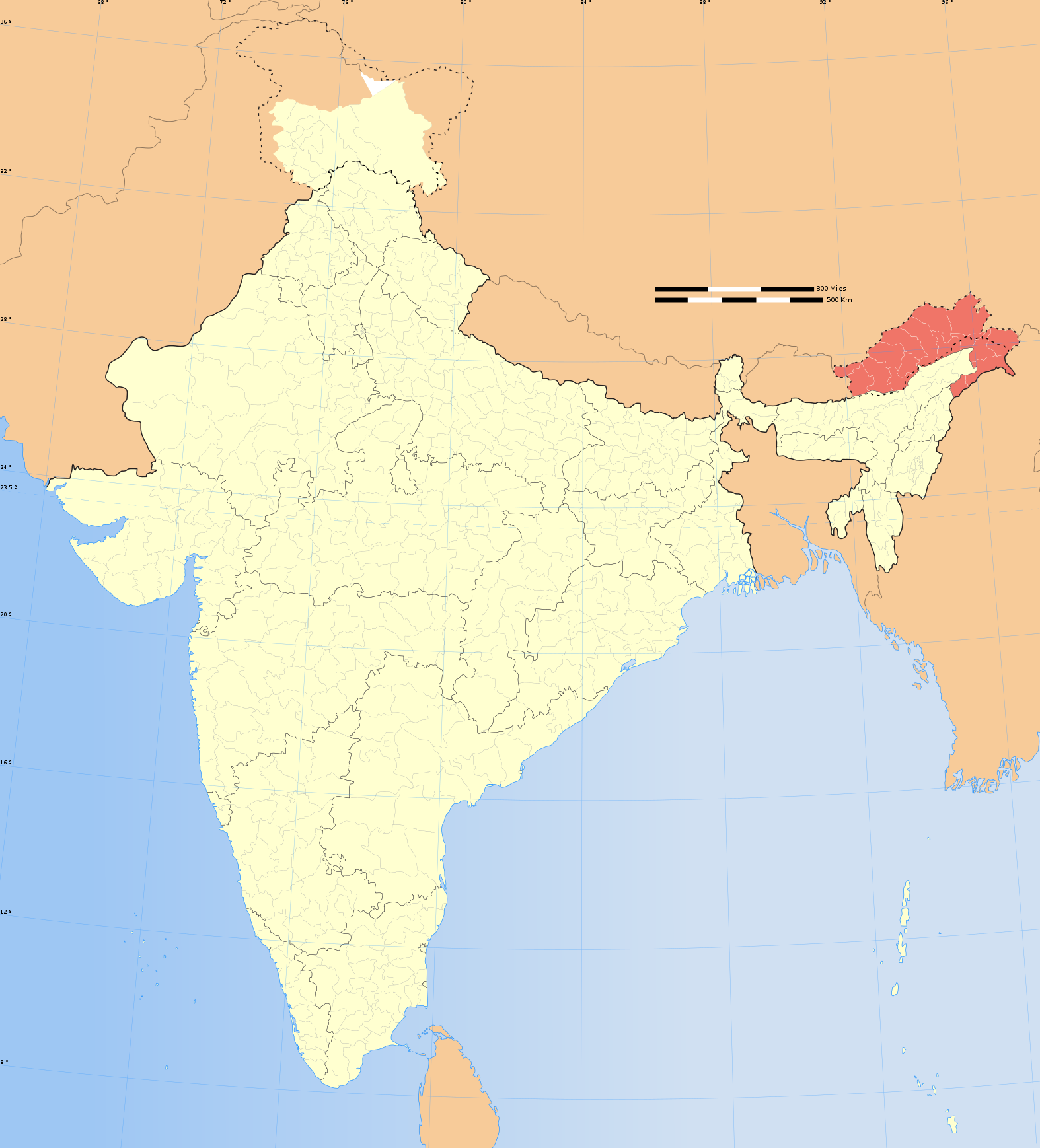
1473:
1413:
827: : The territory India claims is legally theirs, but the claim is disputed by China and Pakistan.
201:
969:"}},"text\/plain":{"en":{"P6216":"copyrighted"}}}}": -->
1274:
The following pages on the
English Knowledge use this file (pages on other projects are not listed):
1576:
1556:
1551:
1536:
1448:
1393:
256:
1383:
1368:
867:
113:
1468:
1408:
779:
915:
377:
260:
1616:
315:
If you dont want to release your work under a creative commons license, please mail me at
8:
1278:
880:
149:
1190:{{Information |Description= |Source= |Date= |Author= |Permission= |other_versions= }}
672:
1288:
100:
941:
352:
I, the copyright holder of this work, hereby publish it under the following license:
1736:
873:
863:
634:
305:
294:
1283:
244:
788:
228:
1691:
1666:
1261:
1246:
1216:
1183:
855:
809:
610:
597:
578:
565:
533:
520:
501:
488:
1716:
1676:
317:
252:
1696:
1258:
1721:
1681:
690:
447:
1114:
1074:
1030:
986:
859:
1671:
1566:
552:
166:
1661:
1701:
883:
is almost entirely claimed by China as part of its
Tibetan territory.
691:
658:
322:
1711:
1686:
1140:
Click on a date/time to view the file as it appeared at that time.
862:). Since 1972, it is divided between all three countries. See also
799:
Please check local laws and modify the map accordingly before use.
208:
197:
1257:
with district boundaries. |Source=. |Date=August 6 2006 |Author=
240:
1726:
816:
1731:
1706:
1656:
153:
894:
For a detailed map of all disputed regions in South Asia, see
1254:
236:
82:(SVG file, nominally 1,574 × 1,738 pixels, file size: 836 KB)
1811:
179:
88:
850:
The northern
Himalayan region of the disputed territory
1781:
935:
Add a one-line explanation of what this file represents
723:
643:
If inappropriate please set warp_status = skip to hide.
469:
1771:
1756:
1786:
1761:
1651:
1272:
804:
1766:
1751:
1527:
1519:
Category:Wikipedians interested in Arunachal Pradesh
1138:
1037:
Creative Commons Attribution-ShareAlike 3.0 Unported
1011:
Creative Commons Attribution-ShareAlike 3.0 Unported
112:
Commons is a freely licensed media file repository.
1816:
1806:
1776:
629:
161:
1801:
1796:
1746:
1741:
653:
130:
1791:
713:
477:
461:
1344:Knowledge:Userboxes/WikiProjects/alphabetical/02
733:
326:to negotiate a custom license as per your needs.
772:
841:
428:https://creativecommons.org/licenses/by-sa/3.0
93:
1364:Knowledge:WikiProject India/userbox templates
1192:Category:WikiProject India State Locator Maps
434:Creative Commons Attribution-Share Alike 3.0
358:
337:
175:
140:
1484:Template:User interest Arunachal Pradesh/doc
664:
272:
185:
14:
1424:Template:User citizen Arunachal Pradesh/doc
394:– to copy, distribute and transmit the work
41:Size of this PNG preview of this SVG file:
127:
1529:The following other wikis use this file:
1514:Category:Wikipedians in Arunachal Pradesh
1339:Knowledge:Userboxes/WikiProjects/Regional
1329:Knowledge:Userboxes/Location/India/States
858:) and the Chinese-occupied territory of (
1479:Template:User interest Arunachal Pradesh
1444:Template:User from Arunachal Pradesh/doc
697:
465:second half of 20 century and 21 century
1597:অরুণাচল প্রদেশের মুখ্যমন্ত্রীদের তালিকা
1542:অৰুণাচল প্ৰদেশৰ মুখ্যমন্ত্ৰীসকলৰ তালিকা
1419:Template:User citizen Arunachal Pradesh
1349:Knowledge:WikiProject Arunachal Pradesh
1304:Knowledge:Userboxes/Life/Citizenship/04
784:) and the National Geographic Society (
753:
637:Georeference the map in Wikimaps Warper
143:India Arunachal Pradesh locator map.svg
1737:Distretto della Bassa Valle del Dibang
1464:Template:User in Arunachal Pradesh/doc
1404:Template:User WP Arunachal Pradesh/doc
1359:Knowledge:WikiProject India/Templates
1319:Knowledge:Userboxes/Life/Residence/04
909:
743:
304:If you are using the image under the
124:
1439:Template:User from Arunachal Pradesh
1379:Template:User Arunachal Pradesh/doc1
1299:Knowledge:Userboxes/Life/Ancestry/06
381:Attribution-Share Alike 3.0 Unported
306:creative commons share alike license
1374:Template:User Arunachal Pradesh/cat
1131:
901:
369:
364:
13:
1677:Distretto dell'Alto Subansiri
1459:Template:User in Arunachal Pradesh
1399:Template:User WP Arunachal Pradesh
1324:Knowledge:Userboxes/Location/India
1314:Knowledge:Userboxes/Life/Origin/04
1309:Knowledge:Userboxes/Life/Ethnicity
940:
934:
896:Image:India disputed areas map.svg
815:
808:
805:Explanation of disputed boundaries
728:Explanation of disputed boundaries
692:
355:
351:
165:
125:
75:
1837:
939:
693:
1692:Distretto del Kameng Occidentale
1667:Distretto della Valle del Dibang
1494:Template:User interest India/doc
1334:Knowledge:Userboxes/Travel/India
1273:
925:
831:Line of Control/Line of Conflict
671:
551:
446:
405:Under the following conditions:
376:This file is licensed under the
368:
363:
357:
277:
92:
31:
21:
1717:Distretto del Siang Occidentale
1509:Category:Arunachali Wikipedians
1434:Template:User citizen India/doc
922:
854:is claimed by India including (
209:University of Texas map library
198:University of Texas map library
1697:Distretto del Kameng Orientale
1672:Distretto dell'Alto Siang
1524:
1504:Template:User proud Indian/doc
1135:
921:
879:The northeastern territory of
234:State and District boundaries:
26:
1:
1722:Distretto del Siang Orientale
1682:Distretto del Basso Subansiri
1294:User talk:WOSlinker/Archive 6
1081:original creation by uploader
1055:original creation by uploader
856:Pakistan-administered Kashmir
635:
135:Arunachal Pradesh locator map
1489:Template:User interest India
1454:Template:User from India/doc
1269:
947:Items portrayed in this file
773:Depiction of India's borders
718:Depiction of India's borders
280:
257:Survey of India Map Explorer
148:Locator map of the state of
7:
1429:Template:User citizen India
1389:Template:User IN states/doc
1354:Knowledge:WikiProject India
852:Indian-administered Kashmir
842:Borders of disputed regions
738:Borders of disputed regions
310:CC-by-sa PlaneMad/Wikimedia
10:
1842:
1662:Template:Arunachal Pradesh
1648:Usage on it.wikipedia.org
1623:Usage on hi.wikipedia.org
1613:Usage on gu.wikipedia.org
1603:Usage on dv.wikipedia.org
1593:Usage on bn.wikipedia.org
1583:Usage on be.wikipedia.org
1573:Usage on ba.wikipedia.org
1533:Usage on as.wikipedia.org
1499:Template:User proud Indian
1474:Template:User in India/doc
1414:Template:User WP India/doc
703:
481:
419:same or compatible license
1702:Distretto di Kurung Kumey
1132:
648:
456:
190:
156:with district boundaries.
16:
1449:Template:User from India
1394:Template:User India/doc1
924:
825:Boundary of Indian claim
767:
470:Spatial reference system
385:
308:please credit the photo
202:India Political map 2001
99:This is a file from the
36:
1712:Distretto di Papum Pare
1587:Штаты і тэрыторыі Індыі
1384:Template:User IN states
1369:Template:Portal/doc/all
1252:
1222:
1189:
1168:06:37, 29 December 2008
103:. Information from its
1687:Distretto di Changlang
1637:निचली दिबांग घाटी जिला
1469:Template:User in India
1409:Template:User WP India
918:for more information.
868:Line of Actual Control
820:
813:
659:WikiProject India Maps
457: Geotemporal data
241:2001 Census State Maps
195:International Borders:
170:
106:description page there
819:
812:
266:Map specific sources:
169:
1642:1987 भारत-चीन संघर्ष
1231:18:14, 6 August 2006
1201:18:19, 6 August 2006
245:Survey of India Maps
69:1,574 × 1,738 pixels
65:1,855 × 2,048 pixels
1727:Distretto di Tawang
1607:އަރުނާޗަލް ޕްރަދޭޝް
1279:Chinese irredentism
649: Archival data
400:– to adapt the work
261:Columbia University
253:US Army Map Service
225:Kashmir Region 2004
221:Western Sector 1988
217:Eastern Sector 1988
213:China-India Borders
47:Other resolutions:
1732:Distretto di Tirap
1707:Distretto di Lohit
1657:Distretto di Anjaw
1562:দাপ'ৰিজ'
910:Territorial waters
821:
814:
758:Territorial waters
320:or catch me at my
171:
61:927 × 1,024 pixels
1826:more global usage
1525:Global file usage
1289:User:Buaidh/Test7
1267:
1021:copyright license
1007:copyright license
933:
881:Arunachal Pradesh
698:
685:
684:
644:
625:
624:
346:
343:Reusing this file
332:
331:
206:Disputed Borders:
150:Arunachal Pradesh
121:
120:
101:Wikimedia Commons
32:Global file usage
1833:
1243:
1213:
1180:
1142:
977:copyright status
963:copyright status
931:
902:Internal borders
759:
756:
749:
748:Internal borders
746:
739:
736:
729:
726:
719:
716:
709:
706:
699:
675:
642:
641:
639:
638:
621:
619:
618:
617:
612:
608:
607:
604:
603:
600:
589:
587:
586:
585:
580:
576:
575:
572:
571:
568:
555:
544:
542:
541:
540:
535:
531:
530:
527:
526:
523:
512:
510:
509:
508:
503:
499:
498:
495:
494:
491:
482:
450:
441:
438:
435:
432:
429:
421:as the original.
378:Creative Commons
372:
371:
367:
366:
361:
360:
340:
278:
192:
181:
180:29 December 2008
144:
128:
117:
96:
95:
89:
83:
72:
57:695 × 768 pixels
53:435 × 480 pixels
49:217 × 240 pixels
43:543 × 600 pixels
1841:
1840:
1836:
1835:
1834:
1832:
1831:
1830:
1523:
1275:
1268:
1262:w:user:Planemad
1249:
1241:
1219:
1211:
1186:
1178:
1134:
1133:
1130:
1129:
1128:
1127:
1126:
1125:
1124:
1123:
1121:
1111:
1110:
1109:
1107:
1092:
1091:
1090:
1089:
1088:
1087:
1086:
1085:
1083:
1071:
1070:
1069:
1067:
1048:
1047:
1046:
1045:
1044:
1043:
1042:
1041:
1039:
1027:
1026:
1025:
1023:
1004:
1003:
1002:
1001:
1000:
999:
998:
997:
995:
983:
982:
981:
979:
960:
959:
958:
957:
956:
954:
938:
937:
936:
912:
904:
874:Siachen glacier
864:Line of Control
844:
807:
775:
770:
765:
757:
754:
747:
744:
737:
734:
727:
724:
717:
714:
707:
704:
700:
696:
686:
679:
676:
636:
633:
615:
613:
609:
605:
601:
598:
596:
594:
583:
581:
577:
573:
569:
566:
564:
562:
538:
536:
532:
528:
524:
521:
519:
517:
506:
504:
500:
496:
492:
489:
487:
485:
444:
443:
442:
439:
436:
433:
430:
427:
426:
384:
373:
354:
353:
333:
237:Census of India
157:
142:
136:
123:
122:
111:
110:
109:is shown below.
85:
81:
74:
73:
46:
12:
11:
5:
1839:
1828:of this file.
1822:
1821:
1820:
1819:
1814:
1809:
1804:
1799:
1794:
1789:
1784:
1779:
1774:
1769:
1764:
1759:
1754:
1749:
1744:
1739:
1734:
1729:
1724:
1719:
1714:
1709:
1704:
1699:
1694:
1689:
1684:
1679:
1674:
1669:
1664:
1659:
1654:
1646:
1645:
1644:
1639:
1634:
1632:पपुम पारे जिला
1629:
1621:
1620:
1619:
1611:
1610:
1609:
1601:
1600:
1599:
1591:
1590:
1589:
1581:
1580:
1579:
1571:
1570:
1569:
1564:
1559:
1554:
1549:
1544:
1539:
1526:
1522:
1521:
1516:
1511:
1506:
1501:
1496:
1491:
1486:
1481:
1476:
1471:
1466:
1461:
1456:
1451:
1446:
1441:
1436:
1431:
1426:
1421:
1416:
1411:
1406:
1401:
1396:
1391:
1386:
1381:
1376:
1371:
1366:
1361:
1356:
1351:
1346:
1341:
1336:
1331:
1326:
1321:
1316:
1311:
1306:
1301:
1296:
1291:
1286:
1284:One Crazy Ride
1281:
1271:
1266:
1265:
1259:w:user:Nichalp
1251:
1247:
1244:
1240:1,639 × 1,852
1238:
1233:
1228:
1225:
1224:
1221:
1217:
1214:
1210:1,639 × 1,852
1208:
1203:
1198:
1195:
1194:
1188:
1184:
1181:
1177:1,574 × 1,738
1175:
1170:
1165:
1161:
1160:
1157:
1154:
1151:
1148:
1145:
1137:
1122:
1119:
1117:
1116:
1115:
1113:
1112:
1108:
1103:
1101:
1100:
1099:
1098:
1096:
1084:
1079:
1077:
1076:
1075:
1073:
1072:
1068:
1065:source of file
1063:
1061:
1060:
1059:
1058:
1056:
1052:
1051:source of file
1040:
1035:
1033:
1032:
1031:
1029:
1028:
1024:
1019:
1017:
1016:
1015:
1014:
1012:
1008:
996:
991:
989:
988:
987:
985:
984:
980:
975:
973:
972:
971:
970:
968:
964:
955:
950:
948:
945:
944:
943:
942:
930:
929:
926:
923:
911:
908:
903:
900:
891:
890:
887:
884:
877:
871:
860:Ladakh plateau
843:
840:
839:
838:
828:
806:
803:
802:
801:
795:
794:verifiability.
791:
774:
771:
769:
766:
764:
763:
762:
761:
751:
741:
731:
721:
695:
683:
682:
681:
680:
677:
670:
666:
665:Other versions
662:
661:
655:
651:
650:
646:
645:
631:
630:Georeferencing
627:
626:
623:
622:
611:6.25°N 96.09°E
592:
590:
559:
558:
556:
549:
546:
545:
534:37.23°N 99.0°E
515:
513:
502:36.70°N 64.8°E
479:
475:
474:
471:
467:
466:
463:
459:
458:
454:
453:
425:
424:
423:
422:
412:
403:
402:
401:
395:
388:You are free:
375:
374:
356:
350:
349:
347:
335:
334:
330:
329:
328:
327:
313:
290:was created by
281:
276:
274:
270:
269:
250:Other sources:
187:
183:
182:
177:
173:
172:
163:
159:
158:
147:
145:
138:
137:
134:
132:
126:
119:
118:
97:
87:
86:
40:
35:
34:
29:
24:
19:
9:
6:
4:
3:
2:
1838:
1829:
1827:
1818:
1815:
1813:
1810:
1808:
1805:
1803:
1800:
1798:
1795:
1793:
1790:
1788:
1785:
1783:
1780:
1778:
1775:
1773:
1770:
1768:
1765:
1763:
1760:
1758:
1755:
1753:
1750:
1748:
1745:
1743:
1740:
1738:
1735:
1733:
1730:
1728:
1725:
1723:
1720:
1718:
1715:
1713:
1710:
1708:
1705:
1703:
1700:
1698:
1695:
1693:
1690:
1688:
1685:
1683:
1680:
1678:
1675:
1673:
1670:
1668:
1665:
1663:
1660:
1658:
1655:
1653:
1650:
1649:
1647:
1643:
1640:
1638:
1635:
1633:
1630:
1628:
1625:
1624:
1622:
1618:
1615:
1614:
1612:
1608:
1605:
1604:
1602:
1598:
1595:
1594:
1592:
1588:
1585:
1584:
1582:
1578:
1575:
1574:
1572:
1568:
1565:
1563:
1560:
1558:
1555:
1553:
1550:
1548:
1545:
1543:
1540:
1538:
1535:
1534:
1532:
1531:
1530:
1520:
1517:
1515:
1512:
1510:
1507:
1505:
1502:
1500:
1497:
1495:
1492:
1490:
1487:
1485:
1482:
1480:
1477:
1475:
1472:
1470:
1467:
1465:
1462:
1460:
1457:
1455:
1452:
1450:
1447:
1445:
1442:
1440:
1437:
1435:
1432:
1430:
1427:
1425:
1422:
1420:
1417:
1415:
1412:
1410:
1407:
1405:
1402:
1400:
1397:
1395:
1392:
1390:
1387:
1385:
1382:
1380:
1377:
1375:
1372:
1370:
1367:
1365:
1362:
1360:
1357:
1355:
1352:
1350:
1347:
1345:
1342:
1340:
1337:
1335:
1332:
1330:
1327:
1325:
1322:
1320:
1317:
1315:
1312:
1310:
1307:
1305:
1302:
1300:
1297:
1295:
1292:
1290:
1287:
1285:
1282:
1280:
1277:
1276:
1263:
1260:
1256:
1250:
1245:
1239:
1237:
1234:
1232:
1229:
1227:
1226:
1220:
1215:
1209:
1207:
1204:
1202:
1199:
1197:
1196:
1193:
1187:
1182:
1176:
1174:
1171:
1169:
1166:
1163:
1162:
1158:
1155:
1152:
1149:
1146:
1144:
1143:
1141:
1120:image/svg+xml
1118:
1106:
1102:
1082:
1078:
1066:
1062:
1038:
1034:
1022:
1018:
994:
990:
978:
974:
953:
949:
946:
927:
920:
919:
917:
907:
899:
898:
897:
888:
885:
882:
878:
875:
872:
869:
865:
861:
857:
853:
849:
848:
847:
836:
832:
829:
826:
823:
822:
818:
811:
800:
796:
792:
789:
786:
783:
780:
777:
776:
760:
752:
750:
742:
740:
732:
730:
722:
720:
712:
711:
710:
702:
701:
689:
688:
674:
669:
668:
667:
663:
660:
656:
652:
647:
640:
632:
628:
620:
593:
591:
588:
579:5.9°N 68.76°E
561:
560:
557:
554:
550:
548:
547:
543:
516:
514:
511:
484:
483:
480:
476:
472:
468:
464:
462:Date depicted
460:
455:
449:
445:
431:CC BY-SA 3.0
420:
416:
413:
410:
407:
406:
404:
399:
396:
393:
390:
389:
387:
386:
382:
379:
362:
348:
344:
339:
336:
325:
324:
319:
318:
314:
311:
307:
303:
302:
301:
300:
297:
296:
295:User:PlaneMad
292:
291:
288:
287:
282:
279:
275:
271:
267:
264:
263:
262:
258:
254:
251:
248:
246:
242:
238:
235:
232:
230:
226:
222:
218:
214:
210:
207:
204:
203:
199:
196:
193:
188:
184:
178:
174:
168:
164:
160:
155:
151:
146:
139:
133:
129:
115:
108:
107:
102:
98:
91:
90:
84:
79:
78:Original file
70:
66:
62:
58:
54:
50:
44:
39:
33:
30:
28:
25:
23:
20:
18:
15:
1823:
1812:Ziro (India)
1528:
1264:|Thumbdir=CH
1139:
1136:File history
913:
905:
893:
892:
845:
834:
833: : The
830:
824:
798:
687:
478:Bounding box
414:
408:
397:
391:
321:
316:
309:
298:
293:
289:
285:
283:
265:
249:
233:
229:Kashmir Maps
205:
194:
189:
114:You can help
104:
76:
22:File history
993:copyrighted
967:copyrighted
616:6.25; 96.09
539:37.23; 99.0
507:36.70; 64.8
415:share alike
409:attribution
141:Description
1782:Naharlagun
1627:लोहित जिला
1270:File usage
1153:Dimensions
1105:media type
1095:media type
584:5.9; 68.76
338:Permission
286:This Image
162:Map legend
27:File usage
1772:Jairampur
1757:Changlang
1577:Һиндостан
1223:wrong map
1150:Thumbnail
1147:Date/Time
678:blank map
1787:Pasighat
1762:Daporijo
1652:Itanagar
1547:নাহৰলগুন
1248:Planemad
1242:(751 KB)
1218:Planemad
1212:(751 KB)
1185:Planemad
1179:(836 KB)
928:Captions
835:de facto
694:Contents
657:Part of
398:to remix
392:to share
383:license.
191:Own work
1767:Deomali
1752:Bomdila
1164:current
1159:Comment
952:depicts
932:English
602:96°05′E
570:68°46′E
525:99°00′E
522:37°14′N
493:64°48′E
490:36°42′N
323:Website
273:Creator
80:
1817:Namsai
1807:Tawang
1777:Khonsa
1557:চেপ্পা
1552:বমডিলা
1537:ইটানগৰ
599:6°15′N
567:5°54′N
452:usage.
219:&
186:Source
1824:View
1802:Roing
1797:Seppa
1747:Basar
1742:Along
1617:તવાંગ
1255:India
768:Notes
708:Notes
654:Notes
473:conic
154:India
131:Title
1792:Tezu
1156:User
916:this
866:and
440:true
437:true
176:Date
17:File
1567:আলং
755:1.5
745:1.4
735:1.3
725:1.2
715:1.1
606:/
574:/
529:/
497:/
787:,
781:,
614:/
582:/
537:/
505:/
259:,
255:,
243:-
239:-
227:-
223:-
215:-
211:-
200:-
152:,
67:|
63:|
59:|
55:|
51:|
45:.
870:.
790:)
705:1
345:)
341:(
299:.
268:.
247:.
231:.
116:.
71:.
Text is available under the Creative Commons Attribution-ShareAlike License. Additional terms may apply.

