490:"}},"text\/plain":{"en":{"":"inception"}}},"{\"value\":{\"time\":\"+2011-01-25T00:00:00Z\",\"timezone\":0,\"before\":0,\"after\":0,\"precision\":11,\"calendarmodel\":\"http:\\\/\\\/www.wikidata.org\\\/entity\\\/Q1985727\"},\"type\":\"time\"}":{"text\/html":{"en":{"P571":"25 January 2011"}},"text\/plain":{"en":{"P571":"25 January 2011"}}}}": -->
264:
43:
270:
275:
99:
528:"}},"text\/plain":{"en":{"":"media type"}}},"{\"value\":\"image\\\/svg+xml\",\"type\":\"string\"}":{"text\/html":{"en":{"P1163":"image\/svg+xml"}},"text\/plain":{"en":{"P1163":"image\/svg+xml"}}}}": -->
446:"}},"text\/plain":{"en":{"":"copyright license"}}},"{\"value\":{\"entity-type\":\"item\",\"numeric-id\":14946043,\"id\":\"Q14946043\"},\"type\":\"wikibase-entityid\"}":{"text\/html":{"en":{"P275":"
402:"}},"text\/plain":{"en":{"":"copyright status"}}},"{\"value\":{\"entity-type\":\"item\",\"numeric-id\":50423863,\"id\":\"Q50423863\"},\"type\":\"wikibase-entityid\"}":{"text\/html":{"en":{"P6216":"
524:
784:
754:
724:
694:
664:
634:
604:
316:– You must give appropriate credit, provide a link to the license, and indicate if changes were made. You may do so in any reasonable manner, but not in any way that suggests the licensor endorses you or your use.
1374:
447:
403:
1136:
525:
399:
771:
include islands which fall under
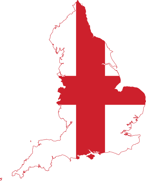
England's administrative region, such as Isle of Wight. Reproduced from the regions map, and the flag shape used in this image.
487:
443:
1194:
1344:
764:
734:
704:
674:
644:
1111:
614:
1106:
450:"}},"text\/plain":{"en":{"P275":"Creative Commons Attribution-ShareAlike 3.0 Unported"}}}}": -->
981:
1413:
1126:
1131:
1379:
69:
211:
73:
65:
61:
57:
53:
47:
473:
429:
1016:
193:
1424:
This file contains additional information, probably added from the digital camera or scanner used to create or digitize it.
1364:
871:
323:
110:
861:
82:
1339:
535:
413:
220:
497:
457:
388:
1274:
1026:
202:
1319:
813:
808:
783:
778:
753:
748:
723:
718:
693:
688:
663:
658:
633:
628:
1394:
916:
1249:
1389:
1224:
921:
901:
189:
168:
285:
1116:
1066:
844:
836:
1427:
If the file has been modified from its original state, some details may not fully reflect the modified file.
1359:
1279:
931:
891:
1284:
1269:
1219:
1209:
951:
322:– If you remix, transform, or build upon the material, you must distribute your contributions under the
896:
1141:
866:
406:"}},"text\/plain":{"en":{"P6216":"copyrighted"}}}}": -->
183:
163:
857:
The following pages on the
English Knowledge use this file (pages on other projects are not listed):
1259:
1164:
886:
881:
840:
832:
1046:
1041:
118:
1086:
1324:
1244:
1239:
1369:
1314:
1184:
1174:
1061:
906:
352:
1031:
282:
8:
1121:
603:
598:
234:
42:
1404:
1399:
1299:
1264:
1204:
1101:
247:
215:
197:
1011:
105:
378:
996:
991:
1329:
1349:
1334:
1309:
1294:
1289:
1234:
1091:
1036:
986:
976:
936:
651:(minor) adjust colour ever so slightly to be the same as the Flag of England file
1056:
1021:
876:
230:
946:
911:
794:
243:
224:
1354:
1304:
1254:
1214:
1199:
1169:
1076:
1071:
941:
824:
206:
545:
507:
467:
423:
1081:
1096:
1006:
971:
926:
1384:
1229:
1179:
1051:
1001:
961:
571:
Click on a date/time to view the file as it appeared at that time.
1189:
1159:
966:
956:
150:
1137:
Knowledge talk:WikiProject
Userboxes/New Userboxes/Archive 30
93:
87:(SVG file, nominally 485 × 601 pixels, file size: 101 KB)
831:{{Information |Description=Flag Map of England |Source=*
372:
Add a one-line explanation of what this file represents
855:
1150:
1112:
User:Tcr25/Userbox/User
England Counties Visited/doc
569:
474:
Creative
Commons Attribution-ShareAlike 3.0 Unported
448:
Creative
Commons Attribution-ShareAlike 3.0 Unported
117:
Commons is a freely licensed media file repository.
741:forgot to delete some cruft outside the page limit
1107:User:Tcr25/Userbox/User England Counties Visited
333:https://creativecommons.org/licenses/by-sa/3.0
98:
339:Creative Commons Attribution-Share Alike 3.0
263:
146:
135:
982:Mudeford, Stanpit and West Highcliffe (ward)
176:
157:
14:
1127:Knowledge:Userboxes/Location/United Kingdom
299:– to copy, distribute and transmit the work
46:Size of this PNG preview of this SVG file:
1152:The following other wikis use this file:
1132:Knowledge:Userboxes/Travel/United Kingdom
839:|Date=2011-01-25 20:41 (UTC) |Author=*
681:make page a little smaller (in pixels)
1017:Roman Catholic Diocese of Glastonbury
129:
872:Barnsley/Dearne Valley built-up area
286:Attribution-Share Alike 3.0 Unported
862:Accrington/Rossendale built-up area
562:
274:
269:
13:
1422:
377:
371:
260:
130:
80:
1456:
1429:
1027:Sir Richard Steele (public house)
376:
212:Northern_Ireland_location_map.svg
856:
362:
310:Under the following conditions:
281:This file is licensed under the
273:
268:
262:
97:
31:
21:
917:Geology of the English counties
359:
194:United_Kingdom_location_map.svg
1147:
922:Highcliffe and Walkford (ward)
902:Brownlow Hill (Liverpool ward)
566:
358:
252:) 20:50, 25 January 2011 (UTC)
26:
1:
1117:User:The Emperor of Byzantium
1067:Waltham Forest (legal forest)
845:File:England_location_map.svg
837:File:England_location_map.svg
36:
932:Huntingdon and Godmanchester
892:Briar Hill, Northamptonshire
852:
384:Items portrayed in this file
221:Europe_laea_location_map.svg
7:
1419:
952:Littledown and Iford (ward)
203:England_Regions_-_Blank.svg
10:
1461:
1156:Usage on ar.wikipedia.org
897:British NVC community SM10
324:same or compatible license
132:
1375:قالب:بذرة جغرافيا إنجلترا
1142:Template:England-geo-stub
867:Atherfield Clay Formation
563:
16:
887:Border Moors and Forests
882:Birkenhead built-up area
847:: *[[:File:United_Kingdo
841:File:Flag_of_England.svg
833:File:Flag_of_England.svg
361:
290:
190:England_location_map.svg
169:England_location_map.svg
104:This is a file from the
41:
1195:مقاطعة سومرست (إنجلترا)
1047:Tamworth Rural District
1042:Strangeways, Manchester
830:
800:
770:
740:
710:
680:
650:
620:
149:
138:Flag map of England.svg
108:. Information from its
1087:User:Asheiou/Userboxes
809:20:50, 25 January 2011
151:25 January 2011, 20:41
111:description page there
1345:جزر القناة الإنجليزية
1062:Victoria Park, Tipton
907:Brunswick, Manchester
1032:Southwest Approaches
711:clean up unused defs
70:1,653 × 2,048 pixels
1122:User talk:SteveGOLD
779:10:48, 21 June 2014
599:23:19, 13 July 2016
305:– to adapt the work
184:Flag_of_England.svg
164:Flag_of_England.svg
142:Flag Map of England
52:Other resolutions:
1102:User:Tcr25/Userbox
66:826 × 1,024 pixels
1448:
1447:
1414:more global usage
1380:ويسبري (ويلتشاير)
1148:Global file usage
1012:Rendlesham Forest
850:
749:15:49, 1 May 2016
719:15:52, 1 May 2016
689:16:45, 1 May 2016
659:16:52, 1 May 2016
629:17:41, 1 May 2016
458:copyright license
444:copyright license
370:
258:
257:
242:derivative work:
229:derivative work:
126:
125:
106:Wikimedia Commons
32:Global file usage
1452:
1430:
997:Noordhinder Bank
992:Nineveh, England
821:
791:
761:
731:
701:
671:
641:
621:+smaller islands
611:
573:
414:copyright status
400:copyright status
368:
346:
343:
340:
337:
334:
326:as the original.
283:Creative Commons
277:
276:
272:
271:
266:
265:
250:
237:
152:
139:
133:
122:
101:
100:
94:
88:
77:
74:485 × 601 pixels
62:620 × 768 pixels
58:387 × 480 pixels
54:194 × 240 pixels
48:484 × 600 pixels
1460:
1459:
1455:
1454:
1453:
1451:
1450:
1449:
1418:
1340:بوسطن (إنجلترا)
1146:
1092:User:Essexman03
1037:Stanford Warren
987:Newmarket Ridge
977:Moordown (ward)
937:Ilmington Downs
858:
851:
827:
819:
797:
789:
767:
759:
737:
729:
707:
699:
677:
669:
647:
639:
617:
609:
565:
564:
561:
560:
559:
558:
557:
556:
555:
554:
552:
542:
541:
540:
538:
523:
522:
521:
520:
519:
518:
517:
516:
514:
513:25 January 2011
504:
503:
502:
500:
485:
484:
483:
482:
481:
480:
479:
478:
476:
464:
463:
462:
460:
441:
440:
439:
438:
437:
436:
435:
434:
432:
420:
419:
418:
416:
397:
396:
395:
394:
393:
391:
375:
374:
373:
348:
347:
344:
341:
338:
335:
332:
331:
289:
278:
259:
248:
235:
137:
128:
127:
116:
115:
114:is shown below.
90:
86:
79:
78:
51:
12:
11:
5:
1458:
1446:
1445:
1442:
1438:
1437:
1434:
1421:
1416:of this file.
1410:
1409:
1408:
1407:
1402:
1397:
1392:
1387:
1382:
1377:
1372:
1367:
1365:مانشستر الكبرى
1362:
1357:
1352:
1347:
1342:
1337:
1332:
1327:
1322:
1320:هولوواي (لندن)
1317:
1312:
1307:
1302:
1297:
1292:
1287:
1282:
1277:
1272:
1267:
1262:
1257:
1252:
1247:
1242:
1237:
1232:
1227:
1222:
1217:
1212:
1207:
1202:
1197:
1192:
1187:
1182:
1177:
1172:
1167:
1162:
1149:
1145:
1144:
1139:
1134:
1129:
1124:
1119:
1114:
1109:
1104:
1099:
1094:
1089:
1084:
1079:
1074:
1069:
1064:
1059:
1057:Upland Britain
1054:
1049:
1044:
1039:
1034:
1029:
1024:
1022:Scapegoat Hill
1019:
1014:
1009:
1004:
999:
994:
989:
984:
979:
974:
969:
964:
959:
954:
949:
944:
939:
934:
929:
924:
919:
914:
909:
904:
899:
894:
889:
884:
879:
877:Birkbeck Fells
874:
869:
864:
854:
849:
848:
829:
825:
822:
816:
811:
806:
803:
802:
799:
795:
792:
786:
781:
776:
773:
772:
769:
766:BurritoBazooka
765:
762:
756:
751:
746:
743:
742:
739:
736:BurritoBazooka
735:
732:
726:
721:
716:
713:
712:
709:
706:BurritoBazooka
705:
702:
696:
691:
686:
683:
682:
679:
676:BurritoBazooka
675:
672:
666:
661:
656:
653:
652:
649:
646:BurritoBazooka
645:
642:
636:
631:
626:
623:
622:
619:
615:
612:
606:
601:
596:
592:
591:
588:
585:
582:
579:
576:
568:
553:
550:
548:
547:
546:
544:
543:
539:
534:
532:
531:
530:
529:
527:
515:
512:
510:
509:
508:
506:
505:
501:
496:
494:
493:
492:
491:
489:
477:
472:
470:
469:
468:
466:
465:
461:
456:
454:
453:
452:
451:
449:
445:
433:
428:
426:
425:
424:
422:
421:
417:
412:
410:
409:
408:
407:
405:
401:
392:
387:
385:
382:
381:
380:
379:
367:
366:
363:
360:
351:Uploaded with
330:
329:
328:
327:
317:
308:
307:
306:
300:
293:You are free:
280:
279:
261:
256:
255:
254:
253:
240:
227:
218:
209:
200:
187:
178:
174:
173:
172:
171:
166:
159:
155:
154:
148:
144:
143:
140:
131:
124:
123:
102:
92:
91:
45:
40:
39:
34:
29:
24:
19:
9:
6:
4:
3:
2:
1457:
1443:
1440:
1439:
1435:
1432:
1431:
1428:
1425:
1417:
1415:
1406:
1403:
1401:
1398:
1396:
1395:براد اون افون
1393:
1391:
1388:
1386:
1383:
1381:
1378:
1376:
1373:
1371:
1368:
1366:
1363:
1361:
1360:كان (إنجلترا)
1358:
1356:
1353:
1351:
1348:
1346:
1343:
1341:
1338:
1336:
1333:
1331:
1328:
1326:
1323:
1321:
1318:
1316:
1313:
1311:
1308:
1306:
1303:
1301:
1298:
1296:
1293:
1291:
1288:
1286:
1283:
1281:
1280:هايغيت (لندن)
1278:
1276:
1273:
1271:
1268:
1266:
1263:
1261:
1258:
1256:
1253:
1251:
1248:
1246:
1243:
1241:
1238:
1236:
1233:
1231:
1228:
1226:
1223:
1221:
1218:
1216:
1213:
1211:
1208:
1206:
1203:
1201:
1198:
1196:
1193:
1191:
1188:
1186:
1183:
1181:
1178:
1176:
1173:
1171:
1168:
1166:
1163:
1161:
1158:
1157:
1155:
1154:
1153:
1143:
1140:
1138:
1135:
1133:
1130:
1128:
1125:
1123:
1120:
1118:
1115:
1113:
1110:
1108:
1105:
1103:
1100:
1098:
1095:
1093:
1090:
1088:
1085:
1083:
1080:
1078:
1075:
1073:
1070:
1068:
1065:
1063:
1060:
1058:
1055:
1053:
1050:
1048:
1045:
1043:
1040:
1038:
1035:
1033:
1030:
1028:
1025:
1023:
1020:
1018:
1015:
1013:
1010:
1008:
1005:
1003:
1000:
998:
995:
993:
990:
988:
985:
983:
980:
978:
975:
973:
970:
968:
965:
963:
960:
958:
955:
953:
950:
948:
947:Kinson (ward)
945:
943:
940:
938:
935:
933:
930:
928:
925:
923:
920:
918:
915:
913:
912:Cnobheresburg
910:
908:
905:
903:
900:
898:
895:
893:
890:
888:
885:
883:
880:
878:
875:
873:
870:
868:
865:
863:
860:
859:
846:
842:
838:
834:
828:
823:
817:
815:
812:
810:
807:
805:
804:
798:
793:
787:
785:
782:
780:
777:
775:
774:
768:
763:
757:
755:
752:
750:
747:
745:
744:
738:
733:
727:
725:
722:
720:
717:
715:
714:
708:
703:
697:
695:
692:
690:
687:
685:
684:
678:
673:
667:
665:
662:
660:
657:
655:
654:
648:
643:
637:
635:
632:
630:
627:
625:
624:
618:
613:
607:
605:
602:
600:
597:
594:
593:
589:
586:
583:
580:
577:
575:
574:
572:
551:image/svg+xml
549:
537:
533:
511:
499:
495:
475:
471:
459:
455:
431:
427:
415:
411:
390:
386:
383:
364:
357:
356:
355:
354:
336:CC BY-SA 3.0
325:
321:
318:
315:
312:
311:
309:
304:
301:
298:
295:
294:
292:
291:
287:
284:
267:
251:
245:
241:
238:
232:
228:
226:
222:
219:
217:
213:
210:
208:
204:
201:
199:
195:
191:
188:
185:
181:
180:
179:
175:
170:
167:
165:
162:
161:
160:
156:
145:
141:
134:
120:
113:
112:
107:
103:
96:
95:
89:
84:
83:Original file
75:
71:
67:
63:
59:
55:
49:
44:
38:
35:
33:
30:
28:
25:
23:
20:
18:
15:
1426:
1423:
1411:
1275:باكينغهامشير
1250:جنوب يوركشير
1151:
1077:User:Apecrab
1072:Whittle Arch
942:Jurassic Way
570:
567:File history
353:derivativeFX
350:
349:
319:
313:
302:
296:
216:NordNordWest
198:NordNordWest
119:You can help
109:
81:
22:File history
1390:نوتنغهامشير
1285:سانت ألبانز
1225:نورثمبرلاند
1082:User:Arakui
430:copyrighted
404:copyrighted
320:share alike
314:attribution
136:Description
1270:بيدفوردشير
1220:أكسفوردشير
1210:لنكولنشاير
1097:User:Harrz
1007:Penhellick
972:Merseybank
927:Hill Manor
853:File usage
818:699 × 930
788:448 × 595
758:525 × 650
728:525 × 650
698:525 × 650
668:518 × 640
638:518 × 640
616:Stasyan117
608:485 × 601
584:Dimensions
536:media type
526:media type
27:File usage
1444:600.64789
1436:484.70749
1325:تاين ووير
1260:غلوسترشير
1245:غرب ساسكس
1240:شرق ساسكس
1165:كانتربيري
581:Thumbnail
578:Date/Time
498:inception
488:inception
1420:Metadata
1370:يوركشاير
1315:كينغزبري
1185:نوتنغهام
1175:هيستينغز
1052:The Leas
1002:Ocklynge
962:Ludgrove
820:(103 KB)
801:simplify
796:AnonMoos
760:(323 KB)
730:(292 KB)
610:(101 KB)
365:Captions
303:to remix
297:to share
288:license.
231:Spischot
37:Metadata
1405:بارنسلي
1400:تشبنهام
1330:نهر كام
1300:بيدفورد
1265:باركشير
1205:كورنوال
826:Fry1989
790:(83 KB)
700:(45 KB)
670:(41 KB)
640:(41 KB)
595:current
590:Comment
389:depicts
369:English
244:Fry1989
225:Alexrk2
85:
1441:Height
1350:وركشير
1335:تريسكو
1310:بروسلي
1295:ميدريج
1290:نابتون
1235:سوفولك
967:Meicen
957:Lolham
207:Ch1902
182:jjllhl
177:Author
158:Source
1433:Width
1412:View
1355:ساسكس
1305:أولني
1255:دورست
1215:نورفك
1200:ديفون
1170:نورتش
153:(UTC)
1385:واتن
1230:إسكس
1180:دوفر
843:: *
587:User
345:true
342:true
249:talk
236:talk
147:Date
17:File
1190:كنت
1160:باث
192:: *
223::
214::
205::
196::
72:|
68:|
64:|
60:|
56:|
50:.
835:*
246:(
239:)
233:(
186::
121:.
76:.
Text is available under the Creative Commons Attribution-ShareAlike License. Additional terms may apply.
