38:
482:"}},"text\/plain":{"en":{"":"inception"}}},"{\"value\":{\"time\":\"+2010-11-29T00:00:00Z\",\"timezone\":0,\"before\":0,\"after\":0,\"precision\":11,\"calendarmodel\":\"http:\\\/\\\/www.wikidata.org\\\/entity\\\/Q1985727\"},\"type\":\"time\"}":{"text\/html":{"en":{"P571":"29 November 2010"}},"text\/plain":{"en":{"P571":"29 November 2010"}}}}": -->
242:
248:
253:
94:
438:"}},"text\/plain":{"en":{"":"copyright license"}}},"{\"value\":{\"entity-type\":\"item\",\"numeric-id\":14946043,\"id\":\"Q14946043\"},\"type\":\"wikibase-entityid\"}":{"text\/html":{"en":{"P275":"
394:"}},"text\/plain":{"en":{"":"copyright status"}}},"{\"value\":{\"entity-type\":\"item\",\"numeric-id\":50423863,\"id\":\"Q50423863\"},\"type\":\"wikibase-entityid\"}":{"text\/html":{"en":{"P6216":"
881:
558:
390:
821:
300:– You must give appropriate credit, provide a link to the license, and indicate if changes were made. You may do so in any reasonable manner, but not in any way that suggests the licensor endorses you or your use.
668:
60:
56:
52:
48:
42:
801:
663:
105:
73:
439:
395:
391:
340:
479:
435:
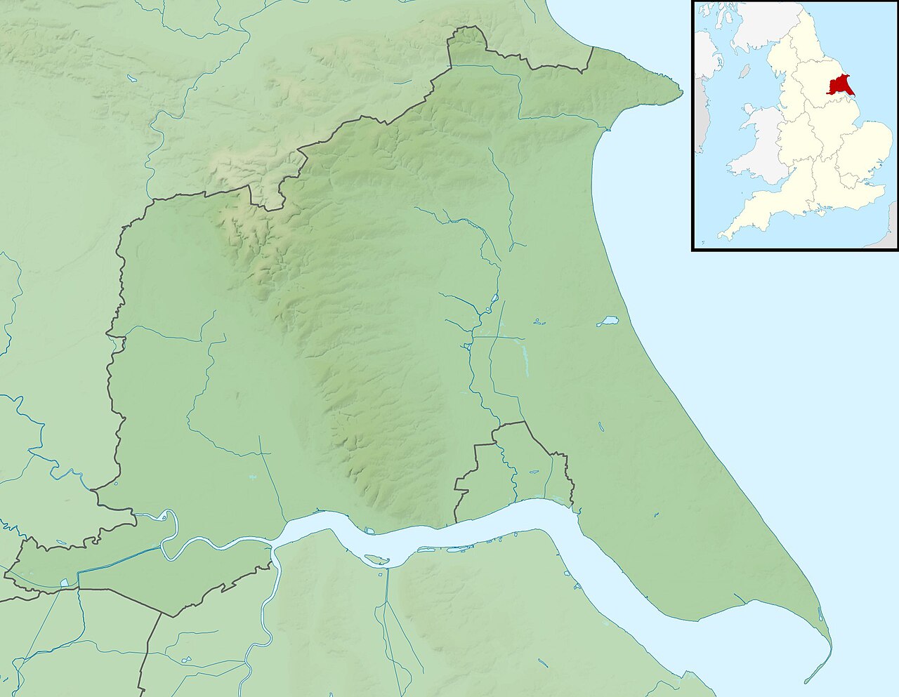
579:, UK. Equirectangular map projection on WGS 84 datum, with N/S stretched 165% Geographic limits: *West: 1.11W *East: 0.25E *North: 54.20N *South: 53.56N
791:
658:
786:
442:"}},"text\/plain":{"en":{"P275":"Creative Commons Attribution-ShareAlike 3.0 Unported"}}}}": -->
941:
231:
936:
465:
421:
706:
696:
841:
307:
686:
405:
489:
449:
380:
896:
557:
552:
64:
37:
916:
891:
653:
628:
202:
263:
906:
721:
971:
951:
781:
306:– If you remix, transform, or build upon the material, you must distribute your contributions under the
741:
398:"}},"text\/plain":{"en":{"P6216":"copyrighted"}}}}": -->
139:
811:
589:
The following pages on the
English Knowledge use this file (pages on other projects are not listed):
576:
766:
185:
113:
926:
911:
831:
633:
260:
866:
851:
8:
598:
593:
100:
370:
623:
603:
182:
648:
618:
219:
568:
206:
638:
613:
499:
459:
415:
608:
871:
856:
756:
145:
Equirectangular map projection on WGS 84 datum, with N/S stretched 165%
942:
Modül:Konum haritası/veri/Birleşik Krallık East Riding
Yorkshire/belge
643:
195:
Administrative borders and coastline data from
Boundary-Line product.
917:
Module:Location map/data/United
Kingdom East Riding of Yorkshire/doc
897:
Module:Location map/data/United
Kingdom East Riding of Yorkshire/doc
669:
Module:Location map/data/United
Kingdom East Riding of Yorkshire/doc
792:モジュール:Location map/data/United Kingdom East Riding of Yorkshire/doc
525:
Click on a date/time to view the file as it appeared at that time.
271:
Contains
Ordnance Survey data © Crown copyright and database right
937:
Modül:Konum haritası/veri/Birleşik Krallık East Riding
Yorkshire
907:
Module:Location map/data/United
Kingdom East Riding of Yorkshire
892:
Module:Location map/data/United
Kingdom East Riding of Yorkshire
664:
Module:Location map/data/United Kingdom East Riding of Yorkshire
787:モジュール:Location map/data/United Kingdom East Riding of Yorkshire
771:
802:ಟೆಂಪ್ಲೇಟು:Location map United Kingdom East Riding of Yorkshire
722:
Plantilya:Location map United Kingdom East Riding of Yorkshire
972:
Template:Location map United Kingdom East Riding of Yorkshire
782:
Template:Location map United Kingdom East Riding of Yorkshire
736:
952:
Batakan:Location map United Kingdom East Riding of Yorkshire
882:Шаблон:ПозКарта Великобритания Восточный райдинг Йоркшира
687:قالب:Location map United Kingdom East Riding of Yorkshire
341:
File:East Riding of Yorkshire UK district map (blank).svg
171:
88:
731:
364:
Add a one-line explanation of what this file represents
961:
746:
587:
78:(1,999 × 1,551 pixels, file size: 225 KB, MIME type:
742:
Plantilla:Mapa de localización de Yorkshire del Este
677:
523:
466:
Creative Commons Attribution-ShareAlike 3.0 Unported
440:
Creative Commons Attribution-ShareAlike 3.0 Unported
112:
Commons is a freely licensed media file repository.
761:
133:
East Riding of Yorkshire UK relief location map.jpg
927:Mall:Kartposition England East Riding of Yorkshire
198:All other geographic data from Meridian 2 product.
912:Module:Location map/data/East Riding of Yorkshire
659:Module:Location map/data/East Riding of Yorkshire
832:Sjabloon:Positiekaart East Riding of Yorkshire
767:Modèle:Géolocalisation/Yorkshire de l'Est
317:https://creativecommons.org/licenses/by-sa/3.0
93:
575:{{Information |Description=Relief map of the
323:Creative Commons Attribution-Share Alike 3.0
241:
226:
167:
130:
336:
215:
192:Relief data from Land-Form Panorama product.
177:
14:
283:– to copy, distribute and transmit the work
679:The following other wikis use this file:
867:Moduł:Mapa/dane/East Riding of Yorkshire
852:Moduł:Mapa/dane/East Riding of Yorkshire
812:Veidne:VietasKarte Jorkšīras Īstraidinga
712:Шаблон:ПК Великобритания Източен Йоркшър
822:Шаблон:ПолКарта Источен Рајдинг Јоркшир
124:
264:Attribution-Share Alike 3.0 Unported
222:, created using Ordnance Survey data
516:
252:
247:
13:
369:
363:
238:
125:
71:
985:
368:
588:
354:
294:Under the following conditions:
259:This file is licensed under the
251:
246:
240:
92:
31:
21:
654:User:DutchTreat/Projects/Places
351:
888:Usage on simple.wikipedia.org
674:
629:River Hull tidal surge barrier
520:
350:
26:
1:
584:
376:Items portrayed in this file
7:
948:Usage on war.wikipedia.org
757:Bataille de Stamford Bridge
718:Usage on ceb.wikipedia.org
693:Usage on arz.wikipedia.org
10:
990:
968:Usage on zh.wikipedia.org
958:Usage on www.wikidata.org
933:Usage on tr.wikipedia.org
923:Usage on sv.wikipedia.org
903:Usage on si.wikipedia.org
878:Usage on ru.wikipedia.org
863:Usage on pl.wikibooks.org
848:Usage on pl.wikipedia.org
838:Usage on os.wikipedia.org
828:Usage on nl.wikipedia.org
818:Usage on mk.wikipedia.org
808:Usage on lv.wikipedia.org
798:Usage on kn.wikipedia.org
778:Usage on ja.wikipedia.org
753:Usage on fr.wikipedia.org
728:Usage on es.wikipedia.org
703:Usage on bg.wikipedia.org
683:Usage on ar.wikipedia.org
308:same or compatible license
127:
517:
16:
577:East Riding of Yorkshire
353:
274:
203:England location map.svg
140:East Riding of Yorkshire
99:This is a file from the
36:
574:
553:01:33, 29 November 2011
170:
103:. Information from its
872:Moduł:Mapa/dane/GB-ERY
857:Moduł:Mapa/dane/GB-ERY
106:description page there
41:Size of this preview:
634:Siege of Hull (1643)
65:1,999 × 1,551 pixels
289:– to adapt the work
201:Inset derived from
148:Geographic limits:
47:Other resolutions:
772:Wolds du Yorkshire
599:Bishop Wilton Wold
138:Relief map of the
61:1,280 × 993 pixels
675:Global file usage
594:Bewholme Vicarage
582:
450:copyright license
436:copyright license
362:
347:
346:
235:
232:Reusing this file
121:
120:
101:Wikimedia Commons
32:Global file usage
981:
737:Cabo Flamborough
707:Бевърли (Англия)
624:Pensana Salt End
604:Flamborough Head
565:
527:
505:29 November 2010
406:copyright status
392:copyright status
360:
330:
327:
324:
321:
318:
310:as the original.
272:
261:Creative Commons
255:
254:
250:
249:
244:
243:
229:
173:
172:29 November 2010
134:
128:
117:
96:
95:
89:
83:
81:
68:
57:990 × 768 pixels
53:619 × 480 pixels
49:309 × 240 pixels
43:773 × 600 pixels
989:
988:
984:
983:
982:
980:
979:
978:
673:
649:Winestead Drain
619:Lambwath Stream
590:
583:
571:
563:
519:
518:
515:
514:
513:
512:
511:
510:
509:
508:
506:
496:
495:
494:
492:
477:
476:
475:
474:
473:
472:
471:
470:
468:
456:
455:
454:
452:
433:
432:
431:
430:
429:
428:
427:
426:
424:
412:
411:
410:
408:
389:
388:
387:
386:
385:
383:
367:
366:
365:
348:
332:
331:
328:
325:
322:
319:
316:
315:
273:
270:
267:
256:
183:Ordnance Survey
132:
123:
122:
111:
110:
109:is shown below.
85:
79:
77:
70:
69:
46:
12:
11:
5:
987:
977:
976:
975:
974:
966:
965:
964:
956:
955:
954:
946:
945:
944:
939:
931:
930:
929:
921:
920:
919:
914:
909:
901:
900:
899:
894:
886:
885:
884:
876:
875:
874:
869:
861:
860:
859:
854:
846:
845:
844:
842:Скæсæн Йоркшир
836:
835:
834:
826:
825:
824:
816:
815:
814:
806:
805:
804:
796:
795:
794:
789:
784:
776:
775:
774:
769:
764:
759:
751:
750:
749:
744:
739:
734:
726:
725:
724:
716:
715:
714:
709:
701:
700:
699:
697:يوركشاير وولدز
691:
690:
689:
676:
672:
671:
666:
661:
656:
651:
646:
641:
636:
631:
626:
621:
616:
611:
606:
601:
596:
586:
581:
580:
573:
569:
566:
562:1,999 × 1,551
560:
555:
550:
546:
545:
542:
539:
536:
533:
530:
522:
507:
504:
502:
501:
500:
498:
497:
493:
488:
486:
485:
484:
483:
481:
469:
464:
462:
461:
460:
458:
457:
453:
448:
446:
445:
444:
443:
441:
437:
425:
420:
418:
417:
416:
414:
413:
409:
404:
402:
401:
400:
399:
397:
393:
384:
379:
377:
374:
373:
372:
371:
359:
358:
355:
352:
345:
344:
338:
337:Other versions
334:
333:
314:
313:
312:
311:
301:
292:
291:
290:
284:
277:You are free:
268:
258:
257:
239:
236:
224:
223:
217:
213:
212:
211:
210:
199:
196:
193:
179:
175:
174:
169:
165:
164:
163:
162:
159:
156:
153:
135:
126:
119:
118:
97:
87:
86:
40:
35:
34:
29:
24:
19:
9:
6:
4:
3:
2:
986:
973:
970:
969:
967:
963:
960:
959:
957:
953:
950:
949:
947:
943:
940:
938:
935:
934:
932:
928:
925:
924:
922:
918:
915:
913:
910:
908:
905:
904:
902:
898:
895:
893:
890:
889:
887:
883:
880:
879:
877:
873:
870:
868:
865:
864:
862:
858:
855:
853:
850:
849:
847:
843:
840:
839:
837:
833:
830:
829:
827:
823:
820:
819:
817:
813:
810:
809:
807:
803:
800:
799:
797:
793:
790:
788:
785:
783:
780:
779:
777:
773:
770:
768:
765:
763:
760:
758:
755:
754:
752:
748:
745:
743:
740:
738:
735:
733:
730:
729:
727:
723:
720:
719:
717:
713:
710:
708:
705:
704:
702:
698:
695:
694:
692:
688:
685:
684:
682:
681:
680:
670:
667:
665:
662:
660:
657:
655:
652:
650:
647:
645:
642:
640:
639:Siemens Goole
637:
635:
632:
630:
627:
625:
622:
620:
617:
615:
612:
610:
607:
605:
602:
600:
597:
595:
592:
591:
578:
572:
567:
561:
559:
556:
554:
551:
548:
547:
543:
540:
537:
534:
531:
529:
528:
526:
503:
491:
487:
467:
463:
451:
447:
423:
419:
407:
403:
382:
378:
375:
356:
349:
342:
339:
335:
320:CC BY-SA 3.0
309:
305:
302:
299:
296:
295:
293:
288:
285:
282:
279:
278:
276:
275:
269:Attribution:
265:
262:
245:
237:
233:
228:
225:
221:
218:
214:
208:
204:
200:
197:
194:
191:
190:
189:
187:
184:
180:
176:
166:
161:South: 53.56N
160:
158:North: 54.20N
157:
154:
151:
150:
149:
146:
143:
141:
136:
129:
115:
108:
107:
102:
98:
91:
90:
84:
75:
74:Original file
66:
62:
58:
54:
50:
44:
39:
33:
30:
28:
25:
23:
20:
18:
15:
678:
614:Hornsea Mere
524:
521:File history
303:
297:
286:
280:
181:
147:
144:
137:
114:You can help
104:
72:
22:File history
609:Gypsey Race
422:copyrighted
396:copyrighted
343:- Blank map
304:share alike
298:attribution
155:East: 0.25E
152:West: 1.11W
131:Description
732:Cabo Spurn
585:File usage
538:Dimensions
227:Permission
80:image/jpeg
27:File usage
644:West Beck
570:Nilfanion
535:Thumbnail
532:Date/Time
490:inception
480:inception
220:Nilfanion
962:Q2600864
747:Petuaria
564:(225 KB)
357:Captions
287:to remix
281:to share
266:license.
207:Spischot
186:OpenData
549:current
544:Comment
381:depicts
361:English
76:
762:Humber
216:Author
178:Source
142:, UK.
541:User
329:true
326:true
168:Date
17:File
205:by
188:.
63:|
59:|
55:|
51:|
45:.
234:)
230:(
209:.
116:.
82:)
67:.

.svg)