640:"}},"text\/plain":{"en":{"":"coordinates of the point of view"}}},"{\"value\":{\"latitude\":51.748863,\"longitude\":-0.986267,\"altitude\":null,\"precision\":1.0e-6,\"globe\":\"http:\\\/\\\/www.wikidata.org\\\/entity\\\/Q2\"},\"type\":\"globecoordinate\"}":{"text\/html":{"en":{"P1259":"51\u00b044'55.907"N, 0\u00b059'10.561"W"}},"text\/plain":{"en":{"P1259":"51\u00b044'55.907\"N, 0\u00b059'10.561\"W"}}},"{\"value\":{\"entity-type\":\"property\",\"numeric-id\":7787,\"id\":\"P7787\"},\"type\":\"wikibase-entityid\"}":{"text\/html":{"en":{"":"
708:"}},"text\/plain":{"en":{"":"coordinates of depicted place"}}},"{\"value\":{\"latitude\":51.74877,\"longitude\":-0.98612,\"altitude\":null,\"precision\":1.0e-5,\"globe\":\"http:\\\/\\\/www.wikidata.org\\\/entity\\\/Q2\"},\"type\":\"globecoordinate\"}":{"text\/html":{"en":{"P9149":"51\u00b044'55.57"N, 0\u00b059'10.03"W"}},"text\/plain":{"en":{"P9149":"51\u00b044'55.57\"N, 0\u00b059'10.03\"W"}}},"{\"value\":{\"entity-type\":\"property\",\"numeric-id\":7787,\"id\":\"P7787\"},\"type\":\"wikibase-entityid\"}":{"text\/html":{"en":{"":"
814:"}},"text\/plain":{"en":{"":"checksum"}}},"{\"value\":\"3ff5345d662e6a59c9e51101e30a3d948246765c\",\"type\":\"string\"}":{"text\/html":{"en":{"P4092":"3ff5345d662e6a59c9e51101e30a3d948246765c"}},"text\/plain":{"en":{"P4092":"3ff5345d662e6a59c9e51101e30a3d948246765c"}}},"{\"value\":{\"entity-type\":\"property\",\"numeric-id\":459,\"id\":\"P459\"},\"type\":\"wikibase-entityid\"}":{"text\/html":{"en":{"":"
602:"}},"text\/plain":{"en":{"":"inception"}}},"{\"value\":{\"time\":\"+2017-11-18T00:00:00Z\",\"timezone\":0,\"before\":0,\"after\":0,\"precision\":11,\"calendarmodel\":\"http:\\\/\\\/www.wikidata.org\\\/entity\\\/Q1985727\"},\"type\":\"time\"}":{"text\/html":{"en":{"P571":"18 November 2017"}},"text\/plain":{"en":{"P571":"18 November 2017"}}}}": -->
378:
311:
261:
303:
253:
810:
275:
38:
346:
384:
389:
86:
818:"}},"text\/plain":{"en":{"":"determination method"}}},"{\"value\":{\"entity-type\":\"item\",\"numeric-id\":13414952,\"id\":\"Q13414952\"},\"type\":\"wikibase-entityid\"}":{"text\/html":{"en":{"P459":"
776:"}},"text\/plain":{"en":{"":"media type"}}},"{\"value\":\"image\\\/jpeg\",\"type\":\"string\"}":{"text\/html":{"en":{"P1163":"image\/jpeg"}},"text\/plain":{"en":{"P1163":"image\/jpeg"}}}}": -->
558:"}},"text\/plain":{"en":{"":"copyright license"}}},"{\"value\":{\"entity-type\":\"item\",\"numeric-id\":19068220,\"id\":\"Q19068220\"},\"type\":\"wikibase-entityid\"}":{"text\/html":{"en":{"P275":"
514:"}},"text\/plain":{"en":{"":"copyright status"}}},"{\"value\":{\"entity-type\":\"item\",\"numeric-id\":50423863,\"id\":\"Q50423863\"},\"type\":\"wikibase-entityid\"}":{"text\/html":{"en":{"P6216":"
881:"}},"text\/plain":{"en":{"":"data size"}}},"{\"value\":{\"amount\":\"+290390\",\"unit\":\"http:\\\/\\\/www.wikidata.org\\\/entity\\\/Q8799\"},\"type\":\"quantity\"}":{"text\/html":{"en":{"P3575":"290,390
971:"}},"text\/plain":{"en":{"":"width"}}},"{\"value\":{\"amount\":\"+1024\",\"unit\":\"http:\\\/\\\/www.wikidata.org\\\/entity\\\/Q355198\"},\"type\":\"quantity\"}":{"text\/html":{"en":{"P2049":"1,024
1054:
926:"}},"text\/plain":{"en":{"":"height"}}},"{\"value\":{\"amount\":\"+683\",\"unit\":\"http:\\\/\\\/www.wikidata.org\\\/entity\\\/Q355198\"},\"type\":\"quantity\"}":{"text\/html":{"en":{"P2048":"683
712:"}},"text\/plain":{"en":{"":"heading"}}},"{\"value\":{\"amount\":\"+157\",\"unit\":\"http:\\\/\\\/www.wikidata.org\\\/entity\\\/Q28390\"},\"type\":\"quantity\"}":{"text\/html":{"en":{"P7787":"157
644:"}},"text\/plain":{"en":{"":"heading"}}},"{\"value\":{\"amount\":\"+157\",\"unit\":\"http:\\\/\\\/www.wikidata.org\\\/entity\\\/Q28390\"},\"type\":\"quantity\"}":{"text\/html":{"en":{"P7787":"157
967:
244:
436:– You must give appropriate credit, provide a link to the license, and indicate if changes were made. You may do so in any reasonable manner, but not in any way that suggests the licensor endorses you or your use.
258:
308:
52:
48:
42:
65:
819:
559:
515:
97:
968:
923:
878:
811:
773:
709:
705:
641:
637:
511:
815:
599:
555:
562:"}},"text\/plain":{"en":{"P275":"Creative Commons Attribution-ShareAlike 2.0 Generic"}}}}": -->
1090:
181:
863:
585:
541:
318:
268:
353:
443:
1053:
1048:
56:
37:
982:
937:
892:
829:
783:
750:
723:
682:
655:
525:
856:
609:
569:
500:
399:
442:– If you remix, transform, or build upon the material, you must distribute your contributions under the
360:
on the
Geograph website for the photographer's contact details. The copyright on this image is owned by
885:"}},"text\/plain":{"en":{"P3575":"290,390 byte"}}}}": -->
975:"}},"text\/plain":{"en":{"P2049":"1,024 pixel"}}}}": -->
518:"}},"text\/plain":{"en":{"P6216":"copyrighted"}}}}": -->
1081:
The following pages on the
English Knowledge use this file (pages on other projects are not listed):
716:"}},"text\/plain":{"en":{"P7787":"157 degree"}}}}": -->
648:"}},"text\/plain":{"en":{"P7787":"157 degree"}}}}": -->
930:"}},"text\/plain":{"en":{"P2048":"683 pixel"}}}}": -->
105:
822:"}},"text\/plain":{"en":{"P459":"SHA-1"}}}}": -->
396:
197:
8:
340:
324:
274:
1064:
365:
92:
490:
213:
170:
160:
1085:
992:
947:
902:
839:
793:
733:
665:
619:
579:
535:
345:
357:
1021:
Click on a date/time to view the file as it appeared at that time.
310:
260:
295:
51° 44′ 55.6″ N, 0° 59′ 10″ W
245:
51° 44′ 55.9″ N, 0° 59′ 11″ W
149:
80:
484:
Add a one-line explanation of what this file represents
1108:
1079:
1099:
1019:
188:
Creative
Commons Attribution Share-alike license 2.0
104:
Commons is a freely licensed media file repository.
586:
Creative
Commons Attribution-ShareAlike 2.0 Generic
560:
Creative
Commons Attribution-ShareAlike 2.0 Generic
70:(1,024 × 683 pixels, file size: 284 KB, MIME type:
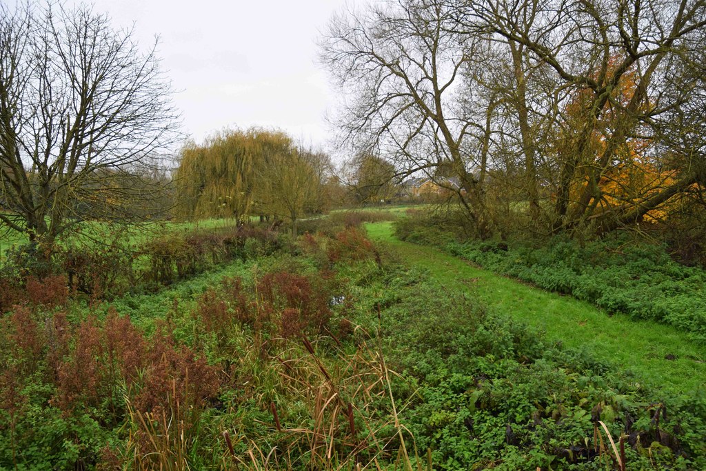
130:Cuttle Brook, Thame, Oxon (geograph 5610105).jpg
453:https://creativecommons.org/licenses/by-sa/2.0
85:
459:Creative Commons Attribution-Share Alike 2.0
377:
176:
145:
127:
1091:List of local nature reserves in Oxfordshire
166:
155:
14:
972:
927:
882:
713:
645:
419:– to copy, distribute and transmit the work
1101:The following other wikis use this file:
845:3ff5345d662e6a59c9e51101e30a3d948246765c
1071:Transferred from geograph.co.uk using
317:View this and other nearby images on:
267:View this and other nearby images on:
220:
116:
364:and is licensed for reuse under the
285:
235:
1012:
400:Attribution-Share Alike 2.0 Generic
388:
383:
368:Attribution-ShareAlike 2.0 license.
13:
489:
483:
374:
351:
134:
117:
63:
1122:
488:
1080:
656:coordinates of the point of view
638:coordinates of the point of view
474:
430:Under the following conditions:
395:This file is licensed under the
387:
382:
376:
344:
323:
309:
301:
273:
259:
251:
84:
31:
21:
471:
135:
1096:
1016:
470:
352:This image was taken from the
26:
1:
724:coordinates of depicted place
706:coordinates of depicted place
671:51°44'55.907"N, 0°59'10.561"W
1076:
496:Items portrayed in this file
336:
300:
250:
7:
739:51°44'55.57"N, 0°59'10.03"W
10:
1127:
1105:Usage on www.wikidata.org
444:same or compatible license
124:
119:
1013:
228:Cuttle Brook, Thame, Oxon
226:P L Chadwick /
209:Cuttle Brook, Thame, Oxon
207:P L Chadwick /
140:Cuttle Brook, Thame, Oxon
16:
473:
410:
91:This is a file from the
36:
1070:
198:required by the license
148:
95:. Information from its
358:this photograph's page
329:51.748770; -0.986120
279:51.748863; -0.986267
98:description page there
41:Size of this preview:
857:determination method
816:determination method
1049:21:41, 3 April 2020
425:– to adapt the work
47:Other resolutions:
57:1,024 × 683 pixels
1097:Global file usage
1074:
974:
929:
884:
715:
647:
570:copyright license
556:copyright license
482:
373:
372:
356:collection. See
334:
333:
284:
283:
233:
232:
201:
185:
182:Reusing this file
113:
112:
93:Wikimedia Commons
32:Global file usage
1118:
1061:
1023:
1001:
956:
911:
866:
861:
761:
760:
755:
693:
692:
687:
625:18 November 2017
526:copyright status
512:copyright status
480:
466:
463:
460:
457:
454:
446:as the original.
408:
397:Creative Commons
391:
390:
386:
385:
380:
379:
366:Creative Commons
354:Geograph project
348:
341:
330:
327:
313:
312:
306:
305:
304:
298:
297:
286:
280:
277:
263:
262:
256:
255:
254:
248:
247:
236:
195:
179:
151:
150:18 November 2017
139:
131:
125:
109:
88:
87:
81:
75:
73:
60:
53:640 × 427 pixels
49:320 × 213 pixels
43:800 × 534 pixels
1126:
1125:
1121:
1120:
1119:
1117:
1116:
1115:
1095:
1082:
1075:
1067:
1059:
1015:
1014:
1011:
1010:
1009:
1008:
1007:
1006:
1005:
1004:
1002:
999:
989:
988:
987:
985:
966:
965:
964:
963:
962:
961:
960:
959:
957:
954:
944:
943:
942:
940:
921:
920:
919:
918:
917:
916:
915:
914:
912:
909:
899:
898:
897:
895:
876:
875:
874:
873:
872:
871:
870:
869:
868:
867:
862:
859:
850:
849:
848:
846:
836:
835:
834:
832:
809:
808:
807:
806:
805:
804:
803:
802:
800:
790:
789:
788:
786:
771:
770:
769:
768:
767:
766:
765:
764:
763:
762:
758:
756:
753:
744:
743:
742:
740:
730:
729:
728:
726:
703:
702:
701:
700:
699:
698:
697:
696:
695:
694:
690:
688:
685:
676:
675:
674:
672:
662:
661:
660:
658:
635:
634:
633:
632:
631:
630:
629:
628:
626:
616:
615:
614:
612:
597:
596:
595:
594:
593:
592:
591:
590:
588:
576:
575:
574:
572:
553:
552:
551:
550:
549:
548:
547:
546:
544:
532:
531:
530:
528:
509:
508:
507:
506:
505:
503:
487:
486:
485:
468:
467:
464:
461:
458:
455:
452:
451:
409:
406:
403:
392:
369:
339:
328:
302:
293:
292:
289:Object location
278:
252:
243:
242:
239:Camera location
234:
223:
216:
204:
161:geograph.org.uk
141:
129:
122:
115:
114:
103:
102:
101:is shown below.
77:
71:
69:
62:
61:
46:
12:
11:
5:
1124:
1114:
1113:
1112:
1111:
1098:
1094:
1093:
1088:
1078:
1073:
1072:
1069:
1065:
1062:
1056:
1051:
1046:
1042:
1041:
1038:
1035:
1032:
1029:
1026:
1018:
1003:
997:
995:
994:
993:
991:
990:
986:
981:
979:
978:
977:
976:
970:
958:
952:
950:
949:
948:
946:
945:
941:
936:
934:
933:
932:
931:
925:
913:
907:
905:
904:
903:
901:
900:
896:
891:
889:
888:
887:
886:
880:
855:
854:
853:
852:
851:
847:
844:
842:
841:
840:
838:
837:
833:
828:
826:
825:
824:
823:
821:
817:
813:
801:
798:
796:
795:
794:
792:
791:
787:
782:
780:
779:
778:
777:
775:
749:
748:
747:
746:
745:
741:
738:
736:
735:
734:
732:
731:
727:
722:
720:
719:
718:
717:
711:
707:
681:
680:
679:
678:
677:
673:
670:
668:
667:
666:
664:
663:
659:
654:
652:
651:
650:
649:
643:
639:
627:
624:
622:
621:
620:
618:
617:
613:
608:
606:
605:
604:
603:
601:
589:
584:
582:
581:
580:
578:
577:
573:
568:
566:
565:
564:
563:
561:
557:
545:
540:
538:
537:
536:
534:
533:
529:
524:
522:
521:
520:
519:
517:
513:
504:
499:
497:
494:
493:
492:
491:
479:
478:
475:
472:
450:
449:
448:
447:
437:
428:
427:
426:
420:
413:You are free:
404:
394:
393:
375:
371:
370:
349:
338:
335:
332:
331:
321:
315:
290:
282:
281:
271:
265:
240:
231:
230:
224:
221:
218:
217:
212:
205:
202:
190:
189:
186:
174:
173:
168:
164:
163:
157:
153:
152:
147:
143:
142:
132:
123:
121:
118:
111:
110:
89:
79:
78:
40:
35:
34:
29:
24:
19:
9:
6:
4:
3:
2:
1123:
1110:
1107:
1106:
1104:
1103:
1102:
1092:
1089:
1087:
1084:
1083:
1068:
1063:
1057:
1055:
1052:
1050:
1047:
1044:
1043:
1039:
1036:
1033:
1030:
1027:
1025:
1024:
1022:
996:
984:
980:
951:
939:
935:
906:
894:
890:
865:
858:
843:
831:
827:
797:
785:
781:
752:
737:
725:
721:
684:
669:
657:
653:
623:
611:
607:
587:
583:
571:
567:
543:
539:
527:
523:
502:
498:
495:
476:
469:
456:CC BY-SA 2.0
445:
441:
438:
435:
432:
431:
429:
424:
421:
418:
415:
414:
412:
411:
405:Attribution:
401:
398:
381:
367:
363:
359:
355:
350:
347:
343:
342:
326:
322:
320:
319:OpenStreetMap
316:
314:
296:
291:
288:
287:
276:
272:
270:
269:OpenStreetMap
266:
264:
246:
241:
238:
237:
229:
225:
219:
215:
211: /
210:
206:
199:
194:
192:
191:
187:
183:
178:
175:
172:
169:
165:
162:
158:
154:
144:
138:
133:
126:
107:
100:
99:
94:
90:
83:
82:
76:
67:
66:Original file
58:
54:
50:
44:
39:
33:
30:
28:
25:
23:
20:
18:
15:
1100:
1086:Cuttle Brook
1066:Dudley Miles
1058:1,024 × 683
1020:
1017:File history
439:
433:
422:
416:
407:P L Chadwick
362:P L Chadwick
361:
299:
249:
227:
214:CC BY-SA 2.0
208:
171:P L Chadwick
136:
106:You can help
96:
64:
22:File history
542:copyrighted
516:copyrighted
440:share alike
434:attribution
193:Attribution
128:Description
1077:File usage
1034:Dimensions
799:image/jpeg
784:media type
774:media type
177:Permission
72:image/jpeg
27:File usage
1109:Q15212231
1031:Thumbnail
1028:Date/Time
893:data size
879:data size
610:inception
600:inception
337:Licensing
222:InfoField
203:InfoField
137:English:
1060:(284 KB)
908:290,390
830:checksum
812:checksum
477:Captions
423:to remix
417:to share
402:license.
1045:current
1040:Comment
751:heading
710:heading
683:heading
642:heading
501:depicts
481:English
120:Summary
68:
998:1,024
938:height
924:height
759:degree
714:degree
691:degree
646:degree
307:
257:
167:Author
156:Source
1000:pixel
983:width
973:pixel
969:width
955:pixel
928:pixel
864:SHA-1
820:SHA-1
159:From
1037:User
953:683
910:byte
883:byte
757:157
689:157
465:true
462:true
146:Date
17:File
860::
754::
686::
55:|
51:|
45:.
200:)
196:(
184:)
180:(
108:.
74:)
59:.
Text is available under the Creative Commons Attribution-ShareAlike License. Additional terms may apply.
.jpg)
.jpg¶ms=051.748863_N_-000.986267_E_globe:Earth_type:camera_source:geograph-osgb36(SP70080606)_heading:157.00&language=en)
.jpg¶ms=051.748770_N_-000.986120_E_globe:Earth_class:object_type:object_source:geograph-osgb36(SP70090605)_heading:157.00&language=en)
