1077:"}},"text\/plain":{"en":{"":"coordinates of the point of view"}}},"{\"value\":{\"latitude\":58.883873562862796,\"longitude\":-2.8977122764779235,\"altitude\":null,\"precision\":0.0001,\"globe\":\"http:\\\/\\\/www.wikidata.org\\\/entity\\\/Q2\"},\"type\":\"globecoordinate\"}":{"text\/html":{"en":{"P1259":"58\u00b053'2.0"N, 2\u00b053'51.7"W"}},"text\/plain":{"en":{"P1259":"58\u00b053'2.0\"N, 2\u00b053'51.7\"W"}}},"{\"value\":{\"entity-type\":\"property\",\"numeric-id\":7787,\"id\":\"P7787\"},\"type\":\"wikibase-entityid\"}":{"text\/html":{"en":{"":"
1265:"}},"text\/plain":{"en":{"":"checksum"}}},"{\"value\":\"2cf8375349e4586f5284c94554175702de8c418f\",\"type\":\"string\"}":{"text\/html":{"en":{"P4092":"2cf8375349e4586f5284c94554175702de8c418f"}},"text\/plain":{"en":{"P4092":"2cf8375349e4586f5284c94554175702de8c418f"}}},"{\"value\":{\"entity-type\":\"property\",\"numeric-id\":459,\"id\":\"P459\"},\"type\":\"wikibase-entityid\"}":{"text\/html":{"en":{"":"
1145:"}},"text\/plain":{"en":{"":"coordinates of depicted place"}}},"{\"value\":{\"latitude\":58.88258956444391,\"longitude\":-2.902015189519356,\"altitude\":null,\"precision\":0.0001,\"globe\":\"http:\\\/\\\/www.wikidata.org\\\/entity\\\/Q2\"},\"type\":\"globecoordinate\"}":{"text\/html":{"en":{"P9149":"58\u00b052'57.4"N, 2\u00b054'7.2"W"}},"text\/plain":{"en":{"P9149":"58\u00b052'57.4\"N, 2\u00b054'7.2\"W"}}}}": -->
38:
788:"}},"text\/plain":{"en":{"":"author name string"}}},"{\"value\":\"Russel Wills\",\"type\":\"string\"}":{"text\/html":{"en":{"P2093":"Russel Wills"}},"text\/plain":{"en":{"P2093":"Russel Wills"}}},"{\"value\":{\"entity-type\":\"property\",\"numeric-id\":1476,\"id\":\"P1476\"},\"type\":\"wikibase-entityid\"}":{"text\/html":{"en":{"":"
633:"}},"text\/plain":{"en":{"":"author name string"}}},"{\"value\":\"Russel Wills\",\"type\":\"string\"}":{"text\/html":{"en":{"P2093":"Russel Wills"}},"text\/plain":{"en":{"P2093":"Russel Wills"}}},"{\"value\":{\"entity-type\":\"property\",\"numeric-id\":3831,\"id\":\"P3831\"},\"type\":\"wikibase-entityid\"}":{"text\/html":{"en":{"":"
403:
337:
281:
235:
214:
198:
182:
166:
149:
1039:"}},"text\/plain":{"en":{"":"inception"}}},"{\"value\":{\"time\":\"+1995-07-00T00:00:00Z\",\"timezone\":0,\"before\":0,\"after\":0,\"precision\":10,\"calendarmodel\":\"http:\\\/\\\/www.wikidata.org\\\/entity\\\/Q1985727\"},\"type\":\"time\"}":{"text\/html":{"en":{"P571":"July 1995"}},"text\/plain":{"en":{"P571":"July 1995"}}}}": -->
916:
344:
296:
776:
1261:
310:
381:
427:
432:
90:
784:"}},"text\/plain":{"en":{"P275":"Creative Commons Attribution-ShareAlike 2.0 Generic"}}},"{\"value\":{\"entity-type\":\"property\",\"numeric-id\":2093,\"id\":\"P2093\"},\"type\":\"wikibase-entityid\"}":{"text\/html":{"en":{"":"
932:"}},"text\/plain":{"en":{"P973":"https:\/\/www.geograph.org.uk\/photo\/3223965"}}},"{\"value\":{\"entity-type\":\"property\",\"numeric-id\":137,\"id\":\"P137\"},\"type\":\"wikibase-entityid\"}":{"text\/html":{"en":{"":"
924:"}},"text\/plain":{"en":{"P7482":"file available on the internet"}}},"{\"value\":{\"entity-type\":\"property\",\"numeric-id\":973,\"id\":\"P973\"},\"type\":\"wikibase-entityid\"}":{"text\/html":{"en":{"":"
940:"}},"text\/plain":{"en":{"P137":"Geograph Britain and Ireland"}}},"{\"value\":{\"entity-type\":\"property\",\"numeric-id\":7384,\"id\":\"P7384\"},\"type\":\"wikibase-entityid\"}":{"text\/html":{"en":{"":"
637:"}},"text\/plain":{"en":{"":"object of statement has role"}}},"{\"value\":{\"entity-type\":\"item\",\"numeric-id\":33231,\"id\":\"Q33231\"},\"type\":\"wikibase-entityid\"}":{"text\/html":{"en":{"P3831":"
1269:"}},"text\/plain":{"en":{"":"determination method"}}},"{\"value\":{\"entity-type\":\"item\",\"numeric-id\":13414952,\"id\":\"Q13414952\"},\"type\":\"wikibase-entityid\"}":{"text\/html":{"en":{"P459":"
1227:"}},"text\/plain":{"en":{"":"media type"}}},"{\"value\":\"image\\\/jpeg\",\"type\":\"string\"}":{"text\/html":{"en":{"P1163":"image\/jpeg"}},"text\/plain":{"en":{"P1163":"image\/jpeg"}}}}": -->
1183:"}},"text\/plain":{"en":{"":"location of creation"}}},"{\"value\":{\"entity-type\":\"item\",\"numeric-id\":100166,\"id\":\"Q100166\"},\"type\":\"wikibase-entityid\"}":{"text\/html":{"en":{"P1071":"
780:"}},"text\/plain":{"en":{"":"copyright license"}}},"{\"value\":{\"entity-type\":\"item\",\"numeric-id\":19068220,\"id\":\"Q19068220\"},\"type\":\"wikibase-entityid\"}":{"text\/html":{"en":{"P275":"
736:"}},"text\/plain":{"en":{"":"copyright status"}}},"{\"value\":{\"entity-type\":\"item\",\"numeric-id\":50423863,\"id\":\"Q50423863\"},\"type\":\"wikibase-entityid\"}":{"text\/html":{"en":{"P6216":"
920:"}},"text\/plain":{"en":{"":"source of file"}}},"{\"value\":{\"entity-type\":\"item\",\"numeric-id\":74228490,\"id\":\"Q74228490\"},\"type\":\"wikibase-entityid\"}":{"text\/html":{"en":{"P7482":"
1332:"}},"text\/plain":{"en":{"":"data size"}}},"{\"value\":{\"amount\":\"+217659\",\"unit\":\"http:\\\/\\\/www.wikidata.org\\\/entity\\\/Q8799\"},\"type\":\"quantity\"}":{"text\/html":{"en":{"P3575":"217,659
1377:"}},"text\/plain":{"en":{"":"height"}}},"{\"value\":{\"amount\":\"+1008\",\"unit\":\"http:\\\/\\\/www.wikidata.org\\\/entity\\\/Q355198\"},\"type\":\"quantity\"}":{"text\/html":{"en":{"P2048":"1,008
641:"}},"text\/plain":{"en":{"P3831":"photographer"}}},"{\"value\":{\"entity-type\":\"property\",\"numeric-id\":2699,\"id\":\"P2699\"},\"type\":\"wikibase-entityid\"}":{"text\/html":{"en":{"":"
1422:"}},"text\/plain":{"en":{"":"width"}}},"{\"value\":{\"amount\":\"+1600\",\"unit\":\"http:\\\/\\\/www.wikidata.org\\\/entity\\\/Q355198\"},\"type\":\"quantity\"}":{"text\/html":{"en":{"P2049":"1,600
548:"}},"text\/plain":{"en":{"P180":"road"}}},"{\"value\":{\"entity-type\":\"item\",\"numeric-id\":18691599,\"id\":\"Q18691599\"},\"type\":\"wikibase-entityid\"}":{"text\/html":{"en":{"P180":"
1505:
1081:"}},"text\/plain":{"en":{"":"heading"}}},"{\"value\":{\"amount\":\"+247\",\"unit\":\"http:\\\/\\\/www.wikidata.org\\\/entity\\\/Q28390\"},\"type\":\"quantity\"}":{"text\/html":{"en":{"P7787":"247
936:"}},"text\/plain":{"en":{"":"operator"}}},"{\"value\":{\"entity-type\":\"item\",\"numeric-id\":1503119,\"id\":\"Q1503119\"},\"type\":\"wikibase-entityid\"}":{"text\/html":{"en":{"P137":"
876:"}},"text\/plain":{"en":{"":"instance of"}}},"{\"value\":{\"entity-type\":\"item\",\"numeric-id\":125191,\"id\":\"Q125191\"},\"type\":\"wikibase-entityid\"}":{"text\/html":{"en":{"P31":"
544:"}},"text\/plain":{"en":{"P180":"coast"}}},"{\"value\":{\"entity-type\":\"item\",\"numeric-id\":34442,\"id\":\"Q34442\"},\"type\":\"wikibase-entityid\"}":{"text\/html":{"en":{"P180":"
540:"}},"text\/plain":{"en":{"":"depicts"}}},"{\"value\":{\"entity-type\":\"item\",\"numeric-id\":93352,\"id\":\"Q93352\"},\"type\":\"wikibase-entityid\"}":{"text\/html":{"en":{"P180":"
629:"}},"text\/plain":{"en":{"":"creator"}}},"{\"value\":{\"entity-type\":\"property\",\"numeric-id\":2093,\"id\":\"P2093\"},\"type\":\"wikibase-entityid\"}":{"text\/html":{"en":{"":"
1418:
329:
482:– You must give appropriate credit, provide a link to the license, and indicate if changes were made. You may do so in any reasonable manner, but not in any way that suggests the licensor endorses you or your use.
293:
341:
56:
52:
48:
42:
101:
69:
945:
1270:
921:
781:
737:
549:
937:
1184:
877:
638:
545:
541:
1419:
1374:
1329:
1262:
1224:
1180:
1142:
1078:
1074:
941:
917:
789:
785:
733:
642:
634:
630:
929:
646:
1266:
1036:
933:
925:
777:
626:
537:
873:
148:
1603:
336:
280:
234:
197:
402:
213:
181:
165:
1515:
1569:
649:"}},"text\/plain":{"en":{"P2699":"https:\/\/www.geograph.org.uk\/profile\/23874"}}}}": -->
1314:
971:
822:
763:
612:
351:
303:
1006:
388:
1547:
This file contains additional information, probably added from the digital camera or scanner used to create or digitize it.
1210:
903:
489:
703:
595:
578:
1504:
1499:
1433:
1388:
1343:
1280:
1234:
1194:
1152:
1119:
1092:
1014:
955:
848:
835:
747:
711:
696:
683:
60:
37:
1307:
1046:
999:
984:
806:
656:
562:
887:
799:"}},"text\/plain":{"en":{"P1476":"Churchill Barrier No 2"}}}}": -->
1626:
442:
1550:
If the file has been modified from its original state, some details may not fully reflect the modified file.
552:"}},"text\/plain":{"en":{"P180":"military facility"}}}}": -->
1187:"}},"text\/plain":{"en":{"P1071":"Orkney Islands"}}}}": -->
488:– If you remix, transform, or build upon the material, you must distribute your contributions under the
395:
on the
Geograph website for the photographer's contact details. The copyright on this image is owned by
1336:"}},"text\/plain":{"en":{"P3575":"217,659 byte"}}}}": -->
1426:"}},"text\/plain":{"en":{"P2049":"1,600 pixel"}}}}": -->
1381:"}},"text\/plain":{"en":{"P2048":"1,008 pixel"}}}}": -->
740:"}},"text\/plain":{"en":{"P6216":"copyrighted"}}}}": -->
1532:
The following pages on the
English Knowledge use this file (pages on other projects are not listed):
1085:"}},"text\/plain":{"en":{"P7787":"247 degree"}}}}": -->
880:"}},"text\/plain":{"en":{"P31":"photograph"}}}}": -->
948:"}},"text\/plain":{"en":{"P7384":"3223965"}}}}": -->
109:
1273:"}},"text\/plain":{"en":{"P459":"SHA-1"}}}}": -->
1021:
991:
718:
796:
439:
8:
375:
1536:
357:
309:
252:
408:
96:
793:
1559:
241:
228:
247:
1522:
Uploading geograph.org.uk image from https://www.geograph.org.uk/photo/3223965
1692:
397:
208:
192:
1443:
1398:
1353:
1290:
1244:
1204:
1162:
1102:
1056:
965:
897:
816:
757:
666:
606:
589:
572:
246:
1674:
380:
240:
227:
392:
1472:
Click on a date/time to view the file as it appeared at that time.
343:
295:
330:
58° 52′ 57.3″ N, 2° 54′ 07″ W
274:
58° 53′ 01.9″ N, 2° 53′ 52″ W
84:
176:
136:
Churchill
Barrier No 2 - geograph.org.uk - 3223965.jpg
1530:
74:(1,600 × 1,008 pixels, file size: 213 KB, MIME type:
1470:
253:
108:
Commons is a freely licensed media file repository.
823:
Creative
Commons Attribution-ShareAlike 2.0 Generic
782:
Creative
Commons Attribution-ShareAlike 2.0 Generic
499:https://creativecommons.org/licenses/by-sa/2.0
89:
930:https:\/\/www.geograph.org.uk\/photo\/3223965
647:https:\/\/www.geograph.org.uk\/profile\/23874
505:Creative Commons Attribution-Share Alike 2.0
420:
172:
133:
204:
188:
14:
1423:
1378:
1333:
1082:
465:– to copy, distribute and transmit the work
401:
335:
279:
233:
212:
196:
180:
164:
147:
992:https://www.geograph.org.uk/photo/3223965
719:https://www.geograph.org.uk/profile/23874
1296:2cf8375349e4586f5284c94554175702de8c418f
350:View this and other nearby images on:
302:View this and other nearby images on:
120:
407:and is licensed for reuse under the
320:
264:
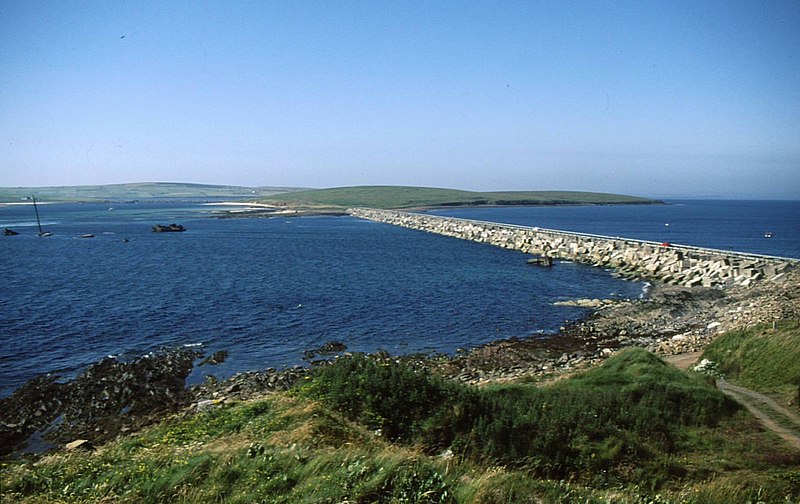
163:coast, road, military facility
1463:
443:Attribution-Share Alike 2.0 Generic
431:
426:
411:Attribution-ShareAlike 2.0 license.
13:
1545:
535:
529:
417:
386:
140:
121:
67:
1709:
1552:
534:
1531:
1093:coordinates of the point of view
1075:coordinates of the point of view
520:
476:Under the following conditions:
438:This file is licensed under the
430:
425:
419:
379:
356:
342:
308:
294:
286:
88:
21:
517:
1467:
972:file available on the internet
922:file available on the internet
516:
387:This image was taken from the
370:
26:
1:
1153:coordinates of depicted place
1143:coordinates of depicted place
285:
31:
1527:
1007:Geograph Britain and Ireland
938:Geograph Britain and Ireland
697:object of statement has role
635:object of statement has role
558:Items portrayed in this file
369:
193:Geograph Britain and Ireland
146:Churchill Barrier No 2
124:
7:
1637:Date and time of digitizing
1542:
10:
1714:
1666:Supported Flashpix version
858:
490:same or compatible license
130:
123:
1645:Meaning of each component
1610:File change date and time
1464:
855:
16:
1168:58°52'57.4"N, 2°54'7.2"W
1108:58°53'2.0"N, 2°53'51.7"W
1015:geograph.org.uk image ID
942:geograph.org.uk image ID
519:
456:
95:This is a file from the
36:
1640:11:59, 12 November 2012
1613:11:59, 12 November 2012
1521:
1500:18:12, 25 February 2022
175:
99:. Information from its
856:Churchill Barrier No 2
794:Churchill Barrier No 2
530:Churchill Barrier No 2
451:Churchill Barrier No 2
393:this photograph's page
362:58.882590; -2.902015
314:58.883874; -2.897712
102:description page there
41:Size of this preview:
1584:Horizontal resolution
1604:CanoScan Toolbox 5.0
1308:determination method
1267:determination method
1195:location of creation
1181:location of creation
453:by Russel Wills
61:1,600 × 1,008 pixels
1618:Y and C positioning
1592:Vertical resolution
1556:Camera manufacturer
471:– to adapt the work
47:Other resolutions:
1697:Auto white balance
1537:Churchill Barriers
836:author name string
786:author name string
684:author name string
631:author name string
57:1,024 × 645 pixels
1701:
1700:
1525:
1425:
1380:
1335:
1084:
807:copyright license
798:
795:
778:copyright license
613:military facility
550:military facility
528:
416:
415:
391:collection. See
367:
366:
319:
318:
262:
261:
257:
221:Place of creation
117:
116:
97:Wikimedia Commons
1705:
1553:
1512:
1474:
1452:
1407:
1362:
1317:
1312:
1130:
1129:
1124:
1024:
1019:
1009:
1004:
994:
989:
985:described at URL
926:described at URL
861:
860:
857:
853:
843:
840:
748:copyright status
734:copyright status
721:
716:
706:
701:
691:
688:
526:
512:
509:
506:
503:
500:
492:as the original.
454:
440:Creative Commons
434:
433:
429:
428:
423:
422:
409:Creative Commons
405:
389:Geograph project
383:
376:
372:
363:
360:
346:
345:
339:
333:
332:
321:
315:
312:
298:
297:
291:
290:
289:
283:
277:
276:
265:
255:
249:
243:
239:
237:
230:
216:
200:
184:
178:
168:
151:
145:
137:
131:
126:
113:
92:
91:
85:
79:
77:
64:
53:640 × 403 pixels
49:320 × 202 pixels
43:800 × 504 pixels
1713:
1712:
1708:
1707:
1706:
1704:
1703:
1702:
1541:
1533:
1526:
1518:
1510:
1466:
1465:
1462:
1461:
1460:
1459:
1458:
1457:
1456:
1455:
1453:
1450:
1440:
1439:
1438:
1436:
1417:
1416:
1415:
1414:
1413:
1412:
1411:
1410:
1408:
1405:
1395:
1394:
1393:
1391:
1372:
1371:
1370:
1369:
1368:
1367:
1366:
1365:
1363:
1360:
1350:
1349:
1348:
1346:
1327:
1326:
1325:
1324:
1323:
1322:
1321:
1320:
1319:
1318:
1313:
1310:
1301:
1300:
1299:
1297:
1287:
1286:
1285:
1283:
1260:
1259:
1258:
1257:
1256:
1255:
1254:
1253:
1251:
1241:
1240:
1239:
1237:
1222:
1221:
1220:
1219:
1218:
1217:
1216:
1215:
1213:
1201:
1200:
1199:
1197:
1178:
1177:
1176:
1175:
1174:
1173:
1172:
1171:
1169:
1159:
1158:
1157:
1155:
1140:
1139:
1138:
1137:
1136:
1135:
1134:
1133:
1132:
1131:
1127:
1125:
1122:
1113:
1112:
1111:
1109:
1099:
1098:
1097:
1095:
1072:
1071:
1070:
1069:
1068:
1067:
1066:
1065:
1063:
1053:
1052:
1051:
1049:
1034:
1033:
1032:
1031:
1030:
1029:
1028:
1027:
1026:
1025:
1020:
1017:
1011:
1010:
1005:
1002:
996:
995:
990:
987:
978:
977:
976:
974:
962:
961:
960:
958:
915:
914:
913:
912:
911:
910:
909:
908:
906:
894:
893:
892:
890:
871:
870:
869:
868:
867:
866:
865:
864:
863:
862:
854:
851:
845:
844:
841:
838:
829:
828:
827:
825:
813:
812:
811:
809:
775:
774:
773:
772:
771:
770:
769:
768:
766:
754:
753:
752:
750:
731:
730:
729:
728:
727:
726:
725:
724:
723:
722:
717:
714:
708:
707:
702:
699:
693:
692:
689:
686:
677:
676:
675:
673:
663:
662:
661:
659:
624:
623:
622:
621:
620:
619:
618:
617:
615:
604:
603:
602:
601:
600:
598:
587:
586:
585:
584:
583:
581:
569:
568:
567:
565:
533:
532:
531:
514:
513:
510:
507:
504:
501:
498:
497:
455:
449:
446:
435:
412:
374:
361:
328:
327:
324:Object location
313:
287:
272:
271:
268:Camera location
263:
224:
160:
152:
141:
135:
128:
119:
118:
107:
106:
105:is shown below.
81:
75:
73:
66:
65:
46:
12:
11:
5:
1711:
1699:
1698:
1695:
1689:
1688:
1685:
1681:
1680:
1677:
1671:
1670:
1667:
1663:
1662:
1661:
1660:
1659:does not exist
1657:
1654:
1651:
1646:
1642:
1641:
1638:
1634:
1633:
1630:
1623:
1622:
1619:
1615:
1614:
1611:
1607:
1606:
1601:
1597:
1596:
1593:
1589:
1588:
1585:
1581:
1580:
1577:
1573:
1572:
1570:CanoScan 4400F
1567:
1563:
1562:
1557:
1544:
1540:
1539:
1529:
1524:
1523:
1520:
1516:
1513:
1509:1,600 × 1,008
1507:
1502:
1497:
1493:
1492:
1489:
1486:
1483:
1480:
1477:
1469:
1454:
1448:
1446:
1445:
1444:
1442:
1441:
1437:
1432:
1430:
1429:
1428:
1427:
1421:
1409:
1403:
1401:
1400:
1399:
1397:
1396:
1392:
1387:
1385:
1384:
1383:
1382:
1376:
1364:
1358:
1356:
1355:
1354:
1352:
1351:
1347:
1342:
1340:
1339:
1338:
1337:
1331:
1306:
1305:
1304:
1303:
1302:
1298:
1295:
1293:
1292:
1291:
1289:
1288:
1284:
1279:
1277:
1276:
1275:
1274:
1272:
1268:
1264:
1252:
1249:
1247:
1246:
1245:
1243:
1242:
1238:
1233:
1231:
1230:
1229:
1228:
1226:
1214:
1211:Orkney Islands
1209:
1207:
1206:
1205:
1203:
1202:
1198:
1193:
1191:
1190:
1189:
1188:
1186:
1185:Orkney Islands
1182:
1170:
1167:
1165:
1164:
1163:
1161:
1160:
1156:
1151:
1149:
1148:
1147:
1146:
1144:
1118:
1117:
1116:
1115:
1114:
1110:
1107:
1105:
1104:
1103:
1101:
1100:
1096:
1091:
1089:
1088:
1087:
1086:
1080:
1076:
1064:
1061:
1059:
1058:
1057:
1055:
1054:
1050:
1045:
1043:
1042:
1041:
1040:
1038:
1013:
1012:
998:
997:
983:
982:
981:
980:
979:
975:
970:
968:
967:
966:
964:
963:
959:
956:source of file
954:
952:
951:
950:
949:
947:
943:
939:
935:
931:
927:
923:
919:
918:source of file
907:
902:
900:
899:
898:
896:
895:
891:
886:
884:
883:
882:
881:
879:
875:
847:
846:
834:
833:
832:
831:
830:
826:
821:
819:
818:
817:
815:
814:
810:
805:
803:
802:
801:
800:
791:
787:
783:
779:
767:
762:
760:
759:
758:
756:
755:
751:
746:
744:
743:
742:
741:
739:
735:
710:
709:
695:
694:
682:
681:
680:
679:
678:
674:
671:
669:
668:
667:
665:
664:
660:
655:
653:
652:
651:
650:
648:
644:
640:
636:
632:
628:
616:
611:
609:
608:
607:
605:
599:
594:
592:
591:
590:
588:
582:
577:
575:
574:
573:
571:
570:
566:
561:
559:
556:
555:
554:
553:
551:
547:
543:
539:
525:
524:
521:
518:
496:
495:
494:
493:
483:
474:
473:
472:
466:
459:You are free:
447:
437:
436:
418:
414:
413:
384:
373:
368:
365:
364:
354:
348:
325:
317:
316:
306:
300:
269:
260:
259:
254:United Kingdom
242:Orkney Islands
229:Orkney Islands
225:
222:
218:
217:
206:
202:
201:
190:
186:
185:
174:
170:
169:
161:
158:
154:
153:
138:
129:
127:
122:
115:
114:
93:
83:
82:
40:
35:
34:
29:
24:
19:
9:
6:
4:
3:
2:
1710:
1696:
1694:
1693:White balance
1691:
1690:
1686:
1683:
1682:
1678:
1676:
1673:
1672:
1668:
1665:
1664:
1658:
1655:
1652:
1649:
1648:
1647:
1644:
1643:
1639:
1636:
1635:
1631:
1628:
1625:
1624:
1620:
1617:
1616:
1612:
1609:
1608:
1605:
1602:
1600:Software used
1599:
1598:
1594:
1591:
1590:
1586:
1583:
1582:
1578:
1575:
1574:
1571:
1568:
1565:
1564:
1561:
1558:
1555:
1554:
1551:
1548:
1538:
1535:
1534:
1519:
1514:
1508:
1506:
1503:
1501:
1498:
1495:
1494:
1490:
1487:
1484:
1481:
1478:
1476:
1475:
1473:
1447:
1435:
1431:
1402:
1390:
1386:
1357:
1345:
1341:
1316:
1309:
1294:
1282:
1278:
1248:
1236:
1232:
1212:
1208:
1196:
1192:
1166:
1154:
1150:
1121:
1106:
1094:
1090:
1060:
1048:
1044:
1023:
1016:
1008:
1001:
993:
986:
973:
969:
957:
953:
905:
901:
889:
885:
850:
837:
824:
820:
808:
804:
765:
761:
749:
745:
720:
713:
705:
698:
685:
670:
658:
654:
614:
610:
597:
593:
580:
576:
564:
560:
557:
522:
515:
502:CC BY-SA 2.0
491:
487:
484:
481:
478:
477:
475:
470:
467:
464:
461:
460:
458:
457:
452:
448:Attribution:
444:
441:
424:
410:
406:
404:
399:
394:
390:
385:
382:
378:
377:
359:
355:
353:
352:OpenStreetMap
349:
347:
338:
331:
326:
323:
322:
311:
307:
305:
304:OpenStreetMap
301:
299:
282:
275:
270:
267:
266:
256:
250:
244:
236:
231:
226:
220:
219:
215:
210:
207:
203:
199:
194:
191:
187:
183:
171:
167:
162:
156:
155:
150:
144:
139:
132:
111:
104:
103:
98:
94:
87:
86:
80:
71:
70:Original file
62:
58:
54:
50:
44:
39:
33:
30:
28:
25:
23:
20:
18:
15:
1566:Camera model
1549:
1546:
1471:
1468:File history
842:Russel Wills
704:photographer
690:Russel Wills
639:photographer
485:
479:
468:
462:
450:
398:Russel Wills
396:
284:
209:Russel Wills
142:
110:You can help
100:
68:
22:File history
1684:File source
1675:Color space
1576:Orientation
1517:GeographBot
888:instance of
874:instance of
764:copyrighted
738:copyrighted
486:share alike
480:attribution
134:Description
1528:File usage
1485:Dimensions
1250:image/jpeg
1235:media type
1225:media type
904:photograph
878:photograph
672:some value
76:image/jpeg
27:File usage
1482:Thumbnail
1479:Date/Time
1344:data size
1330:data size
1062:July 1995
1047:inception
1037:inception
859:(English)
797:(English)
371:Licensing
223:InfoField
177:July 1995
159:InfoField
1621:Centered
1543:Metadata
1511:(213 KB)
1359:217,659
1281:checksum
1263:checksum
1000:operator
934:operator
523:Captions
469:to remix
463:to share
445:license.
248:Scotland
143:English:
32:Metadata
1629:version
1595:300 dpi
1587:300 dpi
1496:current
1491:Comment
1120:heading
1079:heading
1022:3223965
946:3223965
657:creator
627:creator
563:depicts
538:depicts
527:English
157:Depicts
125:Summary
72:
1579:Normal
1449:1,600
1404:1,008
1389:height
1375:height
1128:degree
1083:degree
400:
340:
334:
292:
278:
232:
211:
205:Author
195:
189:Source
179:
1560:Canon
1451:pixel
1434:width
1424:pixel
1420:width
1406:pixel
1379:pixel
1315:SHA-1
1271:SHA-1
849:title
790:title
579:coast
542:coast
1679:sRGB
1632:2.21
1627:Exif
1488:User
1361:byte
1334:byte
1126:247
596:road
546:road
511:true
508:true
173:Date
17:File
712:URL
643:URL
1656:Cr
1653:Cb
1311::
1123::
1018::
1003::
988::
852::
839::
715::
700::
687::
59:|
55:|
51:|
45:.
1687:1
1669:1
1650:Y
258:)
251:→
245:→
238:(
112:.
78:)
63:.
Text is available under the Creative Commons Attribution-ShareAlike License. Additional terms may apply.
