1050:"}},"text\/plain":{"en":{"":"coordinates of the point of view"}}},"{\"value\":{\"latitude\":54.897148999546644,\"longitude\":-2.941137893686479,\"altitude\":null,\"precision\":0.0001,\"globe\":\"http:\\\/\\\/www.wikidata.org\\\/entity\\\/Q2\"},\"type\":\"globecoordinate\"}":{"text\/html":{"en":{"P1259":"54\u00b053'49.6"N, 2\u00b056'28.0"W"}},"text\/plain":{"en":{"P1259":"54\u00b053'49.6\"N, 2\u00b056'28.0\"W"}}},"{\"value\":{\"entity-type\":\"property\",\"numeric-id\":7787,\"id\":\"P7787\"},\"type\":\"wikibase-entityid\"}":{"text\/html":{"en":{"":"
1238:"}},"text\/plain":{"en":{"":"checksum"}}},"{\"value\":\"740031e1c6cb6b6b3ca2f77783163496cfce7bc9\",\"type\":\"string\"}":{"text\/html":{"en":{"P4092":"740031e1c6cb6b6b3ca2f77783163496cfce7bc9"}},"text\/plain":{"en":{"P4092":"740031e1c6cb6b6b3ca2f77783163496cfce7bc9"}}},"{\"value\":{\"entity-type\":\"property\",\"numeric-id\":459,\"id\":\"P459\"},\"type\":\"wikibase-entityid\"}":{"text\/html":{"en":{"":"
1118:"}},"text\/plain":{"en":{"":"coordinates of depicted place"}}},"{\"value\":{\"latitude\":54.89669063331054,\"longitude\":-2.942531327044237,\"altitude\":null,\"precision\":0.0001,\"globe\":\"http:\\\/\\\/www.wikidata.org\\\/entity\\\/Q2\"},\"type\":\"globecoordinate\"}":{"text\/html":{"en":{"P9149":"54\u00b053'48.1"N, 2\u00b056'33.0"W"}},"text\/plain":{"en":{"P9149":"54\u00b053'48.1\"N, 2\u00b056'33.0\"W"}}}}": -->
761:"}},"text\/plain":{"en":{"":"author name string"}}},"{\"value\":\"Ashley Dace\",\"type\":\"string\"}":{"text\/html":{"en":{"P2093":"Ashley Dace"}},"text\/plain":{"en":{"P2093":"Ashley Dace"}}},"{\"value\":{\"entity-type\":\"property\",\"numeric-id\":1476,\"id\":\"P1476\"},\"type\":\"wikibase-entityid\"}":{"text\/html":{"en":{"":"
606:"}},"text\/plain":{"en":{"":"author name string"}}},"{\"value\":\"Ashley Dace\",\"type\":\"string\"}":{"text\/html":{"en":{"P2093":"Ashley Dace"}},"text\/plain":{"en":{"P2093":"Ashley Dace"}}},"{\"value\":{\"entity-type\":\"property\",\"numeric-id\":2699,\"id\":\"P2699\"},\"type\":\"wikibase-entityid\"}":{"text\/html":{"en":{"":"
397:
331:
275:
217:
196:
180:
164:
148:
131:
1012:"}},"text\/plain":{"en":{"":"inception"}}},"{\"value\":{\"time\":\"+2011-07-26T00:00:00Z\",\"timezone\":0,\"before\":0,\"after\":0,\"precision\":11,\"calendarmodel\":\"http:\\\/\\\/www.wikidata.org\\\/entity\\\/Q1985727\"},\"type\":\"time\"}":{"text\/html":{"en":{"P571":"26 July 2011"}},"text\/plain":{"en":{"P571":"26 July 2011"}}}}": -->
889:
338:
290:
749:
1234:
304:
375:
421:
426:
72:
757:"}},"text\/plain":{"en":{"P275":"Creative Commons Attribution-ShareAlike 2.0 Generic"}}},"{\"value\":{\"entity-type\":\"property\",\"numeric-id\":2093,\"id\":\"P2093\"},\"type\":\"wikibase-entityid\"}":{"text\/html":{"en":{"":"
614:"}},"text\/plain":{"en":{"P2699":"https:\/\/www.geograph.org.uk\/profile\/29497"}}},"{\"value\":{\"entity-type\":\"property\",\"numeric-id\":3831,\"id\":\"P3831\"},\"type\":\"wikibase-entityid\"}":{"text\/html":{"en":{"":"
905:"}},"text\/plain":{"en":{"P973":"https:\/\/www.geograph.org.uk\/photo\/2530219"}}},"{\"value\":{\"entity-type\":\"property\",\"numeric-id\":7384,\"id\":\"P7384\"},\"type\":\"wikibase-entityid\"}":{"text\/html":{"en":{"":"
897:"}},"text\/plain":{"en":{"P7482":"file available on the internet"}}},"{\"value\":{\"entity-type\":\"property\",\"numeric-id\":973,\"id\":\"P973\"},\"type\":\"wikibase-entityid\"}":{"text\/html":{"en":{"":"
618:"}},"text\/plain":{"en":{"":"object of statement has role"}}},"{\"value\":{\"entity-type\":\"item\",\"numeric-id\":33231,\"id\":\"Q33231\"},\"type\":\"wikibase-entityid\"}":{"text\/html":{"en":{"P3831":"
1242:"}},"text\/plain":{"en":{"":"determination method"}}},"{\"value\":{\"entity-type\":\"item\",\"numeric-id\":13414952,\"id\":\"Q13414952\"},\"type\":\"wikibase-entityid\"}":{"text\/html":{"en":{"P459":"
1156:"}},"text\/plain":{"en":{"":"location of creation"}}},"{\"value\":{\"entity-type\":\"item\",\"numeric-id\":1094110,\"id\":\"Q1094110\"},\"type\":\"wikibase-entityid\"}":{"text\/html":{"en":{"P1071":"
1200:"}},"text\/plain":{"en":{"":"media type"}}},"{\"value\":\"image\\\/jpeg\",\"type\":\"string\"}":{"text\/html":{"en":{"P1163":"image\/jpeg"}},"text\/plain":{"en":{"P1163":"image\/jpeg"}}}}": -->
753:"}},"text\/plain":{"en":{"":"copyright license"}}},"{\"value\":{\"entity-type\":\"item\",\"numeric-id\":19068220,\"id\":\"Q19068220\"},\"type\":\"wikibase-entityid\"}":{"text\/html":{"en":{"P275":"
709:"}},"text\/plain":{"en":{"":"copyright status"}}},"{\"value\":{\"entity-type\":\"item\",\"numeric-id\":50423863,\"id\":\"Q50423863\"},\"type\":\"wikibase-entityid\"}":{"text\/html":{"en":{"P6216":"
893:"}},"text\/plain":{"en":{"":"source of file"}}},"{\"value\":{\"entity-type\":\"item\",\"numeric-id\":74228490,\"id\":\"Q74228490\"},\"type\":\"wikibase-entityid\"}":{"text\/html":{"en":{"P7482":"
538:"}},"text\/plain":{"en":{"P180":"historic site"}}},"{\"value\":{\"entity-type\":\"item\",\"numeric-id\":1094110,\"id\":\"Q1094110\"},\"type\":\"wikibase-entityid\"}":{"text\/html":{"en":{"P180":"
1508:
1305:"}},"text\/plain":{"en":{"":"data size"}}},"{\"value\":{\"amount\":\"+166000\",\"unit\":\"http:\\\/\\\/www.wikidata.org\\\/entity\\\/Q8799\"},\"type\":\"quantity\"}":{"text\/html":{"en":{"P3575":"166,000
1350:"}},"text\/plain":{"en":{"":"height"}}},"{\"value\":{\"amount\":\"+531\",\"unit\":\"http:\\\/\\\/www.wikidata.org\\\/entity\\\/Q355198\"},\"type\":\"quantity\"}":{"text\/html":{"en":{"P2048":"531
1054:"}},"text\/plain":{"en":{"":"heading"}}},"{\"value\":{\"amount\":\"+247\",\"unit\":\"http:\\\/\\\/www.wikidata.org\\\/entity\\\/Q28390\"},\"type\":\"quantity\"}":{"text\/html":{"en":{"P7787":"247
917:"}},"text\/plain":{"en":{"":"operator"}}},"{\"value\":{\"entity-type\":\"item\",\"numeric-id\":1503119,\"id\":\"Q1503119\"},\"type\":\"wikibase-entityid\"}":{"text\/html":{"en":{"P137":"
849:"}},"text\/plain":{"en":{"":"instance of"}}},"{\"value\":{\"entity-type\":\"item\",\"numeric-id\":125191,\"id\":\"Q125191\"},\"type\":\"wikibase-entityid\"}":{"text\/html":{"en":{"P31":"
1395:"}},"text\/plain":{"en":{"":"width"}}},"{\"value\":{\"amount\":\"+800\",\"unit\":\"http:\\\/\\\/www.wikidata.org\\\/entity\\\/Q355198\"},\"type\":\"quantity\"}":{"text\/html":{"en":{"P2049":"800
534:"}},"text\/plain":{"en":{"":"depicts"}}},"{\"value\":{\"entity-type\":\"item\",\"numeric-id\":1081138,\"id\":\"Q1081138\"},\"type\":\"wikibase-entityid\"}":{"text\/html":{"en":{"P180":"
913:"}},"text\/plain":{"en":{"P7384":"2530219"}}},"{\"value\":{\"entity-type\":\"property\",\"numeric-id\":137,\"id\":\"P137\"},\"type\":\"wikibase-entityid\"}":{"text\/html":{"en":{"":"
602:"}},"text\/plain":{"en":{"":"creator"}}},"{\"value\":{\"entity-type\":\"property\",\"numeric-id\":2093,\"id\":\"P2093\"},\"type\":\"wikibase-entityid\"}":{"text\/html":{"en":{"":"
1391:
845:
909:"}},"text\/plain":{"en":{"":"geograph.org.uk image ID"}}},"{\"value\":\"2530219\",\"type\":\"string\"}":{"text\/html":{"en":{"P7384":"
267:
323:
476:– You must give appropriate credit, provide a link to the license, and indicate if changes were made. You may do so in any reasonable manner, but not in any way that suggests the licensor endorses you or your use.
335:
287:
910:
1243:
894:
754:
710:
1157:
918:
539:
535:
850:
83:
619:
51:
1392:
1347:
1302:
1235:
1197:
1153:
1115:
1051:
1047:
906:
890:
762:
758:
706:
615:
607:
603:
902:
611:
1239:
1009:
914:
898:
750:
599:
531:
846:
130:
1518:
330:
274:
216:
179:
396:
195:
163:
147:
1507:
1502:
1287:
944:
795:
736:
345:
297:
1183:
994:
585:
568:
382:
1570:
This file contains additional information, probably added from the digital camera or scanner used to create or digitize it.
876:
483:
691:
1406:
1361:
1316:
1253:
1207:
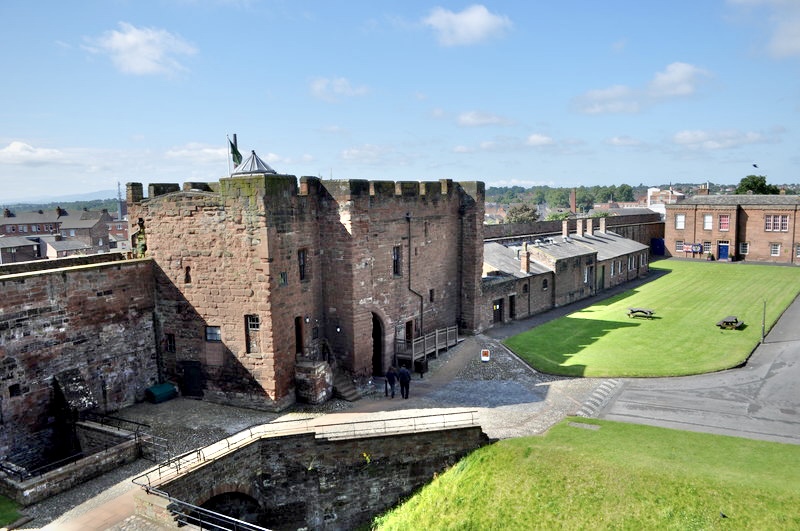
1167:
1125:
1092:
1065:
972:
928:
821:
808:
720:
684:
669:
656:
1280:
1019:
987:
957:
779:
629:
552:
921:"}},"text\/plain":{"en":{"P137":"Geograph Britain and Ireland"}}}}": -->
860:
1477:
1472:
42:
1611:
436:
1573:
If the file has been modified from its original state, some details may not fully reflect the modified file.
772:"}},"text\/plain":{"en":{"P1476":"Carlisle Castle"}}}}": -->
482:– If you remix, transform, or build upon the material, you must distribute your contributions under the
389:
on the
Geograph website for the photographer's contact details. The copyright on this image is owned by
1309:"}},"text\/plain":{"en":{"P3575":"166,000 byte"}}}}": -->
622:"}},"text\/plain":{"en":{"P3831":"photographer"}}}}": -->
713:"}},"text\/plain":{"en":{"P6216":"copyrighted"}}}}": -->
1535:
The following pages on the
English Knowledge use this file (pages on other projects are not listed):
1058:"}},"text\/plain":{"en":{"P7787":"247 degree"}}}}": -->
1399:"}},"text\/plain":{"en":{"P2049":"800 pixel"}}}}": -->
1354:"}},"text\/plain":{"en":{"P2048":"531 pixel"}}}}": -->
1160:"}},"text\/plain":{"en":{"P1071":"Carlisle"}}}}": -->
853:"}},"text\/plain":{"en":{"P31":"photograph"}}}}": -->
542:"}},"text\/plain":{"en":{"P180":"Carlisle"}}}}": -->
91:
234:
1246:"}},"text\/plain":{"en":{"P459":"SHA-1"}}}}": -->
979:
964:
676:
1488:
769:
433:
222:
209:
8:
369:
351:
303:
246:
402:
223:
210:
78:
766:
241:
1525:
Uploading geograph.org.uk image from https://www.geograph.org.uk/photo/2530219
391:
190:
174:
1416:
1371:
1326:
1263:
1217:
1177:
1135:
1075:
1029:
938:
870:
789:
730:
639:
579:
562:
1651:
374:
240:
228:
1539:
386:
1445:
Click on a date/time to view the file as it appeared at that time.
337:
289:
1557:
324:
54° 53′ 48.1″ N, 2° 56′ 33″ W
268:
54° 53′ 49.7″ N, 2° 56′ 28″ W
158:
66:
1533:
1548:
1443:
247:
229:
90:
Commons is a freely licensed media file repository.
796:
Creative
Commons Attribution-ShareAlike 2.0 Generic
755:
Creative
Commons Attribution-ShareAlike 2.0 Generic
56:(800 × 531 pixels, file size: 162 KB, MIME type:
118:Carlisle Castle - geograph.org.uk - 2530219.jpg
52:Carlisle_Castle_-_geograph.org.uk_-_2530219.jpg
493:https://creativecommons.org/licenses/by-sa/2.0
71:
903:https:\/\/www.geograph.org.uk\/photo\/2530219
612:https:\/\/www.geograph.org.uk\/profile\/29497
499:Creative Commons Attribution-Share Alike 2.0
414:
154:
115:
186:
170:
14:
1396:
1351:
1306:
1055:
459:– to copy, distribute and transmit the work
395:
329:
273:
215:
194:
178:
162:
146:
129:
1550:The following other wikis use this file:
965:https://www.geograph.org.uk/photo/2530219
677:https://www.geograph.org.uk/profile/29497
235:
1269:740031e1c6cb6b6b3ca2f77783163496cfce7bc9
344:View this and other nearby images on:
296:View this and other nearby images on:
102:
401:and is licensed for reuse under the
314:
258:
1436:
437:Attribution-Share Alike 2.0 Generic
425:
420:
405:Attribution-ShareAlike 2.0 license.
13:
1568:
529:
523:
411:
380:
122:
103:
49:
1676:
1575:
528:
1534:
1066:coordinates of the point of view
1048:coordinates of the point of view
514:
470:Under the following conditions:
432:This file is licensed under the
424:
419:
413:
373:
350:
336:
302:
288:
280:
70:
31:
21:
511:
46:No higher resolution available.
1554:Usage on simple.wikipedia.org
1545:
1440:
945:file available on the internet
895:file available on the internet
510:
381:This image was taken from the
364:
26:
1:
1126:coordinates of depicted place
1116:coordinates of depicted place
279:
145:historic site, Carlisle
36:
1530:
995:Geograph Britain and Ireland
919:Geograph Britain and Ireland
685:object of statement has role
616:object of statement has role
548:Items portrayed in this file
363:
175:Geograph Britain and Ireland
106:
7:
1565:
10:
1681:
1643:Supported Flashpix version
831:
484:same or compatible license
112:
105:
1622:Meaning of each component
1437:
1141:54°53'48.1"N, 2°56'33.0"W
1081:54°53'49.6"N, 2°56'28.0"W
828:
16:
973:geograph.org.uk image ID
907:geograph.org.uk image ID
513:
450:
77:This is a file from the
41:
1524:
1494:
157:
81:. Information from its
387:this photograph's page
356:54.896691; -2.942531
308:54.897149; -2.941138
84:description page there
1587:Horizontal resolution
1503:06:36, 27 August 2021
1473:16:48, 27 August 2023
128:Carlisle Castle
1281:determination method
1240:determination method
1168:location of creation
1154:location of creation
1603:Y and C positioning
1595:Vertical resolution
465:– to adapt the work
447:by Ashley Dace
1661:Scene capture type
809:author name string
759:author name string
657:author name string
604:author name string
236:North West England
1668:
1667:
1546:Global file usage
1528:
1398:
1353:
1308:
1057:
780:copyright license
771:
768:
751:copyright license
522:
410:
409:
385:collection. See
361:
360:
313:
312:
256:
255:
251:
203:Place of creation
99:
98:
79:Wikimedia Commons
32:Global file usage
1672:
1576:
1515:
1485:
1447:
1425:
1380:
1335:
1290:
1285:
1103:
1102:
1097:
997:
992:
982:
977:
967:
962:
958:described at URL
899:described at URL
834:
833:
830:
826:
816:
813:
721:copyright status
707:copyright status
694:
689:
679:
674:
664:
661:
520:
506:
503:
500:
497:
494:
486:as the original.
448:
434:Creative Commons
428:
427:
423:
422:
417:
416:
403:Creative Commons
399:
383:Geograph project
377:
370:
366:
357:
354:
340:
339:
333:
327:
326:
315:
309:
306:
292:
291:
285:
284:
283:
277:
271:
270:
259:
249:
243:
237:
231:
225:
221:
219:
212:
198:
182:
166:
160:
150:
133:
127:
119:
113:
108:
95:
74:
73:
67:
61:
59:
1680:
1679:
1675:
1674:
1673:
1671:
1670:
1669:
1564:
1544:
1536:
1529:
1521:
1513:
1491:
1490:Chocolateediter
1483:
1439:
1438:
1435:
1434:
1433:
1432:
1431:
1430:
1429:
1428:
1426:
1423:
1413:
1412:
1411:
1409:
1390:
1389:
1388:
1387:
1386:
1385:
1384:
1383:
1381:
1378:
1368:
1367:
1366:
1364:
1345:
1344:
1343:
1342:
1341:
1340:
1339:
1338:
1336:
1333:
1323:
1322:
1321:
1319:
1300:
1299:
1298:
1297:
1296:
1295:
1294:
1293:
1292:
1291:
1286:
1283:
1274:
1273:
1272:
1270:
1260:
1259:
1258:
1256:
1233:
1232:
1231:
1230:
1229:
1228:
1227:
1226:
1224:
1214:
1213:
1212:
1210:
1195:
1194:
1193:
1192:
1191:
1190:
1189:
1188:
1186:
1174:
1173:
1172:
1170:
1151:
1150:
1149:
1148:
1147:
1146:
1145:
1144:
1142:
1132:
1131:
1130:
1128:
1113:
1112:
1111:
1110:
1109:
1108:
1107:
1106:
1105:
1104:
1100:
1098:
1095:
1086:
1085:
1084:
1082:
1072:
1071:
1070:
1068:
1045:
1044:
1043:
1042:
1041:
1040:
1039:
1038:
1036:
1026:
1025:
1024:
1022:
1007:
1006:
1005:
1004:
1003:
1002:
1001:
1000:
999:
998:
993:
990:
984:
983:
978:
975:
969:
968:
963:
960:
951:
950:
949:
947:
935:
934:
933:
931:
888:
887:
886:
885:
884:
883:
882:
881:
879:
867:
866:
865:
863:
844:
843:
842:
841:
840:
839:
838:
837:
836:
835:
829:Carlisle Castle
827:
824:
818:
817:
814:
811:
802:
801:
800:
798:
786:
785:
784:
782:
767:Carlisle Castle
748:
747:
746:
745:
744:
743:
742:
741:
739:
727:
726:
725:
723:
704:
703:
702:
701:
700:
699:
698:
697:
696:
695:
690:
687:
681:
680:
675:
672:
666:
665:
662:
659:
650:
649:
648:
646:
636:
635:
634:
632:
597:
596:
595:
594:
593:
592:
591:
590:
588:
577:
576:
575:
574:
573:
571:
559:
558:
557:
555:
527:
526:
525:
524:Carlisle Castle
508:
507:
504:
501:
498:
495:
492:
491:
449:
445:Carlisle Castle
443:
440:
429:
406:
368:
355:
322:
321:
318:Object location
307:
281:
266:
265:
262:Camera location
257:
206:
142:
134:
123:
117:
110:
101:
100:
89:
88:
87:is shown below.
63:
57:
55:
48:
47:
12:
11:
5:
1678:
1666:
1665:
1662:
1658:
1657:
1654:
1648:
1647:
1644:
1640:
1639:
1638:
1637:
1636:does not exist
1634:
1631:
1628:
1623:
1619:
1618:
1615:
1608:
1607:
1604:
1600:
1599:
1596:
1592:
1591:
1588:
1584:
1583:
1580:
1567:
1563:
1562:
1561:
1560:
1547:
1543:
1542:
1532:
1527:
1526:
1523:
1519:
1516:
1510:
1505:
1500:
1497:
1496:
1493:
1489:
1486:
1480:
1475:
1470:
1466:
1465:
1462:
1459:
1456:
1453:
1450:
1442:
1427:
1421:
1419:
1418:
1417:
1415:
1414:
1410:
1405:
1403:
1402:
1401:
1400:
1394:
1382:
1376:
1374:
1373:
1372:
1370:
1369:
1365:
1360:
1358:
1357:
1356:
1355:
1349:
1337:
1331:
1329:
1328:
1327:
1325:
1324:
1320:
1315:
1313:
1312:
1311:
1310:
1304:
1279:
1278:
1277:
1276:
1275:
1271:
1268:
1266:
1265:
1264:
1262:
1261:
1257:
1252:
1250:
1249:
1248:
1247:
1245:
1241:
1237:
1225:
1222:
1220:
1219:
1218:
1216:
1215:
1211:
1206:
1204:
1203:
1202:
1201:
1199:
1187:
1182:
1180:
1179:
1178:
1176:
1175:
1171:
1166:
1164:
1163:
1162:
1161:
1159:
1155:
1143:
1140:
1138:
1137:
1136:
1134:
1133:
1129:
1124:
1122:
1121:
1120:
1119:
1117:
1091:
1090:
1089:
1088:
1087:
1083:
1080:
1078:
1077:
1076:
1074:
1073:
1069:
1064:
1062:
1061:
1060:
1059:
1053:
1049:
1037:
1034:
1032:
1031:
1030:
1028:
1027:
1023:
1018:
1016:
1015:
1014:
1013:
1011:
986:
985:
971:
970:
956:
955:
954:
953:
952:
948:
943:
941:
940:
939:
937:
936:
932:
929:source of file
927:
925:
924:
923:
922:
920:
916:
912:
908:
904:
900:
896:
892:
891:source of file
880:
875:
873:
872:
871:
869:
868:
864:
859:
857:
856:
855:
854:
852:
848:
820:
819:
807:
806:
805:
804:
803:
799:
794:
792:
791:
790:
788:
787:
783:
778:
776:
775:
774:
773:
764:
760:
756:
752:
740:
735:
733:
732:
731:
729:
728:
724:
719:
717:
716:
715:
714:
712:
708:
683:
682:
668:
667:
655:
654:
653:
652:
651:
647:
644:
642:
641:
640:
638:
637:
633:
628:
626:
625:
624:
623:
621:
617:
613:
609:
605:
601:
589:
584:
582:
581:
580:
578:
572:
567:
565:
564:
563:
561:
560:
556:
551:
549:
546:
545:
544:
543:
541:
537:
533:
519:
518:
515:
512:
490:
489:
488:
487:
477:
468:
467:
466:
460:
453:You are free:
441:
431:
430:
412:
408:
407:
378:
367:
362:
359:
358:
348:
342:
319:
311:
310:
300:
294:
263:
254:
253:
248:United Kingdom
207:
204:
200:
199:
188:
184:
183:
172:
168:
167:
156:
152:
151:
143:
140:
136:
135:
120:
111:
109:
104:
97:
96:
75:
65:
64:
45:
40:
39:
34:
29:
24:
19:
9:
6:
4:
3:
2:
1677:
1663:
1660:
1659:
1655:
1653:
1650:
1649:
1645:
1642:
1641:
1635:
1632:
1629:
1626:
1625:
1624:
1621:
1620:
1616:
1613:
1610:
1609:
1605:
1602:
1601:
1597:
1594:
1593:
1589:
1586:
1585:
1581:
1578:
1577:
1574:
1571:
1559:
1556:
1555:
1553:
1552:
1551:
1541:
1538:
1537:
1522:
1517:
1511:
1509:
1506:
1504:
1501:
1499:
1498:
1492:
1487:
1481:
1479:
1476:
1474:
1471:
1468:
1467:
1463:
1460:
1457:
1454:
1451:
1449:
1448:
1446:
1420:
1408:
1404:
1375:
1363:
1359:
1330:
1318:
1314:
1289:
1282:
1267:
1255:
1251:
1221:
1209:
1205:
1185:
1181:
1169:
1165:
1139:
1127:
1123:
1094:
1079:
1067:
1063:
1033:
1021:
1017:
996:
989:
981:
974:
966:
959:
946:
942:
930:
926:
878:
874:
862:
858:
823:
810:
797:
793:
781:
777:
738:
734:
722:
718:
693:
686:
678:
671:
658:
643:
631:
627:
587:
583:
570:
569:historic site
566:
554:
550:
547:
536:historic site
516:
509:
496:CC BY-SA 2.0
485:
481:
478:
475:
472:
471:
469:
464:
461:
458:
455:
454:
452:
451:
446:
442:Attribution:
438:
435:
418:
404:
400:
398:
393:
388:
384:
379:
376:
372:
371:
353:
349:
347:
346:OpenStreetMap
343:
341:
332:
325:
320:
317:
316:
305:
301:
299:
298:OpenStreetMap
295:
293:
276:
269:
264:
261:
260:
250:
244:
238:
232:
226:
218:
213:
208:
202:
201:
197:
192:
189:
185:
181:
176:
173:
169:
165:
153:
149:
144:
138:
137:
132:
126:
121:
114:
93:
86:
85:
80:
76:
69:
68:
62:
53:
44:
38:
35:
33:
30:
28:
25:
23:
20:
18:
15:
1572:
1569:
1549:
1444:
1441:File history
1035:26 July 2011
692:photographer
620:photographer
479:
473:
462:
456:
444:
390:
278:
159:26 July 2011
124:
92:You can help
82:
50:
22:File history
1652:Color space
1579:Orientation
1520:GeographBot
861:instance of
847:instance of
815:Ashley Dace
737:copyrighted
711:copyrighted
663:Ashley Dace
480:share alike
474:attribution
392:Ashley Dace
191:Ashley Dace
116:Description
1558:Cumberland
1540:Cumberland
1531:File usage
1512:800 × 531
1482:800 × 531
1458:Dimensions
1223:image/jpeg
1208:media type
1198:media type
877:photograph
851:photograph
645:some value
58:image/jpeg
27:File usage
1455:Thumbnail
1452:Date/Time
1317:data size
1303:data size
1020:inception
1010:inception
832:(English)
770:(English)
365:Licensing
205:InfoField
141:InfoField
1664:Standard
1606:Centered
1566:Metadata
1484:(162 KB)
1332:166,000
1254:checksum
1236:checksum
1184:Carlisle
1158:Carlisle
988:operator
915:operator
586:Carlisle
540:Carlisle
517:Captions
463:to remix
457:to share
439:license.
224:Carlisle
211:Carlisle
125:English:
37:Metadata
1614:version
1598:300 dpi
1590:300 dpi
1514:(99 KB)
1495:Shadows
1469:current
1464:Comment
1093:heading
1052:heading
980:2530219
911:2530219
630:creator
600:creator
553:depicts
532:depicts
521:English
242:England
230:Cumbria
139:Depicts
107:Summary
54:
1582:Normal
1362:height
1348:height
1101:degree
1056:degree
394:
334:
328:
286:
272:
214:
193:
187:Author
177:
171:Source
161:
1424:pixel
1407:width
1397:pixel
1393:width
1379:pixel
1352:pixel
1288:SHA-1
1244:SHA-1
822:title
763:title
1656:sRGB
1617:2.21
1612:Exif
1461:User
1422:800
1377:531
1334:byte
1307:byte
1099:247
505:true
502:true
155:Date
17:File
670:URL
608:URL
1633:Cr
1630:Cb
1284::
1096::
991::
976::
961::
825::
812::
688::
673::
660::
1646:1
1627:Y
252:)
245:→
239:→
233:→
227:→
220:(
94:.
60:)
Text is available under the Creative Commons Attribution-ShareAlike License. Additional terms may apply.