944:"}},"text\/plain":{"en":{"":"checksum"}}},"{\"value\":\"9c637f503449729d3efec3dedd94d21dee39fd7b\",\"type\":\"string\"}":{"text\/html":{"en":{"P4092":"9c637f503449729d3efec3dedd94d21dee39fd7b"}},"text\/plain":{"en":{"P4092":"9c637f503449729d3efec3dedd94d21dee39fd7b"}}},"{\"value\":{\"entity-type\":\"property\",\"numeric-id\":459,\"id\":\"P459\"},\"type\":\"wikibase-entityid\"}":{"text\/html":{"en":{"":"
868:"}},"text\/plain":{"en":{"":"coordinates of the point of view"}}},"{\"value\":{\"latitude\":48.1,\"longitude\":-3.075,\"altitude\":null,\"precision\":1.0e-6,\"globe\":\"http:\\\/\\\/www.wikidata.org\\\/entity\\\/Q2\"},\"type\":\"globecoordinate\"}":{"text\/html":{"en":{"P1259":"48\u00b06'0.000"N, 3\u00b04'30.000"W"}},"text\/plain":{"en":{"P1259":"48\u00b06'0.000\"N, 3\u00b04'30.000\"W"}}}}": -->
358:
830:"}},"text\/plain":{"en":{"":"inception"}}},"{\"value\":{\"time\":\"+2008-08-01T00:00:00Z\",\"timezone\":0,\"before\":0,\"after\":0,\"precision\":10,\"calendarmodel\":\"http:\\\/\\\/www.wikidata.org\\\/entity\\\/Q1985727\"},\"type\":\"time\"}":{"text\/html":{"en":{"P571":"August 2008"}},"text\/plain":{"en":{"P571":"August 2008"}}}}": -->
43:
387:
566:
940:
168:
393:
1872:
398:
1867:
99:
725:"}},"text\/plain":{"en":{"P275":"GNU Free Documentation License, version 1.2 or later"}}},"{\"value\":{\"entity-type\":\"item\",\"numeric-id\":14946043,\"id\":\"Q14946043\"},\"type\":\"wikibase-entityid\"}":{"text\/html":{"en":{"P275":"
578:"}},"text\/plain":{"en":{"P2093":"Sting","P4174":"Sting"}}},"{\"value\":{\"entity-type\":\"property\",\"numeric-id\":4174,\"id\":\"P4174\"},\"type\":\"wikibase-entityid\"}":{"text\/html":{"en":{"":"
906:"}},"text\/plain":{"en":{"":"media type"}}},"{\"value\":\"image\\\/svg+xml\",\"type\":\"string\"}":{"text\/html":{"en":{"P1163":"image\/svg+xml"}},"text\/plain":{"en":{"P1163":"image\/svg+xml"}}}}": -->
948:"}},"text\/plain":{"en":{"":"determination method"}}},"{\"value\":{\"entity-type\":\"item\",\"numeric-id\":13414952,\"id\":\"Q13414952\"},\"type\":\"wikibase-entityid\"}":{"text\/html":{"en":{"P459":"
721:"}},"text\/plain":{"en":{"":"copyright license"}}},"{\"value\":{\"entity-type\":\"item\",\"numeric-id\":50829104,\"id\":\"Q50829104\"},\"type\":\"wikibase-entityid\"}":{"text\/html":{"en":{"P275":"
677:"}},"text\/plain":{"en":{"":"copyright status"}}},"{\"value\":{\"entity-type\":\"item\",\"numeric-id\":50423863,\"id\":\"Q50423863\"},\"type\":\"wikibase-entityid\"}":{"text\/html":{"en":{"P6216":"
786:"}},"text\/plain":{"en":{"":"source of file"}}},"{\"value\":{\"entity-type\":\"item\",\"numeric-id\":66458942,\"id\":\"Q66458942\"},\"type\":\"wikibase-entityid\"}":{"text\/html":{"en":{"P7482":"
1011:"}},"text\/plain":{"en":{"":"data size"}}},"{\"value\":{\"amount\":\"+488590\",\"unit\":\"http:\\\/\\\/www.wikidata.org\\\/entity\\\/Q8799\"},\"type\":\"quantity\"}":{"text\/html":{"en":{"P3575":"488,590
582:"}},"text\/plain":{"en":{"":"Wikimedia username"}}},"{\"value\":{\"entity-type\":\"property\",\"numeric-id\":2699,\"id\":\"P2699\"},\"type\":\"wikibase-entityid\"}":{"text\/html":{"en":{"":"
1056:"}},"text\/plain":{"en":{"":"height"}}},"{\"value\":{\"amount\":\"+1001\",\"unit\":\"http:\\\/\\\/www.wikidata.org\\\/entity\\\/Q355198\"},\"type\":\"quantity\"}":{"text\/html":{"en":{"P2048":"1,001
1101:"}},"text\/plain":{"en":{"":"width"}}},"{\"value\":{\"amount\":\"+1615\",\"unit\":\"http:\\\/\\\/www.wikidata.org\\\/entity\\\/Q355198\"},\"type\":\"quantity\"}":{"text\/html":{"en":{"P2049":"1,615
570:"}},"text\/plain":{"en":{"":"creator"}}},"{\"value\":{\"entity-type\":\"property\",\"numeric-id\":2093,\"id\":\"P2093\"},\"type\":\"wikibase-entityid\"}":{"text\/html":{"en":{"":"
1097:
586:"}},"text\/plain":{"en":{"":"URL"}}},"{\"value\":\"http:\\\/\\\/commons.wikimedia.org\\\/wiki\\\/User:Sting\",\"type\":\"string\"}":{"text\/html":{"en":{"P2699":"
574:"}},"text\/plain":{"en":{"":"author name string"}}},"{\"value\":\"Sting\",\"type\":\"string\"}":{"text\/html":{"en":{"P2093":"Sting","P4174":"
349:
439:– You must give appropriate credit, provide a link to the license, and indicate if changes were made. You may do so in any reasonable manner, but not in any way that suggests the licensor endorses you or your use.
145:
575:
151:
949:
787:
726:
722:
678:
1857:
1729:
1220:
587:
1098:
1053:
1008:
941:
903:
865:
783:
674:
583:
579:
571:
945:
827:
718:
567:
2066:
495:
73:
69:
65:
61:
57:
53:
47:
729:"}},"text\/plain":{"en":{"P275":"Creative Commons Attribution-ShareAlike 3.0 Unported"}}}}": -->
110:
1757:
82:
590:"}},"text\/plain":{"en":{"P2699":"http:\/\/commons.wikimedia.org\/wiki\/User:Sting"}}}}": -->
493:; with no Invariant Sections, no Front-Cover Texts, and no Back-Cover Texts. A copy of the license is included in the section entitled
309:
1201:== Summary == {{Location|48|06|00|N|03|04|30|W|scale:2000000}} <br/> {{Information |Description={{en|Blank map of the region of
993:
813:
769:
752:
704:
161:
2077:
This file contains additional information, probably added from the digital camera or scanner used to create or digitize it.
446:
331:) as the author and distribute the copies and derivative works under the same license(s) that the one(s) stated below. A
1112:
1067:
1022:
959:
913:
875:
797:
688:
652:
637:
624:
357:
790:"}},"text\/plain":{"en":{"P7482":"original creation by uploader"}}}}": -->
485:
986:
837:
736:
597:
556:
2037:
332:
408:
2057:
2080:
If the file has been modified from its original state, some details may not fully reflect the modified file.
644:
350:
Niver
Brezhonegrien dre c'hant e pep bro Breizh, diouzh an diagnostik war stad ar brezhoneg graet e 2004.png
211:, France, destinée à la géolocalisation, avec limite distincte des régions, départements et arrondissements.
1777:
1219:
More than 100 pages use this file. The following list shows the first 100 pages that use this file only. A
490:
2052:
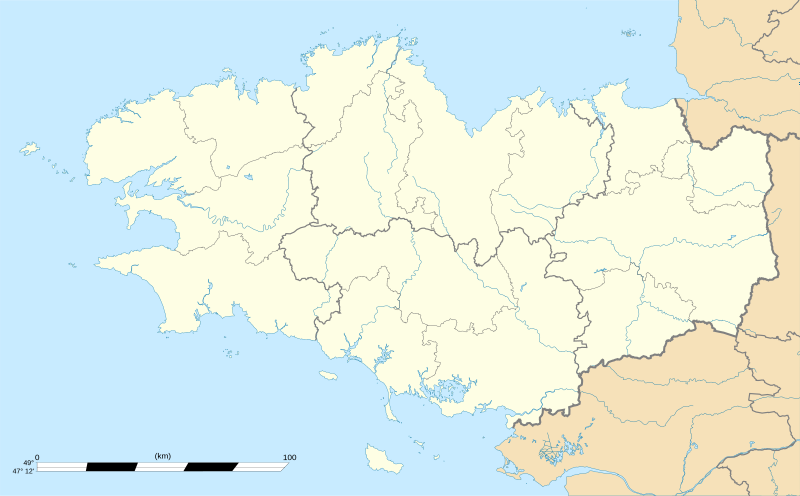
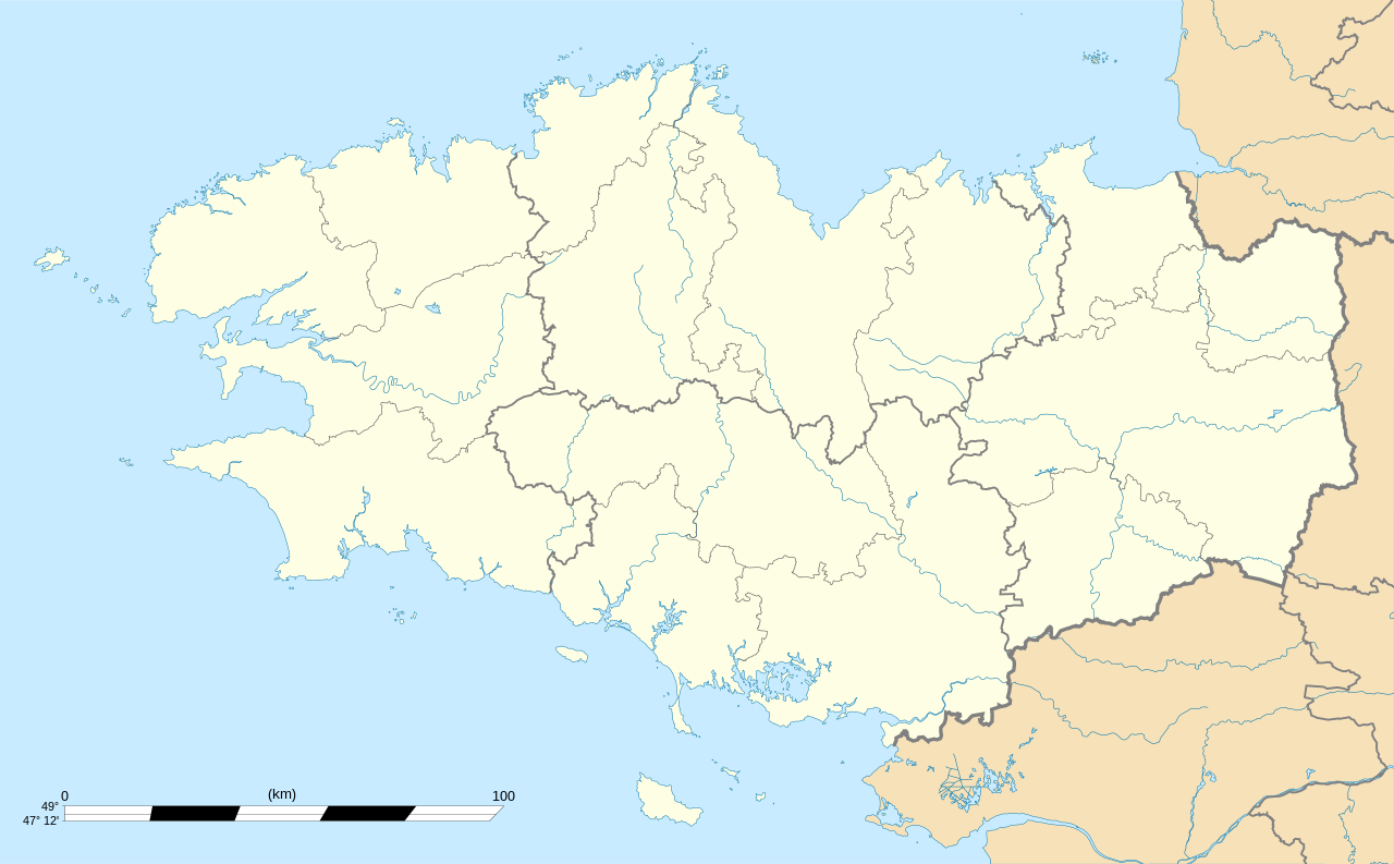
199:, France, for geo-location purpose, with distinct boundaries for regions, departments and arrondissements.
1607:
445:– If you remix, transform, or build upon the material, you must distribute your contributions under the
1772:
1457:
1972:
1617:
1015:"}},"text\/plain":{"en":{"P3575":"488,590 byte"}}}}": -->
1797:
1577:
1105:"}},"text\/plain":{"en":{"P2049":"1,615 pixel"}}}}": -->
1060:"}},"text\/plain":{"en":{"P2048":"1,001 pixel"}}}}": -->
681:"}},"text\/plain":{"en":{"P6216":"copyrighted"}}}}": -->
1712:
1657:
1672:
1622:
1407:
1892:
1762:
1667:
1597:
1183:
1178:
42:
1702:
1647:
1627:
1367:
118:
1582:
1557:
1967:
1652:
1402:
952:"}},"text\/plain":{"en":{"P459":"SHA-1"}}}}": -->
2042:
1962:
1957:
1952:
1947:
1942:
1937:
1932:
1927:
1922:
1917:
1912:
1907:
1902:
1897:
1707:
1662:
1587:
483:
Permission is granted to copy, distribute and/or modify this document under the terms of the
1792:
659:
405:
297:
2032:
1677:
8:
1642:
1592:
1292:
1747:
2047:
1847:
1787:
1492:
167:
1552:
1517:
380:
I, the copyright holder of this work, hereby publish it under the following licenses:
105:
1992:
1987:
546:
1837:
1412:
1282:
1232:
1977:
1722:
1567:
1327:
1272:
273:
Shores : NASA Shuttle Radar
Topography Mission (SWBD) (public domain) ;
2022:
1237:
1827:
1632:
1612:
1477:
1247:
2007:
1822:
1302:
1602:
1487:
1437:
1882:
1547:
1297:
1532:
1507:
1447:
1432:
1206:
1122:
1077:
1032:
969:
923:
885:
847:
807:
763:
746:
698:
607:
293:
208:
1682:
1502:
1497:
1342:
1257:
1637:
1332:
1312:
1194:
1817:
1812:
327:
Any use of this map can be made as long as you credit me (Eric Gaba –
196:
1512:
1372:
1205:, France, for geo-location purpose.}} {{fr|Carte vierge de la région
1262:
1242:
472:
278:
2038:
Knowledge
Diskussion:WikiProjekt Französische Gemeinden/Archiv/2008
1537:
1527:
1472:
1467:
1422:
1417:
1397:
1392:
1382:
1362:
1307:
1202:
1151:
Click on a date/time to view the file as it appeared at that time.
1717:
1387:
1352:
1572:
1542:
1522:
1462:
1452:
1442:
1427:
1337:
1277:
2058:
Knowledge
Diskussion:WikiProjekt Georeferenzierung/Archiv/2010-I
1832:
1347:
153:
1697:
1687:
1562:
1482:
1322:
1287:
1267:
1252:
2053:
Vorlage
Diskussion:Infobox Gemeinde in Frankreich/Archiv/2008
1377:
1317:
1227:
87:(SVG file, nominally 1,615 × 1,001 pixels, file size: 477 KB)
328:
1692:
1357:
1807:
146:
48° 06′ 00″ N, 3° 04′ 30″ W
93:
335:
with a reply address would also be greatly appreciated.
540:
Add a one-line explanation of what this file represents
2012:
256:
1217:
2002:
1738:
1149:
770:
Creative
Commons Attribution-ShareAlike 3.0 Unported
753:
727:
Creative
Commons Attribution-ShareAlike 3.0 Unported
723:
489:, Version 1.2 or any later version published by the
117:
Commons is a freely licensed media file repository.
1798:Tapapitcikesinihikan:Géolocalisation/Documentation
1873:মডিউল:অবস্থান মানচিত্র/উপাত্ত/ফ্রান্স ব্রতাইন/নথি
2043:Knowledge:Kartenwerkstatt/Positionskarten/Europa
1893:Usuari:PereBot/cobertura/França Bretanya/ranking
588:http:\/\/commons.wikimedia.org\/wiki\/User:Sting
1778:Módulu:Mapa de llocalización/datos/Bretaña/usu
456:https://creativecommons.org/licenses/by-sa/3.0
98:
1868:মডিউল:অবস্থান মানচিত্র/উপাত্ত/ফ্রান্স ব্রতাইন
462:Creative Commons Attribution-Share Alike 3.0
386:
304:
252:
182:
343:
288:
262:
14:
1963:Usuari:PereBot/cobertura/França Bretanya/sk
1958:Usuari:PereBot/cobertura/França Bretanya/pl
1953:Usuari:PereBot/cobertura/França Bretanya/nl
1948:Usuari:PereBot/cobertura/França Bretanya/it
1943:Usuari:PereBot/cobertura/França Bretanya/gl
1938:Usuari:PereBot/cobertura/França Bretanya/ga
1933:Usuari:PereBot/cobertura/França Bretanya/fr
1928:Usuari:PereBot/cobertura/França Bretanya/eu
1923:Usuari:PereBot/cobertura/França Bretanya/es
1918:Usuari:PereBot/cobertura/França Bretanya/en
1913:Usuari:PereBot/cobertura/França Bretanya/de
1908:Usuari:PereBot/cobertura/França Bretanya/cy
1903:Usuari:PereBot/cobertura/França Bretanya/ca
1898:Usuari:PereBot/cobertura/França Bretanya/br
1102:
1057:
1012:
422:– to copy, distribute and transmit the work
46:Size of this PNG preview of this SVG file:
2048:Vorlage:Positionskarte Frankreich Bretagne
1973:Mòdul:Location map/data/França Bretanya/ús
1773:Módulu:Mapa de llocalización/datos/Bretaña
1748:Vorlage:Positionskarte Frankreich Bretagne
521:You may select the license of your choice.
195:Blank administrative map of the region of
1848:Vorlog:Positionskarte Frankreich Bretagne
1740:The following other wikis use this file:
207:Carte administrative vierge de la région
2033:Benutzer:Wahrerwattwurm/Trainingsgelände
975:9c637f503449729d3efec3dedd94d21dee39fd7b
1968:Mòdul:Location map/data/França Bretanya
660:http://commons.wikimedia.org/User:Sting
277:Additional reference for confirmation:
215:Equirectangular projection, WGS84 datum
1993:Plantilya:Location map France Brittany
1988:Plantilya:Location map France Bretagne
160:View this and other nearby images on:
348:Derivative works of this file:
129:
1793:Modèle:Géolocalisation/Documentation
1788:Tipapitcikesinihikan:Géolocalisation
501:http://www.gnu.org/copyleft/fdl.html
409:Attribution-Share Alike 3.0 Unported
321:Attribution and Share-Alike required
136:
1142:
397:
392:
13:
2075:
2023:Nodyn:Location map France Bretagne
545:
539:
520:
383:
379:
201:
189:
130:
80:
2109:
2082:
1763:قالب:Location map France Bretagne
544:
220:Standard meridian: 003° 04' 30" W
1978:Mòdul:Location map/data/Bretanya
876:coordinates of the point of view
866:coordinates of the point of view
530:
477:
476:
433:Under the following conditions:
404:This file is licensed under the
396:
391:
385:
356:
185:Bretagne region location map.svg
166:
152:
97:
31:
21:
527:
190:
1735:
1146:
526:
507:GNU Free Documentation License
496:GNU Free Documentation License
486:GNU Free Documentation License
224:True scale parallel: 48° 06' N
202:
26:
1:
1883:Implijer:Matilin/Poull-traezh
814:original creation by uploader
788:original creation by uploader
329:Wikimedia Commons user: Sting
229:Geographic limits of the map:
36:
1214:
552:Items portrayed in this file
373:
318:
7:
2072:
1984:Usage on ceb.wikipedia.org
1844:Usage on bar.wikipedia.org
1804:Usage on azb.wikipedia.org
1784:Usage on atj.wikipedia.org
1769:Usage on ast.wikipedia.org
1744:Usage on als.wikipedia.org
1608:Saint-Christophe-de-Valains
10:
2114:
2029:Usage on de.wikipedia.org
2019:Usage on cy.wikipedia.org
1999:Usage on cs.wikipedia.org
1889:Usage on ca.wikipedia.org
1879:Usage on br.wikipedia.org
1864:Usage on bn.wikipedia.org
1854:Usage on bg.wikipedia.org
1754:Usage on ar.wikipedia.org
891:48°6'0.000"N, 3°4'30.000"W
447:same or compatible license
179:
132:
1143:
267:
16:
1858:Шаблон:ПК Франция Бретан
1673:Saint-Pierre-de-Plesguen
1623:Saint-Hilaire-des-Landes
1578:Ruca, Côtes-d'Armor
1408:La Chapelle-Saint-Aubert
529:
491:Free Software Foundation
413:
104:This is a file from the
41:
1703:Vendel, Ille-et-Vilaine
1648:Saint-Marc-sur-Couesnon
1628:Saint-Jean-sur-Couesnon
1618:Saint-Georges-de-Chesné
1200:
363:Equivalent physical map
255:
108:. Information from its
1713:Vitré, Ille-et-Vilaine
1658:Saint-Méloir-des-Ondes
1583:Saint-Aubin-du-Cormier
1558:Redon, Ille-et-Vilaine
172:48.100000; -3.075000
111:description page there
2008:Šablona:LocMap Bretaň
1708:Vieux-Vy-sur-Couesnon
1668:Saint-Ouen-la-Rouërie
1663:Saint-Ouen-des-Alleux
1598:Saint-Brice-en-Coglès
1588:Saint-Aubin-du-Pavail
1458:Mézières-sur-Couesnon
1179:01:10, 7 August 2008
987:determination method
946:determination method
74:1,615 × 1,001 pixels
70:2,560 × 1,587 pixels
1758:محيط (هندسة رياضية)
1653:Saint-Méen-le-Grand
1643:Saint-Marc-le-Blanc
1593:Saint-Briac-sur-Mer
1403:La Chapelle-Bouëxic
428:– to adapt the work
52:Other resolutions:
1493:Plougastel-Daoulas
1368:Guémené-sur-Scorff
638:Wikimedia username
625:author name string
580:Wikimedia username
572:author name string
66:1,280 × 793 pixels
62:1,024 × 635 pixels
2101:
2100:
2067:more global usage
1736:Global file usage
1678:Saint-Pol-de-Léon
1212:
1104:
1059:
1014:
737:copyright license
719:copyright license
538:
518:
517:
370:
369:
339:
338:
313:
310:Reusing this file
177:
176:
126:
125:
106:Wikimedia Commons
32:Global file usage
2105:
2083:
1518:Pont-l'Abbé
1413:La Roche-Maurice
1283:Carhaix-Plouguer
1233:Bangor, Morbihan
1191:
1153:
1131:
1086:
1041:
996:
991:
689:copyright status
675:copyright status
662:
657:
647:
642:
632:
629:
536:
514:
511:
508:
505:
502:
480:
479:
473:
469:
466:
463:
460:
457:
449:as the original.
406:Creative Commons
400:
399:
395:
394:
389:
388:
360:
317:
316:
307:
269:
258:
246:South: 47° 12' N
238:East: 000° 54' W
234:West: 005° 15' W
206:
204:Français :
194:
186:
180:
173:
170:
156:
155:
149:
148:
137:
122:
101:
100:
94:
88:
77:
58:640 × 397 pixels
54:320 × 198 pixels
48:800 × 496 pixels
2113:
2112:
2108:
2107:
2106:
2104:
2103:
2102:
2071:
1734:
1568:Rohan, Morbihan
1328:Dol-de-Bretagne
1273:Camaret-sur-Mer
1213:
1197:
1189:
1145:
1144:
1141:
1140:
1139:
1138:
1137:
1136:
1135:
1134:
1132:
1129:
1119:
1118:
1117:
1115:
1096:
1095:
1094:
1093:
1092:
1091:
1090:
1089:
1087:
1084:
1074:
1073:
1072:
1070:
1051:
1050:
1049:
1048:
1047:
1046:
1045:
1044:
1042:
1039:
1029:
1028:
1027:
1025:
1006:
1005:
1004:
1003:
1002:
1001:
1000:
999:
998:
997:
992:
989:
980:
979:
978:
976:
966:
965:
964:
962:
939:
938:
937:
936:
935:
934:
933:
932:
930:
920:
919:
918:
916:
901:
900:
899:
898:
897:
896:
895:
894:
892:
882:
881:
880:
878:
863:
862:
861:
860:
859:
858:
857:
856:
854:
844:
843:
842:
840:
825:
824:
823:
822:
821:
820:
819:
818:
816:
804:
803:
802:
800:
781:
780:
779:
778:
777:
776:
775:
774:
772:
761:
760:
759:
758:
757:
755:
743:
742:
741:
739:
716:
715:
714:
713:
712:
711:
710:
709:
707:
695:
694:
693:
691:
672:
671:
670:
669:
668:
667:
666:
665:
664:
663:
658:
655:
649:
648:
643:
640:
634:
633:
630:
627:
618:
617:
616:
614:
604:
603:
602:
600:
565:
564:
563:
562:
561:
559:
543:
542:
541:
524:
523:
522:
512:
509:
506:
503:
500:
471:
470:
467:
464:
461:
458:
455:
454:
412:
401:
382:
381:
376:
371:
364:
361:
212:
200:
184:
171:
144:
143:
140:Camera location
135:
128:
127:
116:
115:
114:is shown below.
90:
86:
79:
78:
51:
12:
11:
5:
2111:
2099:
2098:
2095:
2091:
2090:
2087:
2074:
2069:of this file.
2063:
2062:
2061:
2060:
2055:
2050:
2045:
2040:
2035:
2027:
2026:
2025:
2017:
2016:
2015:
2010:
2005:
1997:
1996:
1995:
1990:
1982:
1981:
1980:
1975:
1970:
1965:
1960:
1955:
1950:
1945:
1940:
1935:
1930:
1925:
1920:
1915:
1910:
1905:
1900:
1895:
1887:
1886:
1885:
1877:
1876:
1875:
1870:
1862:
1861:
1860:
1852:
1851:
1850:
1842:
1841:
1840:
1835:
1830:
1825:
1820:
1815:
1810:
1802:
1801:
1800:
1795:
1790:
1782:
1781:
1780:
1775:
1767:
1766:
1765:
1760:
1752:
1751:
1750:
1737:
1732:to this file.
1726:
1725:
1723:Île-d'Arz
1720:
1715:
1710:
1705:
1700:
1695:
1690:
1685:
1680:
1675:
1670:
1665:
1660:
1655:
1650:
1645:
1640:
1635:
1630:
1625:
1620:
1615:
1610:
1605:
1600:
1595:
1590:
1585:
1580:
1575:
1570:
1565:
1560:
1555:
1550:
1545:
1540:
1535:
1530:
1525:
1520:
1515:
1510:
1505:
1500:
1495:
1490:
1485:
1480:
1475:
1470:
1465:
1460:
1455:
1450:
1445:
1440:
1435:
1430:
1425:
1420:
1415:
1410:
1405:
1400:
1395:
1390:
1385:
1380:
1375:
1370:
1365:
1360:
1355:
1350:
1345:
1340:
1335:
1330:
1325:
1320:
1315:
1310:
1305:
1300:
1295:
1293:Cesson-Sévigné
1290:
1285:
1280:
1275:
1270:
1265:
1260:
1255:
1250:
1245:
1240:
1238:Baud, Morbihan
1235:
1230:
1223:is available.
1216:
1211:
1210:
1199:
1195:
1192:
1188:1,615 × 1,001
1186:
1181:
1176:
1172:
1171:
1168:
1165:
1162:
1159:
1156:
1148:
1133:
1127:
1125:
1124:
1123:
1121:
1120:
1116:
1111:
1109:
1108:
1107:
1106:
1100:
1088:
1082:
1080:
1079:
1078:
1076:
1075:
1071:
1066:
1064:
1063:
1062:
1061:
1055:
1043:
1037:
1035:
1034:
1033:
1031:
1030:
1026:
1021:
1019:
1018:
1017:
1016:
1010:
985:
984:
983:
982:
981:
977:
974:
972:
971:
970:
968:
967:
963:
958:
956:
955:
954:
953:
951:
947:
943:
931:
928:
926:
925:
924:
922:
921:
917:
912:
910:
909:
908:
907:
905:
893:
890:
888:
887:
886:
884:
883:
879:
874:
872:
871:
870:
869:
867:
855:
852:
850:
849:
848:
846:
845:
841:
836:
834:
833:
832:
831:
829:
817:
812:
810:
809:
808:
806:
805:
801:
798:source of file
796:
794:
793:
792:
791:
789:
785:
784:source of file
773:
768:
766:
765:
764:
762:
756:
751:
749:
748:
747:
745:
744:
740:
735:
733:
732:
731:
730:
728:
724:
720:
708:
703:
701:
700:
699:
697:
696:
692:
687:
685:
684:
683:
682:
680:
676:
651:
650:
636:
635:
623:
622:
621:
620:
619:
615:
612:
610:
609:
608:
606:
605:
601:
596:
594:
593:
592:
591:
589:
585:
581:
577:
573:
569:
560:
555:
553:
550:
549:
548:
547:
535:
534:
531:
528:
519:
516:
515:
481:
453:
452:
451:
450:
440:
431:
430:
429:
423:
416:You are free:
403:
402:
384:
378:
377:
375:
372:
368:
367:
366:
365:
362:
355:
345:
344:Other versions
341:
340:
337:
336:
324:
323:
314:
302:
301:
290:
286:
285:
284:
283:
275:
264:
260:
259:
254:
250:
249:
248:
247:
244:
240:
236:
227:
226:
222:
187:
178:
175:
174:
164:
158:
141:
134:
131:
124:
123:
102:
92:
91:
45:
40:
39:
34:
29:
24:
19:
9:
6:
4:
3:
2:
2110:
2096:
2093:
2092:
2088:
2085:
2084:
2081:
2078:
2070:
2068:
2059:
2056:
2054:
2051:
2049:
2046:
2044:
2041:
2039:
2036:
2034:
2031:
2030:
2028:
2024:
2021:
2020:
2018:
2014:
2011:
2009:
2006:
2004:
2001:
2000:
1998:
1994:
1991:
1989:
1986:
1985:
1983:
1979:
1976:
1974:
1971:
1969:
1966:
1964:
1961:
1959:
1956:
1954:
1951:
1949:
1946:
1944:
1941:
1939:
1936:
1934:
1931:
1929:
1926:
1924:
1921:
1919:
1916:
1914:
1911:
1909:
1906:
1904:
1901:
1899:
1896:
1894:
1891:
1890:
1888:
1884:
1881:
1880:
1878:
1874:
1871:
1869:
1866:
1865:
1863:
1859:
1856:
1855:
1853:
1849:
1846:
1845:
1843:
1839:
1836:
1834:
1831:
1829:
1826:
1824:
1821:
1819:
1816:
1814:
1811:
1809:
1806:
1805:
1803:
1799:
1796:
1794:
1791:
1789:
1786:
1785:
1783:
1779:
1776:
1774:
1771:
1770:
1768:
1764:
1761:
1759:
1756:
1755:
1753:
1749:
1746:
1745:
1743:
1742:
1741:
1733:
1731:
1724:
1721:
1719:
1716:
1714:
1711:
1709:
1706:
1704:
1701:
1699:
1696:
1694:
1691:
1689:
1686:
1684:
1681:
1679:
1676:
1674:
1671:
1669:
1666:
1664:
1661:
1659:
1656:
1654:
1651:
1649:
1646:
1644:
1641:
1639:
1636:
1634:
1633:Saint-Lunaire
1631:
1629:
1626:
1624:
1621:
1619:
1616:
1614:
1613:Saint-Coulomb
1611:
1609:
1606:
1604:
1601:
1599:
1596:
1594:
1591:
1589:
1586:
1584:
1581:
1579:
1576:
1574:
1571:
1569:
1566:
1564:
1561:
1559:
1556:
1554:
1551:
1549:
1546:
1544:
1541:
1539:
1536:
1534:
1531:
1529:
1526:
1524:
1521:
1519:
1516:
1514:
1511:
1509:
1506:
1504:
1501:
1499:
1496:
1494:
1491:
1489:
1486:
1484:
1481:
1479:
1478:Perros-Guirec
1476:
1474:
1471:
1469:
1466:
1464:
1461:
1459:
1456:
1454:
1451:
1449:
1446:
1444:
1441:
1439:
1436:
1434:
1431:
1429:
1426:
1424:
1421:
1419:
1416:
1414:
1411:
1409:
1406:
1404:
1401:
1399:
1396:
1394:
1391:
1389:
1386:
1384:
1381:
1379:
1376:
1374:
1371:
1369:
1366:
1364:
1361:
1359:
1356:
1354:
1351:
1349:
1346:
1344:
1341:
1339:
1336:
1334:
1331:
1329:
1326:
1324:
1321:
1319:
1316:
1314:
1311:
1309:
1306:
1304:
1301:
1299:
1296:
1294:
1291:
1289:
1286:
1284:
1281:
1279:
1276:
1274:
1271:
1269:
1266:
1264:
1261:
1259:
1256:
1254:
1251:
1249:
1248:Brest, France
1246:
1244:
1241:
1239:
1236:
1234:
1231:
1229:
1226:
1225:
1224:
1222:
1208:
1204:
1198:
1193:
1187:
1185:
1182:
1180:
1177:
1174:
1173:
1169:
1166:
1163:
1160:
1157:
1155:
1154:
1152:
1126:
1114:
1110:
1081:
1069:
1065:
1036:
1024:
1020:
995:
988:
973:
961:
957:
929:image/svg+xml
927:
915:
911:
889:
877:
873:
851:
839:
835:
815:
811:
799:
795:
771:
767:
754:
750:
738:
734:
706:
702:
690:
686:
661:
654:
646:
639:
626:
611:
599:
595:
558:
554:
551:
532:
525:
498:
497:
492:
488:
487:
482:
475:
474:
459:CC BY-SA 3.0
448:
444:
441:
438:
435:
434:
432:
427:
424:
421:
418:
417:
415:
414:
410:
407:
390:
359:
354:
353:
352:
351:
346:
342:
334:
330:
326:
325:
322:
319:
315:
311:
306:
303:
299:
295:
291:
287:
282:
280:
276:
274:
272:
271:
270:
265:
261:
251:
245:
243:
241:
239:
237:
235:
233:
232:
231:
230:
225:
223:
221:
219:
218:
217:
216:
213:
210:
205:
198:
193:
188:
181:
169:
165:
163:
162:OpenStreetMap
159:
157:
147:
142:
139:
138:
120:
113:
112:
107:
103:
96:
95:
89:
84:
83:Original file
75:
71:
67:
63:
59:
55:
49:
44:
38:
35:
33:
30:
28:
25:
23:
20:
18:
15:
2079:
2076:
2064:
1739:
1727:
1603:Saint-Brieuc
1488:Ploubazlanec
1438:Locmariaquer
1218:
1150:
1147:File history
494:
484:
442:
436:
425:
419:
347:
320:
266:
242:North: 49° N
228:
214:
203:
191:
119:You can help
109:
81:
22:File history
1533:Questembert
1508:Plusquellec
1448:Montertelot
1433:Le Tiercent
853:August 2008
705:copyrighted
679:copyrighted
443:share alike
437:attribution
292:Eric Gaba (
257:August 2008
183:Description
1730:more links
1638:Saint-Malo
1553:Quéménéven
1333:Douarnenez
1313:Concarneau
1303:Châteaulin
1215:File usage
1164:Dimensions
914:media type
904:media type
613:some value
305:Permission
279:Géoportail
27:File usage
2013:Brasparts
1548:Quimperlé
1513:Pont-Aven
1373:Hennebont
1298:Chauvigné
1221:full list
1161:Thumbnail
1158:Date/Time
1023:data size
1009:data size
838:inception
828:inception
374:Licensing
192:English:
2073:Metadata
1683:Tréguier
1538:Quiberon
1528:Querrien
1503:Ploërmel
1498:Plouézec
1473:Penmarch
1468:Paimpont
1423:Langolen
1418:Lamballe
1398:Kerlouan
1393:Josselin
1383:Huelgoat
1363:Guingamp
1343:Fougères
1308:Combourg
1258:Bécherel
1207:Bretagne
1203:Bretagne
1190:(477 KB)
1038:488,590
960:checksum
942:checksum
533:Captions
426:to remix
420:to share
411:license.
298:fr:Sting
268:Own work
209:Bretagne
197:Bretagne
37:Metadata
2003:Morlaix
1838:لو کنکه
1573:Roscoff
1543:Quimper
1523:Pontivy
1463:Paimpol
1453:Morlaix
1443:Lorient
1428:Lannion
1338:Erdeven
1278:Cancale
1209:, Franc
1175:current
1170:Comment
598:creator
568:creator
557:depicts
537:English
333:message
133:Summary
85:
2094:Height
1828:سن-ملو
1698:Vannes
1688:Ushant
1563:Rennes
1483:Plouay
1323:Dinard
1288:Carnac
1268:Callac
1263:Bégard
1253:Broons
1243:Beaucé
1128:1,615
1083:1,001
1068:height
1054:height
289:Author
263:Source
150:
2086:Width
2065:View
1823:روسکف
1728:View
1718:Évran
1388:Hœdic
1378:Houat
1353:Gosné
1318:Dinan
1228:Auray
1196:Sting
1130:pixel
1113:width
1103:pixel
1099:width
1085:pixel
1058:pixel
994:SHA-1
950:SHA-1
645:Sting
631:Sting
576:Sting
294:Sting
2097:1001
2089:1615
1818:کمپر
1813:برست
1693:Uzel
1358:Guer
1348:Gaël
1167:User
1040:byte
1013:byte
513:true
510:true
504:GFDL
468:true
465:true
253:Date
17:File
1833:ونس
653:URL
584:URL
1808:رن
990::
656::
641::
628::
296:-
72:|
68:|
64:|
60:|
56:|
50:.
499:.
312:)
308:(
300:)
281:.
121:.
76:.
Text is available under the Creative Commons Attribution-ShareAlike License. Additional terms may apply.
