1092:"}},"text\/plain":{"en":{"":"checksum"}}},"{\"value\":\"9afdb76892666b8dee35966960d94d6273206165\",\"type\":\"string\"}":{"text\/html":{"en":{"P4092":"9afdb76892666b8dee35966960d94d6273206165"}},"text\/plain":{"en":{"P4092":"9afdb76892666b8dee35966960d94d6273206165"}}},"{\"value\":{\"entity-type\":\"property\",\"numeric-id\":459,\"id\":\"P459\"},\"type\":\"wikibase-entityid\"}":{"text\/html":{"en":{"":"
972:"}},"text\/plain":{"en":{"":"inception"}}},"{\"value\":{\"time\":\"+2013-11-27T00:00:00Z\",\"timezone\":0,\"before\":0,\"after\":0,\"precision\":11,\"calendarmodel\":\"http:\\\/\\\/www.wikidata.org\\\/entity\\\/Q1985727\"},\"type\":\"time\"}":{"text\/html":{"en":{"P571":"27 November 2013"}},"text\/plain":{"en":{"P571":"27 November 2013"}}}}": -->
264:
43:
773:
1088:
652:
328:
310:
657:
99:
785:"}},"text\/plain":{"en":{"P2093":"NordNordWest","P4174":"NordNordWest"}}},"{\"value\":{\"entity-type\":\"property\",\"numeric-id\":4174,\"id\":\"P4174\"},\"type\":\"wikibase-entityid\"}":{"text\/html":{"en":{"":"
289:
1054:"}},"text\/plain":{"en":{"":"media type"}}},"{\"value\":\"image\\\/svg+xml\",\"type\":\"string\"}":{"text\/html":{"en":{"P1163":"image\/svg+xml"}},"text\/plain":{"en":{"P1163":"image\/svg+xml"}}}}": -->
1096:"}},"text\/plain":{"en":{"":"determination method"}}},"{\"value\":{\"entity-type\":\"item\",\"numeric-id\":13414952,\"id\":\"Q13414952\"},\"type\":\"wikibase-entityid\"}":{"text\/html":{"en":{"P459":"
1159:"}},"text\/plain":{"en":{"":"data size"}}},"{\"value\":{\"amount\":\"+2150113\",\"unit\":\"http:\\\/\\\/www.wikidata.org\\\/entity\\\/Q8799\"},\"type\":\"quantity\"}":{"text\/html":{"en":{"P3575":"2,150,113
928:"}},"text\/plain":{"en":{"":"copyright license"}}},"{\"value\":{\"entity-type\":\"item\",\"numeric-id\":19068220,\"id\":\"Q19068220\"},\"type\":\"wikibase-entityid\"}":{"text\/html":{"en":{"P275":"
884:"}},"text\/plain":{"en":{"":"copyright status"}}},"{\"value\":{\"entity-type\":\"item\",\"numeric-id\":50423863,\"id\":\"Q50423863\"},\"type\":\"wikibase-entityid\"}":{"text\/html":{"en":{"P6216":"
1010:"}},"text\/plain":{"en":{"":"source of file"}}},"{\"value\":{\"entity-type\":\"item\",\"numeric-id\":66458942,\"id\":\"Q66458942\"},\"type\":\"wikibase-entityid\"}":{"text\/html":{"en":{"P7482":"
789:"}},"text\/plain":{"en":{"":"Wikimedia username"}}},"{\"value\":{\"entity-type\":\"property\",\"numeric-id\":2699,\"id\":\"P2699\"},\"type\":\"wikibase-entityid\"}":{"text\/html":{"en":{"":"
1204:"}},"text\/plain":{"en":{"":"height"}}},"{\"value\":{\"amount\":\"+1026\",\"unit\":\"http:\\\/\\\/www.wikidata.org\\\/entity\\\/Q355198\"},\"type\":\"quantity\"}":{"text\/html":{"en":{"P2048":"1,026
1249:"}},"text\/plain":{"en":{"":"width"}}},"{\"value\":{\"amount\":\"+1504\",\"unit\":\"http:\\\/\\\/www.wikidata.org\\\/entity\\\/Q355198\"},\"type\":\"quantity\"}":{"text\/html":{"en":{"P2049":"1,504
777:"}},"text\/plain":{"en":{"":"creator"}}},"{\"value\":{\"entity-type\":\"property\",\"numeric-id\":2093,\"id\":\"P2093\"},\"type\":\"wikibase-entityid\"}":{"text\/html":{"en":{"":"
1245:
1332:
781:"}},"text\/plain":{"en":{"":"author name string"}}},"{\"value\":\"NordNordWest\",\"type\":\"string\"}":{"text\/html":{"en":{"P2093":"NordNordWest","P4174":"
793:"}},"text\/plain":{"en":{"":"URL"}}},"{\"value\":\"http:\\\/\\\/commons.wikimedia.org\\\/wiki\\\/User:NordNordWest\",\"type\":\"string\"}":{"text\/html":{"en":{"P2699":"
698:– You must give appropriate credit, provide a link to the license, and indicate if changes were made. You may do so in any reasonable manner, but not in any way that suggests the licensor endorses you or your use.
1649:
782:
300:
613:
The ODbL does not require any particular license for maps produced from ODbL data. Prior to 1 August 2020, map tiles produced by the OpenStreetMap
Foundation were licensed under the
794:
1097:
1011:
929:
885:
1639:
1246:
1201:
1156:
1089:
1051:
1007:
881:
790:
786:
778:
1093:
969:
925:
774:
1868:
797:"}},"text\/plain":{"en":{"P2699":"http:\/\/commons.wikimedia.org\/wiki\/User:NordNordWest"}}}}": -->
73:
69:
65:
61:
57:
53:
47:
932:"}},"text\/plain":{"en":{"P275":"Creative Commons Attribution-ShareAlike 2.0 Generic"}}}}": -->
342:
110:
1566:
82:
1141:
1037:
955:
911:
1561:
1387:}} Quadratische Plattkarte. Geographische Begrenzung der Karte: * N: 47.9037638° N * S: 46.5040638° N * W: 10.0237916° O *...
1879:
This file contains additional information, probably added from the digital camera or scanner used to create or digitize it.
705:
1361:
1356:
1614:
1260:
1215:
1170:
1107:
1061:
1021:
895:
859:
844:
831:
1014:"}},"text\/plain":{"en":{"P7482":"original creation by uploader"}}}}": -->
1134:
979:
939:
804:
763:
1411:
1406:
1401:
851:
1491:
667:
567:
263:
1882:
If the file has been modified from its original state, some details may not fully reflect the modified file.
335:
1556:
1163:"}},"text\/plain":{"en":{"P3575":"2,150,113 byte"}}}}": -->
704:– If you remix, transform, or build upon the material, you must distribute your contributions under the
1421:
1609:
1506:
1253:"}},"text\/plain":{"en":{"P2049":"1,504 pixel"}}}}": -->
1208:"}},"text\/plain":{"en":{"P2048":"1,026 pixel"}}}}": -->
888:"}},"text\/plain":{"en":{"P6216":"copyrighted"}}}}": -->
1397:
The following pages on the
English Knowledge use this file (pages on other projects are not listed):
1854:
1839:
1819:
866:
1461:
118:
1331:
1326:
42:
1456:
1629:
1100:"}},"text\/plain":{"en":{"P459":"SHA-1"}}}}": -->
1749:
1481:
154:
664:
1584:
8:
1759:
1699:
1526:
327:
1496:
249:
1664:
1372:
1342:
105:
753:
639:
I, the copyright holder of this work, hereby publish it under the following license:
377:
1384:
614:
158:
1684:
1536:
1446:
1416:
606:
1824:
1729:
1426:
186:
485:
449:
1431:
557:
548:
539:
530:
521:
512:
503:
494:
476:
467:
458:
440:
431:
422:
413:
404:
395:
386:
368:
359:
350:
1734:
1541:
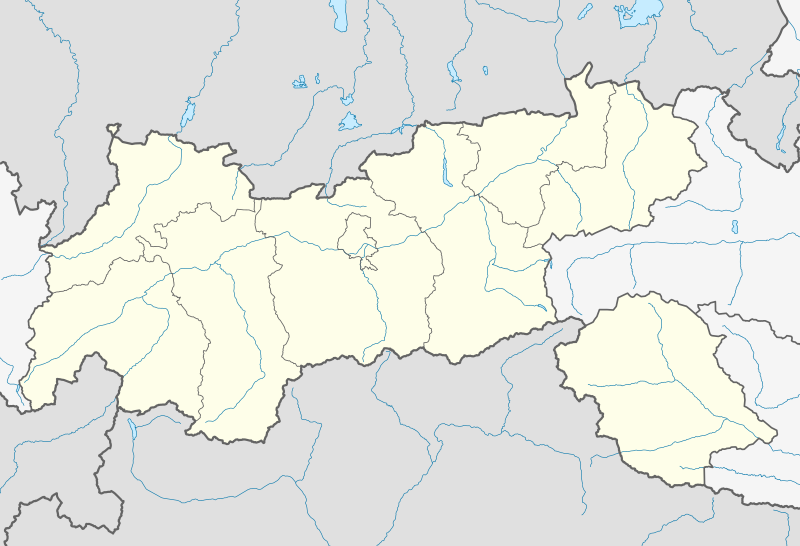
1379:== {{int:filedesc}} == {{Information |Description= {{de|Positionskarte von
1829:
1809:
1599:
1451:
1270:
1225:
1180:
1117:
1071:
1031:
989:
949:
905:
814:
1789:
1764:
1744:
1719:
1594:
593:
1769:
1436:
295:
1704:
1531:
588:
1804:
1724:
1694:
1486:
1380:
1299:
Click on a date/time to view the file as it appeared at that time.
309:
190:
1774:
1714:
1709:
1679:
1669:
1516:
1471:
617:. Maps produced by other people may be subject to other licences.
602:
1739:
1689:
1859:
1834:
1674:
1659:
1511:
1501:
1441:
1784:
87:(SVG file, nominally 1,504 × 1,026 pixels, file size: 2.05 MB)
1754:
1546:
1521:
1466:
163:
Quadratische
Plattkarte. Geographische Begrenzung der Karte:
288:
1844:
1779:
1551:
1476:
316:
195:
Equirectangular projection. Geographic limits of the map:
218:
93:
1849:
1799:
795:
http:\/\/commons.wikimedia.org\/wiki\/User:NordNordWest
747:
Add a one-line explanation of what this file represents
1794:
1624:
1814:
1395:
334:
This SVG map has been made or improved in the German
1575:
1297:
117:
Commons is a freely licensed media file repository.
956:
Creative
Commons Attribution-ShareAlike 2.0 Generic
930:
Creative
Commons Attribution-ShareAlike 2.0 Generic
1750:Knowledge:Kartenwerkstatt/Positionskarten/Europa
867:http://commons.wikimedia.org/User:NordNordWest
715:https://creativecommons.org/licenses/by-sa/2.0
98:
721:Creative Commons Attribution-Share Alike 2.0
645:
626:http://opendatacommons.org/licenses/odbl/1.0/
214:
140:
1855:Österreichische Fußballmeisterschaft 2015/16
1840:Österreichische Fußballmeisterschaft 2013/14
1820:Österreichische Fußballmeisterschaft 2012/13
255:
245:
224:
14:
1250:
1205:
1160:
681:– to copy, distribute and transmit the work
46:Size of this PNG preview of this SVG file:
1567:Module:Location map/data/Austria Tyrol/doc
1577:The following other wikis use this file:
1615:وحدة:Location map/data/Austria Tyrol/شرح
1123:9afdb76892666b8dee35966960d94d6273206165
1760:Vorlage:Positionskarte Österreich Tirol
1585:Vorlage:Positionskarte Österreich Tirol
1562:Module:Location map/data/Austria Tyrol
319:was created with an unknown SVG tool.
129:
1610:وحدة:Location map/data/Austria Tyrol
605:, which is made available under the
601:This work contains information from
1825:Tiroler Wasserkraft Arena Innsbruck
1290:
668:Attribution-Share Alike 2.0 Generic
656:
651:
13:
1877:
1630:Şablon:Yer xəritəsi Avstriya Tirol
752:
746:
642:
638:
333:
314:
293:
179:
147:
130:
80:
1911:
1884:
1407:2018 UCI Road World Championships
751:
1396:
737:
692:Under the following conditions:
663:This file is licensed under the
655:
650:
644:
592:
326:
308:
287:
262:
97:
31:
21:
1700:Großglockner Resort Kals–Matrei
1685:Europabrücke (Brenner Autobahn)
734:
378:
180:
1735:Flugplatz Kufstein-Langkampfen
1665:Stephansbrücke (Brennerstraße)
1650:Шаблон:ПозКартти Австри Тироль
1600:Bavaro d'a val d'Ötz
1572:
1294:
733:
148:
143:Austria Tyrol location map.svg
26:
1:
1810:Flugplatz St. Johann in Tirol
1730:Hohe Brücke (St. Georgenberg)
1595:Bavaro d'a val de Stubai
1412:2018–19 Austrian Regionalliga
1402:2017–18 Austrian Regionalliga
1038:original creation by uploader
1012:original creation by uploader
36:
1392:
759:Items portrayed in this file
607:Open Database License (ODbL)
591:
584:
7:
1874:
1790:Landeskrankenhaus Innsbruck
1765:Diskussion:Zugspitze/Archiv
1581:Usage on als.wikipedia.org
1557:User:Spitzmauskc/St. Johann
10:
1916:
1745:Flugplatz Lienz-Nikolsdorf
1720:Tivoli-Stadion (Innsbruck)
1656:Usage on de.wikipedia.org
1646:Usage on cv.wikipedia.org
1636:Usage on bg.wikipedia.org
1621:Usage on az.wikipedia.org
1606:Usage on ar.wikipedia.org
1591:Usage on an.wikipedia.org
1492:Prägraten am Großvenediger
1422:Austrian Regionalliga West
706:same or compatible license
322:
137:
132:
1507:Sankt Leonhard im Pitztal
1291:
486:
450:
229:
16:
1770:Bezirkskrankenhaus Lienz
736:
672:
558:
549:
540:
531:
522:
513:
504:
495:
477:
468:
459:
441:
432:
423:
414:
405:
396:
387:
369:
360:
351:
104:This is a file from the
41:
1640:Шаблон:ПК Австрия Тирол
1462:Landesliga West (Tyrol)
1378:
1357:22:53, 26 November 2013
1348:
1327:19:01, 27 November 2013
217:
108:. Information from its
1725:Olympiahalle Innsbruck
1457:Landesliga Ost (Tyrol)
111:description page there
1775:Olympia Eiskanal Igls
1715:Hintertuxer Gletscher
1482:Olympiaregion Seefeld
620:Open Database License
1670:Tivoli Stadion Tirol
1135:determination method
1094:determination method
615:CC-BY-SA-2.0 license
345:to improve as well.
279:SVG development
74:1,504 × 1,026 pixels
70:2,560 × 1,746 pixels
1830:Hängebrücke Holzgau
1690:Flughafen Innsbruck
1527:St. Johann in Tirol
687:– to adapt the work
153:Positionskarte von
52:Other resolutions:
1835:Mittelpunkt Tirols
1705:Wildbichler Brücke
1660:Alpenzoo Innsbruck
1497:Regionalliga Tirol
845:Wikimedia username
832:author name string
787:Wikimedia username
779:author name string
379:Deutsch (Sie-Form)
236:OpenStreetMap data
66:1,280 × 873 pixels
62:1,024 × 699 pixels
1903:
1902:
1869:more global usage
1805:Raritätenzoo Ebbs
1785:Cyta Shoppingwelt
1695:Pontlatzer Brücke
1573:Global file usage
1390:
1252:
1207:
1162:
940:copyright license
926:copyright license
745:
635:
634:
618:
581:
580:
576:
575:
570:
126:
125:
106:Wikimedia Commons
32:Global file usage
1907:
1885:
1755:Dolomitenstadion
1710:Hundalm-Eishöhle
1369:
1339:
1301:
1279:
1234:
1189:
1144:
1139:
995:27 November 2013
896:copyright status
882:copyright status
869:
864:
854:
849:
839:
836:
743:
728:
725:
722:
719:
716:
708:as the original.
665:Creative Commons
659:
658:
654:
653:
648:
647:
630:
627:
624:
621:
612:
596:
589:
571:
566:
330:
323:
312:
303:
291:
266:
231:
220:
219:27 November 2013
208:E: 13.0531722° E
205:W: 10.0237916° E
202:S: 46.5040638° N
199:N: 47.9037638° N
185:Location map of
184:
176:O: 13.0531722° O
173:W: 10.0237916° O
170:S: 46.5040638° N
167:N: 47.9037638° N
152:
144:
138:
122:
101:
100:
94:
88:
77:
58:640 × 437 pixels
54:320 × 218 pixels
48:800 × 546 pixels
1915:
1914:
1910:
1909:
1908:
1906:
1905:
1904:
1873:
1680:Tischofer Höhle
1571:
1537:Tannheim, Tyrol
1447:Jochberg, Tyrol
1417:Arzl im Pitztal
1398:
1391:
1375:
1367:
1345:
1337:
1293:
1292:
1289:
1288:
1287:
1286:
1285:
1284:
1283:
1282:
1280:
1277:
1267:
1266:
1265:
1263:
1244:
1243:
1242:
1241:
1240:
1239:
1238:
1237:
1235:
1232:
1222:
1221:
1220:
1218:
1199:
1198:
1197:
1196:
1195:
1194:
1193:
1192:
1190:
1187:
1177:
1176:
1175:
1173:
1154:
1153:
1152:
1151:
1150:
1149:
1148:
1147:
1146:
1145:
1140:
1137:
1128:
1127:
1126:
1124:
1114:
1113:
1112:
1110:
1087:
1086:
1085:
1084:
1083:
1082:
1081:
1080:
1078:
1068:
1067:
1066:
1064:
1049:
1048:
1047:
1046:
1045:
1044:
1043:
1042:
1040:
1028:
1027:
1026:
1024:
1005:
1004:
1003:
1002:
1001:
1000:
999:
998:
996:
986:
985:
984:
982:
967:
966:
965:
964:
963:
962:
961:
960:
958:
946:
945:
944:
942:
923:
922:
921:
920:
919:
918:
917:
916:
914:
902:
901:
900:
898:
879:
878:
877:
876:
875:
874:
873:
872:
871:
870:
865:
862:
856:
855:
850:
847:
841:
840:
837:
834:
825:
824:
823:
821:
811:
810:
809:
807:
772:
771:
770:
769:
768:
766:
750:
749:
748:
731:
730:
729:
726:
723:
720:
717:
714:
713:
671:
660:
641:
640:
628:
625:
622:
619:
587:
582:
577:
572:
560:
551:
542:
533:
524:
515:
506:
497:
488:
479:
470:
461:
452:
443:
434:
425:
416:
407:
398:
389:
380:
371:
362:
353:
349:
346:
336:Kartenwerkstatt
321:
320:
306:
305:
299:
282:
272:
271:
267:
239:SRTM30 v.2 data
193:
161:
142:
135:
128:
127:
116:
115:
114:is shown below.
90:
86:
79:
78:
51:
12:
11:
5:
1913:
1901:
1900:
1897:
1893:
1892:
1889:
1876:
1871:of this file.
1865:
1864:
1863:
1862:
1857:
1852:
1847:
1845:Bahnhof Patsch
1842:
1837:
1832:
1827:
1822:
1817:
1812:
1807:
1802:
1797:
1792:
1787:
1782:
1780:Kaufhaus Tyrol
1777:
1772:
1767:
1762:
1757:
1752:
1747:
1742:
1740:Kajetansbrücke
1737:
1732:
1727:
1722:
1717:
1712:
1707:
1702:
1697:
1692:
1687:
1682:
1677:
1672:
1667:
1662:
1654:
1653:
1652:
1644:
1643:
1642:
1634:
1633:
1632:
1627:
1619:
1618:
1617:
1612:
1604:
1603:
1602:
1597:
1589:
1588:
1587:
1574:
1570:
1569:
1564:
1559:
1554:
1549:
1544:
1539:
1534:
1529:
1524:
1519:
1514:
1509:
1504:
1499:
1494:
1489:
1484:
1479:
1474:
1469:
1464:
1459:
1454:
1449:
1444:
1439:
1434:
1429:
1427:Berneck Castle
1424:
1419:
1414:
1409:
1404:
1394:
1389:
1388:
1377:
1373:
1370:
1366:1,504 × 1,026
1364:
1359:
1354:
1351:
1350:
1347:
1343:
1340:
1336:1,504 × 1,026
1334:
1329:
1324:
1320:
1319:
1316:
1313:
1310:
1307:
1304:
1296:
1281:
1275:
1273:
1272:
1271:
1269:
1268:
1264:
1259:
1257:
1256:
1255:
1254:
1248:
1236:
1230:
1228:
1227:
1226:
1224:
1223:
1219:
1214:
1212:
1211:
1210:
1209:
1203:
1191:
1185:
1183:
1182:
1181:
1179:
1178:
1174:
1169:
1167:
1166:
1165:
1164:
1158:
1133:
1132:
1131:
1130:
1129:
1125:
1122:
1120:
1119:
1118:
1116:
1115:
1111:
1106:
1104:
1103:
1102:
1101:
1099:
1095:
1091:
1079:
1076:
1074:
1073:
1072:
1070:
1069:
1065:
1060:
1058:
1057:
1056:
1055:
1053:
1041:
1036:
1034:
1033:
1032:
1030:
1029:
1025:
1022:source of file
1020:
1018:
1017:
1016:
1015:
1013:
1009:
1008:source of file
997:
994:
992:
991:
990:
988:
987:
983:
978:
976:
975:
974:
973:
971:
959:
954:
952:
951:
950:
948:
947:
943:
938:
936:
935:
934:
933:
931:
927:
915:
910:
908:
907:
906:
904:
903:
899:
894:
892:
891:
890:
889:
887:
883:
858:
857:
843:
842:
830:
829:
828:
827:
826:
822:
819:
817:
816:
815:
813:
812:
808:
803:
801:
800:
799:
798:
796:
792:
788:
784:
780:
776:
767:
762:
760:
757:
756:
755:
754:
742:
741:
738:
735:
712:
711:
710:
709:
699:
690:
689:
688:
682:
675:You are free:
662:
661:
643:
637:
636:
633:
632:
599:
597:
586:
583:
579:
578:
574:
573:
348:
331:
307:
286:
285:
283:
280:
276:
275:
274:
273:
270:Relief version
269:
268:
261:
257:
256:Other versions
253:
252:
247:
243:
242:
241:
240:
237:
226:
222:
221:
216:
212:
211:
210:
209:
206:
203:
200:
178:
177:
174:
171:
168:
145:
136:
134:
131:
124:
123:
102:
92:
91:
45:
40:
39:
34:
29:
24:
19:
9:
6:
4:
3:
2:
1912:
1898:
1895:
1894:
1890:
1887:
1886:
1883:
1880:
1872:
1870:
1861:
1860:Pitztalbrücke
1858:
1856:
1853:
1851:
1848:
1846:
1843:
1841:
1838:
1836:
1833:
1831:
1828:
1826:
1823:
1821:
1818:
1816:
1813:
1811:
1808:
1806:
1803:
1801:
1798:
1796:
1793:
1791:
1788:
1786:
1783:
1781:
1778:
1776:
1773:
1771:
1768:
1766:
1763:
1761:
1758:
1756:
1753:
1751:
1748:
1746:
1743:
1741:
1738:
1736:
1733:
1731:
1728:
1726:
1723:
1721:
1718:
1716:
1713:
1711:
1708:
1706:
1703:
1701:
1698:
1696:
1693:
1691:
1688:
1686:
1683:
1681:
1678:
1676:
1675:MARTHA-Dörfer
1673:
1671:
1668:
1666:
1663:
1661:
1658:
1657:
1655:
1651:
1648:
1647:
1645:
1641:
1638:
1637:
1635:
1631:
1628:
1626:
1623:
1622:
1620:
1616:
1613:
1611:
1608:
1607:
1605:
1601:
1598:
1596:
1593:
1592:
1590:
1586:
1583:
1582:
1580:
1579:
1578:
1568:
1565:
1563:
1560:
1558:
1555:
1553:
1550:
1548:
1545:
1543:
1540:
1538:
1535:
1533:
1530:
1528:
1525:
1523:
1520:
1518:
1515:
1513:
1510:
1508:
1505:
1503:
1500:
1498:
1495:
1493:
1490:
1488:
1485:
1483:
1480:
1478:
1475:
1473:
1470:
1468:
1465:
1463:
1460:
1458:
1455:
1453:
1450:
1448:
1445:
1443:
1440:
1438:
1435:
1433:
1432:Hall in Tirol
1430:
1428:
1425:
1423:
1420:
1418:
1415:
1413:
1410:
1408:
1405:
1403:
1400:
1399:
1386:
1382:
1376:
1371:
1365:
1363:
1360:
1358:
1355:
1353:
1352:
1346:
1341:
1335:
1333:
1330:
1328:
1325:
1322:
1321:
1317:
1314:
1311:
1308:
1305:
1303:
1302:
1300:
1274:
1262:
1258:
1229:
1217:
1213:
1184:
1172:
1168:
1143:
1136:
1121:
1109:
1105:
1077:image/svg+xml
1075:
1063:
1059:
1039:
1035:
1023:
1019:
993:
981:
977:
957:
953:
941:
937:
913:
909:
897:
893:
868:
861:
853:
846:
833:
818:
806:
802:
765:
761:
758:
739:
732:
718:CC BY-SA 2.0
707:
703:
700:
697:
694:
693:
691:
686:
683:
680:
677:
676:
674:
673:
669:
666:
649:
631:
616:
610:
608:
604:
603:OpenStreetMap
600:
598:
595:
590:
569:
565:
561:
556:
552:
547:
543:
538:
534:
529:
525:
520:
516:
511:
507:
502:
498:
493:
489:
484:
480:
475:
471:
466:
462:
457:
453:
448:
444:
439:
435:
430:
426:
421:
417:
412:
408:
403:
399:
394:
390:
385:
381:
376:
372:
367:
363:
358:
354:
347:
344:
340:
337:
332:
329:
325:
324:
318:
311:
302:
297:
290:
284:
278:
277:
265:
260:
259:
258:
254:
251:
248:
244:
238:
235:
234:
233:
227:
223:
213:
207:
204:
201:
198:
197:
196:
192:
188:
183:
175:
172:
169:
166:
165:
164:
160:
156:
151:
146:
139:
120:
113:
112:
107:
103:
96:
95:
89:
84:
83:Original file
75:
71:
67:
63:
59:
55:
49:
44:
38:
35:
33:
30:
28:
25:
23:
20:
18:
15:
1881:
1878:
1866:
1576:
1542:Tiroler Liga
1374:NordNordWest
1344:NordNordWest
1298:
1295:File history
852:NordNordWest
838:NordNordWest
783:NordNordWest
701:
695:
684:
678:
611:
563:
554:
545:
536:
527:
518:
509:
500:
491:
482:
473:
464:
455:
451:Plattdüütsch
446:
437:
428:
419:
410:
401:
392:
383:
374:
365:
356:
352:azərbaycanca
343:propose maps
338:
250:NordNordWest
228:
194:
181:
162:
149:
119:You can help
109:
81:
22:File history
1850:Highline179
1800:Zettersfeld
912:copyrighted
886:copyrighted
702:share alike
696:attribution
496:slovenščina
141:Description
1393:File usage
1385:Österreich
1312:Dimensions
1186:2,150,113
1062:media type
1052:media type
820:some value
514:македонски
442:Nederlands
341:. You can
159:Österreich
27:File usage
1899:1026.25px
1891:1503.75px
1795:Aqua Dome
1452:Kitzbühel
1437:Innsbruck
1368:(2.04 MB)
1338:(2.05 MB)
1309:Thumbnail
1306:Date/Time
1171:data size
1157:data size
980:inception
970:inception
585:Licensing
487:sicilianu
469:português
339:(Map Lab)
281:InfoField
232:, using
182:English:
150:Deutsch:
1875:Metadata
1815:Sillpark
1487:Pinswang
1108:checksum
1090:checksum
740:Captions
685:to remix
679:to share
670:license.
424:latviešu
415:italiano
406:français
298:code is
230:Own work
37:Metadata
1517:Sillian
1472:Mutters
1323:current
1318:Comment
805:creator
775:creator
764:depicts
744:English
541:հայերեն
532:ქართული
523:русский
397:español
388:English
370:Deutsch
361:čeština
191:Austria
133:Summary
85:
1896:Height
1532:Sölden
1512:Schwaz
1502:Reutte
1442:Ischgl
1276:1,504
1231:1,026
1216:height
1202:height
562:
553:
544:
535:
526:
517:
508:
499:
490:
481:
478:română
472:
463:
460:polski
454:
445:
436:
433:magyar
427:
418:
409:
400:
391:
382:
373:
364:
355:
315:This
313:
292:
246:Author
225:Source
1888:Width
1867:View
1547:Wenns
1522:Spiss
1467:Lienz
1381:Tirol
1278:pixel
1261:width
1251:pixel
1247:width
1233:pixel
1206:pixel
1142:SHA-1
1098:SHA-1
550:বাংলা
505:suomi
301:valid
187:Tyrol
155:Tirol
1625:Ötzi
1552:Zams
1477:Oetz
1315:User
1188:byte
1161:byte
727:true
724:true
629:true
623:ODbL
294:The
215:Date
17:File
860:URL
791:URL
568:+/−
559:ไทย
317:map
296:SVG
1383:,
1138::
863::
848::
835::
609:.
189:,
157:,
72:|
68:|
64:|
60:|
56:|
50:.
1349:c
564:∙
555:∙
546:∙
537:∙
528:∙
519:∙
510:∙
501:∙
492:∙
483:∙
474:∙
465:∙
456:∙
447:∙
438:∙
429:∙
420:∙
411:∙
402:∙
393:∙
384:∙
375:∙
366:∙
357:∙
304:.
121:.
76:.
Text is available under the Creative Commons Attribution-ShareAlike License. Additional terms may apply.


