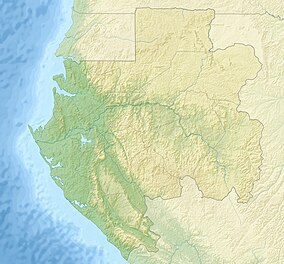
47:
54:
262:
comprise 25% of the total protected mangrove in the continent. They play an important role in the ecosystem and help stabilise the coastline around
Libreville. Human encroachment from both building and crop planting are a threat to both parks.
224:
271:
239:
are designed to represent the biodiversity of the country and encourage tourism. Akanda
National Park is located in the northeast of the country, near
357:
270:. Akanda is internationally important as a site for migratory birds and is home to the largest populations of such birds in Gabon. It is an
468:
46:
92:
473:
350:
143:
382:
463:
343:
392:
366:
216:
478:
422:
28:
228:
330:
417:
458:
232:
427:
266:
Both of the bays are rich in marine life, and
Corisco bay provides an important feeding area for
387:
432:
412:
259:
407:
402:
397:
8:
437:
295:
155:
316:
200:
255:
452:
236:
107:
94:
32:
335:
240:
220:
208:
80:
290:
247:
267:
251:
212:
70:
243:, with coastline along the Mondah and Corisco bays.
450:
258:in Africa, but Akanda together with the nearby
351:
53:
365:
358:
344:
246:The national park is composed chiefly of
451:
215:'s capital city. It is also one of 13
339:
469:Protected areas established in 2002
13:
331:Virtual Tour of the National Parks
144:National Agency for National Parks
14:
490:
52:
45:
283:
223:after a two-year study by the
1:
277:
474:2002 establishments in Gabon
219:set up in 2002 by President
7:
254:has only 2.5% of the total
207:) is located just north of
10:
495:
250:and tidal beach habitats.
373:
298:Sites Information Service
190:
186:
178:
170:
162:
153:
149:
139:
131:
123:
86:
76:
66:
40:
26:
21:
464:National parks of Gabon
367:National Parks of Gabon
217:National Parks in Gabon
291:"Parc National Akanda"
205:Parc national d'Akanda
16:National park in Gabon
479:Ramsar sites in Gabon
260:Pongara National Park
197:Akanda National Park
166:Parc National Akanda
22:Akanda National Park
140:Governing body
104: /
272:IUCN Critical Site
179:Reference no.
446:
445:
393:Crystal Mountains
194:
193:
77:Nearest city
486:
459:IUCN Category II
423:Moukalaba-Doudou
360:
353:
346:
337:
336:
327:
325:
323:
317:"National Parks"
309:
308:
306:
304:
287:
119:
118:
116:
115:
114:
109:
105:
102:
101:
100:
97:
56:
55:
49:
19:
18:
494:
493:
489:
488:
487:
485:
484:
483:
449:
448:
447:
442:
369:
364:
321:
319:
315:
312:
302:
300:
289:
288:
284:
280:
174:2 February 2007
158:
112:
110:
108:0.617°N 9.550°E
106:
103:
98:
95:
93:
91:
90:
62:
61:
60:
59:
58:
57:
36:
17:
12:
11:
5:
492:
482:
481:
476:
471:
466:
461:
444:
443:
441:
440:
435:
430:
425:
420:
415:
410:
405:
400:
395:
390:
385:
383:Batéké Plateau
380:
374:
371:
370:
363:
362:
355:
348:
340:
334:
333:
328:
311:
310:
281:
279:
276:
256:mangrove swamp
237:national parks
192:
191:
188:
187:
184:
183:
180:
176:
175:
172:
168:
167:
164:
160:
159:
156:Ramsar Wetland
154:
151:
150:
147:
146:
141:
137:
136:
133:
129:
128:
125:
121:
120:
88:
84:
83:
78:
74:
73:
68:
64:
63:
51:
50:
44:
43:
42:
41:
38:
37:
27:
24:
23:
15:
9:
6:
4:
3:
2:
491:
480:
477:
475:
472:
470:
467:
465:
462:
460:
457:
456:
454:
439:
436:
434:
431:
429:
426:
424:
421:
419:
416:
414:
411:
409:
406:
404:
401:
399:
396:
394:
391:
389:
386:
384:
381:
379:
376:
375:
372:
368:
361:
356:
354:
349:
347:
342:
341:
338:
332:
329:
318:
314:
313:
299:
297:
292:
286:
282:
275:
273:
269:
264:
261:
257:
253:
249:
244:
242:
238:
234:
230:
226:
222:
218:
214:
210:
206:
202:
198:
189:
185:
181:
177:
173:
169:
165:
163:Official name
161:
157:
152:
148:
145:
142:
138:
134:
130:
126:
122:
117:
89:
85:
82:
79:
75:
72:
69:
65:
48:
39:
34:
33:national park
30:
29:IUCN category
25:
20:
377:
320:. Retrieved
301:. Retrieved
294:
285:
265:
245:
204:
196:
195:
113:0.617; 9.550
322:January 15,
132:Established
111: /
87:Coordinates
453:Categories
278:References
241:Libreville
221:Omar Bongo
209:Libreville
171:Designated
81:Libreville
235:. The 13
388:Birougou
303:25 April
248:mangrove
67:Location
433:Pongara
428:Mwangné
418:Minkébé
413:Mayumba
268:turtles
403:Loango
398:Ivindo
378:Akanda
296:Ramsar
201:French
127:540 km
99:9°33′E
96:0°37′N
252:Gabon
213:Gabon
71:Gabon
438:Waka
408:Lopé
324:2007
305:2018
231:and
182:1652
135:2002
124:Area
31:II (
233:WWF
229:WCS
225:DFC
455::
293:.
274:.
227:,
211:,
203::
359:e
352:t
345:v
326:.
307:.
199:(
35:)
Text is available under the Creative Commons Attribution-ShareAlike License. Additional terms may apply.
