1044:"}},"text\/plain":{"en":{"":"coordinates of the point of view"}}},"{\"value\":{\"latitude\":55.277933312443814,\"longitude\":-3.86794009914522,\"altitude\":null,\"precision\":0.0001,\"globe\":\"http:\\\/\\\/www.wikidata.org\\\/entity\\\/Q2\"},\"type\":\"globecoordinate\"}":{"text\/html":{"en":{"P1259":"55\u00b016'40.4"N, 3\u00b052'4.4"W"}},"text\/plain":{"en":{"P1259":"55\u00b016'40.4\"N, 3\u00b052'4.4\"W"}}},"{\"value\":{\"entity-type\":\"property\",\"numeric-id\":7787,\"id\":\"P7787\"},\"type\":\"wikibase-entityid\"}":{"text\/html":{"en":{"":"
1112:"}},"text\/plain":{"en":{"":"coordinates of depicted place"}}},"{\"value\":{\"latitude\":55.27811092936031,\"longitude\":-3.868263820299469,\"altitude\":null,\"precision\":0.0001,\"globe\":\"http:\\\/\\\/www.wikidata.org\\\/entity\\\/Q2\"},\"type\":\"globecoordinate\"}":{"text\/html":{"en":{"P9149":"55\u00b016'41.2"N, 3\u00b052'5.9"W"}},"text\/plain":{"en":{"P9149":"55\u00b016'41.2\"N, 3\u00b052'5.9\"W"}}}}": -->
755:"}},"text\/plain":{"en":{"":"author name string"}}},"{\"value\":\"Richard Webb\",\"type\":\"string\"}":{"text\/html":{"en":{"P2093":"Richard Webb"}},"text\/plain":{"en":{"P2093":"Richard Webb"}}},"{\"value\":{\"entity-type\":\"property\",\"numeric-id\":1476,\"id\":\"P1476\"},\"type\":\"wikibase-entityid\"}":{"text\/html":{"en":{"":"
600:"}},"text\/plain":{"en":{"":"author name string"}}},"{\"value\":\"Richard Webb\",\"type\":\"string\"}":{"text\/html":{"en":{"P2093":"Richard Webb"}},"text\/plain":{"en":{"P2093":"Richard Webb"}}},"{\"value\":{\"entity-type\":\"property\",\"numeric-id\":3831,\"id\":\"P3831\"},\"type\":\"wikibase-entityid\"}":{"text\/html":{"en":{"":"
391:
325:
269:
217:
196:
180:
164:
148:
131:
1006:"}},"text\/plain":{"en":{"":"inception"}}},"{\"value\":{\"time\":\"+2010-03-20T00:00:00Z\",\"timezone\":0,\"before\":0,\"after\":0,\"precision\":11,\"calendarmodel\":\"http:\\\/\\\/www.wikidata.org\\\/entity\\\/Q1985727\"},\"type\":\"time\"}":{"text\/html":{"en":{"P571":"20 March 2010"}},"text\/plain":{"en":{"P571":"20 March 2010"}}}}": -->
883:
332:
284:
743:
1040:
298:
369:
415:
420:
72:
751:"}},"text\/plain":{"en":{"P275":"Creative Commons Attribution-ShareAlike 2.0 Generic"}}},"{\"value\":{\"entity-type\":\"property\",\"numeric-id\":2093,\"id\":\"P2093\"},\"type\":\"wikibase-entityid\"}":{"text\/html":{"en":{"":"
907:"}},"text\/plain":{"en":{"P973":"https:\/\/www.geograph.org.uk\/photo\/1812040"}}},"{\"value\":{\"entity-type\":\"property\",\"numeric-id\":137,\"id\":\"P137\"},\"type\":\"wikibase-entityid\"}":{"text\/html":{"en":{"":"
891:"}},"text\/plain":{"en":{"P7482":"file available on the internet"}}},"{\"value\":{\"entity-type\":\"property\",\"numeric-id\":7384,\"id\":\"P7384\"},\"type\":\"wikibase-entityid\"}":{"text\/html":{"en":{"":"
604:"}},"text\/plain":{"en":{"":"object of statement has role"}}},"{\"value\":{\"entity-type\":\"item\",\"numeric-id\":33231,\"id\":\"Q33231\"},\"type\":\"wikibase-entityid\"}":{"text\/html":{"en":{"P3831":"
1150:"}},"text\/plain":{"en":{"":"location of creation"}}},"{\"value\":{\"entity-type\":\"item\",\"numeric-id\":68816355,\"id\":\"Q68816355\"},\"type\":\"wikibase-entityid\"}":{"text\/html":{"en":{"P1071":"
532:"}},"text\/plain":{"en":{"P180":"agricultural tool"}}},"{\"value\":{\"entity-type\":\"item\",\"numeric-id\":68816355,\"id\":\"Q68816355\"},\"type\":\"wikibase-entityid\"}":{"text\/html":{"en":{"P180":"
1194:"}},"text\/plain":{"en":{"":"media type"}}},"{\"value\":\"image\\\/jpeg\",\"type\":\"string\"}":{"text\/html":{"en":{"P1163":"image\/jpeg"}},"text\/plain":{"en":{"P1163":"image\/jpeg"}}}}": -->
747:"}},"text\/plain":{"en":{"":"copyright license"}}},"{\"value\":{\"entity-type\":\"item\",\"numeric-id\":19068220,\"id\":\"Q19068220\"},\"type\":\"wikibase-entityid\"}":{"text\/html":{"en":{"P275":"
703:"}},"text\/plain":{"en":{"":"copyright status"}}},"{\"value\":{\"entity-type\":\"item\",\"numeric-id\":50423863,\"id\":\"Q50423863\"},\"type\":\"wikibase-entityid\"}":{"text\/html":{"en":{"P6216":"
887:"}},"text\/plain":{"en":{"":"source of file"}}},"{\"value\":{\"entity-type\":\"item\",\"numeric-id\":74228490,\"id\":\"Q74228490\"},\"type\":\"wikibase-entityid\"}":{"text\/html":{"en":{"P7482":"
608:"}},"text\/plain":{"en":{"P3831":"photographer"}}},"{\"value\":{\"entity-type\":\"property\",\"numeric-id\":2699,\"id\":\"P2699\"},\"type\":\"wikibase-entityid\"}":{"text\/html":{"en":{"":"
528:"}},"text\/plain":{"en":{"":"depicts"}}},"{\"value\":{\"entity-type\":\"item\",\"numeric-id\":21082653,\"id\":\"Q21082653\"},\"type\":\"wikibase-entityid\"}":{"text\/html":{"en":{"P180":"
1048:"}},"text\/plain":{"en":{"":"heading"}}},"{\"value\":{\"amount\":\"+292\",\"unit\":\"http:\\\/\\\/www.wikidata.org\\\/entity\\\/Q28390\"},\"type\":\"quantity\"}":{"text\/html":{"en":{"P7787":"292
911:"}},"text\/plain":{"en":{"":"operator"}}},"{\"value\":{\"entity-type\":\"item\",\"numeric-id\":1503119,\"id\":\"Q1503119\"},\"type\":\"wikibase-entityid\"}":{"text\/html":{"en":{"P137":"
843:"}},"text\/plain":{"en":{"":"instance of"}}},"{\"value\":{\"entity-type\":\"item\",\"numeric-id\":125191,\"id\":\"Q125191\"},\"type\":\"wikibase-entityid\"}":{"text\/html":{"en":{"P31":"
899:"}},"text\/plain":{"en":{"P7384":"1812040"}}},"{\"value\":{\"entity-type\":\"property\",\"numeric-id\":973,\"id\":\"P973\"},\"type\":\"wikibase-entityid\"}":{"text\/html":{"en":{"":"
596:"}},"text\/plain":{"en":{"":"creator"}}},"{\"value\":{\"entity-type\":\"property\",\"numeric-id\":2093,\"id\":\"P2093\"},\"type\":\"wikibase-entityid\"}":{"text\/html":{"en":{"":"
1190:
759:"}},"text\/plain":{"en":{"":"title"}}},"{\"value\":{\"text\":\"Lime\",\"language\":\"en\"},\"type\":\"monolingualtext\"}":{"text\/html":{"en":{"P1476":"
903:"}},"text\/plain":{"en":{"":"described at URL"}}},"{\"value\":\"https:\\\/\\\/www.geograph.org.uk\\\/photo\\\/1812040\",\"type\":\"string\"}":{"text\/html":{"en":{"P973":"
612:"}},"text\/plain":{"en":{"":"URL"}}},"{\"value\":\"https:\\\/\\\/www.geograph.org.uk\\\/profile\\\/196\",\"type\":\"string\"}":{"text\/html":{"en":{"P2699":"
895:"}},"text\/plain":{"en":{"":"geograph.org.uk image ID"}}},"{\"value\":\"1812040\",\"type\":\"string\"}":{"text\/html":{"en":{"P7384":"
43:
470:– You must give appropriate credit, provide a link to the license, and indicate if changes were made. You may do so in any reasonable manner, but not in any way that suggests the licensor endorses you or your use.
329:
281:
261:
317:
896:
1151:
888:
748:
704:
533:
529:
912:
844:
605:
1191:
1147:
1109:
1045:
1041:
892:
884:
756:
752:
700:
609:
601:
597:
904:
1003:
908:
900:
744:
593:
525:
613:
840:
1280:
83:
51:
130:
324:
268:
216:
179:
390:
195:
163:
147:
616:"}},"text\/plain":{"en":{"P2699":"https:\/\/www.geograph.org.uk\/profile\/196"}}}}": -->
1177:
938:
789:
730:
579:
562:
339:
291:
988:
376:
1332:
This file contains additional information, probably added from the digital camera or scanner used to create or digitize it.
870:
477:
670:
1201:
1161:
1119:
1086:
1059:
951:
922:
815:
802:
714:
678:
663:
650:
1013:
981:
966:
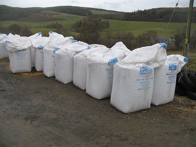
773:
623:
546:
915:"}},"text\/plain":{"en":{"P137":"Geograph Britain and Ireland"}}}}": -->
854:
1440:
430:
1335:
If the file has been modified from its original state, some details may not fully reflect the modified file.
476:– If you remix, transform, or build upon the material, you must distribute your contributions under the
383:
on the
Geograph website for the photographer's contact details. The copyright on this image is owned by
1269:
1264:
42:
707:"}},"text\/plain":{"en":{"P6216":"copyrighted"}}}}": -->
228:
1297:
The following pages on the
English Knowledge use this file (pages on other projects are not listed):
1052:"}},"text\/plain":{"en":{"P7787":"292 degree"}}}}": -->
847:"}},"text\/plain":{"en":{"P31":"photograph"}}}}": -->
1154:"}},"text\/plain":{"en":{"P1071":"Penpont"}}}}": -->
91:
536:"}},"text\/plain":{"en":{"P180":"Penpont"}}}}": -->
766:"}},"text\/plain":{"en":{"P1476":"Lime"}}}}": -->
1506:
973:
958:
1354:
763:
427:
685:
8:
1534:
363:
345:
297:
240:
396:
78:
760:
1344:
235:
1287:
Uploading geograph.org.uk image from https://www.geograph.org.uk/photo/1812040
223:
210:
1618:
1524:
1488:
1361:
1301:
174:
1628:
1390:
1211:
1171:
1129:
1069:
1023:
932:
864:
783:
724:
633:
573:
556:
234:
385:
222:
209:
190:
1552:
368:
380:
1371:
1237:
Click on a date/time to view the file as it appeared at that time.
331:
283:
318:
55° 16′ 41.2″ N, 3° 52′ 06″ W
262:
55° 16′ 40.6″ N, 3° 52′ 05″ W
1319:
158:
66:
229:
1295:
1310:
1235:
241:
90:
Commons is a freely licensed media file repository.
790:
Creative
Commons Attribution-ShareAlike 2.0 Generic
749:
Creative
Commons Attribution-ShareAlike 2.0 Generic
56:(640 × 480 pixels, file size: 77 KB, MIME type:
487:https://creativecommons.org/licenses/by-sa/2.0
71:
905:https:\/\/www.geograph.org.uk\/photo\/1812040
493:Creative Commons Attribution-Share Alike 2.0
408:
154:
115:
186:
170:
14:
1049:
614:https:\/\/www.geograph.org.uk\/profile\/196
453:– to copy, distribute and transmit the work
389:
323:
267:
215:
194:
178:
162:
146:
129:
1312:The following other wikis use this file:
974:https://www.geograph.org.uk/photo/1812040
686:https://www.geograph.org.uk/profile/196
338:View this and other nearby images on:
290:View this and other nearby images on:
102:
395:and is licensed for reuse under the
308:
252:
118:Lime - geograph.org.uk - 1812040.jpg
52:Lime_-_geograph.org.uk_-_1812040.jpg
1228:
431:Attribution-Share Alike 2.0 Generic
419:
414:
399:Attribution-ShareAlike 2.0 license.
13:
1330:
523:
517:
405:
374:
122:
103:
49:
1654:
1337:
522:
1381:Date and time of data generation
1296:
1060:coordinates of the point of view
1042:coordinates of the point of view
508:
464:Under the following conditions:
426:This file is licensed under the
418:
413:
407:
367:
344:
330:
296:
282:
274:
145:agricultural tool, Penpont
70:
31:
21:
505:
46:No higher resolution available.
1307:
1232:
939:file available on the internet
889:file available on the internet
504:
375:This image was taken from the
358:
26:
1:
1539:Flash did not fire, auto mode
1120:coordinates of depicted place
1110:coordinates of depicted place
273:
36:
1292:
989:Geograph Britain and Ireland
913:Geograph Britain and Ireland
664:object of statement has role
602:object of statement has role
542:Items portrayed in this file
357:
175:Geograph Britain and Ireland
106:
7:
1578:Focal plane resolution unit
1451:Date and time of digitizing
1327:
10:
1659:
1589:One-chip color area sensor
1544:Supported Flashpix version
1316:Usage on ig.wikipedia.org
825:
478:same or compatible license
112:
105:
1459:Meaning of each component
1424:File change date and time
1229:
822:
16:
1570:Focal plane Y resolution
1562:Focal plane X resolution
1135:55°16'41.2"N, 3°52'5.9"W
1075:55°16'40.4"N, 3°52'4.4"W
952:geograph.org.uk image ID
893:geograph.org.uk image ID
507:
444:
77:This is a file from the
41:
1602:Custom image processing
1286:
157:
81:. Information from its
1480:Image compression mode
381:this photograph's page
350:55.278111; -3.868264
302:55.277933; -3.867940
84:description page there
1516:Maximum land aperture
1408:Horizontal resolution
230:Dumfries and Galloway
1597:Digital still camera
1519:2.96875 APEX (f/2.8)
1454:11:57, 20 March 2010
1427:11:57, 20 March 2010
1384:11:57, 20 March 2010
1366:1/320 sec (0.003125)
1355:Canon PowerShot A640
1265:02:02, 16 March 2021
1162:location of creation
1148:location of creation
441:by Richard Webb
1432:Y and C positioning
1416:Vertical resolution
1341:Camera manufacturer
459:– to adapt the work
1639:Scene capture type
1623:Auto white balance
803:author name string
753:author name string
651:author name string
598:author name string
1646:
1645:
1308:Global file usage
1290:
1051:
774:copyright license
765:
762:
745:copyright license
563:agricultural tool
530:agricultural tool
516:
404:
403:
379:collection. See
355:
354:
307:
306:
250:
249:
245:
203:Place of creation
99:
98:
79:Wikimedia Commons
32:Global file usage
1650:
1573:7,925.5813953488
1565:7,916.3763066202
1338:
1277:
1239:
1097:
1096:
1091:
991:
986:
976:
971:
967:described at URL
961:
956:
901:described at URL
828:
827:
824:
820:
810:
807:
715:copyright status
701:copyright status
688:
683:
673:
668:
658:
655:
514:
500:
497:
494:
491:
488:
480:as the original.
442:
428:Creative Commons
422:
421:
417:
416:
411:
410:
397:Creative Commons
393:
377:Geograph project
371:
364:
360:
351:
348:
334:
333:
327:
321:
320:
309:
303:
300:
286:
285:
279:
278:
277:
271:
265:
264:
253:
243:
237:
231:
225:
221:
219:
212:
198:
182:
166:
160:
150:
133:
127:
119:
113:
108:
95:
74:
73:
67:
61:
59:
1658:
1657:
1653:
1652:
1651:
1649:
1648:
1647:
1326:
1306:
1298:
1291:
1283:
1275:
1231:
1230:
1227:
1226:
1225:
1224:
1223:
1222:
1221:
1220:
1218:
1208:
1207:
1206:
1204:
1189:
1188:
1187:
1186:
1185:
1184:
1183:
1182:
1180:
1168:
1167:
1166:
1164:
1145:
1144:
1143:
1142:
1141:
1140:
1139:
1138:
1136:
1126:
1125:
1124:
1122:
1107:
1106:
1105:
1104:
1103:
1102:
1101:
1100:
1099:
1098:
1094:
1092:
1089:
1080:
1079:
1078:
1076:
1066:
1065:
1064:
1062:
1039:
1038:
1037:
1036:
1035:
1034:
1033:
1032:
1030:
1020:
1019:
1018:
1016:
1001:
1000:
999:
998:
997:
996:
995:
994:
993:
992:
987:
984:
978:
977:
972:
969:
963:
962:
957:
954:
945:
944:
943:
941:
929:
928:
927:
925:
882:
881:
880:
879:
878:
877:
876:
875:
873:
861:
860:
859:
857:
838:
837:
836:
835:
834:
833:
832:
831:
830:
829:
821:
818:
812:
811:
808:
805:
796:
795:
794:
792:
780:
779:
778:
776:
742:
741:
740:
739:
738:
737:
736:
735:
733:
721:
720:
719:
717:
698:
697:
696:
695:
694:
693:
692:
691:
690:
689:
684:
681:
675:
674:
669:
666:
660:
659:
656:
653:
644:
643:
642:
640:
630:
629:
628:
626:
591:
590:
589:
588:
587:
586:
585:
584:
582:
571:
570:
569:
568:
567:
565:
553:
552:
551:
549:
521:
520:
519:
502:
501:
498:
495:
492:
489:
486:
485:
443:
437:
434:
423:
400:
362:
349:
316:
315:
312:Object location
301:
275:
260:
259:
256:Camera location
251:
206:
142:
134:
123:
117:
110:
101:
100:
89:
88:
87:is shown below.
63:
57:
55:
48:
47:
12:
11:
5:
1656:
1644:
1643:
1640:
1636:
1635:
1632:
1625:
1624:
1621:
1615:
1614:
1611:
1607:
1606:
1605:Normal process
1603:
1599:
1598:
1595:
1591:
1590:
1587:
1586:Sensing method
1583:
1582:
1579:
1575:
1574:
1571:
1567:
1566:
1563:
1559:
1558:
1555:
1549:
1548:
1545:
1541:
1540:
1537:
1531:
1530:
1527:
1521:
1520:
1517:
1513:
1512:
1509:
1503:
1502:
1499:
1495:
1494:
1491:
1485:
1484:
1481:
1477:
1476:
1475:
1474:
1473:does not exist
1471:
1468:
1465:
1460:
1456:
1455:
1452:
1448:
1447:
1444:
1437:
1436:
1433:
1429:
1428:
1425:
1421:
1420:
1417:
1413:
1412:
1409:
1405:
1404:
1401:
1397:
1396:
1393:
1386:
1385:
1382:
1378:
1377:
1374:
1368:
1367:
1364:
1358:
1357:
1352:
1348:
1347:
1342:
1329:
1325:
1324:
1323:
1322:
1309:
1305:
1304:
1294:
1289:
1288:
1285:
1281:
1278:
1272:
1267:
1262:
1258:
1257:
1254:
1251:
1248:
1245:
1242:
1234:
1219:
1216:
1214:
1213:
1212:
1210:
1209:
1205:
1200:
1198:
1197:
1196:
1195:
1193:
1181:
1176:
1174:
1173:
1172:
1170:
1169:
1165:
1160:
1158:
1157:
1156:
1155:
1153:
1149:
1137:
1134:
1132:
1131:
1130:
1128:
1127:
1123:
1118:
1116:
1115:
1114:
1113:
1111:
1085:
1084:
1083:
1082:
1081:
1077:
1074:
1072:
1071:
1070:
1068:
1067:
1063:
1058:
1056:
1055:
1054:
1053:
1047:
1043:
1031:
1028:
1026:
1025:
1024:
1022:
1021:
1017:
1012:
1010:
1009:
1008:
1007:
1005:
980:
979:
965:
964:
950:
949:
948:
947:
946:
942:
937:
935:
934:
933:
931:
930:
926:
923:source of file
921:
919:
918:
917:
916:
914:
910:
906:
902:
898:
894:
890:
886:
885:source of file
874:
869:
867:
866:
865:
863:
862:
858:
853:
851:
850:
849:
848:
846:
842:
814:
813:
801:
800:
799:
798:
797:
793:
788:
786:
785:
784:
782:
781:
777:
772:
770:
769:
768:
767:
758:
754:
750:
746:
734:
729:
727:
726:
725:
723:
722:
718:
713:
711:
710:
709:
708:
706:
702:
677:
676:
662:
661:
649:
648:
647:
646:
645:
641:
638:
636:
635:
634:
632:
631:
627:
622:
620:
619:
618:
617:
615:
611:
607:
603:
599:
595:
583:
578:
576:
575:
574:
572:
566:
561:
559:
558:
557:
555:
554:
550:
545:
543:
540:
539:
538:
537:
535:
531:
527:
513:
512:
509:
506:
484:
483:
482:
481:
471:
462:
461:
460:
454:
447:You are free:
435:
425:
424:
406:
402:
401:
372:
361:
356:
353:
352:
342:
336:
313:
305:
304:
294:
288:
257:
248:
247:
242:United Kingdom
207:
204:
200:
199:
188:
184:
183:
172:
168:
167:
156:
152:
151:
143:
140:
136:
135:
120:
111:
109:
104:
97:
96:
75:
65:
64:
45:
40:
39:
34:
29:
24:
19:
9:
6:
4:
3:
2:
1655:
1641:
1638:
1637:
1633:
1630:
1627:
1626:
1622:
1620:
1619:White balance
1617:
1616:
1613:Auto exposure
1612:
1610:Exposure mode
1609:
1608:
1604:
1601:
1600:
1596:
1593:
1592:
1588:
1585:
1584:
1580:
1577:
1576:
1572:
1569:
1568:
1564:
1561:
1560:
1556:
1554:
1551:
1550:
1546:
1543:
1542:
1538:
1536:
1533:
1532:
1528:
1526:
1525:Metering mode
1523:
1522:
1518:
1515:
1514:
1510:
1508:
1507:Exposure bias
1505:
1504:
1500:
1498:APEX aperture
1497:
1496:
1492:
1490:
1489:Shutter speed
1487:
1486:
1482:
1479:
1478:
1472:
1469:
1466:
1463:
1462:
1461:
1458:
1457:
1453:
1450:
1449:
1445:
1442:
1439:
1438:
1434:
1431:
1430:
1426:
1423:
1422:
1418:
1415:
1414:
1410:
1407:
1406:
1402:
1399:
1398:
1394:
1392:
1388:
1387:
1383:
1380:
1379:
1375:
1373:
1370:
1369:
1365:
1363:
1362:Exposure time
1360:
1359:
1356:
1353:
1350:
1349:
1346:
1343:
1340:
1339:
1336:
1333:
1321:
1318:
1317:
1315:
1314:
1313:
1303:
1302:Liming (soil)
1300:
1299:
1284:
1279:
1273:
1271:
1268:
1266:
1263:
1260:
1259:
1255:
1252:
1249:
1246:
1243:
1241:
1240:
1238:
1215:
1203:
1199:
1179:
1175:
1163:
1159:
1133:
1121:
1117:
1088:
1073:
1061:
1057:
1029:20 March 2010
1027:
1015:
1011:
990:
983:
975:
968:
960:
953:
940:
936:
924:
920:
872:
868:
856:
852:
817:
804:
791:
787:
775:
771:
732:
728:
716:
712:
687:
680:
672:
665:
652:
637:
625:
621:
581:
577:
564:
560:
548:
544:
541:
510:
503:
490:CC BY-SA 2.0
479:
475:
472:
469:
466:
465:
463:
458:
455:
452:
449:
448:
446:
445:
440:
436:Attribution:
432:
429:
412:
398:
394:
392:
387:
382:
378:
373:
370:
366:
365:
347:
343:
341:
340:OpenStreetMap
337:
335:
326:
319:
314:
311:
310:
299:
295:
293:
292:OpenStreetMap
289:
287:
270:
263:
258:
255:
254:
244:
238:
232:
226:
218:
213:
208:
202:
201:
197:
192:
189:
185:
181:
176:
173:
169:
165:
159:20 March 2010
153:
149:
144:
138:
137:
132:
126:
121:
114:
93:
86:
85:
80:
76:
69:
68:
62:
53:
44:
38:
35:
33:
30:
28:
25:
23:
20:
18:
15:
1629:Digital zoom
1391:focal length
1351:Camera model
1334:
1331:
1320:Liming (ala)
1311:
1236:
1233:File history
809:Richard Webb
671:photographer
657:Richard Webb
606:photographer
473:
467:
456:
450:
438:
386:Richard Webb
384:
272:
191:Richard Webb
124:
92:You can help
82:
50:
22:File history
1594:File source
1553:Color space
1400:Orientation
1282:GeographBot
855:instance of
841:instance of
731:copyrighted
705:copyrighted
474:share alike
468:attribution
116:Description
1293:File usage
1274:640 × 480
1250:Dimensions
1217:image/jpeg
1202:media type
1192:media type
871:photograph
845:photograph
639:some value
128:Lime
58:image/jpeg
27:File usage
1247:Thumbnail
1244:Date/Time
1014:inception
1004:inception
826:(English)
764:(English)
359:Licensing
205:InfoField
141:InfoField
1642:Standard
1435:Centered
1372:F-number
1328:Metadata
982:operator
909:operator
511:Captions
457:to remix
451:to share
433:license.
236:Scotland
125:English:
37:Metadata
1529:Pattern
1443:version
1276:(77 KB)
1261:current
1256:Comment
1178:Penpont
1152:Penpont
1087:heading
1046:heading
959:1812040
897:1812040
624:creator
594:creator
580:Penpont
547:depicts
534:Penpont
526:depicts
515:English
224:Penpont
211:Penpont
139:Depicts
107:Summary
54:
1581:inches
1493:8.3125
1419:72 dpi
1411:72 dpi
1403:Normal
1395:7.3 mm
1095:degree
1050:degree
388:
328:
322:
280:
266:
214:
193:
187:Author
177:
171:Source
161:
1631:ratio
1535:Flash
1389:Lens
1345:Canon
816:title
757:title
1557:sRGB
1441:Exif
1253:User
1093:292
823:Lime
761:Lime
518:Lime
499:true
496:true
439:Lime
155:Date
17:File
1446:2.2
1376:f/4
679:URL
610:URL
1470:Cr
1467:Cb
1090::
985::
970::
955::
819::
806::
682::
667::
654::
1634:1
1547:1
1511:0
1501:4
1483:5
1464:Y
246:)
239:→
233:→
227:→
220:(
94:.
60:)
Text is available under the Creative Commons Attribution-ShareAlike License. Additional terms may apply.