55:
38:
485:
88:
95:
62:
342:
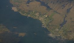
Sistranda has schools representing all levels up to high school. It is also the centre of transportation on the island of Frøya, with buses to locations around the region and ferries with daily routes to
526:
54:
123:
555:
519:
545:
201:
550:
512:
87:
37:
285:
468:(in Norwegian) (14 ed.). Kristiania, Norge: W. C. Fabritius & sønners bogtrikkeri. p. 58.
435:
165:
379:
which means "side" (here in the sense of the "coast"). The farm is today divided in three parts:
312:
308:
264:
206:
421:
274:
8:
189:
368:
336:
177:
352:
335:. The 1.04-square-kilometre (260-acre) village has a population (2018) of 1,041 and a
417:
324:
500:
463:
332:
496:
170:
539:
138:
125:
484:
492:
316:
182:
328:
281:
260:
459:
344:
255:
348:
320:
158:
339:
of 1,001 inhabitants per square kilometre (2,590/sq mi).
439:
356:
194:
327:, about 4 kilometres (2.5 mi) north of the village of
422:"Urban settlements. Population and area, by municipality"
416:
391:(Inner-Sian). The last element is the finite form of
375:). The name of the farm is identical with the word
323:. The village is located on the east side of the
537:
367:The first element is the name of an old farm (
520:
527:
513:
465:Norske gaardnavne: Søndre Trondhjems amt
538:
412:
410:
408:
479:
458:
221:1.04 km (0.40 sq mi)
13:
405:
14:
567:
94:
61:
16:Village in Central Norway, Norway
483:
93:
86:
60:
53:
36:
452:
436:"Sistranda, Frøya (Trøndelag)"
428:
1:
398:
499:. You can help Knowledge by
7:
250:1,001/km (2,590/sq mi)
10:
572:
478:
556:Trøndelag geography stubs
292:
271:
254:
246:
238:
233:
225:
217:
212:
200:
188:
176:
164:
154:
119:
47:
35:
28:
21:
331:and the entrance to the
372:
362:
311:of the municipality of
74:Location of the village
495:location article is a
418:Statistisk sentralbyrå
229:12 m (39 ft)
546:Villages in Trøndelag
309:administrative centre
273: • Summer (
77:Show map of Trøndelag
247: • Density
139:63.7252°N 08.8332°E
135: /
42:View of the village
420:(1 January 2018).
387:(Middle-Sian) and
337:population density
239: • Total
218: • Total
110:Show map of Norway
107:Sistranda (Norway)
508:
507:
302:
301:
563:
551:Frøya, Trøndelag
529:
522:
515:
487:
480:
470:
469:
456:
450:
449:
447:
446:
432:
426:
425:
414:
278:
150:
149:
147:
146:
145:
144:63.7252; 08.8332
140:
136:
133:
132:
131:
128:
111:
97:
96:
90:
78:
64:
63:
57:
40:
19:
18:
571:
570:
566:
565:
564:
562:
561:
560:
536:
535:
534:
533:
476:
474:
473:
457:
453:
444:
442:
434:
433:
429:
415:
406:
401:
365:
325:island of Frøya
298:
272:
143:
141:
137:
134:
129:
126:
124:
122:
121:
115:
114:
113:
112:
109:
108:
105:
104:
103:
102:
98:
81:
80:
79:
76:
75:
72:
71:
70:
69:
65:
43:
31:
24:
17:
12:
11:
5:
569:
559:
558:
553:
548:
532:
531:
524:
517:
509:
506:
505:
488:
472:
471:
451:
427:
403:
402:
400:
397:
383:(Outer-Sian),
364:
361:
300:
299:
297:7260 Sistranda
296:
294:
290:
289:
279:
269:
268:
258:
252:
251:
248:
244:
243:
240:
236:
235:
231:
230:
227:
223:
222:
219:
215:
214:
210:
209:
204:
198:
197:
192:
186:
185:
180:
174:
173:
171:Central Norway
168:
162:
161:
156:
152:
151:
117:
116:
106:
100:
99:
92:
91:
85:
84:
83:
82:
73:
67:
66:
59:
58:
52:
51:
50:
49:
48:
45:
44:
41:
33:
32:
29:
26:
25:
22:
15:
9:
6:
4:
3:
2:
568:
557:
554:
552:
549:
547:
544:
543:
541:
530:
525:
523:
518:
516:
511:
510:
504:
502:
498:
494:
489:
486:
482:
481:
477:
467:
466:
461:
455:
441:
437:
431:
423:
419:
413:
411:
409:
404:
396:
394:
390:
386:
382:
378:
374:
370:
360:
358:
354:
350:
346:
340:
338:
334:
330:
326:
322:
318:
314:
310:
306:
295:
291:
287:
283:
280:
276:
270:
266:
262:
259:
257:
253:
249:
245:
241:
237:
232:
228:
224:
220:
216:
211:
208:
205:
203:
199:
196:
193:
191:
187:
184:
181:
179:
175:
172:
169:
167:
163:
160:
157:
153:
148:
120:Coordinates:
118:
89:
56:
46:
39:
34:
27:
20:
501:expanding it
490:
475:
464:
454:
443:. Retrieved
430:
392:
388:
384:
380:
376:
366:
341:
333:Frøya Tunnel
304:
303:
202:Municipality
142: /
540:Categories
460:Rygh, Oluf
445:2018-02-19
399:References
329:Hammarvika
234:Population
127:63°43′31″N
493:Trøndelag
389:Innersian
381:Yttersian
369:Old Norse
345:Trondheim
317:Trøndelag
305:Sistranda
293:Post Code
282:UTC+02:00
261:UTC+01:00
256:Time zone
226:Elevation
183:Trøndelag
130:8°50′00″E
101:Sistranda
68:Sistranda
23:Sistranda
462:(1901).
385:Midtsian
319:county,
190:District
349:Mausund
307:is the
155:Country
30:Village
393:strand
355:, and
321:Norway
178:County
166:Region
159:Norway
491:This
440:yr.no
357:Froan
313:Frøya
242:1,041
207:Frøya
195:Fosen
497:stub
377:síða
373:Síða
363:Name
353:Sula
286:CEST
213:Area
315:in
275:DST
265:CET
542::
438:.
407:^
395:.
371::
359:.
351:,
347:,
528:e
521:t
514:v
503:.
448:.
424:.
288:)
284:(
277:)
267:)
263:(
Text is available under the Creative Commons Attribution-ShareAlike License. Additional terms may apply.


