118:
1402:
1065:
758:
129:
27:
555:
611:
19:
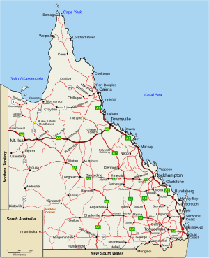
42:. Due to its large size and decentralised population, the state is often divided into regions for statistical and administrative purposes. Each region varies somewhat in terms of its economy, population, climate, geography, flora and fauna. Cultural and official perceptions and definitions of the various regions differ somewhat depending on the government agency or popular group by which they are being applied.
607:. The region also consists of many Aboriginal and farming communities. The region covers an area of 380,748.3 square kilometres (147,008 sq mi) and in 2012 the region's population was 301,256 of which 146,778 lived in Cairns. Significant industries include tourism, cattle grazing, agriculture (sugar cane and tropical fruits) and mining of both sand and bauxite.
295:
626:
Other names for regions are in popular usage, for example by different government agencies and in various regional maps of
Queensland. The state also contains smaller regions within those discussed above which are not necessarily used for statistical purposes, but which are distinct in terms of their
203:
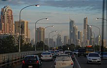
Coasts, located south and north of
Brisbane respectively, are two of the Queensland's most popular tourist regions, containing many hotels and resorts. Each region has an airport which caters primarily to tourists. The remaining parts of the region are located inland, west of Brisbane, and are
50:
Various
Queensland state government departments adopt different definitions of regions for administrative purposes. The Queensland government Trade and Investment Queensland defines seven regions. These are (roughly from south to north):
443:
local government areas. Despite its vast land area of 497,714 square kilometres (192,168 sq mi), it only had a population of 200,172 (2008). The region's economy is heavily dominated by coal mining, and cattle grazing. A major
952:
139:
is commonly considered to be a single region. It contains two statistical regions listed above, Brisbane and
Moreton. The region has a population of 3,500,000 people, or 72% of the state's population. The area contains
191:
local government areas. The metropolitan area has a population of 2,360,241 (2016) It is the state's main commercial and administrative centre and contains the state's largest domestic and international airport.
286:. In 2008, the region had a population of 257,749. Economic activities include cattle grazing, cotton farming, and natural resource extraction such as natural gas and opal mining.
909:
874:
75:
798:
834:
1361:
1366:
942:
486:. The coastal areas are densely covered in sugar cane farms, while the less densely populated inland areas have several mining communities.
845:
905:
870:
820:
794:
1042:
1160:
658:– a group of islands in the Mackay region. A popular tourist destination, the name usually includes the coastal community of
1103:
979:
933:
1175:
1096:
1387:
246:. It has an area of 410,129 square kilometres (158,352 sq mi) and contains the local government areas of
1252:
1351:
1144:
901:
1423:
522:
and cattle exports from coastal and inland areas. The region also contains a bulk sugar exporting terminal at
1428:
1356:
1170:
1139:
771:
1134:
527:
1320:
1108:
1047:
316:
200:
164:. The region is the major administrative and commercial centre and focus of tourism within Queensland.
153:
1165:
1052:
698:
615:
367:, a popular tourist destination and world's largest sand island. Its population in 2008 was 276,752.
1091:
1086:
972:
659:
1401:
571:
The Far North region is
Queensland's largest region covering 22% of the state's area and includes
1305:
1222:
1012:
382:
356:
838:
1285:
1275:
1081:
1073:
934:
Office of
Economic and Statistical research – Aborisginal and Torres Strait Islander population
692:
663:
479:
196:
149:
1280:
1217:
1202:
1113:
1032:
1022:
1017:
1002:
738:
722:
669:
600:
539:
531:
424:
400:
319:, covering a region of 52,377 square kilometres (20,223 sq mi). It consists of the
255:
243:
217:
136:
112:
100:
92:
55:
1242:
1212:
1007:
833:
682:
638:
588:
566:
336:
332:
306:
259:
235:
85:
65:
222:
The
Darling Downs South West region is located about 160 kilometres (100 mi) west of
8:
1394:
1037:
965:
714:
708:
631:
580:
572:
559:
523:
432:
324:
184:
157:
124:
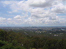
is the largest city in both the South East
Queensland region and the state of Queensland.
1064:
627:
geography, economy or demographic characteristics. Such regions in
Queensland include:
1300:
1227:
1118:
678:
655:
592:
543:
483:
471:
467:
392:
376:
251:
96:
70:
1380:
814:
763:
596:
475:
461:
416:
1232:
728:
673:
642:
495:
436:
412:
320:
283:
267:
247:
172:
80:
117:
704:
637:
Tropical North
Queensland – an area of tropical Queensland that usually includes
604:
535:
440:
428:
420:
388:
275:
271:
239:
231:
227:
188:
279:
263:
161:
1417:
1207:
576:
457:
364:
328:
312:
213:
60:
583:. The main population and administrative centre of the region is located in
1237:
688:
501:
180:
466:
The Mackay, Isaac and Whitsunday region is centred on the coastal city of
1315:
408:
396:
91:
Smaller regions may also exist within these defined regions, such as the
1335:
1330:
1295:
988:
507:
506:
The North Queensland region is a coastal region centred on the city of
360:
348:
298:
176:
145:
39:
906:"3218.0 – Regional Population Growth, Australia, 2007-08 – Queensland"
554:
1325:
1310:
1265:
519:
511:
445:
363:
farms and mills and has a significant tourism industry – it includes
340:
128:
953:
Australian Bureau of Statistics – Wide Bay-Burnet divisional profile
1260:
352:
234:. The region consists of the fertile agricultural area west of the
223:
168:
141:
121:
26:
610:
18:
649:
515:
404:
1290:
1270:
900:
839:"3218.0 – South East Queensland Regional Plan, Australia, 2017"
742:
732:
584:
344:
957:
943:
Australian Bureau of Statistics – North West regional profile
634:– the area of the state north of latitude 23.5 degrees South.
701:– an area near the border of New South Wales and Queensland.
681:– a fertile agricultural district in the Cairns hinterland,
835:
Department of Infrastructure, Local Government and Planning
691:– an area of south-east Queensland centred on the town of
707:– a section of the Central Queensland coastline near the
311:
The Wide Bay–Burnett region is located north-east of the
38:
refer to the geographic areas of the Australian state of
294:
672:– islands between the northern tip of Queensland and
652:– refers generally to Australian arid inland regions.
403:, the coastal areas and popular holiday destinations
753:
717:– a district that is sometimes referred to as the
526:in the region's north. Other inland towns include
1415:
470:and extends some 300 km inland. It contains the
789:
787:
451:
339:local government areas. Major centres include
973:
784:
415:, and well as the areas further west of the
929:
207:
144:, the state's capital city, as well as the
980:
966:
871:"2016 Census QuickStats: Greater Brisbane"
167:The Brisbane region comprises the greater
896:
894:
892:
609:
553:
514:. Townsville is the location of a major
293:
127:
116:
106:
25:
17:
587:. Other key population centres include
549:
1416:
819:: CS1 maint: archived copy as title (
387:The Central Queensland region borders
301:is part of the Wide Bay–Burnett region
961:
889:
370:
242:state border, centred on the city of
912:from the original on 20 January 2012
621:
558:Tropical rainforests and beaches on
395:, and contains the major centres of
489:
289:
13:
851:from the original on 18 April 2018
801:from the original on 19 April 2018
171:metropolitan area, centred on the
14:
1440:
948:
938:
877:from the original on 14 July 2017
448:smelter is located in Gladstone.
30:Cities and highways in Queensland
1400:
1063:
756:
902:Australian Bureau of Statistics
518:handling exports from mines in
474:group and the coastal towns of
987:
863:
827:
1:
777:
510:and secondary inland city of
772:List of regions in Australia
731:– a coastal area centred on
452:Mackay, Isaac and Whitsunday
76:Mackay, Isaac and Whitsunday
7:
1161:Fire and Emergency Services
749:
534:, and the coastal towns of
45:
10:
1445:
564:
499:
493:
455:
380:
374:
304:
226:and borders the states of
211:
110:
1375:
1344:
1251:
1188:
1153:
1127:
1072:
1061:
1043:Australian rules football
995:
616:Boodjamulla National Park
208:Darling Downs South West
1074:Politics and Government
383:Central West Queensland
175:and also including the
618:
562:
359:. The area is rich in
302:
133:
125:
31:
23:
1424:Regions of Queensland
1362:Members of Parliament
1198:Regions of Queensland
739:North West Queensland
723:South West Queensland
719:Western Darling Downs
670:Torres Strait Islands
662:, and sometimes also
641:, and sometimes also
613:
557:
456:Further information:
297:
218:South West Queensland
137:South East Queensland
131:
120:
113:South East Queensland
107:South East Queensland
101:South West Queensland
93:Torres Strait Islands
56:South East Queensland
36:Regions of Queensland
29:
21:
1429:Regions of Australia
1176:Electoral Commission
1097:Legislative Assembly
683:Far North Queensland
639:Far North Queensland
567:Far North Queensland
550:Far North Queensland
236:Great Dividing Range
86:Far North Queensland
709:Tropic of Capricorn
632:Tropical Queensland
614:Lawn Hill Gorge in
581:Gulf of Carpentaria
573:Cape York Peninsula
560:Hinchinbrook Island
837:(11 August 2017).
741:– the area around
679:Atherton Tableland
656:Whitsunday Islands
619:
593:Atherton Tableland
563:
472:Whitsunday Islands
393:Northern Territory
377:Central Queensland
371:Central Queensland
303:
134:
126:
97:Whitsunday Islands
71:Central Queensland
32:
24:
22:Queensland Regions
1411:
1410:
1213:Wide Bay–Burnett
1184:
1183:
1171:Ambulance Service
1145:Magistrates Court
904:(23 April 2009).
764:Queensland portal
622:Other definitions
462:Whitsunday Region
315:and north of the
238:and south to the
204:primarily rural.
1436:
1404:
1253:Cities and towns
1125:
1124:
1104:Local Government
1067:
982:
975:
968:
959:
958:
951:
941:
932:
922:
921:
919:
917:
898:
887:
886:
884:
882:
867:
861:
860:
858:
856:
850:
843:
831:
825:
824:
818:
810:
808:
806:
791:
766:
761:
760:
759:
729:The Marlin Coast
674:Papua New Guinea
643:North Queensland
496:North Queensland
490:North Queensland
307:Wide Bay–Burnett
290:Wide Bay–Burnett
173:City of Brisbane
81:North Queensland
66:Wide Bay–Burnett
1444:
1443:
1439:
1438:
1437:
1435:
1434:
1433:
1414:
1413:
1412:
1407:
1371:
1340:
1247:
1180:
1149:
1123:
1068:
1059:
991:
986:
926:
925:
915:
913:
899:
890:
880:
878:
869:
868:
864:
854:
852:
848:
841:
832:
828:
812:
811:
804:
802:
795:"Archived copy"
793:
792:
785:
780:
762:
757:
755:
752:
705:Capricorn Coast
624:
605:Thursday Island
569:
552:
528:Charters Towers
504:
498:
492:
464:
454:
389:South Australia
385:
379:
373:
309:
292:
240:New South Wales
232:South Australia
228:New South Wales
220:
212:Main articles:
210:
115:
109:
48:
12:
11:
5:
1442:
1432:
1431:
1426:
1409:
1408:
1406:
1405:
1398:
1391:
1384:
1376:
1373:
1372:
1370:
1369:
1364:
1359:
1354:
1348:
1346:
1342:
1341:
1339:
1338:
1333:
1328:
1323:
1321:Sunshine Coast
1318:
1313:
1308:
1303:
1298:
1293:
1288:
1283:
1278:
1273:
1268:
1263:
1257:
1255:
1249:
1248:
1246:
1245:
1240:
1235:
1230:
1225:
1220:
1215:
1210:
1205:
1200:
1194:
1192:
1186:
1185:
1182:
1181:
1179:
1178:
1173:
1168:
1163:
1157:
1155:
1151:
1150:
1148:
1147:
1142:
1140:District Court
1137:
1131:
1129:
1122:
1121:
1116:
1111:
1106:
1101:
1100:
1099:
1089:
1084:
1078:
1076:
1070:
1069:
1062:
1060:
1058:
1057:
1056:
1055:
1050:
1045:
1035:
1030:
1025:
1020:
1015:
1010:
1005:
999:
997:
993:
992:
985:
984:
977:
970:
962:
956:
955:
946:
936:
924:
923:
888:
862:
826:
782:
781:
779:
776:
775:
774:
768:
767:
751:
748:
747:
746:
736:
726:
712:
702:
696:
686:
676:
667:
653:
646:
635:
623:
620:
565:Main article:
551:
548:
494:Main article:
491:
488:
453:
450:
425:Blackall-Tambo
375:Main article:
372:
369:
317:Sunshine Coast
305:Main article:
291:
288:
256:Southern Downs
209:
206:
162:Lockyer Valley
154:Sunshine Coast
132:The Gold Coast
111:Main article:
108:
105:
89:
88:
83:
78:
73:
68:
63:
58:
47:
44:
9:
6:
4:
3:
2:
1441:
1430:
1427:
1425:
1422:
1421:
1419:
1403:
1399:
1397:
1396:
1392:
1390:
1389:
1385:
1383:
1382:
1378:
1377:
1374:
1368:
1365:
1363:
1360:
1358:
1355:
1353:
1352:Queenslanders
1350:
1349:
1347:
1343:
1337:
1334:
1332:
1329:
1327:
1324:
1322:
1319:
1317:
1314:
1312:
1309:
1307:
1304:
1302:
1299:
1297:
1294:
1292:
1289:
1287:
1284:
1282:
1279:
1277:
1274:
1272:
1269:
1267:
1264:
1262:
1259:
1258:
1256:
1254:
1250:
1244:
1241:
1239:
1236:
1234:
1231:
1229:
1226:
1224:
1221:
1219:
1216:
1214:
1211:
1209:
1208:Darling Downs
1206:
1204:
1201:
1199:
1196:
1195:
1193:
1191:
1187:
1177:
1174:
1172:
1169:
1167:
1164:
1162:
1159:
1158:
1156:
1152:
1146:
1143:
1141:
1138:
1136:
1135:Supreme Court
1133:
1132:
1130:
1126:
1120:
1117:
1115:
1112:
1110:
1107:
1105:
1102:
1098:
1095:
1094:
1093:
1090:
1088:
1085:
1083:
1080:
1079:
1077:
1075:
1071:
1066:
1054:
1051:
1049:
1046:
1044:
1041:
1040:
1039:
1036:
1034:
1031:
1029:
1026:
1024:
1021:
1019:
1016:
1014:
1011:
1009:
1006:
1004:
1001:
1000:
998:
994:
990:
983:
978:
976:
971:
969:
964:
963:
960:
954:
950:
947:
944:
940:
937:
935:
931:
928:
927:
911:
907:
903:
897:
895:
893:
876:
872:
866:
847:
840:
836:
830:
822:
816:
800:
796:
790:
788:
783:
773:
770:
769:
765:
754:
744:
740:
737:
734:
730:
727:
724:
720:
716:
713:
710:
706:
703:
700:
699:Border Rivers
697:
694:
690:
687:
684:
680:
677:
675:
671:
668:
665:
661:
657:
654:
651:
647:
644:
640:
636:
633:
630:
629:
628:
617:
612:
608:
606:
602:
598:
594:
590:
586:
582:
578:
577:Torres Strait
574:
568:
561:
556:
547:
545:
541:
537:
533:
529:
525:
521:
517:
513:
509:
503:
497:
487:
485:
481:
477:
473:
469:
463:
459:
458:Mackay Region
449:
447:
442:
438:
434:
430:
426:
422:
418:
414:
410:
406:
402:
398:
394:
390:
384:
378:
368:
366:
365:Fraser Island
362:
358:
354:
350:
346:
342:
338:
337:South Burnett
334:
333:North Burnett
330:
326:
322:
318:
314:
313:Darling Downs
308:
300:
296:
287:
285:
281:
277:
273:
269:
265:
261:
260:Western Downs
257:
253:
249:
245:
241:
237:
233:
229:
225:
219:
215:
214:Darling Downs
205:
202:
198:
193:
190:
186:
182:
178:
174:
170:
165:
163:
159:
155:
151:
147:
143:
138:
130:
123:
119:
114:
104:
102:
98:
94:
87:
84:
82:
79:
77:
74:
72:
69:
67:
64:
62:
61:Darling Downs
59:
57:
54:
53:
52:
43:
41:
37:
28:
20:
16:
1393:
1386:
1379:
1238:Gulf Country
1223:Central West
1197:
1189:
1109:Constitution
1048:Rugby league
1027:
949:
939:
930:
914:. Retrieved
879:. Retrieved
865:
853:. Retrieved
829:
803:. Retrieved
718:
689:Granite Belt
660:Airlie Beach
625:
570:
505:
502:Gulf Country
465:
386:
325:Fraser Coast
310:
221:
194:
166:
135:
90:
49:
35:
33:
15:
1388:WikiProject
1357:Brisbanites
1316:Rockhampton
1306:Maryborough
1053:Rugby union
409:Agnes Water
397:Rockhampton
357:Maryborough
252:Goondiwindi
185:Moreton Bay
1418:Categories
1331:Townsville
1296:Hervey Bay
1286:Gold Coast
1276:Caboolture
1218:South West
1203:South East
1092:Parliament
1087:Government
989:Queensland
778:References
693:Stanthorpe
664:Proserpine
579:, and the
508:Townsville
500:See also:
480:Proserpine
433:Diamantina
417:Barcaldine
381:See also:
361:sugar cane
349:Hervey Bay
299:Hervey Bay
150:Gold Coast
146:Logan City
40:Queensland
1326:Toowoomba
1311:Mount Isa
1281:Gladstone
1266:Bundaberg
1243:Far North
1013:Geography
855:11 August
601:Normanton
540:Home Hill
532:Cloncurry
520:Mount Isa
512:Mount Isa
446:aluminium
437:Longreach
401:Gladstone
341:Bundaberg
321:Bundaberg
248:Toowoomba
244:Toowoomba
1395:Category
1367:Premiers
1261:Brisbane
1154:Services
1082:Politics
910:Archived
881:18 April
875:Archived
846:Archived
815:cite web
805:18 April
799:Archived
750:See also
589:Cooktown
391:and the
353:Kingaroy
224:Brisbane
201:Sunshine
169:Brisbane
160:and the
142:Brisbane
122:Brisbane
46:Overview
1228:Central
1190:Regions
1114:Premier
1033:Symbols
1028:Regions
1023:History
1018:Geology
1003:Economy
996:General
715:Maranoa
650:Outback
524:Lucinda
516:seaport
405:Yeppoon
284:Quilpie
268:Balonne
264:Maranoa
189:Ipswich
181:Redland
158:Ipswich
1381:Portal
1345:People
1336:Logan
1301:Mackay
1291:Gympie
1271:Cairns
1166:Police
1128:Courts
1008:Energy
916:30 May
743:Mt Isa
733:Cairns
603:, and
591:, the
585:Cairns
575:, the
544:Ingham
484:Sarina
482:, and
468:Mackay
441:Winton
429:Boulia
421:Barcoo
345:Gympie
329:Gympie
276:Murweh
272:Bulloo
1233:North
1038:Sport
849:(PDF)
842:(PDF)
721:, in
597:Weipa
476:Bowen
280:Paroo
177:Logan
1119:Flag
918:2008
883:2018
857:2017
821:link
807:2018
648:The
542:and
530:and
460:and
439:and
413:1770
411:and
399:and
355:and
335:and
282:and
230:and
216:and
199:and
197:Gold
195:The
187:and
99:and
34:The
536:Ayr
1420::
908:.
891:^
873:.
844:.
817:}}
813:{{
797:.
786:^
599:,
595:,
546:.
538:,
478:,
435:,
431:,
427:,
423:,
419:,
407:,
351:,
347:,
343:,
331:,
327:,
323:,
278:,
274:,
270:,
266:,
262:,
258:,
254:,
250:,
183:,
179:,
156:,
152:,
148:,
103:.
95:,
981:e
974:t
967:v
945:.
920:.
885:.
859:.
823:)
809:.
745:.
735:.
725:.
711:.
695:.
685:.
666:.
645:.
Text is available under the Creative Commons Attribution-ShareAlike License. Additional terms may apply.


