257:
60:
44:
67:
188:
lies on its western slopes, and was once the largest winery in the United States. The area is currently isolated from the urban core and serves as habitat for deer and other creatures. The southern end of the ridge developed with many houses in the historic
337:
298:
317:
94:
322:
327:
291:
231:
284:
59:
190:
162:
222:
332:
264:
227:
129:
217:
194:
181:
17:
256:
185:
166:
43:
8:
272:
16:
This article is about the point and hills in
Richmond, California. For other uses, see
34:
140:
268:
311:
158:
109:
96:
177:
133:
80:
173:
145:
176:
and lies between San Pablo Bay to the west and north, and
193:neighborhood. Part of the western coast is part of
309:
338:Contra Costa County, California geography stubs
184:and Potrero Ridge lay just east of the point.
292:
318:Landforms of Contra Costa County, California
299:
285:
232:United States Department of the Interior
323:Landforms of the San Francisco Bay Area
310:
212:
210:
66:
251:
223:Geographic Names Information System
207:
13:
14:
349:
328:Geography of Richmond, California
255:
65:
58:
42:
265:Contra Costa County, California
228:United States Geological Survey
161:forming a cape and hugging the
1:
79:location of Point Potrero in
271:. You can help Knowledge by
7:
10:
354:
250:
195:Point Molate Regional Park
15:
182:Chevron Richmond Refinery
172:The cape is covered with
139:
125:
110:37.904092°N 122.3663599°W
90:
53:
41:
32:
25:
200:
18:Potrero (disambiguation)
333:Headlands of California
115:37.904092; -122.3663599
267:–related article is a
167:Richmond, California
130:Contra Costa County
106: /
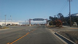
48:Point Potrero gate
280:
279:
180:to the east. The
152:
151:
345:
301:
294:
287:
259:
252:
242:
241:
239:
238:
214:
121:
120:
118:
117:
116:
111:
107:
104:
103:
102:
99:
69:
68:
62:
46:
23:
22:
353:
352:
348:
347:
346:
344:
343:
342:
308:
307:
306:
305:
248:
246:
245:
236:
234:
218:"Point Potrero"
216:
215:
208:
203:
114:
112:
108:
105:
100:
97:
95:
93:
92:
86:
85:
84:
83:
77:
76:
75:
74:
70:
49:
37:
28:
21:
12:
11:
5:
351:
341:
340:
335:
330:
325:
320:
304:
303:
296:
289:
281:
278:
277:
260:
244:
243:
205:
204:
202:
199:
191:Point Richmond
157:is a point in
150:
149:
143:
137:
136:
127:
123:
122:
88:
87:
78:
72:
71:
64:
63:
57:
56:
55:
54:
51:
50:
47:
39:
38:
33:
30:
29:
26:
9:
6:
4:
3:
2:
350:
339:
336:
334:
331:
329:
326:
324:
321:
319:
316:
315:
313:
302:
297:
295:
290:
288:
283:
282:
276:
274:
270:
266:
261:
258:
254:
253:
249:
233:
229:
225:
224:
219:
213:
211:
206:
198:
196:
192:
187:
183:
179:
175:
170:
168:
164:
163:Potrero Hills
160:
159:San Pablo Bay
156:
155:Point Potrero
147:
144:
142:
138:
135:
131:
128:
124:
119:
91:Coordinates:
89:
82:
73:Point Potrero
61:
52:
45:
40:
36:
31:
27:Point Potrero
24:
19:
273:expanding it
262:
247:
235:. Retrieved
221:
171:
154:
153:
178:Castro Cove
113: /
101:122°21′59″W
312:Categories
237:2009-05-04
134:California
98:37°54′15″N
81:California
186:Winehaven
174:chaparral
148:Richmond
141:Topo map
126:Location
263:This
201:Notes
269:stub
146:USGS
35:Cape
165:in
314::
230:,
226:.
220:.
209:^
197:.
169:.
132:,
300:e
293:t
286:v
275:.
240:.
20:.
Text is available under the Creative Commons Attribution-ShareAlike License. Additional terms may apply.

