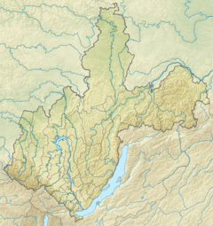
33:
40:
406:
363:, which form the Mama river, have their sources in the heights of the range, at 1,720 m (5,640 ft) the first and at about 1,900 m (6,200 ft) the second. They are fast-flowing mountain rivers, with
375:
among rocky banks. The river is navigable downstream from the confluence of the Bramya, a small tributary. Finally the Mama meets the lower course of the Vitim 171 km (106 mi) from its mouth in the Lena.
398:
bare summits. The main tributaries of the Mama are the 153 kilometres (95 mi) long
Konkudera, the 48 kilometres (30 mi) long Kaverga and the 40 kilometres (25 mi) long Bolshoi Ugli.
164:
451:
99:
336:
312:
of 18,900 square kilometres (7,300 sq mi). The total length of the river including the Left Mama is 406 kilometres (252 mi).
324:
32:
495:
485:
490:
470:
316:
367:
and waterfalls. After the confluence the Mama flows roughly northeastwards across a fragmented
8:
395:
352:
277:
434:
309:
285:
48:
479:
391:
301:
256:
179:
166:
150:
114:
101:
466:
340:
320:
260:
145:
380:
372:
368:
328:
264:
297:
332:
289:
364:
308:. The river has a length of 211 kilometres (131 mi) and a
293:
68:
351:
The river basin is located on the slopes and foothills of the
387:
384:
305:
383:. Most of the territory adjacent to the river is covered by
405:
435:"Река МАМА in the State Water Register of Russia"
409:
Basin of the Vitim with the Mama in the upper part.
319:of Irkutsk Oblast is named after rivers Mama and
477:
304:, the second largest in basin area after the
379:The river is located in an area marked by
404:
239:350 m/s (12,000 cu ft/s)
478:
217:18,900 km (7,300 sq mi)
87:Confluence of Left Mama and Right Mama
429:
427:
39:
13:
424:
14:
507:
460:
445:
394:in the upper reaches, crowned by
38:
31:
158: • coordinates
93: • coordinates
1:
417:
75:Physical characteristics
197: • elevation
132: • elevation
7:
10:
512:
402:
343:are located by the river.
235: • average
136:439 m (1,440 ft)
471:Great Soviet Encyclopedia
346:
281:
252:
247:
243:
233:
225:
221:
213:
209:211 km (131 mi)
205:
195:
156:
144:
140:
130:
91:
83:
79:
74:
64:
59:
26:
21:
496:Rivers of Irkutsk Oblast
201:209 m (686 ft)
486:Tributaries of the Lena
317:Mamsko-Chuysky District
452:Mama - Water of Russia
410:
180:58.30750°N 112.92194°E
115:57.18472°N 111.39139°E
408:
323:. The settlements of
355:. Rivers Left Mama
248:Basin features
185:58.30750; 112.92194
176: /
120:57.18472; 111.39139
111: /
491:Rivers of Buryatia
411:
353:Upper Angara Range
47:Mouth location in
415:
414:
270:
269:
503:
454:
449:
443:
442:
431:
401:
400:
284:) is a river in
283:
236:
191:
190:
188:
187:
186:
181:
177:
174:
173:
172:
169:
133:
126:
125:
123:
122:
121:
116:
112:
109:
108:
107:
104:
94:
42:
41:
35:
19:
18:
511:
510:
506:
505:
504:
502:
501:
500:
476:
475:
463:
458:
457:
450:
446:
433:
432:
425:
420:
359:and Right Mama
349:
296:. It is a left
234:
198:
184:
182:
178:
175:
170:
167:
165:
163:
162:
159:
131:
119:
117:
113:
110:
105:
102:
100:
98:
97:
92:
55:
54:
53:
52:
45:
44:
43:
17:
16:River in Russia
12:
11:
5:
509:
499:
498:
493:
488:
474:
473:
462:
461:External links
459:
456:
455:
444:
422:
421:
419:
416:
413:
412:
361:(Pravaya Mama)
348:
345:
310:drainage basin
286:Irkutsk Oblast
268:
267:
254:
250:
249:
245:
244:
241:
240:
237:
231:
230:
227:
223:
222:
219:
218:
215:
211:
210:
207:
203:
202:
199:
196:
193:
192:
160:
157:
154:
153:
148:
142:
141:
138:
137:
134:
128:
127:
95:
89:
88:
85:
81:
80:
77:
76:
72:
71:
66:
62:
61:
57:
56:
49:Irkutsk Oblast
46:
37:
36:
30:
29:
28:
27:
24:
23:
15:
9:
6:
4:
3:
2:
508:
497:
494:
492:
489:
487:
484:
483:
481:
472:
468:
465:
464:
453:
448:
441:(in Russian).
440:
436:
430:
428:
423:
407:
403:
399:
397:
393:
392:Siberian pine
389:
386:
382:
377:
374:
370:
366:
362:
358:
357:(Levaya Mama)
354:
344:
342:
338:
334:
330:
326:
322:
318:
313:
311:
307:
303:
299:
295:
291:
287:
279:
275:
266:
262:
258:
255:
251:
246:
242:
238:
232:
228:
224:
220:
216:
212:
208:
204:
200:
194:
189:
161:
155:
152:
149:
147:
143:
139:
135:
129:
124:
96:
90:
86:
82:
78:
73:
70:
67:
63:
58:
50:
34:
25:
20:
447:
438:
378:
360:
356:
350:
314:
273:
271:
469:Article in
467:Мама (река)
253:Progression
183: /
171:112°55′19″E
118: /
106:111°23′29″E
480:Categories
439:textual.ru
418:References
381:permafrost
373:meandering
369:floodplain
329:Slyudyanka
265:Laptev Sea
214:Basin size
168:58°18′27″N
103:57°11′05″N
371:slightly
298:tributary
226:Discharge
333:Lugovsky
290:Buryatia
60:Location
51:, Russia
300:of the
278:Russian
65:Country
396:golets
365:rapids
347:Course
325:Bramya
294:Russia
229:
206:Length
84:Source
69:Russia
388:taiga
385:larch
337:Zarya
321:Chuya
306:Tsipa
302:Vitim
257:Vitim
151:Vitim
146:Mouth
390:and
341:Mama
339:and
315:The
288:and
282:Мама
274:Mama
272:The
261:Lena
22:Mama
482::
437:.
426:^
335:,
331:,
327:,
292:,
280::
263:→
259:→
276:(
Text is available under the Creative Commons Attribution-ShareAlike License. Additional terms may apply.
