245:
211:
203:
237:
47:
623:
98:
321:
In 2012, the district population was estimated at 358,700, up from 236,200 in 1991 and 294,600 in 2002. According to 2014 National
Housing and Population census, the Kayunga population was about 368,064 with 181,920 (49%) males and 186,142 (51%) females. At that time the population density was 231
438:
388:, led by the Mehta and Madhvani families.These investors acquired large chunks of land leaving some residents landless. Media covered land wrangles that involve some members of district administration, politicians and locals.
574:
460:
571:
333:
Agriculture is the main economic activity and represents 90% of total employment. Kayunga practices animal husbandry and crop husbandry, primarily as
244:
589:
611:
60:
604:
1392:
46:
619:
1387:
597:
289:
to the northwest. District headquarters
Kayunga lies approximately 74 kilometres (46 mi) northeast of
400:. The King attempted to visit the district, but was banned by the Ugandan government, provoking riots in
210:
1382:
980:
334:
202:
1183:
1113:
782:
639:
482:
413:
226:
115:
236:
652:
1286:
885:
860:
757:
286:
8:
1397:
1296:
1206:
1201:
935:
702:
627:
566:
515:
418:
222:
37:
1351:
1108:
940:
930:
880:
825:
767:
722:
672:
657:
1356:
1341:
1331:
1306:
1301:
1281:
1251:
1246:
1236:
1226:
1211:
1008:
1003:
993:
835:
752:
687:
631:
258:
110:
1336:
1326:
1321:
1316:
1311:
1276:
1271:
1256:
1196:
1191:
1158:
1093:
1048:
1043:
960:
950:
915:
890:
845:
815:
810:
742:
732:
712:
707:
682:
677:
282:
262:
175:
1361:
1346:
1291:
1261:
1241:
1231:
1221:
1163:
1133:
1098:
1073:
1068:
1058:
1053:
1033:
1013:
970:
965:
955:
920:
895:
875:
870:
865:
850:
840:
805:
800:
795:
790:
772:
747:
727:
717:
697:
662:
647:
578:
310:
302:
278:
274:
266:
537:
1216:
1173:
1168:
1153:
1143:
1138:
1128:
1123:
1118:
1078:
1018:
998:
945:
925:
910:
905:
855:
830:
820:
762:
737:
667:
396:
In
September 2009, Kayunga attempted to secede from the traditional Kingdom of
270:
1376:
1266:
1148:
1103:
1083:
1063:
1038:
1028:
1023:
988:
900:
377:
306:
75:
62:
1088:
384:,About 30% of the arable land of Kayunga district is used for commercial
385:
372:
357:
166:
325:
Members of over 75% of the tribes of Uganda reside in the district.
483:"Estimated Population of Kayunga District In 1991, 2002 &2012"
401:
397:
352:
347:
342:
290:
230:
125:
17:
622:
367:
313:. It covers 1,587.8 square kilometres (613.1 sq mi).
171:
103:
206:
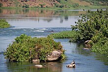
Kalagala-Itanda Offset Falls in
Kangulumira, Kayunga District.
362:
248:
These pineapples are much grown in
Bugerere-Kayunga District.
187:
583:
541:
305:
in
December 2000. The district consists of two counties,
503:
214:
The beauty of Sun set in
Namagabi, Kayunga district.
1374:
584:Rural Initiative for Development and Empowerment
605:
572:Kayunga District Five Year Development Plan
439:"Distance from Kampala to Kayunga with Map"
612:
598:
461:"Map of Kayunga District At Google Maps"
243:
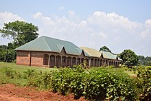
240:Different Residential Designs in Kayunga
235:
209:
201:
516:"Economic Activity In Kayunga District"
140:1,587.8 km (613.1 sq mi)
1375:
593:
328:
293:, on an all-weather tarmac highway.
229:. It is named after its chief town,
301:Kayunga District was carved out of
13:
23:District in Central Uganda, Uganda
14:
1409:
560:
538:"Kampala Hit By Renewed Violence"
621:
257:Kayunga District is bordered by
96:
45:
530:
508:
497:
475:
453:
431:
1:
424:
404:. Thirty people were killed.
316:
252:
7:
407:
296:
51:District location in Uganda
10:
1414:
586:, Kayunga District, Uganda
391:
15:
1182:
979:
781:
638:
182:
165:
161:225.9/km (585/sq mi)
157:
149:
144:
136:
131:
121:
109:
91:
56:
44:
35:
28:
567:Kayunga District Portal
335:subsistence agriculture
1393:Central Region, Uganda
414:Central Region, Uganda
249:
241:
215:
207:
16:For Kayunga Town, see
518:. Uganda Travel Guide
504:http://www.ubos.go.ug
247:
239:
213:
205:
287:Nakasongola District
158: • Density
1388:Districts of Uganda
628:Districts of Uganda
544:. 11 September 2009
485:. Citypopulation.de
419:Districts of Uganda
72: /
577:2012-02-24 at the
337:. Crops include:
281:to the southwest,
273:to the southeast,
265:to the northeast,
250:
242:
216:
208:
150: • Total
1370:
1369:
329:Economic activity
285:to the west, and
259:Amolatar District
200:
199:
137: • Land
1405:
1383:Kayunga District
626:
625:
614:
607:
600:
591:
590:
554:
553:
551:
549:
534:
528:
527:
525:
523:
512:
506:
501:
495:
494:
492:
490:
479:
473:
472:
470:
468:
457:
451:
450:
448:
446:
435:
322:persons per km.
283:Luweero District
263:Buyende District
219:Kayunga District
196:
193:
191:
189:
102:
100:
99:
87:
86:
84:
83:
82:
77:
76:1.000°N 32.867°E
73:
70:
69:
68:
65:
49:
30:Kayunga District
26:
25:
1413:
1412:
1408:
1407:
1406:
1404:
1403:
1402:
1373:
1372:
1371:
1366:
1178:
975:
777:
634:
620:
618:
579:Wayback Machine
563:
558:
557:
547:
545:
536:
535:
531:
521:
519:
514:
513:
509:
502:
498:
488:
486:
481:
480:
476:
466:
464:
459:
458:
454:
444:
442:
441:. Globefeed.com
437:
436:
432:
427:
410:
394:
382:
331:
319:
311:Ntenjeru County
303:Mukono District
299:
279:Mukono District
275:Buikwe District
267:Kamuli District
255:
186:
97:
95:
80:
78:
74:
71:
66:
63:
61:
59:
58:
52:
40:
31:
24:
21:
12:
11:
5:
1411:
1401:
1400:
1395:
1390:
1385:
1368:
1367:
1365:
1364:
1359:
1354:
1349:
1344:
1339:
1334:
1329:
1324:
1319:
1314:
1309:
1304:
1299:
1294:
1289:
1284:
1279:
1274:
1269:
1264:
1259:
1254:
1249:
1244:
1239:
1234:
1229:
1224:
1219:
1214:
1209:
1204:
1199:
1194:
1188:
1186:
1180:
1179:
1177:
1176:
1171:
1166:
1161:
1156:
1151:
1146:
1141:
1136:
1131:
1126:
1121:
1116:
1111:
1106:
1101:
1096:
1091:
1086:
1081:
1076:
1071:
1066:
1061:
1056:
1051:
1046:
1041:
1036:
1031:
1026:
1021:
1016:
1011:
1006:
1001:
996:
991:
985:
983:
977:
976:
974:
973:
968:
963:
958:
953:
948:
943:
938:
933:
928:
923:
918:
913:
908:
903:
898:
893:
888:
883:
878:
873:
868:
863:
858:
853:
848:
843:
838:
833:
828:
823:
818:
813:
808:
803:
798:
793:
787:
785:
779:
778:
776:
775:
770:
765:
760:
755:
750:
745:
740:
735:
730:
725:
720:
715:
710:
705:
700:
695:
690:
685:
680:
675:
670:
665:
660:
655:
650:
644:
642:
636:
635:
617:
616:
609:
602:
594:
588:
587:
581:
569:
562:
561:External links
559:
556:
555:
529:
507:
496:
474:
452:
429:
428:
426:
423:
422:
421:
416:
409:
406:
393:
390:
381:
380:
375:
370:
365:
360:
355:
350:
345:
339:
330:
327:
318:
315:
298:
295:
277:to the south,
271:Jinja District
261:to the north,
254:
251:
227:Central Uganda
198:
197:
184:
180:
179:
169:
163:
162:
159:
155:
154:
151:
147:
146:
142:
141:
138:
134:
133:
129:
128:
123:
119:
118:
116:Central Uganda
113:
107:
106:
93:
89:
88:
54:
53:
50:
42:
41:
36:
33:
32:
29:
22:
9:
6:
4:
3:
2:
1410:
1399:
1396:
1394:
1391:
1389:
1386:
1384:
1381:
1380:
1378:
1363:
1360:
1358:
1355:
1353:
1350:
1348:
1345:
1343:
1340:
1338:
1335:
1333:
1330:
1328:
1325:
1323:
1320:
1318:
1315:
1313:
1310:
1308:
1305:
1303:
1300:
1298:
1295:
1293:
1290:
1288:
1285:
1283:
1280:
1278:
1275:
1273:
1270:
1268:
1265:
1263:
1260:
1258:
1255:
1253:
1250:
1248:
1245:
1243:
1240:
1238:
1235:
1233:
1230:
1228:
1225:
1223:
1220:
1218:
1215:
1213:
1210:
1208:
1205:
1203:
1200:
1198:
1195:
1193:
1190:
1189:
1187:
1185:
1181:
1175:
1172:
1170:
1167:
1165:
1162:
1160:
1157:
1155:
1152:
1150:
1147:
1145:
1142:
1140:
1137:
1135:
1132:
1130:
1127:
1125:
1122:
1120:
1117:
1115:
1114:Nakapiripirit
1112:
1110:
1107:
1105:
1102:
1100:
1097:
1095:
1092:
1090:
1087:
1085:
1082:
1080:
1077:
1075:
1072:
1070:
1067:
1065:
1062:
1060:
1057:
1055:
1052:
1050:
1047:
1045:
1042:
1040:
1037:
1035:
1032:
1030:
1027:
1025:
1022:
1020:
1017:
1015:
1012:
1010:
1007:
1005:
1002:
1000:
997:
995:
992:
990:
987:
986:
984:
982:
978:
972:
969:
967:
964:
962:
959:
957:
954:
952:
949:
947:
944:
942:
939:
937:
934:
932:
929:
927:
924:
922:
919:
917:
914:
912:
909:
907:
904:
902:
899:
897:
894:
892:
889:
887:
884:
882:
879:
877:
874:
872:
869:
867:
864:
862:
859:
857:
854:
852:
849:
847:
844:
842:
839:
837:
834:
832:
829:
827:
824:
822:
819:
817:
814:
812:
809:
807:
804:
802:
799:
797:
794:
792:
789:
788:
786:
784:
780:
774:
771:
769:
766:
764:
761:
759:
756:
754:
751:
749:
746:
744:
741:
739:
736:
734:
731:
729:
726:
724:
721:
719:
716:
714:
711:
709:
706:
704:
701:
699:
696:
694:
691:
689:
686:
684:
681:
679:
676:
674:
671:
669:
666:
664:
661:
659:
656:
654:
651:
649:
646:
645:
643:
641:
637:
633:
629:
624:
615:
610:
608:
603:
601:
596:
595:
592:
585:
582:
580:
576:
573:
570:
568:
565:
564:
543:
539:
533:
517:
511:
505:
500:
484:
478:
463:. Google Maps
462:
456:
440:
434:
430:
420:
417:
415:
412:
411:
405:
403:
399:
389:
387:
379:
378:Passion fruit
376:
374:
371:
369:
366:
364:
361:
359:
356:
354:
351:
349:
346:
344:
341:
340:
338:
336:
326:
323:
314:
312:
308:
307:Bbaale County
304:
294:
292:
288:
284:
280:
276:
272:
269:to the east,
268:
264:
260:
246:
238:
234:
232:
228:
224:
220:
212:
204:
195:
185:
181:
177:
173:
170:
168:
164:
160:
156:
152:
148:
143:
139:
135:
130:
127:
124:
120:
117:
114:
112:
108:
105:
94:
90:
85:
81:1.000; 32.867
57:Coordinates:
55:
48:
43:
39:
34:
27:
19:
692:
653:Bukomansimbi
546:. Retrieved
532:
520:. Retrieved
510:
499:
487:. Retrieved
477:
465:. Retrieved
455:
443:. Retrieved
433:
395:
383:
332:
324:
320:
300:
256:
218:
217:
1287:Kiryandongo
1089:Madi-Okollo
886:Kapelebyong
861:Kaberamaido
758:Nakasongola
79: /
1398:Lake Kyoga
1377:Categories
1297:Kitagwenda
1207:Bunyangabu
1202:Bundibugyo
936:Namisindwa
703:Kyankwanzi
425:References
386:sugar cane
373:Watermelon
358:Pineapples
317:Population
145:Population
1352:Rukungiri
1109:Nabilatuk
941:Namutumba
931:Namayingo
881:Kapchorwa
826:Bulambuli
768:Sembabule
723:Lyantonde
673:Kalangala
658:Butambala
253:Geography
167:Time zone
1357:Rwampara
1342:Rubirizi
1332:Ntungamo
1307:Kyenjojo
1302:Kyegegwa
1282:Kiruhura
1252:Kamwenge
1247:Kakumiro
1237:Kabarole
1227:Isingiro
1212:Bushenyi
1009:Amolatar
1004:Alebtong
994:Adjumani
981:Northern
836:Butaleja
753:Nakaseke
688:Kassanda
575:Archived
542:BBC News
408:See also
297:Overview
223:district
190:.kayunga
38:District
1337:Rubanda
1327:Ntoroko
1322:Mitooma
1317:Mbarara
1312:Masindi
1277:Kikuube
1272:Kibaale
1257:Kanungu
1197:Buliisa
1192:Buhweju
1184:Western
1159:Pakwach
1094:Maracha
1049:Karenga
1044:Kaabong
961:Sironko
951:Pallisa
916:Manafwa
891:Katakwi
846:Buyende
816:Bukedea
811:Bugweri
783:Eastern
743:Mubende
733:Mityana
713:Luweero
708:Kyotera
693:Kayunga
683:Kampala
678:Kalungu
640:Central
402:Kampala
398:Buganda
392:History
353:Matooke
348:Cassava
343:Vanilla
291:Kampala
231:Kayunga
183:Website
153:358,700
126:Kayunga
122:Capital
92:Country
67:32°52′E
64:01°00′N
18:Kayunga
1362:Sheema
1347:Rukiga
1292:Kisoro
1262:Kasese
1242:Kagadi
1232:Kabale
1222:Ibanda
1164:Terego
1134:Obongi
1099:Moroto
1074:Kwania
1069:Kotido
1059:Koboko
1054:Kitgum
1034:Dokolo
1014:Amudat
971:Tororo
966:Soroti
956:Serere
921:Mayuge
896:Kibuku
876:Kamuli
871:Kaliro
866:Kalaki
851:Iganga
841:Butebo
806:Bugiri
801:Bududa
796:Budaka
791:Amuria
773:Wakiso
748:Mukono
728:Masaka
718:Lwengo
698:Kiboga
663:Buvuma
648:Buikwe
632:region
368:Millet
111:Region
104:Uganda
101:
1217:Hoima
1174:Zombo
1169:Yumbe
1154:Pader
1144:Otuke
1139:Omoro
1129:Nwoya
1124:Nebbi
1119:Napak
1079:Lamwo
1019:Amuru
999:Agago
946:Ngora
926:Mbale
911:Luuka
906:Kween
856:Jinja
831:Busia
821:Bukwo
763:Rakai
738:Mpigi
668:Gomba
548:1 May
522:1 May
489:1 May
467:1 May
445:1 May
363:Maize
221:is a
172:UTC+3
1267:Kazo
1149:Oyam
1104:Moyo
1084:Lira
1064:Kole
1039:Gulu
1029:Arua
1024:Apac
989:Abim
901:Kumi
550:2014
524:2014
491:2014
469:2014
447:2014
309:and
132:Area
630:by
225:in
194:.ug
192:.go
188:www
176:EAT
1379::
540:.
233:.
613:e
606:t
599:v
552:.
526:.
493:.
471:.
449:.
178:)
174:(
20:.
Text is available under the Creative Commons Attribution-ShareAlike License. Additional terms may apply.


