328:
27:
39:
241:
The island of Huglo has no road connections off of the island other than the regular car ferry routes connecting to Stord and Tysnesøy islands. There are about 100 inhabitants there and the main industries are
235:
369:
238:
lies immediately northeast of this island. The highest point on the rugged island is the 218-metre (715 ft) tall Høgafjellet.
73:
362:
398:
355:
388:
263:
297:
251:
8:
223:
393:
343:
339:
227:
382:
88:
75:
231:
26:
327:
222:. The 13.5-square-kilometre (5.2 sq mi) island lies in the
247:
335:
215:
164:
57:
243:
38:
219:
207:
152:
61:
211:
174:
301:
283:
296:
380:
363:
370:
356:
37:
25:
381:
322:
226:, just east of the large island of
13:
290:
108:13.5 km (5.2 sq mi)
14:
410:
334:This article about an island in
326:
276:
1:
269:
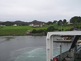
31:View of Huglo, from the ferry
342:. You can help Knowledge by
7:
257:
10:
415:
321:
124:3.8 km (2.36 mi)
116:6.9 km (4.29 mi)
264:List of islands of Norway
193:
185:
180:
170:
160:
149:
144:
136:
128:
120:
112:
104:
67:
53:
48:
36:
24:
132:218 m (715 ft)
234:. The small island of
197:8.1/km (21/sq mi)
129:Highest elevation
43:Location of the island
399:Vestland island stubs
298:Store norske leksikon
389:Islands of Vestland
85: /
21:
286:. 5 November 2020.
246:and the making of
230:and just south of
137:Highest point
89:59.8508°N 5.5850°E
19:
351:
350:
201:
200:
406:
372:
365:
358:
330:
323:
313:
312:
310:
309:
294:
288:
287:
280:
224:Hardangerfjorden
214:municipality in
100:
99:
97:
96:
95:
90:
86:
83:
82:
81:
78:
41:
29:
22:
18:
16:Island in Norway
414:
413:
409:
408:
407:
405:
404:
403:
379:
378:
377:
376:
319:
317:
316:
307:
305:
295:
291:
282:
281:
277:
272:
260:
250:and customized
156:
94:59.8508; 5.5850
93:
91:
87:
84:
79:
76:
74:
72:
71:
44:
32:
17:
12:
11:
5:
412:
402:
401:
396:
391:
375:
374:
367:
360:
352:
349:
348:
331:
315:
314:
304:(in Norwegian)
289:
274:
273:
271:
268:
267:
266:
259:
256:
199:
198:
195:
191:
190:
187:
183:
182:
178:
177:
172:
168:
167:
162:
158:
157:
150:
147:
146:
145:Administration
142:
141:
138:
134:
133:
130:
126:
125:
122:
118:
117:
114:
110:
109:
106:
102:
101:
69:
65:
64:
55:
51:
50:
46:
45:
42:
34:
33:
30:
15:
9:
6:
4:
3:
2:
411:
400:
397:
395:
392:
390:
387:
386:
384:
373:
368:
366:
361:
359:
354:
353:
347:
345:
341:
337:
332:
329:
325:
324:
320:
303:
299:
293:
285:
279:
275:
265:
262:
261:
255:
253:
249:
245:
239:
237:
233:
229:
225:
221:
217:
213:
209:
205:
196:
192:
188:
184:
179:
176:
173:
169:
166:
163:
159:
155:
154:
148:
143:
139:
135:
131:
127:
123:
119:
115:
111:
107:
103:
98:
70:
66:
63:
59:
56:
52:
47:
40:
35:
28:
23:
344:expanding it
333:
318:
306:. Retrieved
292:
278:
240:
203:
202:
194:Pop. density
181:Demographics
171:Municipality
151:
140:Høgafjellet
92: /
68:Coordinates
383:Categories
308:2015-02-03
270:References
252:golf clubs
189:110 (2017)
186:Population
77:59°51′03″N
248:furniture
80:5°35′06″E
49:Geography
336:Vestland
258:See also
232:Tysnesøy
218:county,
216:Vestland
165:Vestland
58:Vestland
54:Location
302:"Huglo"
284:"Huglo"
244:farming
236:Skorpo
220:Norway
208:island
206:is an
161:County
153:Norway
113:Length
62:Norway
394:Stord
338:is a
228:Stord
212:Stord
204:Huglo
175:Stord
121:Width
20:Huglo
340:stub
105:Area
210:in
385::
300:.
254:.
60:,
371:e
364:t
357:v
346:.
311:.
Text is available under the Creative Commons Attribution-ShareAlike License. Additional terms may apply.

