26:
221:
122:
102:
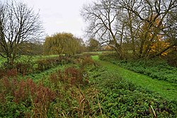
There are seven entrances to this site close to Thame town centre. It has diverse habitats, including the brook and its banks, scrub, woodland, meadows, reed beds, hedges and sedge beds.
228:
268:
59:
375:
144:
352:
347:
291:
396:
214:
237:
177:
53:
319:
25:
329:
88:
8:
339:
263:
206:
306:
245:
362:
253:
324:
390:
192:
179:
96:
370:
286:
296:
258:
278:
169:
92:
78:
Thame Town
Council & Cuttle Brook Conservation Volunteers
236:
99:. It is owned and managed by Thame Town Council.
388:
222:
229:
215:
147:. Local Nature Reserves. Natural England
125:. Local Nature Reserves. Natural England
389:
210:
137:
117:
115:
397:Local nature reserves in Oxfordshire
238:Local Nature Reserves in Oxfordshire
13:
112:
14:
408:
163:
24:
1:
105:
7:
87:is a 13-hectare (32-acre)
10:
413:
170:Cuttlebrook nature reserve
361:
338:
305:
277:
244:
74:
66:
52:
44:
36:
32:
23:
18:
320:Ewelme Watercress Beds
145:"Map of Cuttle Brook"
70:13 hectares (32 acres)
330:Watlington Chalk Pit
89:Local Nature Reserve
40:Local Nature Reserve
340:Vale of White Horse
189: /
264:Kirtlington Quarry
48:Thame, Oxfordshire
384:
383:
307:South Oxfordshire
82:
81:
404:
363:West Oxfordshire
353:Tuckmill Meadows
231:
224:
217:
208:
207:
204:
203:
201:
200:
199:
194:
193:51.745°N 0.986°W
190:
187:
186:
185:
182:
157:
156:
154:
152:
141:
135:
134:
132:
130:
119:
62:
28:
16:
15:
412:
411:
407:
406:
405:
403:
402:
401:
387:
386:
385:
380:
357:
348:Abbey Fishponds
334:
301:
292:Magdalen Quarry
273:
254:Adderbury Lakes
240:
235:
197:
195:
191:
188:
183:
180:
178:
176:
175:
166:
161:
160:
150:
148:
143:
142:
138:
128:
126:
121:
120:
113:
108:
75:Managed by
58:
12:
11:
5:
410:
400:
399:
382:
381:
379:
378:
373:
367:
365:
359:
358:
356:
355:
350:
344:
342:
336:
335:
333:
332:
327:
325:Mowbray Fields
322:
317:
311:
309:
303:
302:
300:
299:
294:
289:
283:
281:
275:
274:
272:
271:
266:
261:
256:
250:
248:
242:
241:
234:
233:
226:
219:
211:
198:51.745; -0.986
173:
172:
165:
164:External links
162:
159:
158:
136:
123:"Cuttle Brook"
110:
109:
107:
104:
80:
79:
76:
72:
71:
68:
64:
63:
56:
50:
49:
46:
42:
41:
38:
34:
33:
30:
29:
21:
20:
9:
6:
4:
3:
2:
409:
398:
395:
394:
392:
377:
374:
372:
369:
368:
366:
364:
360:
354:
351:
349:
346:
345:
343:
341:
337:
331:
328:
326:
323:
321:
318:
316:
313:
312:
310:
308:
304:
298:
295:
293:
290:
288:
285:
284:
282:
280:
276:
270:
267:
265:
262:
260:
257:
255:
252:
251:
249:
247:
243:
239:
232:
227:
225:
220:
218:
213:
212:
209:
205:
202:
171:
168:
167:
146:
140:
124:
118:
116:
111:
103:
100:
98:
94:
90:
86:
77:
73:
69:
65:
61:
57:
55:
51:
47:
43:
39:
35:
31:
27:
22:
17:
315:Cuttle Brook
314:
174:
149:. Retrieved
139:
127:. Retrieved
101:
85:Cuttle Brook
84:
83:
19:Cuttle Brook
371:Crecy Hill
196: /
97:Oxfordshire
287:Lye Valley
181:51°44′42″N
106:References
60:SP 701 056
297:Rock Edge
269:The Slade
259:Bure Park
184:0°59′10″W
151:8 April
391:Category
246:Cherwell
45:Location
376:Saltway
129:8 April
54:OS grid
279:Oxford
93:Thame
153:2020
131:2020
67:Area
37:Type
95:in
91:in
393::
114:^
230:e
223:t
216:v
155:.
133:.
Text is available under the Creative Commons Attribution-ShareAlike License. Additional terms may apply.
