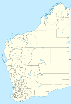
32:
191:
39:
175:
Due to its isolated location, artefacts from explorers and earlier travels are known to have been observed or found in the station area, as well as more recently, lost or ill-equipped travellers in the area.
63:
52:
240:
244:
414:
31:
409:
304:
225:
137:
216:
Hema Maps (Firm); Zell, Len; Glover, Ian (Ian Thomas), 1949-; Sakker, Elizabeth; Wild
Discovery Guides (Firm) (2007),
166:
141:
20:
279:
180:
215:
110:
154:
The
Carnegie Station Airport is located approximately 10 kilometres (6 mi) west of the homestead.
114:
147:
The area of the station is also within the Wiluna Native Title Claim area, also known as the
133:
8:
380:
324:
184:
162:
352:
257:
300:
275:
234:
221:
122:
118:
19:
This article is about the pastoral lease in
Western Australia. For other uses, see
183:
to the station, a distance of 900 miles (1,400 km), utilising in part the
347:
403:
375:
319:
158:
79:
65:
190:
148:
172:
The history of the station is related to the history of the Linke family.
195:
169:
and is found at the western terminus of the original
Gunbarrel Highway.
165:, it is situated on the eastern side of the Lady Lawley Range, north of
194:
Image of an original cartoon at
Carnegie Station painted by
179:
In 1940, G Lanagan and his wife drove 800 cattle from the
121:
and is the most eastern of pastoral leases found on the
220:(1st ed.), Hema Maps & Wild Discovery Guides,
272:
A Lifetime in the Bush:The biography of Len
Beadell
258:
http://www.ga.gov.au/place-names/index.xhtml.Record
218:Australia's great desert tracks atlas & guide
401:
294:
239:: CS1 maint: multiple names: authors list (
392:– via National Library of Australia.
364:– via National Library of Australia.
336:– via National Library of Australia.
243:) CS1 maint: numeric names: authors list (
274:. Adelaide: Corkwood Press. p. 68.
269:
189:
402:
384:. Perth. 30 September 1940. p. 11
263:
128:In some sources it is identified as
157:Located on the western edge of the
16:Pastoral lease in Western Australia
13:
151:claim that was clarified in 2013.
14:
426:
328:. Perth. 17 July 1953. p. 10
105:(25°47'45.0"S 122°58'31.1"E), or
415:Stations in Goldfields–Esperance
132:, with the features including a
38:
37:
30:
410:Homesteads in Western Australia
368:
340:
312:
297:And if her droughts are bitter
288:
251:
208:
1:
161:and the southern edge of the
56:Location in Western Australia
7:
356:. 3 January 1994. p. 1
10:
431:
18:
140:, outcamp, woolshed, and
320:"Natives Talk Of A Dray"
201:
270:Shephard, Mark (1998).
107:Carnegie pastoral lease
295:Linke, Gladys (1996),
198:
109:, is located north of
376:"CANNING STOCK ROUTE"
193:
142:Aboriginal outstation
53:class=notpageimage|
381:The West Australian
325:The West Australian
299:, Hesperian Press,
185:Canning Stock Route
163:Little Sandy Desert
75: /
353:The Canberra Times
199:
80:25.796°S 122.975°E
306:978-0-85905-228-3
227:978-1-86500-382-5
123:Gunbarrel Highway
119:Western Australia
422:
394:
393:
391:
389:
372:
366:
365:
363:
361:
344:
338:
337:
335:
333:
316:
310:
309:
292:
286:
285:
267:
261:
255:
249:
248:
238:
230:
212:
103:Carnegie Station
99:
98:
96:
95:
94:
92:
87:
86:
85:-25.796; 122.975
81:
76:
73:
72:
71:
68:
41:
40:
34:
21:Carnegie station
430:
429:
425:
424:
423:
421:
420:
419:
400:
399:
398:
397:
387:
385:
374:
373:
369:
359:
357:
348:"Tourist found"
346:
345:
341:
331:
329:
318:
317:
313:
307:
293:
289:
282:
268:
264:
256:
252:
232:
231:
228:
214:map 198–199 of
213:
209:
204:
90:
88:
84:
82:
78:
77:
74:
69:
66:
64:
62:
61:
59:
58:
57:
55:
49:
48:
47:
46:
42:
24:
17:
12:
11:
5:
428:
418:
417:
412:
396:
395:
367:
339:
311:
305:
287:
280:
262:
250:
226:
206:
205:
203:
200:
51:
50:
44:
43:
36:
35:
29:
28:
27:
15:
9:
6:
4:
3:
2:
427:
416:
413:
411:
408:
407:
405:
383:
382:
377:
371:
355:
354:
349:
343:
327:
326:
321:
315:
308:
302:
298:
291:
283:
277:
273:
266:
259:
254:
246:
242:
236:
229:
223:
219:
211:
207:
197:
192:
188:
186:
182:
177:
173:
170:
168:
167:Lake Carnegie
164:
160:
159:Gibson Desert
155:
152:
150:
145:
143:
139:
135:
131:
126:
124:
120:
116:
112:
108:
104:
100:
97:
54:
33:
26:
22:
386:. Retrieved
379:
370:
358:. Retrieved
351:
342:
330:. Retrieved
323:
314:
296:
290:
271:
265:
253:
217:
210:
178:
174:
171:
156:
153:
146:
129:
127:
113:and east of
106:
102:
101:
60:
25:
196:Len Beadell
83: /
70:122°58′30″E
404:Categories
281:1876247053
260:ID:GA31433
138:outstation
89: (
67:25°47′46″S
181:Kimberley
134:homestead
235:citation
130:Carnegie
111:Laverton
91:Carnegie
45:Carnegie
388:10 July
360:10 July
332:10 July
303:
278:
224:
115:Wiluna
202:Notes
149:Martu
390:2015
362:2015
334:2015
301:ISBN
276:ISBN
245:link
241:link
222:ISBN
117:in
406::
378:.
350:.
322:.
237:}}
233:{{
187:.
144:.
136:,
125:.
284:.
247:)
93:)
23:.
Text is available under the Creative Commons Attribution-ShareAlike License. Additional terms may apply.

